Hollyhill Wood

Wood, Forest in Gloucestershire Forest of Dean

England

Hollyhill Wood

Hicksters Ways bat roost A fabricated bat roost at Hicksters Ways in the Forest of Dean.
Hicksters Ways bat roost Credit: Philip Halling

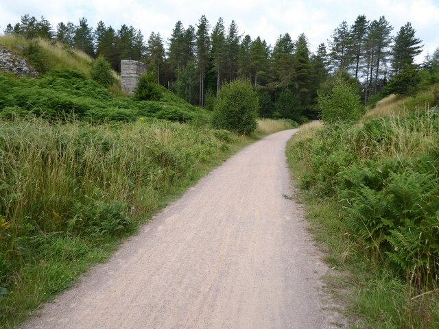
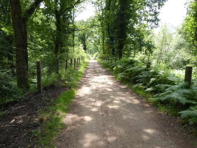
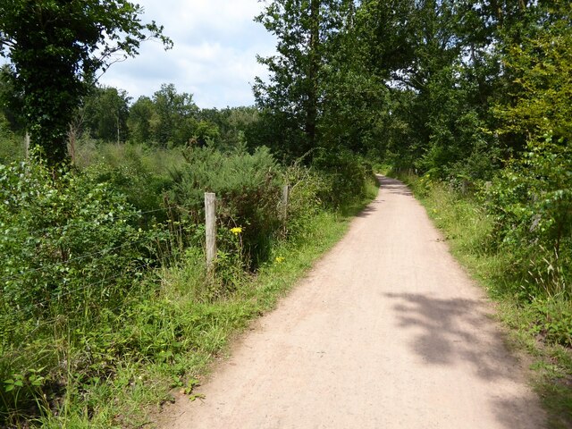
Hollyhill Wood is a picturesque woodland located in Gloucestershire, England. Covering an area of approximately 100 acres, this woodland is renowned for its natural beauty and diverse ecosystem. Situated on the outskirts of the village of Hollyhill, the wood is easily accessible and attracts numerous visitors throughout the year.

The woodland is predominantly composed of native broadleaf trees, including oak, beech, and ash, which provide a dense canopy, creating a peaceful and tranquil atmosphere. The forest floor is covered in a thick carpet of moss, ferns, and wildflowers, adding to its enchanting appeal.

Hollyhill Wood is home to a rich array of wildlife, offering a haven for both common and rare species. Birdwatchers can often spot various woodland birds, such as woodpeckers, owls, and thrushes. Squirrels, foxes, and badgers can also be seen, adding to the woodland's charm and natural diversity.

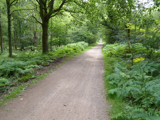
Several footpaths and trails wind their way through the wood, making it an ideal destination for nature enthusiasts and walkers. These paths offer opportunities for exploration and provide breathtaking views of the surrounding countryside.

The woodland is well-maintained, with conservation efforts in place to preserve its natural habitat. Local volunteers regularly organize clean-up events to maintain the cleanliness and serenity of the wood, ensuring that it remains a cherished destination for visitors and a vital part of the local ecosystem.

Overall, Hollyhill Wood is a captivating woodland, offering visitors a chance to connect with nature and escape the hustle and bustle of everyday life. Its stunning scenery, diverse wildlife, and peaceful ambiance make it a must-visit destination for anyone seeking a tranquil retreat in Gloucestershire.

If you have any feedback on the listing, please let us know in the comments section below.

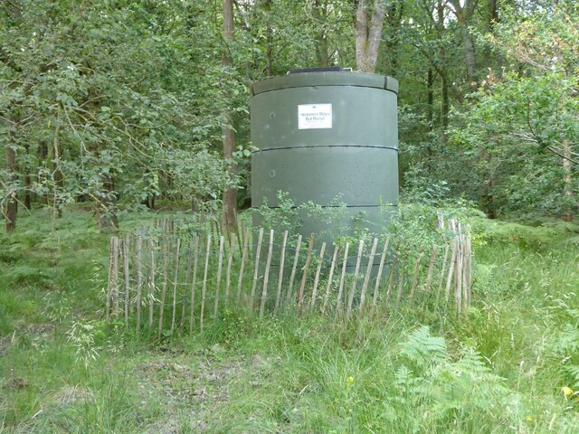
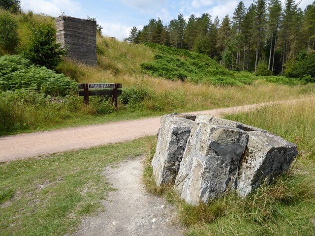
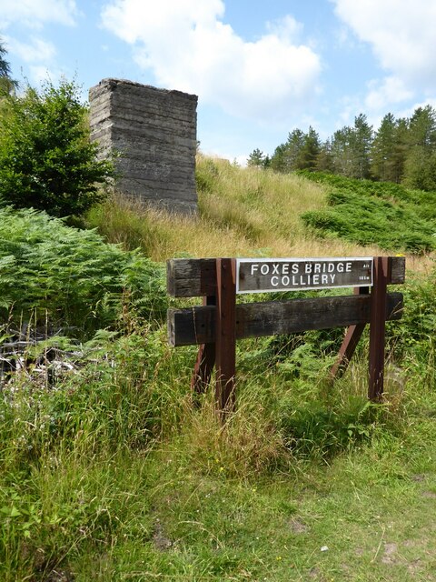
Hollyhill Wood Images

Images are sourced within 2km of 51.830541/-2.5107693 or Grid Reference SO6414. Thanks to Geograph Open Source API. All images are credited.

Hicksters Ways bat roost A fabricated bat roost at Hicksters Ways in the Forest of Dean.
Hicksters Ways bat roost
A fabricated bat roost at Hicksters Ways in the Forest of Dean.
Cycleway and former railway Cycleway and former railway trackbed passing through Crabtreehill Plantation in the Forest of Dean.
Cycleway and former railway
Cycleway and former railway trackbed passing through Crabtreehill Plantation in the Forest of Dean.
Site of Foxes Bridge Colliery Former railway track and now a cycleway passing through the site of Foxes Bridge Colliery.  Trees have been felled since I last photographed this site just over seven years ago <a href="https://www.geograph.org.uk/photo/3954592">SO6313 : Foxes Bridge Colliery</a>.
Site of Foxes Bridge Colliery
Former railway track and now a cycleway passing through the site of Foxes Bridge Colliery. Trees have been felled since I last photographed this site just over seven years ago SO6313 : Foxes Bridge Colliery.
Site of Foxes Bridge Colliery The site of Foxes Bridge Colliery viewed from a former railway track and now cycleway.
Site of Foxes Bridge Colliery
The site of Foxes Bridge Colliery viewed from a former railway track and now cycleway.
Site of Foxes Bridge Colliery Former railway track and now a cycleway passing through the site of Foxes Bridge Colliery.
Site of Foxes Bridge Colliery
Former railway track and now a cycleway passing through the site of Foxes Bridge Colliery.
Cycleway passing through Crabtreehill Plantation Cycleway on a former railway trackbed passing through Crabtreehill Plantation.
Cycleway passing through Crabtreehill Plantation
Cycleway on a former railway trackbed passing through Crabtreehill Plantation.
Cycleway near Dilke Hospital Cycleway and former railway trackbed near Dilke Hospital in the Forest of Dean.
Cycleway near Dilke Hospital
Cycleway and former railway trackbed near Dilke Hospital in the Forest of Dean.
Pump bob - Foxes Bridge Colliery near Cinderford This inverted tee bob was undoubtedly associated with a steam pumping engine for draining this colliery and has been retained on site on a specially made concrete pad. Unfortunately it is being reclaimed by nature and is fairly well hidden although there is a well established path to it. It took me a while of hunting to find it from the nearby cycle trail.
Pump bob - Foxes Bridge Colliery near Cinderford
This inverted tee bob was undoubtedly associated with a steam pumping engine for draining this colliery and has been retained on site on a specially made concrete pad. Unfortunately it is being reclaimed by nature and is fairly well hidden although there is a well established path to it. It took me a while of hunting to find it from the nearby cycle trail.
Trig point near Crabtree Hill, forest of Dean
Remains of Foxes Bridge Colliery near Cinderford Some large lumps of masonry adjoining a cycle trail through the site. There are other interesting foundations and the remains of a pumping bob nearby but they do take a little hunting for.
Remains of Foxes Bridge Colliery near Cinderford
Some large lumps of masonry adjoining a cycle trail through the site. There are other interesting foundations and the remains of a pumping bob nearby but they do take a little hunting for.
Junction of tracks near the site of Foxes Bridge Colliery The crossing track is a family cycle way. The houses in the distance are in Cinderford
Junction of tracks near the site of Foxes Bridge Colliery
The crossing track is a family cycle way. The houses in the distance are in Cinderford
Site of Foxes Bridge Colliery The cycle way passing through behind the large lump of masonry is on the track bed of a former railway serving the colliery. There are quite a few remains in the undergrowth including an inverted tee bob from a pumping engine.
Site of Foxes Bridge Colliery
The cycle way passing through behind the large lump of masonry is on the track bed of a former railway serving the colliery. There are quite a few remains in the undergrowth including an inverted tee bob from a pumping engine.
Site of Foxes Bridge Colliery - machinery foundations  The site contains scattered lumps of masonry and concrete. This is possibly the footings for a steam winding engine. Cinderford is seen in the distance.
Site of Foxes Bridge Colliery - machinery foundations
The site contains scattered lumps of masonry and concrete. This is possibly the footings for a steam winding engine. Cinderford is seen in the distance.
Site of Foxes Bridge Colliery This shows a concrete footing in the foreground with an inverted tee bob from a pumping installation in the background. This latter had been erected on a ne concrete pad. Unfortunately nature is claiming it back. There are similar pieces at New Fancy colliery but not as well preserved or presented.
Site of Foxes Bridge Colliery
This shows a concrete footing in the foreground with an inverted tee bob from a pumping installation in the background. This latter had been erected on a ne concrete pad. Unfortunately nature is claiming it back. There are similar pieces at New Fancy colliery but not as well preserved or presented.
Site of Foxes Bridge Colliery - machinery foundations  I think this is probably part of the foundations for a steam winding engine. In the background hidden by the green bush right of centre is the inverted tee bob from a pumping engine.
Site of Foxes Bridge Colliery - machinery foundations
I think this is probably part of the foundations for a steam winding engine. In the background hidden by the green bush right of centre is the inverted tee bob from a pumping engine.
Site of Foxes Bridge Colliery - machinery footings  I think these foundations were probably for a steam winding engine. The houses in the background are in Cinderford.
Site of Foxes Bridge Colliery - machinery footings
I think these foundations were probably for a steam winding engine. The houses in the background are in Cinderford.
Cycle trail through the site of Foxes Bridge Colliery
Overgrown pathway
Overgrown pathway
Show me another place!

Hollyhill Wood is located at Grid Ref: SO6414 (Lat: 51.830541, Lng: -2.5107693)

Administrative County: Gloucestershire

District: Forest of Dean

Police Authority: Gloucestershire

What 3 Words

///domestic.princes.snacking. Near Cinderford, Gloucestershire

Related Wikis

Cinderford Canal

The Cinderford Canal was a private canal, opened in about 1797, in Gloucestershire, England, which was used to provide coke and water to Cinderford Ironworks...

Whimsey Halt railway station

Whimsey Halt railway station served the town of Cinderford, Gloucestershire, England, from 1907 to 1930 on the Mitcheldean Road and Forest of Dean Junction...

Laymoor Quag

Laymoor Quag (grid reference SO644146) is a 3.5-hectare (8.6-acre) nature reserve within the Forest of Dean in Gloucestershire. The site is listed in the...

Cinderford New railway station

Cinderford New railway station was a disused railway station that was opened by the former Severn and Wye Railway to serve the mining town of Cinderford...

Bilson Halt railway station

Bilson Halt railway station is a disused railway station opened on the former Bullo Pill Railway, later known as the Great Western Railway Forest of Dean...

Steam Mills Crossing Halt railway station

Steam Mills Crossing Halt railway station served the village of Steam Mills, Gloucestershire, England, from 1907 to 1930 on the Mitcheldean Road and Forest...

Steam Mills

Steam Mills is a village in the Forest of Dean, west Gloucestershire, England. During the 18th and 19th centuries there were local coal mines and a steam...

Cinderford

Cinderford is a town and civil parish on the eastern fringe of the Forest of Dean in Gloucestershire, England. The population was 8,777 at the 2021 Census...

Nearby Amenities

Located within 500m of 51.830541,-2.5107693
Bus Stop
Valley Road
Bus: yes
Naptan AtcoCode: 1600GL1247
Naptan Bearing: NW
Naptan CommonName: Valley Rd & Boey's Pike
Naptan NaptanCode: gloajgjt
Naptan Street: Steam Mills Rd
Naptan Verified: no
Public Transport: platform
Source: naptan_import
Lat/Long: 51.8304379/-2.5061712
Bus Stop
Valley Road
Bus: yes
Naptan AtcoCode: 1600GL1248
Naptan Bearing: SE
Naptan CommonName: Valley Rd & Boey's Pike
Naptan NaptanCode: gloajgmp
Naptan Street: Steam Mills Rd
Naptan Verified: no
Public Transport: platform
Source: naptan_import
Lat/Long: 51.8303058/-2.5055312
Bus Stop
KWB Coach Depot
Naptan AtcoCode: 1600GL1256
Naptan Bearing: N
Naptan CommonName: KWB Coach Depot
Naptan NaptanCode: gloajgma
Naptan Street: Valley Rd
Naptan Verified: no
Source: naptan_import
Lat/Long: 51.8294492/-2.5060875
Bus Stop
Cinderford Enterprise Centre
Naptan AtcoCode: 1600GL5029
Naptan Bearing: S
Naptan CommonName: Cinderford Enterprise Centre
Naptan Indicator: Opp
Naptan NaptanCode: gloajgja
Naptan Street: Valley Rd
Naptan Verified: no
Source: naptan_import
Lat/Long: 51.8271607/-2.5071937
Bus Stop
Cinderford Enterprise Centre
Naptan AtcoCode: 1600GL5030
Naptan Bearing: N
Naptan CommonName: Cinderford Enterprise Centre
Naptan NaptanCode: gloajgdm
Naptan Street: Valley Rd
Naptan Verified: no
Source: naptan_import
Lat/Long: 51.8271332/-2.507295
Bus Stop
Upper Bilson Inn
Naptan AtcoCode: 1600GLA90875
Naptan Bearing: S
Naptan CommonName: Upper Bilson Inn
Naptan NaptanCode: glogpdma
Naptan Street: Valley Rd
Naptan Verified: no
Source: naptan_import
Lat/Long: 51.8288022/-2.5060077
Bus Stop
Steam Mills Rd & Boey's Pike
Naptan AtcoCode: 1600GLF259
Naptan Bearing: S
Naptan CommonName: Steam Mills Rd & Boey's Pike
Naptan NaptanCode: gloajgmd
Naptan Street: Valley Rd
Naptan Verified: no
Source: naptan_import
Lat/Long: 51.8300617/-2.5058332
Bus Stop
Speculation Rd
Naptan AtcoCode: 1600GLF529
Naptan Bearing: SW
Naptan CommonName: Speculation Rd
Naptan NaptanCode: gloajdpt
Naptan Street: Broadmoor Rd
Naptan Verified: no
Source: naptan_import
Lat/Long: 51.8340612/-2.5124524
Bus Stop
Speculation Rd
Naptan AtcoCode: 1600GLF530
Naptan Bearing: NE
Naptan CommonName: Speculation Rd
Naptan Indicator: Opp
Naptan NaptanCode: gloajdpa
Naptan Street: Broadmoor Rd
Naptan Verified: no
Source: naptan_import
Lat/Long: 51.8337698/-2.5132908
Bus Stop
Crabtree Rd
Naptan AtcoCode: 1600GLF531
Naptan Bearing: S
Naptan CommonName: Crabtree Rd
Naptan NaptanCode: gloajdpm
Naptan Street: Forest Vale Rd
Naptan Verified: no
Source: naptan_import
Lat/Long: 51.8265439/-2.5125848
Bus Stop
Crabtree Rd
Naptan AtcoCode: 1600GLF532
Naptan Bearing: N
Naptan CommonName: Crabtree Rd
Naptan Indicator: Opp
Naptan NaptanCode: gloajdpj
Naptan Street: Forest Vale Rd
Naptan Verified: no
Source: naptan_import
Lat/Long: 51.8266236/-2.5128614
Bus Stop
Broadmoor Rd
Naptan AtcoCode: 1600GLF789
Naptan Bearing: N
Naptan CommonName: Broadmoor Rd
Naptan Indicator: Opp
Naptan NaptanCode: gloajdma
Naptan Street: Forest Vale Rd
Naptan Verified: no
Source: naptan_import
Lat/Long: 51.8326355/-2.5156725
Bus Stop
Broadmoor Rd
Naptan AtcoCode: 1600GLF790
Naptan Bearing: S
Naptan CommonName: Broadmoor Rd
Naptan NaptanCode: gloajdmg
Naptan Street: Forest Vale Rd
Naptan Verified: no
Source: naptan_import
Lat/Long: 51.832753/-2.5155287
Perry's Tyres
Shop: car_repair
Lat/Long: 51.8305463/-2.5064967
Fuel
Brand: Gulf
Lat/Long: 51.830722/-2.5067656
Co-op Food
Addr Street: Valley Road
Brand: Co-op Food
Brand Wikidata: Q3277439
Brand Wikipedia: en:Co-op Food
Operator: Midcounties Co-operative
Operator Wikidata: Q6841138
Shop: convenience
Lat/Long: 51.8270135/-2.5071025
Cinderford Junction
Historic Railway: junction
Railway: site
Lat/Long: 51.8277509/-2.5115704
Give Way
Direction: backward
Lat/Long: 51.8302863/-2.5057599
Give Way
Direction: forward
Lat/Long: 51.8286229/-2.5060804
Post Box
Operator: Royal Mail
Post Box Type: wall
Lat/Long: 51.8287952/-2.5059088
Power: pole
Lat/Long: 51.8294183/-2.5173398
Power: pole
Lat/Long: 51.8303366/-2.5169642
Generator Method: photovoltaic
Generator Output Electricity: yes
Generator Source: solar
Generator Type: solar_photovoltaic_panel
Location: roof
Power: generator
Lat/Long: 51.8310189/-2.5040111
Generator Method: photovoltaic
Generator Output Electricity: yes
Generator Source: solar
Generator Type: solar_photovoltaic_panel
Location: roof
Power: generator
Lat/Long: 51.8275843/-2.5054783
Bench
Backrest: yes
Material: wood
Lat/Long: 51.8270081/-2.5076928
Bench
Backrest: yes
Material: wood
Lat/Long: 51.826993/-2.5078998
Doctors
Forest Health Care
Addr City: Cinderford
Addr Housename: Cinderford Medical Centre
Addr Postcode: GL14 2NX
Addr Street: Valley Road
Contact Phone: +44 1594 820820
Contact Website: https://www.foresthealthcentre.nhs.uk
Healthcare: doctor
Opening Hours: Mo-Fr 08:30-18:00
Lat/Long: 51.8268485/-2.5078889
Bicycle Parking
Bicycle Parking: stands
Capacity: 10
Covered: yes
Lat/Long: 51.8267361/-2.5075566
Noexit: yes
Lat/Long: 51.8269481/-2.5081919
Bicycle Parking
Bicycle Parking: stands
Capacity: 10
Covered: yes
Lat/Long: 51.8269707/-2.5082208
Noexit: yes
Lat/Long: 51.8270168/-2.5083064
Doctors
Dockham Surgery
Addr City: Cinderford
Addr Housename: Cinderford Medical Centre
Addr Postcode: GL14 2NX
Addr Street: Valley Road
Contact Fax: +44 1594 820017
Contact Phone: +44 1594 820010
Contact Website: https://dockhamsurgery.nhs.uk
Healthcare: doctor
Opening Hours: Mo-Fr 08:30-18:00
Lat/Long: 51.8269402/-2.5075611
Noexit: yes
Lat/Long: 51.8273746/-2.5075382
Bilson North Junction
Historic Railway: junction
Railway: site
Lat/Long: 51.8303571/-2.5179358
Whimsey
Historic Railway: halt
Railway: site
Wikidata: Q111914496
Wikipedia: en:Whimsey Halt railway station
Lat/Long: 51.8340706/-2.5108735
The data included in this document is from www.openstreetmap.org. The data is made available under ODbL.

Have you been to Hollyhill Wood?

Leave your review of Hollyhill Wood below (or comments, questions and feedback).