Chapel Wood

Wood, Forest in Cumberland Eden

England

Chapel Wood

Grazing land near Kirkland Grazing land near Kirkland, the track leads to Cross Fell.
Grazing land near Kirkland Credit: Colin Kinnear

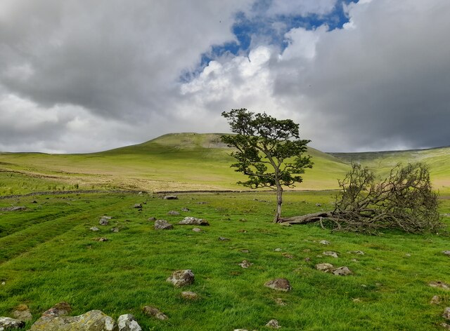
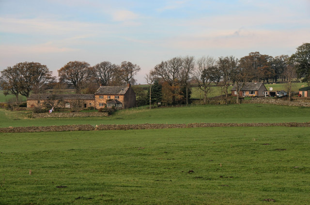
Chapel Wood, located in Cumberland, is a pristine forest that covers a vast area of land. This ancient woodland is renowned for its rich biodiversity and natural beauty. The wood is situated in the northern part of England, near the Scottish border, making it a popular destination for nature enthusiasts and hikers.

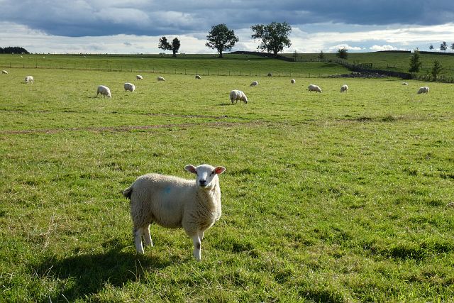
The forest is characterized by its dense canopy, consisting mainly of oak, beech, and ash trees, which provide shelter and food for a diverse range of wildlife. Visitors can expect to encounter various species of birds, such as woodpeckers, owls, and thrushes, as well as small mammals like squirrels and badgers. The forest floor is carpeted in a vibrant array of wildflowers, including bluebells, primroses, and foxgloves, creating a picturesque setting.

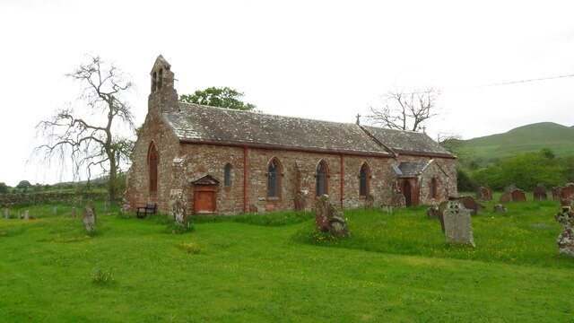
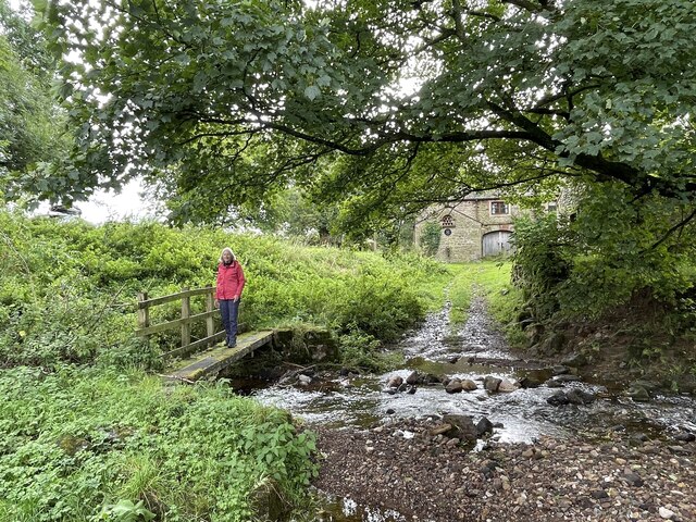
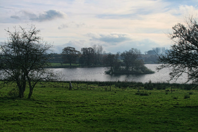
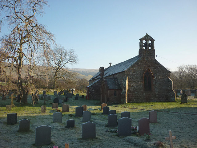
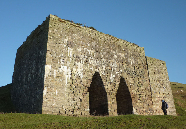
Chapel Wood is intersected by a network of walking trails, allowing visitors to explore its natural wonders at their own pace. The paths meander through the forest, leading to hidden clearings, babbling brooks, and charming wooden bridges. One of the highlights of the wood is a small chapel, nestled amidst the trees, which dates back several centuries. This historical landmark adds a touch of mystique and spirituality to the woodland ambiance.

The management of Chapel Wood is dedicated to preserving its ecological integrity and ensuring its accessibility to the public. As such, it is equipped with visitor facilities, including picnic areas and information boards, providing educational resources about the forest's flora and fauna. Whether one seeks tranquility, adventure, or an opportunity to connect with nature, Chapel Wood offers a captivating experience for all who venture into its majestic embrace.

If you have any feedback on the listing, please let us know in the comments section below.

Chapel Wood Images

Images are sourced within 2km of 54.692501/-2.5475614 or Grid Reference NY6433. Thanks to Geograph Open Source API. All images are credited.

Grazing land near Kirkland Grazing land near Kirkland, the track leads to Cross Fell.
Grazing land near Kirkland
Grazing land near Kirkland, the track leads to Cross Fell.
Pasture, Culgaith Sheep beside the bridleway between Blencarn and Wythwaite.
Pasture, Culgaith
Sheep beside the bridleway between Blencarn and Wythwaite.
Old limekilns & bridge over Ardale Beck near Townhead
Ousby - St Luke's Church
Kirkland Hall Ford This ford is found beside Beck Cottage at Kirkland.
Kirkland Hall Ford
This ford is found beside Beck Cottage at Kirkland.
The Flosh House at Kirkland.
The Flosh
House at Kirkland.
Bank Wood Barn beneath Bank Wood near Kirkland.
Bank Wood
Barn beneath Bank Wood near Kirkland.
Burrellhill Green lane between Kirkland and Townhead near Burrellhill.
Burrellhill
Green lane between Kirkland and Townhead near Burrellhill.
Blencarn Lake Blencarn fishing lake.
Blencarn Lake
Blencarn fishing lake.
St Luke's Church, Ousby The rectory looks larger than the church <a title="https://www.geograph.org.uk/photo/1140892" href="https://www.geograph.org.uk/photo/1140892">Link</a> The North Pennines beyond.
St Luke's Church, Ousby
The rectory looks larger than the church Link The North Pennines beyond.
The lane at Townhead The mud was still frozen so easier to walk over.
The lane at Townhead
The mud was still frozen so easier to walk over.
Heading out of Townhead The track towards Ardale and the freedom of the North Pennine fells.
Heading out of Townhead
The track towards Ardale and the freedom of the North Pennine fells.
Pasture above Acorn Sike Looking towards the shadowed valleys of Ardale (left) and Kirkdale in the North Pennines.
Pasture above Acorn Sike
Looking towards the shadowed valleys of Ardale (left) and Kirkdale in the North Pennines.
Sheep feeder above Acorn Sike A popular spot with these Swaledale ewes on this frosty morning.
Sheep feeder above Acorn Sike
A popular spot with these Swaledale ewes on this frosty morning.
Lime kiln at Ardale The track above contains the remains of an old narrow gauge railway which may have brought down limestone for burning here. Note the figure of Ali for scale!
Lime kiln at Ardale
The track above contains the remains of an old narrow gauge railway which may have brought down limestone for burning here. Note the figure of Ali for scale!
Egyptian temple? No, the left-hand opening of the Ardale lime kiln <a title="https://www.geograph.org.uk/photo/2768869" href="https://www.geograph.org.uk/photo/2768869">Link</a>
Egyptian temple?
No, the left-hand opening of the Ardale lime kiln Link
Looking into the top of the Ardale lime kiln The brickwork is still in excellent condition.
Looking into the top of the Ardale lime kiln
The brickwork is still in excellent condition.
Climbing out of Ardale On the track above the lime kiln which leads to the Maiden Way and the high fells. A narrow gauge railway once ran down this way. Across the Eden Valley are the northern fells of the Lake District.
Climbing out of Ardale
On the track above the lime kiln which leads to the Maiden Way and the high fells. A narrow gauge railway once ran down this way. Across the Eden Valley are the northern fells of the Lake District.
Show me another place!

Chapel Wood is located at Grid Ref: NY6433 (Lat: 54.692501, Lng: -2.5475614)

Administrative County: Cumbria

District: Eden

Police Authority: Cumbria

What 3 Words

///stolen.hardening.voted. Near Appleby-in-Westmorland, Cumbria

Nearby Locations

Bank Wood Chapel Wood

Related Wikis

Kirkland, Culgaith

Kirkland is a village in the Eden district of the English county of Cumbria. It is in the historic county of Cumberland. There is a fell called Kirkland...

Blencarn

Blencarn is a small village located in the Eden District of Cumbria, England. The village is situated at the foot of the Pennines. In Blencarn there is...

Ousby

Ousby is a village and civil parish in Eden district, in the English county of Cumbria. It is a Thankful Village, one of 52 parishes in England and Wales...

Skirwith

Skirwith is a village and former civil parish, now in the parish of Culgaith, in the Eden district, in the county of Cumbria, England. In 1931 the parish...

Skirwith Abbey

Skirwith Abbey is a country house in Skirwith, Cumbria, England. The House is a two-storey house of five by three bays, built by Thomas Addison, mason...

Milburn, Cumbria

Milburn is a small village and civil parish in the Eden district of Cumbria, England. It is located on the northern side of the Eden Valley, about 9 miles...

Cross Fell

Cross Fell is the highest mountain in the Pennines of Northern England and the highest point in England outside the Lake District. It is located in the...

Culgaith

Culgaith is a village and civil parish in the Eden district of Cumbria, England. It is located on the River Eden, between Temple Sowerby and Langwathby...

Nearby Amenities

Located within 500m of 54.692501,-2.5475614
Lime Kiln
Historic: lime_kiln
Lat/Long: 54.6962907/-2.5453506
Bank Rigg
Place: locality
Lat/Long: 54.6930606/-2.5434102
Natural: sinkhole
Lat/Long: 54.6932717/-2.5426799
Natural: sinkhole
Lat/Long: 54.6934639/-2.54288
Natural: sinkhole
Lat/Long: 54.693412/-2.5427728
Natural: sinkhole
Lat/Long: 54.69334/-2.5429946
Natural: sinkhole
Lat/Long: 54.6934494/-2.5430993
Natural: sinkhole
Lat/Long: 54.6935157/-2.5430295
Natural: sinkhole
Lat/Long: 54.693546/-2.5429547
Natural: sinkhole
Lat/Long: 54.6936381/-2.5430494
Natural: sinkhole
Lat/Long: 54.6937159/-2.5431317
Natural: sinkhole
Lat/Long: 54.693896/-2.5432538
Natural: sinkhole
Lat/Long: 54.6940198/-2.5433485
Natural: sinkhole
Lat/Long: 54.6939838/-2.5434955
Natural: sinkhole
Lat/Long: 54.6939507/-2.5435354
Natural: sinkhole
Lat/Long: 54.6937692/-2.5433435
Natural: sinkhole
Lat/Long: 54.693582/-2.5432289
Natural: sinkhole
Lat/Long: 54.6935287/-2.543179
Natural: sinkhole
Lat/Long: 54.6943752/-2.5436144
Natural: sinkhole
Lat/Long: 54.6943945/-2.5437314
Natural: sinkhole
Lat/Long: 54.6946032/-2.5437482
Natural: sinkhole
Lat/Long: 54.6947018/-2.5437114
Natural: sinkhole
Lat/Long: 54.6947849/-2.5436545
Natural: sinkhole
Lat/Long: 54.6949395/-2.5436244
Natural: sinkhole
Lat/Long: 54.694924/-2.5437883
Natural: sinkhole
Lat/Long: 54.6948467/-2.5437983
Natural: sinkhole
Lat/Long: 54.6946979/-2.543922
Natural: sinkhole
Lat/Long: 54.694866/-2.544009
Natural: sinkhole
Lat/Long: 54.6947849/-2.544009
Natural: sinkhole
Lat/Long: 54.6950032/-2.5440123
Natural: sinkhole
Lat/Long: 54.695152/-2.5440691
Natural: sinkhole
Lat/Long: 54.6952158/-2.5439755
Natural: sinkhole
Lat/Long: 54.6952216/-2.5438485
Natural: sinkhole
Lat/Long: 54.6951385/-2.5437548
Natural: sinkhole
Lat/Long: 54.6951559/-2.5439488
Power: pole
Lat/Long: 54.6886418/-2.5508735
Power: pole
Lat/Long: 54.6896164/-2.5506463
Power: pole
Lat/Long: 54.690591/-2.5504127
Power: pole
Lat/Long: 54.6910477/-2.5502852
The data included in this document is from www.openstreetmap.org. The data is made available under ODbL.

Have you been to Chapel Wood?

Leave your review of Chapel Wood below (or comments, questions and feedback).