Ardaneaskan

Settlement in Ross-shire

Scotland

Ardaneaskan

Loch Carron
Loch Carron Credit: Matthew Chadwick

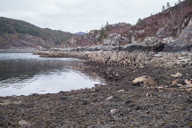
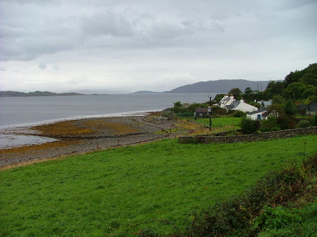
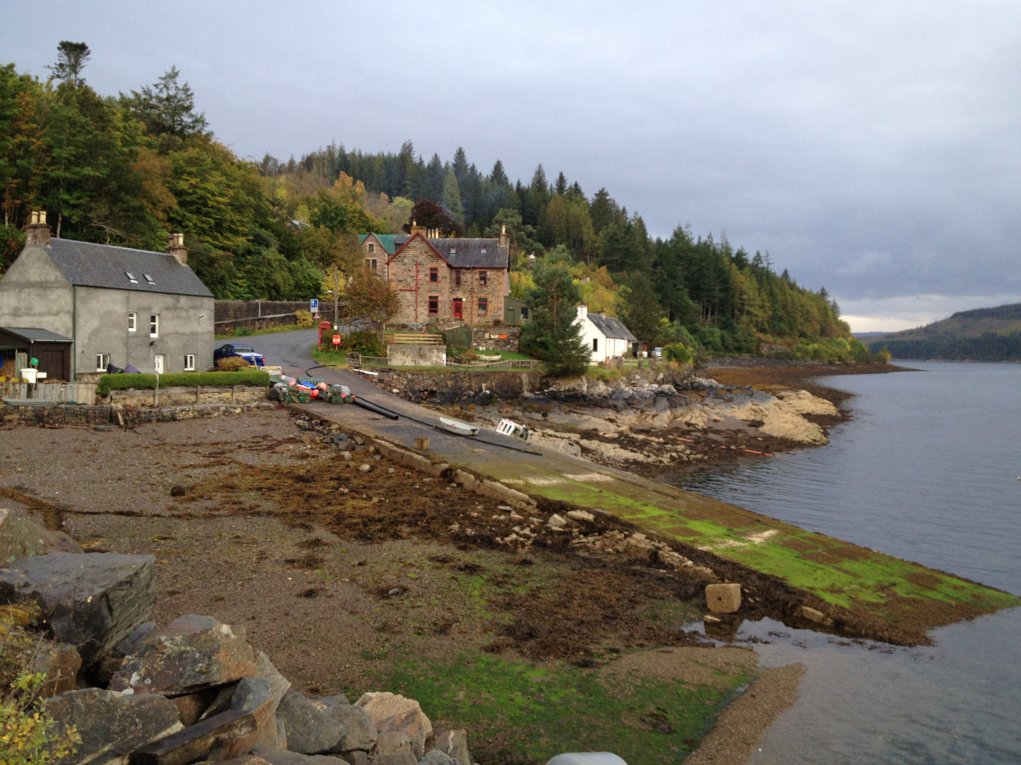
Ardaneaskan is a small village located in the county of Ross-shire, Scotland. Situated on the western coast, it lies on the banks of Loch Kishorn, offering picturesque views of the surrounding mountains and rugged landscapes. With a population of around 150 people, it is a close-knit community with a peaceful and tranquil atmosphere.

The village is known for its rich history, dating back to ancient times. It was once a significant hub for the fishing industry, with locals relying on the abundant fish stocks in Loch Kishorn for their livelihoods. Today, fishing still plays a role in the village's economy, but it has become more of a recreational activity.

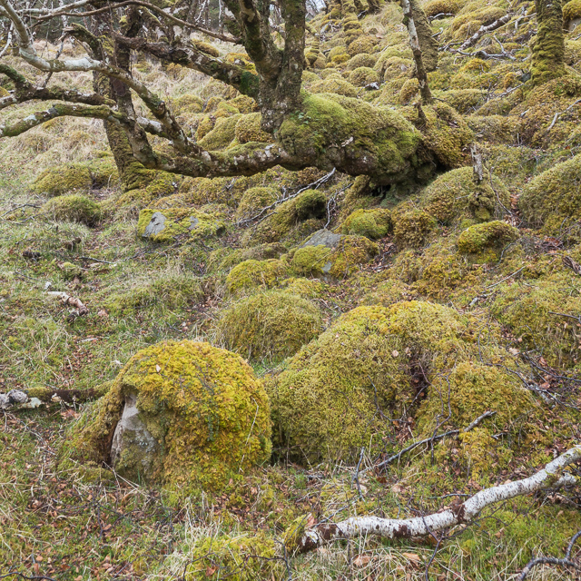
Nature enthusiasts are drawn to Ardaneaskan for its stunning scenery and wildlife. The area is home to a wide range of bird species, including red-throated divers and white-tailed eagles. The nearby mountains provide excellent opportunities for hiking and climbing, attracting outdoor enthusiasts from far and wide.

Despite its small size, Ardaneaskan offers a few amenities to its residents. There is a village hall that serves as a community center, hosting various events and gatherings throughout the year. However, for more extensive facilities and services, residents often rely on nearby towns such as Lochcarron or Kyle of Lochalsh.

Overall, Ardaneaskan is a charming village that offers a peaceful retreat for those seeking a slower pace of life and a closer connection to nature.

If you have any feedback on the listing, please let us know in the comments section below.

Ardaneaskan Images

Images are sourced within 2km of 57.356945/-5.606689 or Grid Reference NG8335. Thanks to Geograph Open Source API. All images are credited.

Loch Carron
Loch Carron
Mouth of Abhainn Srath Ascaig
Loch Carron
Loch Carron
Shore view near Craig from the Kyle to Inverness train On the left is Eilean na Creige Duibhe and the line of the railway ahead is right beside the water.
Shore view near Craig from the Kyle to Inverness train
On the left is Eilean na Creige Duibhe and the line of the railway ahead is right beside the water.
Cairn on secondary top of Aonach Pairc Dhughaill The view here is towards An Sgurr in the distance.
Cairn on secondary top of Aonach Pairc Dhughaill
The view here is towards An Sgurr in the distance.
The edge of Reraig Forest The temperate rainforest provides perfect conditions for moss which covers almost every surface.
The edge of Reraig Forest
The temperate rainforest provides perfect conditions for moss which covers almost every surface.
Moss covered rocks and trees at the edge of Reraig Forest The wet and undisturbed conditions within the forest provide the perfect conditions for moss - and it grows everywhere
Moss covered rocks and trees at the edge of Reraig Forest
The wet and undisturbed conditions within the forest provide the perfect conditions for moss - and it grows everywhere
Within Reraig Forest Reraig Forest was planted in 1913.  At various places within the forest you can find evidence of pre-forest structures such as the partially standing wall shown in this photo.  All such walls are thoroughly covered by moss which has prospered in the still, damp conditions within the forest.

The local estate run guided tours of some of the forest, as we found when chatting to the gamekeeper at the end of the day. Anyone wanting to view the interior of the forest would be well advised to go on such a tour unless you are very sure of your ability to navigate in very dense wooded areas.  We're pretty good in such conditions but even so ended up with a somewhat suboptimal route through the trees with a couple of steep sections which might be a little off-putting to some people.
Within Reraig Forest
Reraig Forest was planted in 1913. At various places within the forest you can find evidence of pre-forest structures such as the partially standing wall shown in this photo. All such walls are thoroughly covered by moss which has prospered in the still, damp conditions within the forest. The local estate run guided tours of some of the forest, as we found when chatting to the gamekeeper at the end of the day. Anyone wanting to view the interior of the forest would be well advised to go on such a tour unless you are very sure of your ability to navigate in very dense wooded areas. We're pretty good in such conditions but even so ended up with a somewhat suboptimal route through the trees with a couple of steep sections which might be a little off-putting to some people.
Hillside within Reraig Forest The forest was planted in 1913.  Other than the infrequently used tracks marked on the OS maps there are no paths through the forest.
Hillside within Reraig Forest
The forest was planted in 1913. Other than the infrequently used tracks marked on the OS maps there are no paths through the forest.
Track in Reraig Forest
Shoreline at Ardaneaskan
Coast at Rubha Thollaidh
View out to Loch Reraig
Reraig Bay
Reraig Bay
Road to Ardaneaskan The road out to the small village on the headland north of Loch Carron.
Road to Ardaneaskan
The road out to the small village on the headland north of Loch Carron.
Entering Ardaneaskan The small community, like many here, is strung out along the fringe of land below steeper ground.
Entering Ardaneaskan
The small community, like many here, is strung out along the fringe of land below steeper ground.
In Ardaneaskan Some land between the houses being put to good use grazing sheep.
In Ardaneaskan
Some land between the houses being put to good use grazing sheep.
Croft museum, Ardaneaskan The churlish would see this as a shed full of old junk, but the items are a fascinating mixture of the bygone and not-so-old. Your photographer remembers the old-style 'school' sign and the shop weighscales. Note the tin sign for the ferry, the fisherman's oilskin jacket, the child's toy cash register and various gardening tools.
Croft museum, Ardaneaskan
The churlish would see this as a shed full of old junk, but the items are a fascinating mixture of the bygone and not-so-old. Your photographer remembers the old-style 'school' sign and the shop weighscales. Note the tin sign for the ferry, the fisherman's oilskin jacket, the child's toy cash register and various gardening tools.
Show me another place!

Ardaneaskan is located at Grid Ref: NG8335 (Lat: 57.356945, Lng: -5.606689)

Unitary Authority: Highland

Police Authority: Highlands and Islands

What 3 Words

///reserving.scavenger.years. Near Lochcarron, Highland

Related Wikis

Ardaneaskan

Ardaneaskan (Scottish Gaelic: Àird nan Easgann) is a village on the north shore of Loch Carron in Strathcarron, Ross-shire, in Highland, and is within...

Duncraig Castle

Duncraig Castle is a mansion in Lochalsh, in the west of the Scottish Highlands. A category-C listed building, it is situated in the Highland council area...

Duncraig railway station

Duncraig railway station is a remote railway station by the shore of Loch Carron on the Kyle of Lochalsh Line, originally (privately) serving Duncraig...

Achintraid

Achintraid (Scottish Gaelic: Achadh na Tràghad) is a small one-time crofting township, situated at the north-eastern end of the sea loch Loch Kishorn,...

Bad a' Chreamha

Bad a' Chreamha is a small hill in Scotland, occupying the broad peninsula between Loch Carron and Loch Kishorn. It consists of a long low ridge; the northwestern...
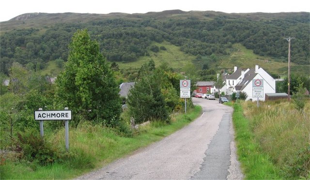
Achmore, Highland

Achmore (Scottish Gaelic: Acha Mòr, lit. 'big field') is a hamlet located close to the south shore of Loch Carron, approximately seven miles (eleven kilometres...
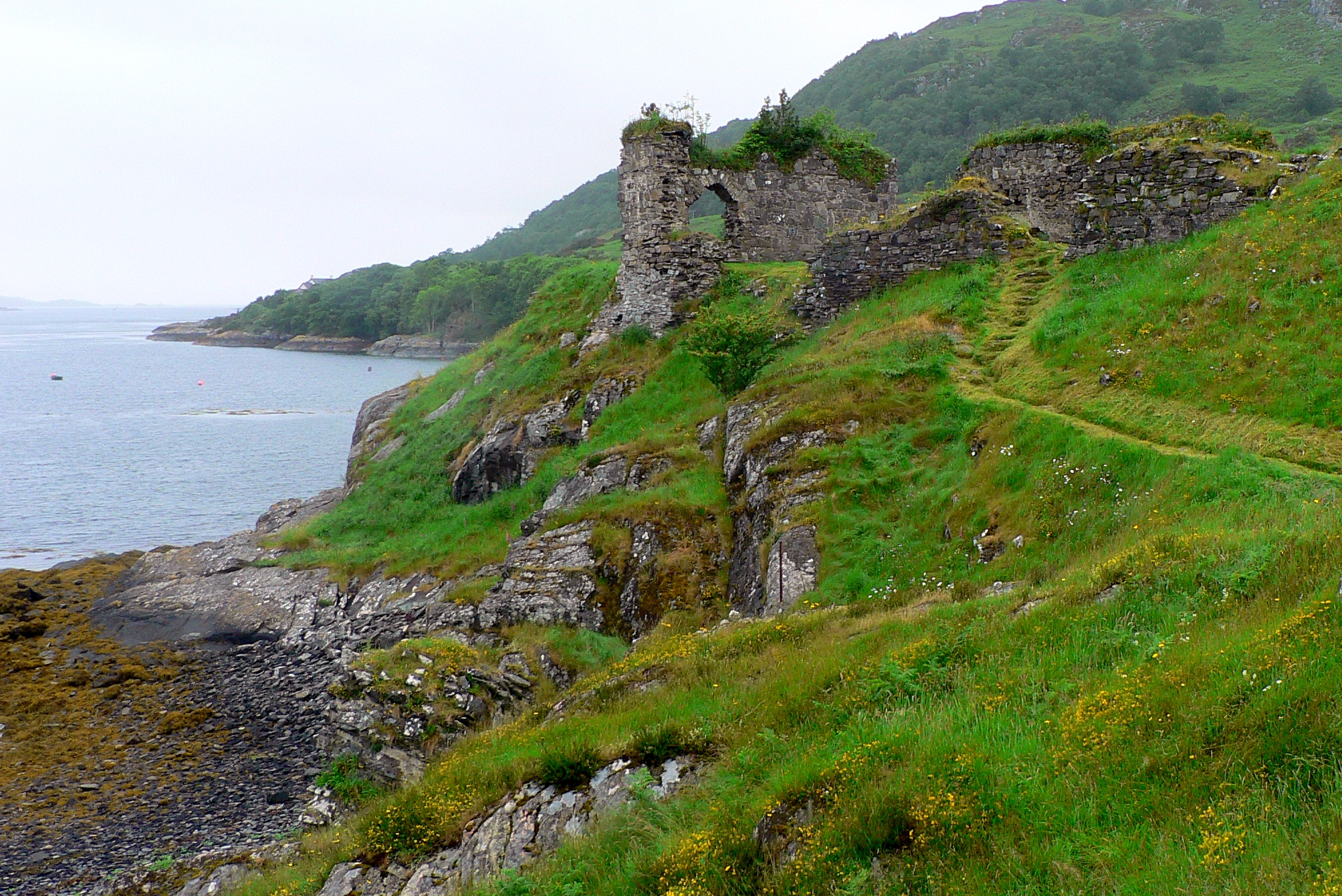
Strome Castle

Strome Castle is a ruined castle on the shore of Loch Carron in Stromemore, 3.5 miles south-west of the village of Lochcarron, on the headland between...

Stromeferry

Stromeferry (Scottish Gaelic: Port an t-Sròim) is a village, located on the south shore of the west coast sea loch, Loch Carron, in western Ross-shire...

Nearby Amenities

Located within 500m of 57.356945,-5.606689
Created By: almien_coastlines
Source: PGS
Lat/Long: 57.355474/-5.600085
Created By: almien_coastlines
Source: PGS
Lat/Long: 57.355749/-5.599157
Source: PGS
Lat/Long: 57.3598418/-5.6115665
Source: PGS
Lat/Long: 57.3590635/-5.6127084
Source: PGS
Lat/Long: 57.3588489/-5.6124436
Source: PGS
Lat/Long: 57.3587217/-5.6122095
Created By: almien_coastlines
Source: PGS
Lat/Long: 57.358701/-5.611214
Source: PGS
Lat/Long: 57.3582206/-5.6102629
Source: PGS
Lat/Long: 57.3580114/-5.6099932
Source: PGS
Lat/Long: 57.3576977/-5.6095626
Source: PGS
Lat/Long: 57.3575737/-5.6095802
Source: PGS
Lat/Long: 57.3575241/-5.6095523
Source: PGS
Lat/Long: 57.3574683/-5.6095077
Created By: almien_coastlines
Source: PGS
Lat/Long: 57.357457/-5.609468
Source: PGS
Lat/Long: 57.3574288/-5.6093395
Source: PGS
Lat/Long: 57.3572205/-5.6080057
Source: PGS
Lat/Long: 57.3570503/-5.6077496
Source: PGS
Lat/Long: 57.3566477/-5.6074182
Source: PGS
Lat/Long: 57.356205/-5.6071992
Source: PGS
Lat/Long: 57.3558179/-5.6066734
Source: PGS
Lat/Long: 57.3557702/-5.6064685
Source: PGS
Lat/Long: 57.3557496/-5.6061601
Source: PGS
Lat/Long: 57.3556479/-5.6051386
Source: PGS
Lat/Long: 57.3555981/-5.6049157
Source: PGS
Lat/Long: 57.3556078/-5.6046303
Source: PGS
Lat/Long: 57.3557351/-5.6043228
Source: PGS
Lat/Long: 57.355805/-5.6040112
Source: PGS
Lat/Long: 57.3553432/-5.6023965
Source: PGS
Lat/Long: 57.3551518/-5.6017805
Source: PGS
Lat/Long: 57.3553375/-5.6006378
Barrier: cattle_grid
Source: survey
Lat/Long: 57.3582271/-5.6067905
Post Box
Post Box Type: lamp
Ref: IV54 255
Royal Cypher: scottish_crown
Source: survey
Lat/Long: 57.3563081/-5.6062917
Telephone
Booth: K6
Covered: booth
Phone: +44 1520 722334
Source: survey
Lat/Long: 57.3563005/-5.6062367
Ardaneaskan
Name Gd: Àrd an Easgain
Place: hamlet
Source: survey
Source Name Gd: estimate
Lat/Long: 57.3573105/-5.6029025
Power: pole
Lat/Long: 57.3609163/-5.6031415
Power: pole
Lat/Long: 57.3608727/-5.6048728
Power: pole
Lat/Long: 57.3608525/-5.6061371
Power: pole
Lat/Long: 57.358874/-5.6074885
Power: pole
Lat/Long: 57.357976/-5.6070401
Power: pole
Lat/Long: 57.3572465/-5.6063924
Power: pole
Lat/Long: 57.3566771/-5.6062844
Power: pole
Lat/Long: 57.3563081/-5.606162
Power: pole
Lat/Long: 57.3559912/-5.6039552
Power: pole
Lat/Long: 57.3557673/-5.6031778
Power: pole
Lat/Long: 57.3555517/-5.602281
Power: pole
Lat/Long: 57.3561189/-5.59974
Power: pole
Lat/Long: 57.3561716/-5.6040799
Bench
Lat/Long: 57.3561302/-5.6063723
The data included in this document is from www.openstreetmap.org. The data is made available under ODbL.

Have you been to Ardaneaskan?

Leave your review of Ardaneaskan below (or comments, questions and feedback).