Light Moor

Wood, Forest in Gloucestershire Forest of Dean

England

Light Moor

Cycleway and former railway Cycleway and former railway trackbed passing through Crabtreehill Plantation in the Forest of Dean.
Cycleway and former railway Credit: Philip Halling

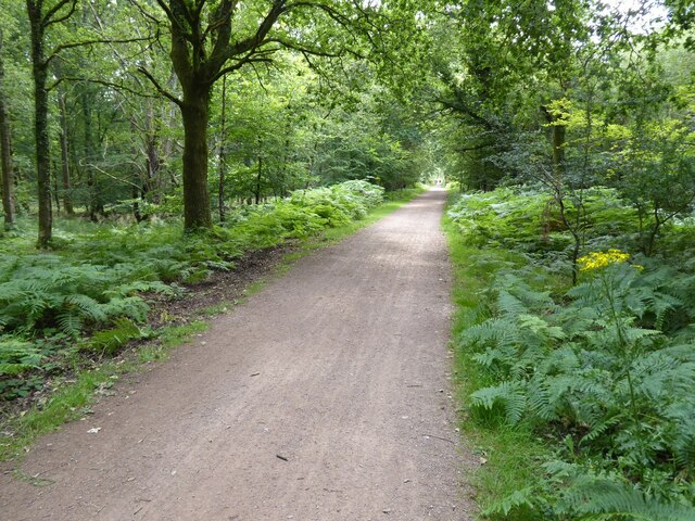
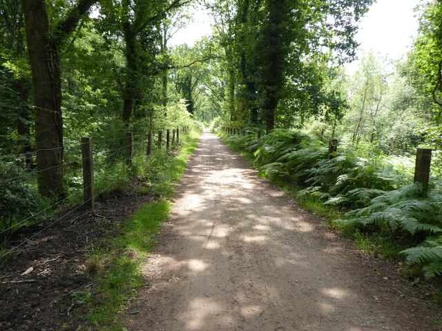
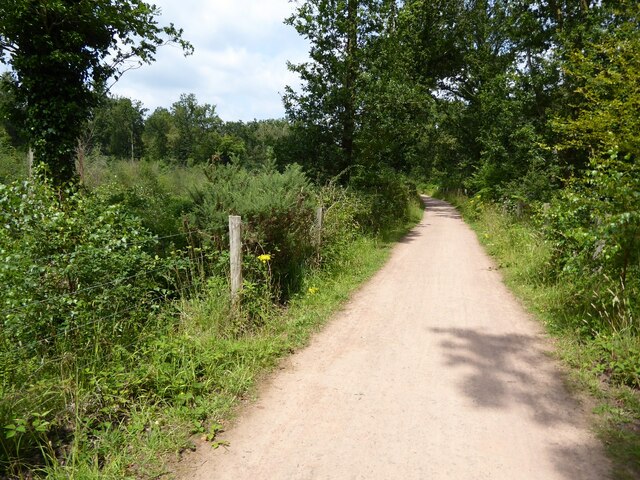
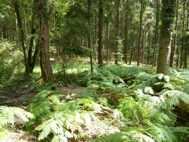
Light Moor is a beautiful woodland located in Gloucestershire, England. Nestled in the heart of the county, it is known for its stunning natural beauty and diverse ecosystem. Covering an area of approximately 100 acres, Light Moor is characterized by its dense forest, sprawling meadows, and vibrant flora and fauna.

The woodland is predominantly composed of oak and beech trees, which provide a rich canopy and create a serene and tranquil atmosphere. The forest floor is adorned with a variety of wildflowers, including bluebells and primroses, adding a splash of color to the landscape during the spring season.

Light Moor is a haven for wildlife enthusiasts, as it is home to a wide range of species. Birdwatchers can spot various avian species such as woodpeckers, owls, and thrushes, while nature lovers might catch glimpses of deer, foxes, and badgers among the trees. The woodland also boasts a small pond that attracts amphibians and insects, making it an ideal spot for observing the local aquatic life.

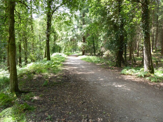
This enchanting woodland offers numerous opportunities for outdoor activities. Visitors can enjoy leisurely walks along the well-maintained trails, breathing in the crisp, fresh air and immersing themselves in nature. The forest's serene ambiance and picturesque surroundings make it a popular destination for picnics, photography, and even meditation.

Light Moor, with its natural beauty and abundant wildlife, is a true gem in the Gloucestershire countryside. It provides a much-needed escape from the hustle and bustle of daily life, offering visitors a chance to connect with nature and appreciate the wonders of the woodland ecosystem.

If you have any feedback on the listing, please let us know in the comments section below.
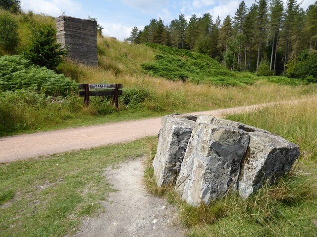
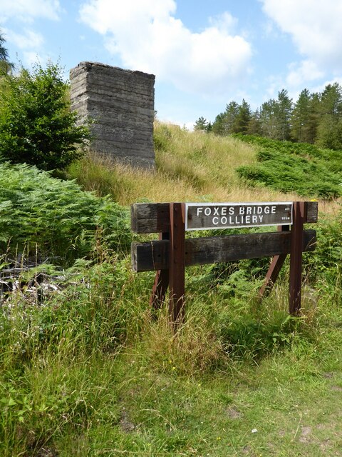
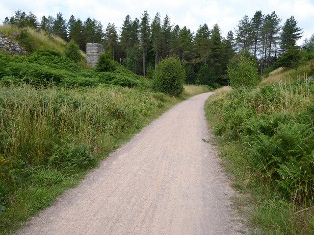
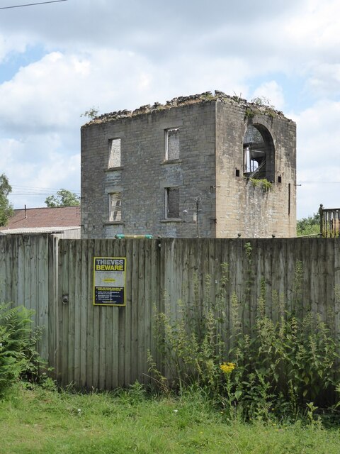
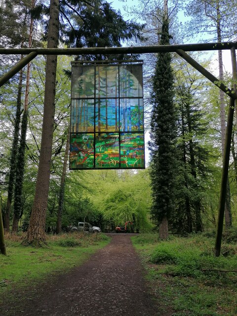
Light Moor Images

Images are sourced within 2km of 51.80781/-2.52345 or Grid Reference SO6412. Thanks to Geograph Open Source API. All images are credited.

Cycleway and former railway Cycleway and former railway trackbed passing through Crabtreehill Plantation in the Forest of Dean.
Cycleway and former railway
Cycleway and former railway trackbed passing through Crabtreehill Plantation in the Forest of Dean.
Site of Foxes Bridge Colliery Former railway track and now a cycleway passing through the site of Foxes Bridge Colliery.  Trees have been felled since I last photographed this site just over seven years ago <a href="https://www.geograph.org.uk/photo/3954592">SO6313 : Foxes Bridge Colliery</a>.
Site of Foxes Bridge Colliery
Former railway track and now a cycleway passing through the site of Foxes Bridge Colliery. Trees have been felled since I last photographed this site just over seven years ago SO6313 : Foxes Bridge Colliery.
Site of Foxes Bridge Colliery The site of Foxes Bridge Colliery viewed from a former railway track and now cycleway.
Site of Foxes Bridge Colliery
The site of Foxes Bridge Colliery viewed from a former railway track and now cycleway.
Site of Foxes Bridge Colliery Former railway track and now a cycleway passing through the site of Foxes Bridge Colliery.
Site of Foxes Bridge Colliery
Former railway track and now a cycleway passing through the site of Foxes Bridge Colliery.
Cycleway passing through Crabtreehill Plantation Cycleway on a former railway trackbed passing through Crabtreehill Plantation.
Cycleway passing through Crabtreehill Plantation
Cycleway on a former railway trackbed passing through Crabtreehill Plantation.
Cycleway near Dilke Hospital Cycleway and former railway trackbed near Dilke Hospital in the Forest of Dean.
Cycleway near Dilke Hospital
Cycleway and former railway trackbed near Dilke Hospital in the Forest of Dean.
Dilke Hospital Dilke Memorial Hospital opened in 1921 and is named after Sir Charles Dilke, 2nd Baronet who was a Liberal MP for the Forest of Dean and died in 1911.
Dilke Hospital
Dilke Memorial Hospital opened in 1921 and is named after Sir Charles Dilke, 2nd Baronet who was a Liberal MP for the Forest of Dean and died in 1911.
Former Lightmoor Colliery Engine House The derelict engine house of the former Lightmoor Colliery viewed from the cycleway which passes by following a former railway.
Former Lightmoor Colliery Engine House
The derelict engine house of the former Lightmoor Colliery viewed from the cycleway which passes by following a former railway.
Forestry at Great Palescot Ferns and trees at Great Palescot in the Forest of Dean.
Forestry at Great Palescot
Ferns and trees at Great Palescot in the Forest of Dean.
Cycleway near Great Saintlow Cycleway and former railway trackbed near Great Saintlow.
Cycleway near Great Saintlow
Cycleway and former railway trackbed near Great Saintlow.
Forest of Dean Sculpture Trail Stained glass window at Forest of Dean Sculpture Trail
Forest of Dean Sculpture Trail
Stained glass window at Forest of Dean Sculpture Trail
Pump bob - Foxes Bridge Colliery near Cinderford This inverted tee bob was undoubtedly associated with a steam pumping engine for draining this colliery and has been retained on site on a specially made concrete pad. Unfortunately it is being reclaimed by nature and is fairly well hidden although there is a well established path to it. It took me a while of hunting to find it from the nearby cycle trail.
Pump bob - Foxes Bridge Colliery near Cinderford
This inverted tee bob was undoubtedly associated with a steam pumping engine for draining this colliery and has been retained on site on a specially made concrete pad. Unfortunately it is being reclaimed by nature and is fairly well hidden although there is a well established path to it. It took me a while of hunting to find it from the nearby cycle trail.
Dilke Memorial Hospital near Cinderford
Trig point near Crabtree Hill, forest of Dean
Entrance to Forest of Dean Crematorium
Remains of Foxes Bridge Colliery near Cinderford Some large lumps of masonry adjoining a cycle trail through the site. There are other interesting foundations and the remains of a pumping bob nearby but they do take a little hunting for.
Remains of Foxes Bridge Colliery near Cinderford
Some large lumps of masonry adjoining a cycle trail through the site. There are other interesting foundations and the remains of a pumping bob nearby but they do take a little hunting for.
Junction of tracks near the site of Foxes Bridge Colliery The crossing track is a family cycle way. The houses in the distance are in Cinderford
Junction of tracks near the site of Foxes Bridge Colliery
The crossing track is a family cycle way. The houses in the distance are in Cinderford
Show me another place!

Light Moor is located at Grid Ref: SO6412 (Lat: 51.80781, Lng: -2.52345)

Administrative County: Gloucestershire

District: Forest of Dean

Police Authority: Gloucestershire

What 3 Words

///boomer.branched.routines. Near Cinderford, Gloucestershire

Related Wikis

Foxes Bridge Bog

Foxes Bridge Bog (grid reference SO630125) is a 5.3-hectare (13-acre) nature reserve in Gloucestershire. The site is owned by the Forestry Commission and...

Ruspidge Halt railway station

Ruspidge Halt railway station is a disused railway station opened by the Great Western Railway (GWR) on the former Bullo Pill Railway, later known as the...

Woorgreens Lake and Marsh

Woorgreens Lake and Marsh (grid reference SO630127) is a 9-hectare (22-acre) nature reserve in Gloucestershire.The site is owned by the Forestry Commission...

Staple Edge Halt railway station

Staple Edge Halt railway station is a disused railway station opened by the Great Western Railway (GWR) on the former Bullo Pill Railway, later known as...

Nearby Amenities

Located within 500m of 51.80781,-2.52345
Lightmoor
Historic: colliery
Is In: Gloucestershire, England, UK
Place: locality
Lat/Long: 51.8060501/-2.527492
Bus Stop
Dilke Hospital
Naptan AtcoCode: 1600GL1609
Naptan Bearing: E
Naptan CommonName: Dilke Hospital
Naptan NaptanCode: gloajawt
Naptan Street: Speech House Rd
Naptan Verified: no
Source: naptan_import
Lat/Long: 51.8105258/-2.5197573
Bus Stop
Dilke Hospital
Naptan AtcoCode: 1600GL1610
Naptan Bearing: W
Naptan CommonName: Dilke Hospital
Naptan Indicator: Opp
Naptan NaptanCode: gloajdad
Naptan Street: Speech House Rd
Naptan Verified: no
Source: naptan_import
Lat/Long: 51.810445/-2.5197274
Bus Stop
Yew Tree Brake Cemetery
Naptan AtcoCode: 1600GL5441
Naptan Bearing: E
Naptan CommonName: Yew Tree Brake Cemetery
Naptan Indicator: Opp
Naptan NaptanCode: gloajadg
Naptan Street: Speech House Rd
Naptan Verified: no
Source: naptan_import
Lat/Long: 51.8099761/-2.5261043
Bus Stop
Yew Tree Brake Cemetery
Naptan AtcoCode: 1600GL5442
Naptan Bearing: W
Naptan CommonName: Yew Tree Brake Cemetery
Naptan NaptanCode: gloajadp
Naptan Street: Speech House Rd
Naptan Verified: no
Source: naptan_import
Lat/Long: 51.8099687/-2.5257561
Parking
Lat/Long: 51.8101666/-2.5212389
Power: pole
Lat/Long: 51.8065227/-2.5220154
Power: pole
Lat/Long: 51.8068552/-2.5214911
Power: pole
Lat/Long: 51.8070733/-2.5205523
Power: pole
Lat/Long: 51.808769/-2.5178365
Power: pole
Lat/Long: 51.8095948/-2.5179693
Power: pole
Lat/Long: 51.8106811/-2.5181088
Power: pole
Lat/Long: 51.8103204/-2.5252086
Power: pole
Lat/Long: 51.8108336/-2.5242484
Power: pole
Lat/Long: 51.8111089/-2.5231299
Power: pole
Lat/Long: 51.8114737/-2.5216547
Gorsy Tump
Place: locality
Lat/Long: 51.808341/-2.528395
Light Moor
Place: locality
Lat/Long: 51.8075182/-2.523506
Description: In-patients (ward) entrace
Entrance: yes
Wheelchair: yes
Lat/Long: 51.8110483/-2.5197848
Entrance: main
Wheelchair: yes
Lat/Long: 51.811055/-2.5200376
The data included in this document is from www.openstreetmap.org. The data is made available under ODbL.

Have you been to Light Moor?

Leave your review of Light Moor below (or comments, questions and feedback).