Ruppen Coppice

Wood, Forest in Dorset

England

Ruppen Coppice

Benchmark on Remedy House, near Hermitage Ordnance Survey benchmark, described on database at <span class="nowrap"><a title="http://www.bench-marks.org.uk/bm71318" rel="nofollow ugc noopener" href="http://www.bench-marks.org.uk/bm71318">Link</a><img style="margin-left:2px;" alt="External link" title="External link - shift click to open in new window" src="https://s1.geograph.org.uk/img/external.png" width="10" height="10"/></span>. See also <a href="https://www.geograph.org.uk/photo/4723466">ST6405 : Remedy House gate, near Hermitage</a>.
Benchmark on Remedy House, near Hermitage Credit: Becky Williamson

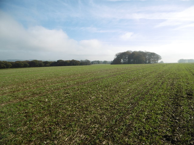
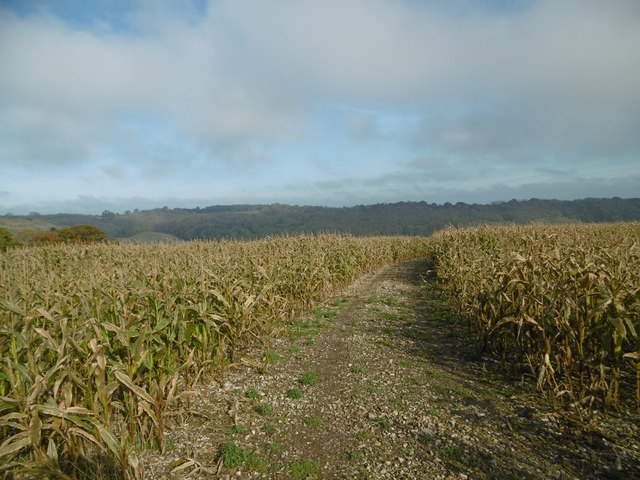
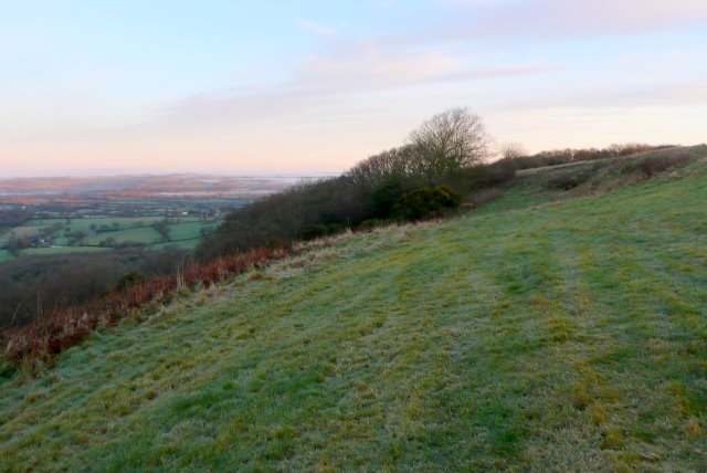
Ruppen Coppice, located in the county of Dorset, is a captivating wood that offers visitors a serene and picturesque forest experience. Encompassing an area of approximately 100 acres, Ruppen Coppice is known for its breathtaking beauty and diverse flora and fauna.

The wood is predominantly made up of a mixture of deciduous and evergreen trees, including oak, beech, ash, and birch, which create a rich canopy providing shade and shelter. The forest floor is covered with a vibrant carpet of bluebells, primroses, and wild garlic during the spring, transforming the woodland into a magical realm.

Ruppen Coppice is home to a plethora of wildlife, making it a haven for nature enthusiasts. Visitors may encounter various bird species such as woodpeckers, buzzards, and owls, as well as mammals like deer, foxes, and badgers. The wood's tranquil atmosphere also attracts butterflies and other insects, adding to the biodiversity of the area.

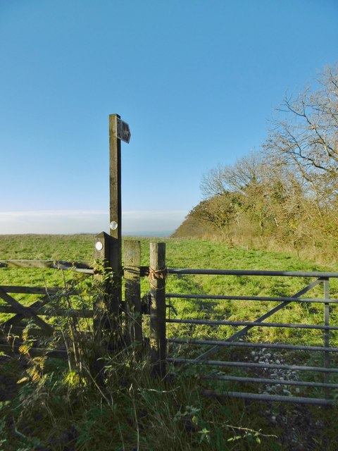
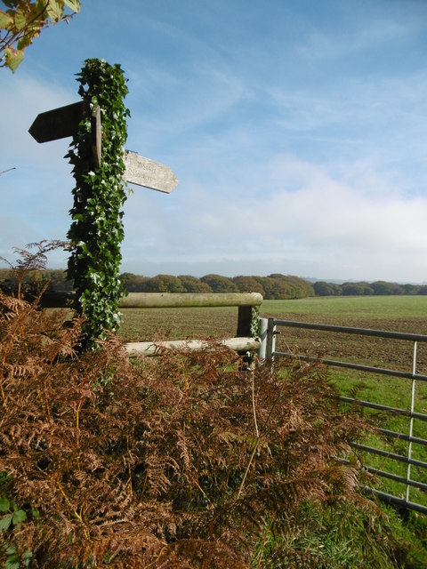
Walking trails wind through Ruppen Coppice, allowing visitors to explore the wood and appreciate its natural wonders. These paths provide an opportunity to immerse oneself in the peaceful ambiance and enjoy the sounds of birdsong and rustling leaves. Additionally, the wood offers picnic areas where visitors can relax and enjoy the surroundings.

Ruppen Coppice is a popular destination for both locals and tourists seeking solace and a connection with nature. Its beauty and tranquility make it an excellent spot for photography, painting, or simply unwinding and recharging amidst the beauty of Dorset's natural landscape.

If you have any feedback on the listing, please let us know in the comments section below.

Ruppen Coppice Images

Images are sourced within 2km of 50.837808/-2.5155143 or Grid Reference ST6304. Thanks to Geograph Open Source API. All images are credited.

Benchmark on Remedy House, near Hermitage Ordnance Survey benchmark, described on database at <span class="nowrap"><a title="http://www.bench-marks.org.uk/bm71318" rel="nofollow ugc noopener" href="http://www.bench-marks.org.uk/bm71318">Link</a><img style="margin-left:2px;" alt="External link" title="External link - shift click to open in new window" src="https://s1.geograph.org.uk/img/external.png" width="10" height="10"/></span>. See also <a href="https://www.geograph.org.uk/photo/4723466">ST6405 : Remedy House gate, near Hermitage</a>.
Benchmark on Remedy House, near Hermitage
Ordnance Survey benchmark, described on database at LinkExternal link. See also ST6405 : Remedy House gate, near Hermitage.
Remedy House gate, near Hermitage There is an Ordnance Survey benchmark on the right-hand side of the gable end of this house. See <a href="https://www.geograph.org.uk/photo/4723461">ST6405 : Benchmark on Remedy House, near Hermitage</a>
Ordnance Survey benchmark, described on database at <span class="nowrap"><a title="http://www.bench-marks.org.uk/bm71318" rel="nofollow ugc noopener" href="http://www.bench-marks.org.uk/bm71318">Link</a><img style="margin-left:2px;" alt="External link" title="External link - shift click to open in new window" src="https://s1.geograph.org.uk/img/external.png" width="10" height="10"/></span>.
Remedy House gate, near Hermitage
There is an Ordnance Survey benchmark on the right-hand side of the gable end of this house. See ST6405 : Benchmark on Remedy House, near Hermitage Ordnance Survey benchmark, described on database at LinkExternal link.
East Hill, minor road Along the ridge, from Holywell to Minterne Magna.
East Hill, minor road
Along the ridge, from Holywell to Minterne Magna.
East Hill, gate Leading to White's Wood - visitors not welcome.
East Hill, gate
Leading to White's Wood - visitors not welcome.
East Hill, farm road Leading to a barn on Batcombe Down.
East Hill, farm road
Leading to a barn on Batcombe Down.
Gore Hill, byway Leading to Redpost Hill.
Gore Hill, byway
Leading to Redpost Hill.
Gore Hill, cereal field Where is that path? Wherever, it does not seem to have been used since this large field was ploughed and seeded.
Gore Hill, cereal field
Where is that path? Wherever, it does not seem to have been used since this large field was ploughed and seeded.
Gore Hill, bridleway junction On the Wessex Ridgeway. <span class="nowrap"><a title="https://www.ldwa.org.uk/ldp/members/show_path.php?path_name=Wessex+Ridgeway+Trail" rel="nofollow ugc noopener" href="https://www.ldwa.org.uk/ldp/members/show_path.php?path_name=Wessex+Ridgeway+Trail">Link</a><img style="margin-left:2px;" alt="External link" title="External link - shift click to open in new window" src="https://s1.geograph.org.uk/img/external.png" width="10" height="10"/></span>
Gore Hill, bridleway junction
On the Wessex Ridgeway. LinkExternal link
Gore Hill, bridleway marker Across grazing land to Batcombe.
Gore Hill, bridleway marker
Across grazing land to Batcombe.
Gore Hill, footpath marker On the way to Telegraph Hill or Seldon Hill.
Gore Hill, footpath marker
On the way to Telegraph Hill or Seldon Hill.
Up Sydling, bridleway Bridleway and farm road, on the Wessex Ridgeway. <span class="nowrap"><a title="https://www.ldwa.org.uk/ldp/members/show_path.php?path_name=Wessex+Ridgeway+Trail" rel="nofollow ugc noopener" href="https://www.ldwa.org.uk/ldp/members/show_path.php?path_name=Wessex+Ridgeway+Trail">Link</a><img style="margin-left:2px;" alt="External link" title="External link - shift click to open in new window" src="https://s1.geograph.org.uk/img/external.png" width="10" height="10"/></span>
Up Sydling, bridleway
Bridleway and farm road, on the Wessex Ridgeway. LinkExternal link
Up Sydling, bridleway Junction Bridleways and farm roads: left, Wessex Ridgeway, towards Sydling St. Nicholas; right, to Up Sydling. <span class="nowrap"><a title="https://www.ldwa.org.uk/ldp/members/show_path.php?path_name=Wessex+Ridgeway+Trail" rel="nofollow ugc noopener" href="https://www.ldwa.org.uk/ldp/members/show_path.php?path_name=Wessex+Ridgeway+Trail">Link</a><img style="margin-left:2px;" alt="External link" title="External link - shift click to open in new window" src="https://s1.geograph.org.uk/img/external.png" width="10" height="10"/></span>
Up Sydling, bridleway Junction
Bridleways and farm roads: left, Wessex Ridgeway, towards Sydling St. Nicholas; right, to Up Sydling. LinkExternal link
Up Sydling, cattle trough In a field on Redpost Hill.
Up Sydling, cattle trough
In a field on Redpost Hill.
Up Sydling, bridleway Bridleway and farm road from <a href="https://www.geograph.org.uk/photo/4723897">ST6302 : Up Sydling, bridleway Junction</a> to the village.
Up Sydling, bridleway
Bridleway and farm road from ST6302 : Up Sydling, bridleway Junction to the village.
Up Sydling, gate At the beginning of a farm track towards Eastcombe Bottom.
Up Sydling, gate
At the beginning of a farm track towards Eastcombe Bottom.
Up Cerne, maize field On Bazon Hill.
Up Cerne, maize field
On Bazon Hill.
Up Cerne, farm track Left, Fernycombe Coppice; right, a young cereal crop.
Up Cerne, farm track
Left, Fernycombe Coppice; right, a young cereal crop.
Up Cerne, Wessex Ridgeway Farm track, and part of the Wessex Ridgeway: <span class="nowrap"><a title="https://www.ldwa.org.uk/ldp/members/show_path.php?path_name=Wessex+Ridgeway+Trail" rel="nofollow ugc noopener" href="https://www.ldwa.org.uk/ldp/members/show_path.php?path_name=Wessex+Ridgeway+Trail">Link</a><img style="margin-left:2px;" alt="External link" title="External link - shift click to open in new window" src="https://s1.geograph.org.uk/img/external.png" width="10" height="10"/></span>
Up Cerne, Wessex Ridgeway
Farm track, and part of the Wessex Ridgeway: LinkExternal link
Show me another place!

Ruppen Coppice is located at Grid Ref: ST6304 (Lat: 50.837808, Lng: -2.5155143)

Unitary Authority: Dorset

Police Authority: Dorset

What 3 Words

///printouts.hometown.score. Near Maiden Newton, Dorset

Related Wikis

Hilfield

Hilfield is a small, scattered village and civil parish in west Dorset, England, situated under the scarp face of the Dorset Downs 7 miles (11 km) south...

Cerne, Totcombe and Modbury Hundred

Cerne, Totcombe and Modbury Hundred was a hundred in the county of Dorset, England. Some of its tithings and parishes were exclaves which indicates that...

Telegraph Hill, Dorset

Telegraph Hill (267 metres, 876 feet high) is a hill about 1 mile northwest of Minterne Magna and about 10 miles north of Dorchester in the county of Dorset...

Batcombe Down

Batcombe Down (grid reference ST623040) is an 18.6 hectare biological Site of Special Scientific Interest in Dorset, England: notified in 1952. == Sources... ==

Nearby Amenities

Located within 500m of 50.837808,-2.5155143
Barrier: bollard
Lat/Long: 50.8336968/-2.5174537
Barrier: bollard
Lat/Long: 50.8336748/-2.5175241
The data included in this document is from www.openstreetmap.org. The data is made available under ODbL.

Have you been to Ruppen Coppice?

Leave your review of Ruppen Coppice below (or comments, questions and feedback).