Serpent Brae
Wood, Forest in Northumberland
England
Serpent Brae
Located in Northumberland, England, Serpent Brae is a captivating woodland area known for its natural beauty and serene atmosphere. Nestled within the heart of the county, this enchanting forest offers visitors a peaceful retreat from the hustle and bustle of everyday life.
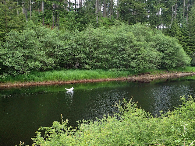
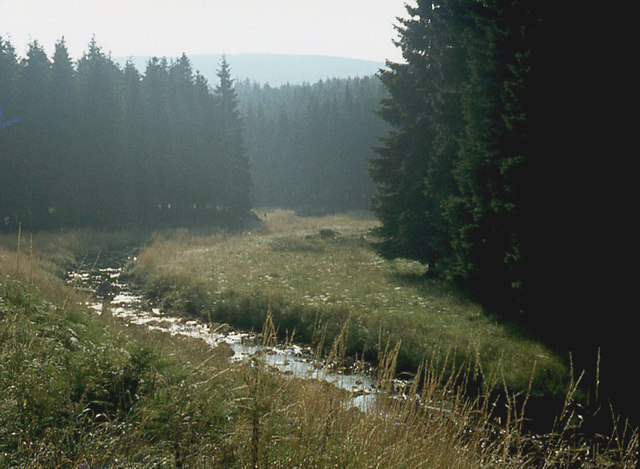
Serpent Brae is characterized by its dense, ancient woodlands, consisting primarily of oak, birch, and beech trees. The area's rich biodiversity is home to a plethora of flora and fauna, with vibrant wildflowers carpeting the forest floor in the springtime. The woodland's diverse ecosystem attracts a variety of bird species, including woodpeckers, owls, and warblers, making it a haven for birdwatchers and nature enthusiasts.
The forest's name, Serpent Brae, is derived from a meandering trail that winds its way through the woods, resembling the sinuous path of a serpent. This trail offers visitors the opportunity to explore the forest's hidden gems, revealing picturesque viewpoints, babbling brooks, and secretive wildlife habitats along the way.
Serpent Brae is a popular destination for outdoor activities such as hiking, cycling, and nature walks. The forest boasts a network of well-maintained trails, catering to all levels of fitness and ability. Whether one seeks a leisurely stroll or a challenging hike, there is a path to suit every adventurer.
As a designated Area of Outstanding Natural Beauty, Serpent Brae is not only a haven for nature enthusiasts but also a valuable ecological resource. The woodlands provide vital habitats for endangered species, contributing to the preservation of Northumberland's natural heritage.
In summary, Serpent Brae is a captivating woodland area in Northumberland, renowned for its ancient trees, diverse wildlife, and serene atmosphere. With its enchanting trails and breathtaking vistas, it offers a tranquil escape for those seeking solace in nature's embrace.
If you have any feedback on the listing, please let us know in the comments section below.
Serpent Brae Images
Images are sourced within 2km of 55.191666/-2.579051 or Grid Reference NY6388. Thanks to Geograph Open Source API. All images are credited.


Serpent Brae is located at Grid Ref: NY6388 (Lat: 55.191666, Lng: -2.579051)
Unitary Authority: Northumberland
Police Authority: Northumbria
What 3 Words
///splinters.troll.builders. Near Bellingham, Northumberland
Nearby Locations
Related Wikis

HMS Standard (shore establishment)
HMS Standard was a British Royal Navy shore establishment between 1942 and 1945. Situated well away from the sea near Kielder in Northumberland, the base...
Lewiefield Halt railway station
Lewiefield Halt was a wooden-built halt that served the hamlet of Lewie, and a Ministry of Labour training camp, in Northumberland, England. == History... ==
Plashetts railway station
Plashetts railway station is a closed stone built railway station that served the mining hamlet of Plashetts, in Northumberland, England, which is now...

Kielder Forest
Kielder Forest is a large forestry plantation in Northumberland, England, surrounding Kielder village and the Kielder Water reservoir. It is the largest...
Devil's Lapful
Devil's Lapful is an archaeological site in Northumberland, England, in Kielder Forest about 0.8 miles (1.3 km) south-east of Kielder. The site, a Neolithic...
Plashetts
Plashetts is a small settlement in Northumberland, in England south east of Kielder, Northumberland. It is about 22 miles (35 km) north west of Hexham...

Butteryhaugh
Butteryhaugh is a village in Northumberland, in England. It is situated a short distance to the south-east of Kielder. Although a separate "village" from...

Kielder
Kielder is a small, remote village in western Northumberland, England. Located at the head of Kielder Water and in the north west of Kielder Forest, the...
Related Videos

Family Activities in Northumberland | Kielder Waterside
Looking for things to do in Northumberland this year? Kielder Waterside provides a large number of onsite activities, including ...

Entertaining vibes from winter wonderland Kielder.
winter wonderland Kielder is in Northumberland, it is a unitary authority and historic county in the northeast of England. while ...

Kielder Waterside - Birds of Prey Centre in Northumberland
Visit Kielder Waterside for the chance for you and your family to come face to face with Britain's Birds of Prey. Our experts will treat ...
Nearby Amenities
Located within 500m of 55.191666,-2.579051Have you been to Serpent Brae?
Leave your review of Serpent Brae below (or comments, questions and feedback).