Honeycombe Wood

Wood, Forest in Dorset

England

Honeycombe Wood

Direction Sign – Signpost on the A352 in Castleton parish Located at Dancing Hill on the north side of the junction of the A352 Sherborne Hill and Pound Road in Castleton parish. 3 arms and annulus & bar finial. 

Milestone Society National ID: DO_ST6315
Direction Sign – Signpost on the A352 in Castleton parish Credit: Mr Red

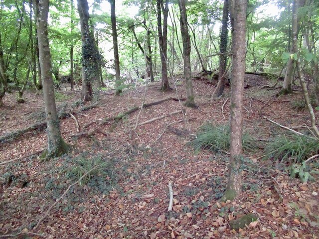
Honeycombe Wood is a picturesque forest located in the county of Dorset, England. Nestled within the stunning landscape of the region, this wood is a haven for nature enthusiasts and those seeking tranquility amidst natural beauty.

Covering an area of approximately 100 acres, Honeycombe Wood is predominantly made up of deciduous trees, including oak, beech, and ash. The dense foliage creates a lush canopy overhead, providing shade and shelter for a diverse range of flora and fauna.

The wood is crisscrossed with winding trails and footpaths, allowing visitors to explore its enchanting surroundings. These paths lead to hidden clearings, babbling brooks, and stunning viewpoints that offer breathtaking views of the surrounding countryside.

Wildlife is abundant within Honeycombe Wood, making it a haven for birdwatchers and wildlife enthusiasts. Visitors may spot various species of birds, such as woodpeckers, warblers, and owls, as well as small mammals like hedgehogs, squirrels, and foxes. The wood is also home to a variety of insects, including butterflies and beetles, adding to its ecological diversity.

Honeycombe Wood is a popular destination for outdoor activities such as hiking, picnicking, and photography. The peaceful ambiance and natural beauty make it an ideal spot for relaxation and connecting with nature. The wood is open to the public throughout the year, with no entrance fee, providing an accessible and enjoyable experience for all.

If you have any feedback on the listing, please let us know in the comments section below.

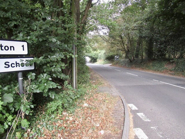
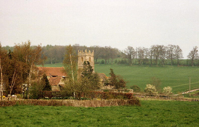
Honeycombe Wood Images

Images are sourced within 2km of 50.927828/-2.5245627 or Grid Reference ST6314. Thanks to Geograph Open Source API. All images are credited.

Direction Sign – Signpost on the A352 in Castleton parish Located at Dancing Hill on the north side of the junction of the A352 Sherborne Hill and Pound Road in Castleton parish. 3 arms and annulus & bar finial. 

Milestone Society National ID: DO_ST6315
Direction Sign – Signpost on the A352 in Castleton parish
Located at Dancing Hill on the north side of the junction of the A352 Sherborne Hill and Pound Road in Castleton parish. 3 arms and annulus & bar finial. Milestone Society National ID: DO_ST6315
Sherborne - Bandstand The bandstand in Pageant Gardens was refurbished in 1996 and is used by the Sherborne Town Band for summer concerts.
<span class="nowrap"><a title="www.sherborne-tc.gov.uk" rel="nofollow ugc noopener" href="http://www.sherborne-tc.gov.uk">Link</a><img style="margin-left:2px;" alt="External link" title="External link - shift click to open in new window" src="https://s1.geograph.org.uk/img/external.png" width="10" height="10"/></span>
Sherborne - Bandstand
The bandstand in Pageant Gardens was refurbished in 1996 and is used by the Sherborne Town Band for summer concerts. LinkExternal link
A352 north of Longburton
Stile and gate, Windmill Hill
Fields, Windmill Hill Forage maize in the background.
Fields, Windmill Hill
Forage maize in the background.
Honeycombe Wood A lovely woodland and with complex contours. It has been quarried in the past.
Honeycombe Wood
A lovely woodland and with complex contours. It has been quarried in the past.
Path, Honeycombe Wood
Near the summit, Honeycombe  Tout Complex contouring in what was once a quarry.
Near the summit, Honeycombe Tout
Complex contouring in what was once a quarry.
Lenthay Common Taken during a mad dash to catch a train from Yeovil Junction. The line through Sherborne had closed due to shrinkage of the clay during a dry spell. The tracks on one embankment had been distorted. The path here (I had taken a wrong turn in Sherborne) had some big cracks in the clay too.
Lenthay Common
Taken during a mad dash to catch a train from Yeovil Junction. The line through Sherborne had closed due to shrinkage of the clay during a dry spell. The tracks on one embankment had been distorted. The path here (I had taken a wrong turn in Sherborne) had some big cracks in the clay too.
Car park at Sherborne station
Gulls following the ploughing tractor, near Sherborne
Honeycombe Wood taken from Lenthay Common, Sherborne
Western tip of Sherborne taken from the Yeovil Sherborne mainline
Playing Fields at Dancing Hill - Sherborne This picture taken looking west from a recently launched hot air balloon
Playing Fields at Dancing Hill - Sherborne
This picture taken looking west from a recently launched hot air balloon
Lillington: church and hamlet The centre of a small parish south of Sherborne; Lower Farm and the church are the main features here. The parish is bordered by the even smaller Leweston, to the east, on the hill
Lillington: church and hamlet
The centre of a small parish south of Sherborne; Lower Farm and the church are the main features here. The parish is bordered by the even smaller Leweston, to the east, on the hill
Lenthay Copse, Yeo valley, near Sherborne, Dorset – view E, with new conservation hedgerow in the foreground.
Lenthay Copse, Yeo valley, near Sherborne, Dorset
– view E, with new conservation hedgerow in the foreground.
Road north out of Longburton towards Sherborne
Westhill Lodge at the road junction above Sherborne
Show me another place!

Honeycombe Wood is located at Grid Ref: ST6314 (Lat: 50.927828, Lng: -2.5245627)

Unitary Authority: Dorset

Police Authority: Dorset

What 3 Words

///tastier.happy.ruffle. Near Sherborne, Dorset

Related Wikis

Lillington, Dorset

Lillington is a hamlet and civil parish in north west Dorset, England, situated 3 miles (4.8 km) south of Sherborne. Dorset County Council estimate that...

Sherborne RFC

Sherborne Rugby Football Club is a rugby union club in Dorset in the south west of England. The club was established in 1980. It has a membership of 100...

Sherborne Town F.C.

Sherborne Town Football Club are a football club based in the town of Sherborne, Dorset, England. They are currently members of the Wessex League Premier...

Sherborne railway station

Sherborne railway station serves the town of Sherborne in Dorset, England. It is situated on the West of England Main Line, 118 miles 4 chains (190.0 km...

Related Videos

A Glorious Early Morning Walk in a Cotswold Village, Woodland & Countryside

So, today we are out and about walking in the Cotswold village of Sherborne which is located nearly 3.5 miles east of Northleach ...

WALKS IN DORSET at SHERBORNE (4K)

In this episode of my series “ Walks in Dorset”, I take a 6 mile circular walk starting & finishing in the historic town of Sherborne.

Walk around Sherborne castle grounds.(1)

video clips of a walk around Sherborne castle grounds. A very wonderful day.

Nearby Amenities

Located within 500m of 50.927828,-2.5245627
Communication Microwave: yes
Man Made: tower
Tower Type: communication
Lat/Long: 50.923965/-2.5235742
Power: pole
Source: bing
Lat/Long: 50.9310541/-2.5232559
The data included in this document is from www.openstreetmap.org. The data is made available under ODbL.

Have you been to Honeycombe Wood?

Leave your review of Honeycombe Wood below (or comments, questions and feedback).