Corney

Settlement in Cumberland Copeland

England

Corney

Gateway and fields Gateway and fields looking towards Flatts Farm
Gateway and fields Credit: P Gaskell

Corney is a small village located in the county of Cumberland, in the northwest region of England. Situated in the picturesque Lake District National Park, Corney is surrounded by stunning natural beauty and offers a tranquil and idyllic setting.

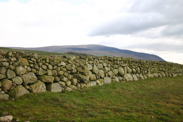
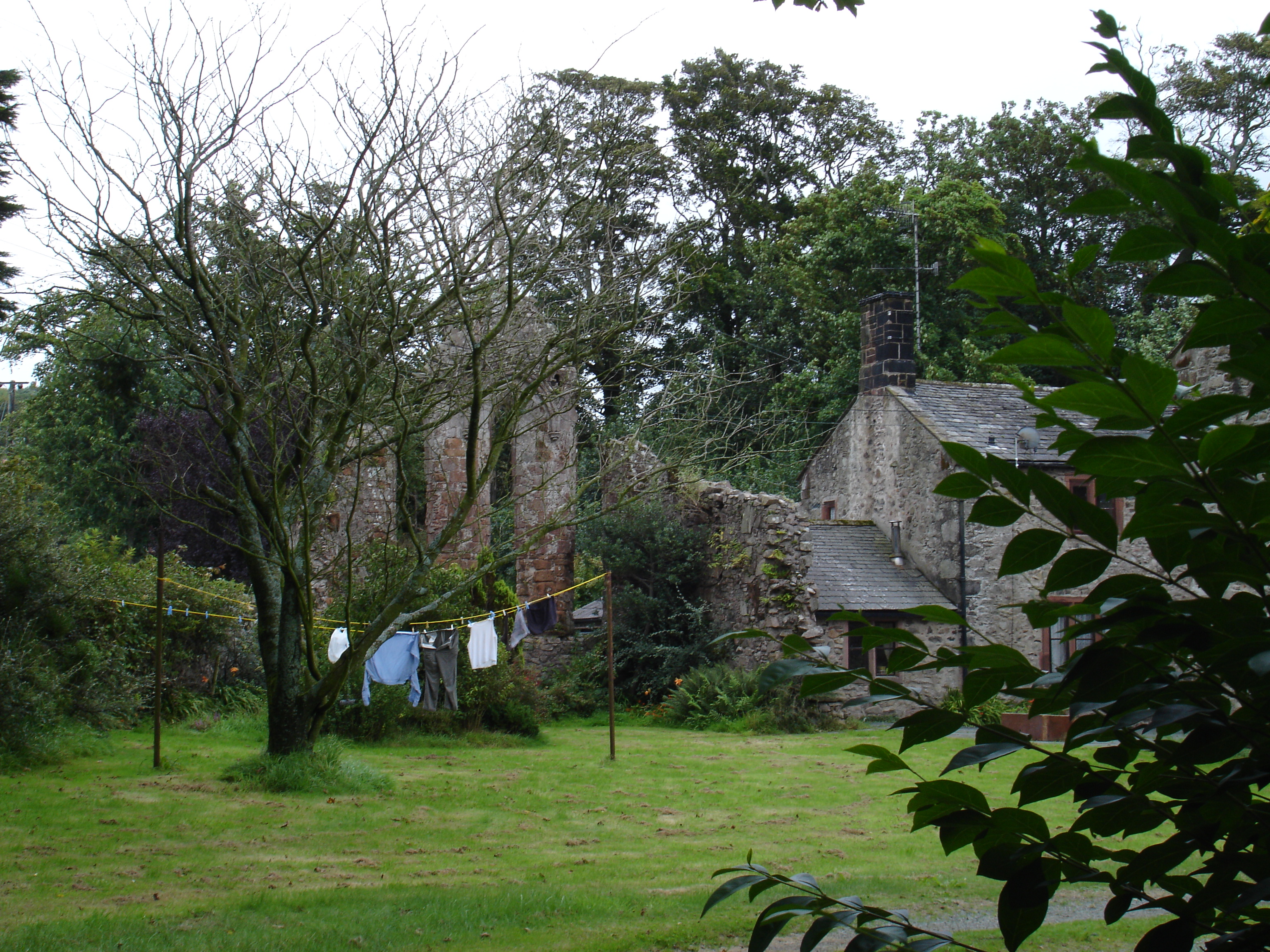
The village is characterized by its charming and traditional architecture, with many buildings dating back centuries. The local economy primarily revolves around agriculture, with lush green fields and rolling hills dominating the landscape. The area is known for its dairy farming, producing high-quality milk and cheese.

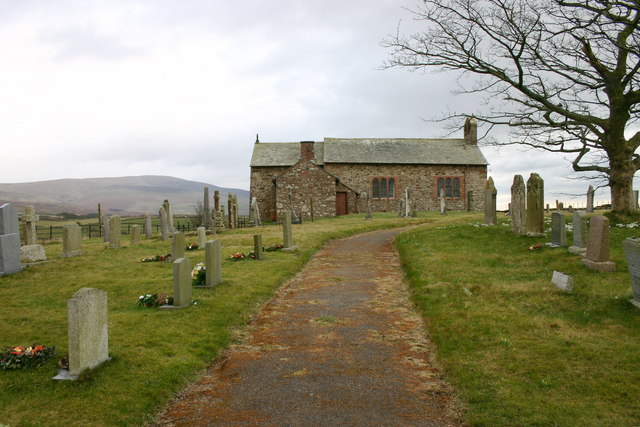
Corney is also home to St. John's Church, a historic place of worship that holds regular services for the local community. The church, built in the 12th century, boasts beautiful stained glass windows and intricate stonework, attracting visitors interested in the region's rich history.

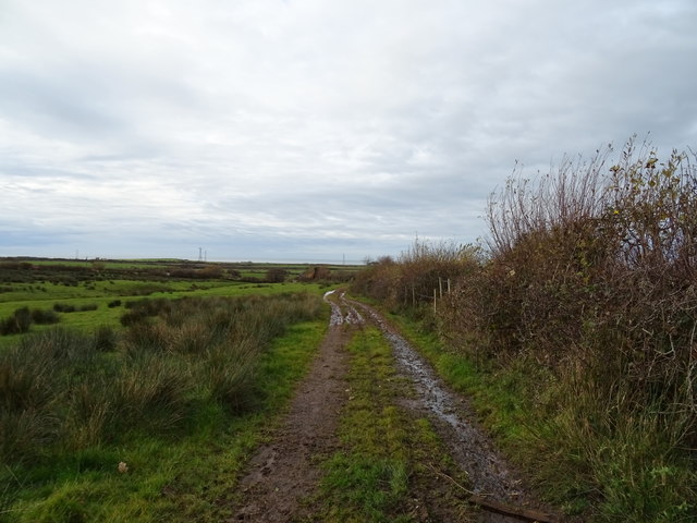
Nature enthusiasts will find plenty to explore in Corney, as the village is in close proximity to some of the Lake District's most popular hiking trails and scenic spots. One such attraction is Black Combe, a striking mountain offering breathtaking panoramic views of the surrounding countryside.

Despite its small size, Corney has a strong sense of community, with a village hall serving as a hub for social gatherings and events. Additionally, there is a local pub where residents and visitors can enjoy traditional British cuisine and ales.

Corney, Cumberland, offers a peaceful retreat for those seeking a rural getaway amidst the stunning natural beauty of the Lake District.

If you have any feedback on the listing, please let us know in the comments section below.

Corney Images

Images are sourced within 2km of 54.311733/-3.36476 or Grid Reference SD1191. Thanks to Geograph Open Source API. All images are credited.

Gateway and fields Gateway and fields looking towards Flatts Farm
Gateway and fields
Gateway and fields looking towards Flatts Farm
Ordnance Survey Cut Mark This OS cut mark can be found on the wall west side of the road. It marks a point 107.982m above mean sea level.
Ordnance Survey Cut Mark
This OS cut mark can be found on the wall west side of the road. It marks a point 107.982m above mean sea level.
Derelict Farm and Ford, Middleton Place Middleton Place is a very compact, hidden hamlet.
Derelict Farm and Ford, Middleton Place
Middleton Place is a very compact, hidden hamlet.
The road to Seaton Hall
Bridleway to Corney Fell Typical West Cumbrian landscapape.
Bridleway to Corney Fell
Typical West Cumbrian landscapape.
Rough grazing near Swallowhurst Hall
Farm track off the A595 Near Swallowhurst Hall.
Farm track off the A595
Near Swallowhurst Hall.
Track (footpath) to Middleton Place Off the A595.
Track (footpath) to Middleton Place
Off the A595.
Ordnance Survey Cut Mark This OS cut mark can be found on the north parapet of the bridge. It marks a point 11.866m above mean sea level.
Ordnance Survey Cut Mark
This OS cut mark can be found on the north parapet of the bridge. It marks a point 11.866m above mean sea level.
Waberthwaite School No signs!
Waberthwaite School
No signs!
Big Stone Wall Some of the lower stones in this wall are massive, having required great effort to move. Behind lies the bleak Corney Fell.
Big Stone Wall
Some of the lower stones in this wall are massive, having required great effort to move. Behind lies the bleak Corney Fell.
Rough Grazing
Rough Grazing
Corney Chapel Beautifully situated, with views over the fells and sea.
Corney Chapel
Beautifully situated, with views over the fells and sea.
Lane to Normoss Farm
Welcome Nook Farm Located on bleak Corney Fell
Welcome Nook Farm
Located on bleak Corney Fell
Lane to  Far Banks
Lane to Far Banks
Ruin, Lambground On the descent of Corney Fell.
Ruin, Lambground
On the descent of Corney Fell.
The Road to Low Kinmont
Show me another place!

Corney is located at Grid Ref: SD1191 (Lat: 54.311733, Lng: -3.36476)

Administrative County: Cumbria

District: Copeland

Police Authority: Cumbria

What 3 Words

///think.mothering.onion. Near Seascale, Cumbria

Nearby Locations

Corney

Related Wikis

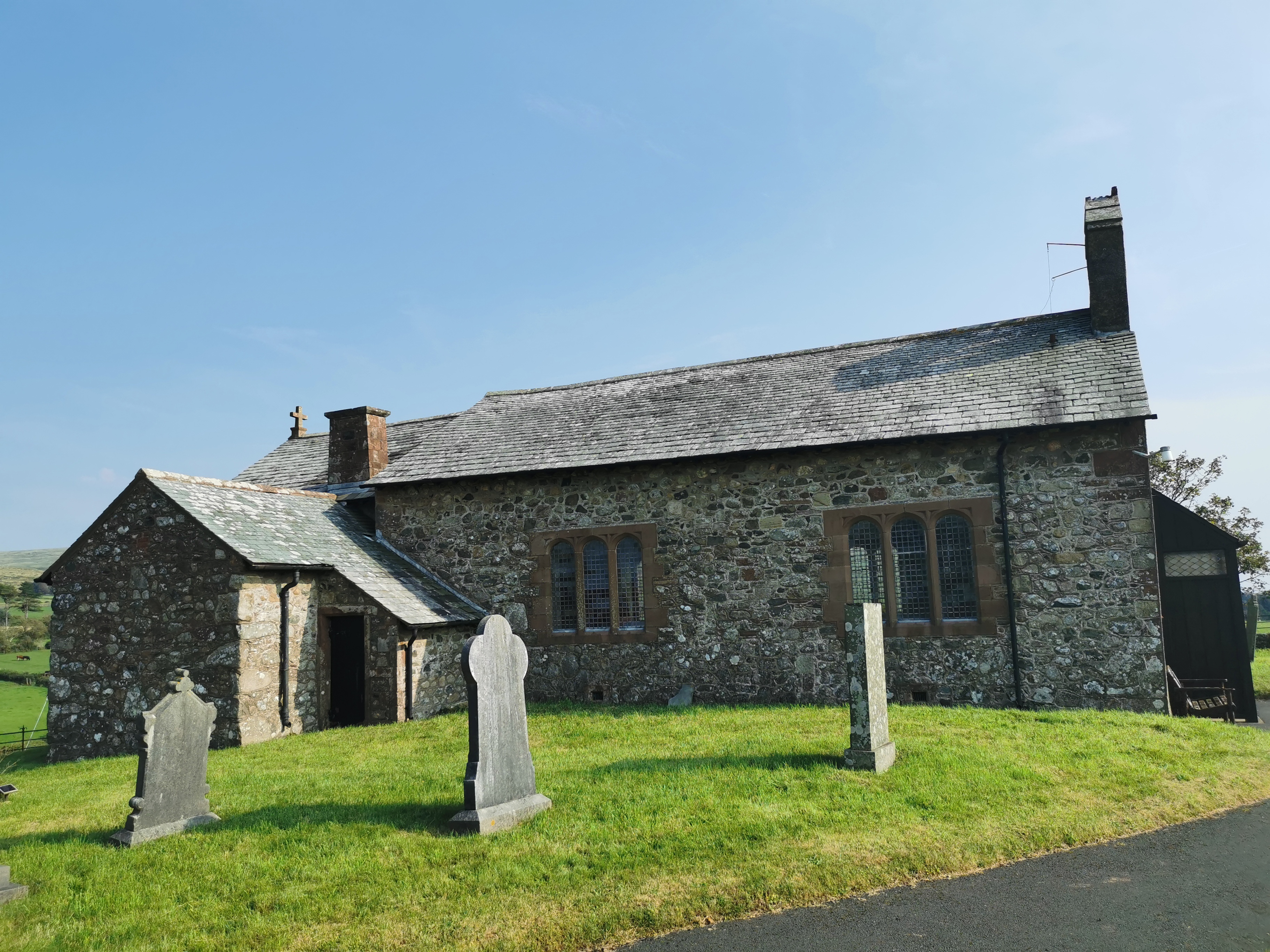
St John the Baptist, Corney

St John the Baptist, is in Corney, Cumbria, England. It is an Anglican parish church in the deanery of Calder, and the diocese of Carlisle. Its benefice...

Corney

Corney is a village and former civil parish, now in the parish of Waberthwaite, in the Cumberland district, in the ceremonial county of Cumbria, England...

Seaton Priory

Originally called the nunnery of Lekeley from the name of the land it was built upon, the former nunnery of Seaton is to the north of the parish of Bootle...

Waberthwaite

Waberthwaite is a small, former rural civil parish (about 4 square miles in area) on the south bank of the estuary of the River Esk, in Copeland, Cumbria...

Nearby Amenities

Located within 500m of 54.311733,-3.36476
Power: pole
Lat/Long: 54.3078197/-3.3638759
Power: pole
Lat/Long: 54.3088073/-3.3639515
Power: pole
Lat/Long: 54.3097845/-3.3640071
Power: pole
Lat/Long: 54.310355/-3.3632167
Power: pole
Lat/Long: 54.3110913/-3.3622139
Power: pole
Lat/Long: 54.3118604/-3.3611767
Power: pole
Lat/Long: 54.3124126/-3.3604144
Power: pole
Lat/Long: 54.3130158/-3.3595803
Power: pole
Lat/Long: 54.3139835/-3.3582526
Give Way
Direction: backward
Lat/Long: 54.3132961/-3.3668702
Power: pole
Lat/Long: 54.3075039/-3.3655875
Power: pole
Lat/Long: 54.307937/-3.3652796
Power: pole
Lat/Long: 54.3083506/-3.3649964
Power: pole
Lat/Long: 54.3087519/-3.3647431
Power: pole
Lat/Long: 54.309145/-3.3644862
Power: pole
Lat/Long: 54.3094252/-3.3649419
Power: pole
Lat/Long: 54.3096622/-3.3653254
Power: pole
Lat/Long: 54.3087488/-3.3607885
Power: pole
Lat/Long: 54.3112889/-3.3634308
Power: pole
Lat/Long: 54.3114787/-3.3646446
Power: pole
Lat/Long: 54.3117138/-3.3661592
Power: pole
Lat/Long: 54.3114808/-3.367366
Power: pole
Lat/Long: 54.311292/-3.3681611
Power: pole
Lat/Long: 54.3120032/-3.3628749
Power: pole
Lat/Long: 54.312819/-3.3623348
Power: pole
Lat/Long: 54.3135415/-3.3616206
Power: pole
Lat/Long: 54.3142423/-3.3608307
The data included in this document is from www.openstreetmap.org. The data is made available under ODbL.

Have you been to Corney?

Leave your review of Corney below (or comments, questions and feedback).