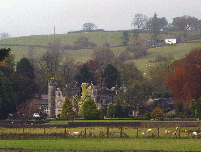
Hawkrigg Wood

Wood, Forest in Westmorland South Lakeland

England

Hawkrigg Wood

Stile, Firbank Fell A gap stile where a path leaves the road.
Stile, Firbank Fell Credit: Richard Webb

Hawkrigg Wood is a picturesque woodland located in the historic county of Westmorland, England. Spread over an area of approximately 50 acres, this enchanting forest is nestled within the undulating landscape of the Lake District National Park, renowned for its natural beauty.

The wood is predominantly composed of native broadleaf trees, including oak, ash, birch, and beech, which form a dense canopy, providing a tranquil and shaded ambiance. The forest floor is adorned with a rich carpet of vibrant wildflowers during the spring and summer months, creating a colorful tapestry of nature.

Hawkrigg Wood is home to a diverse range of wildlife, making it a haven for nature enthusiasts. Birdwatchers can spot a variety of avian species, such as woodpeckers, nuthatches, and thrushes, darting among the tree branches. The wood is also inhabited by small mammals like squirrels, badgers, and foxes, which can occasionally be glimpsed as they scuttle through the undergrowth.

Tranquility and serenity abound in this ancient woodland, making it a popular destination for walkers and hikers. Well-maintained footpaths wind their way through the trees, allowing visitors to immerse themselves in the peaceful atmosphere and enjoy the sights and sounds of nature. The wood also offers breathtaking views of the surrounding countryside, with glimpses of rolling hills and distant mountains.

Hawkrigg Wood is a true gem of Westmorland, attracting both locals and tourists alike with its natural beauty and abundant wildlife. It offers a rejuvenating escape from the bustling modern world, allowing visitors to reconnect with nature and experience the timeless charm of the British countryside.

If you have any feedback on the listing, please let us know in the comments section below.

Hawkrigg Wood Images

Images are sourced within 2km of 54.325741/-2.5820536 or Grid Reference SD6292. Thanks to Geograph Open Source API. All images are credited.

Stile, Firbank Fell A gap stile where a path leaves the road.
Stile, Firbank Fell
A gap stile where a path leaves the road.
Firbank Fell Used by the Westmorland Motor Club, but quiet today.
Firbank Fell
Used by the Westmorland Motor Club, but quiet today.
Crooked tree behind Fox's Pulpit A very attractive bit of moorland with complex contours.
Crooked tree behind Fox's Pulpit
A very attractive bit of moorland with complex contours.
Summit, Knotts A view of the Howgill Fells.
Summit, Knotts
A view of the Howgill Fells.
Knotts The summit area.
Knotts
The summit area.
Road over Firbank Fell Taken during a scenic detour due to the M6 being closed. It was raining hard. View towards Fox's Pulpit.
Road over Firbank Fell
Taken during a scenic detour due to the M6 being closed. It was raining hard. View towards Fox's Pulpit.
River Lune at Killington New Bridge
Waterlogged Field in the Lune Valley
River Lune
River Lune
Lune Viaduct Lune Viaduct, Ingleton branch. The Ingleton branch left the Skipton - Lancaster line at Clapham Junction and ran through Ingleton, Kirkby Lonsdale & Sedburgh, joining what is now the WCML at Lowgill, south of Tebay. Had the Midland and the LNWR reached agreement before parliament forced the Midland to build the S&C, this would have been the Midland’s main line to Scotland. As it was, the Midland was ordered to follow through with its plans for the S&C, and the Ingleton branch operated for around a century as a country backwater and sometime diversionary route. The stone pillars are from the characteristic Cumbrian red Sandstone, the two sets of arches are linked with a cast iron span. Opened 1861, closed to passengers 1954 and closed outright 1967.
Lune Viaduct
Lune Viaduct, Ingleton branch. The Ingleton branch left the Skipton - Lancaster line at Clapham Junction and ran through Ingleton, Kirkby Lonsdale & Sedburgh, joining what is now the WCML at Lowgill, south of Tebay. Had the Midland and the LNWR reached agreement before parliament forced the Midland to build the S&C, this would have been the Midland’s main line to Scotland. As it was, the Midland was ordered to follow through with its plans for the S&C, and the Ingleton branch operated for around a century as a country backwater and sometime diversionary route. The stone pillars are from the characteristic Cumbrian red Sandstone, the two sets of arches are linked with a cast iron span. Opened 1861, closed to passengers 1954 and closed outright 1967.
Crossdale Beck Just a few hundred yards along the line from the Lune Viaduct, Crossdale Beck was crossed by the former North Western Railway's Ingleton Branch by culverting the stream and constructing a significant embankment on top.
Crossdale Beck
Just a few hundred yards along the line from the Lune Viaduct, Crossdale Beck was crossed by the former North Western Railway's Ingleton Branch by culverting the stream and constructing a significant embankment on top.
The road to High Branthwaite Branthwaite is in the valley of the River Lune, on the lower slopes of Winder in the Howgill Fells.
The road to High Branthwaite
Branthwaite is in the valley of the River Lune, on the lower slopes of Winder in the Howgill Fells.
Three sheep grazing Contented animals in a field on the north-east side of Howgill Lane near to Sedbergh.
Arant Haw is the hill beyond.
Three sheep grazing
Contented animals in a field on the north-east side of Howgill Lane near to Sedbergh. Arant Haw is the hill beyond.
The Lane to Ghyll Farm
Fox's Pulpit
Fox's Pulpit
Grave Yard at Fox's Pulpit
Severely trimmed hedges bounding farm lane The lane is heading south towards the A683. It left the A684 as a bridleway at Ingmire Hall but shortly before reaching the next road it becomes one those ways known by the OS as an 'other route with public access'.
The hill rising in the distance will be Holme Knott.
Severely trimmed hedges bounding farm lane
The lane is heading south towards the A683. It left the A684 as a bridleway at Ingmire Hall but shortly before reaching the next road it becomes one those ways known by the OS as an 'other route with public access'. The hill rising in the distance will be Holme Knott.
River Rawthey near Holme Open Farm
Show me another place!

Hawkrigg Wood is located at Grid Ref: SD6292 (Lat: 54.325741, Lng: -2.5820536)

Administrative County: Cumbria

District: South Lakeland

Police Authority: Cumbria

What 3 Words

///embraced.works.emulating. Near Sedbergh, Cumbria

Nearby Locations

Hawkrigg Wood Moor Wood

Related Wikis

St Gregory's Church, Vale of Lune

St Gregory's Church, Vale of Lune, also known as the Vale of Lune Chapel, is a redundant Anglican church situated on the A684 road about 1.5 miles (2 km...

Ingmire Hall

Ingmire Hall is a grade II listed 16th century country house built around the remains of a pele tower some 2 miles west of Sedbergh, Cumbria, England.The...

Firbank

Firbank is a village and civil parish in the South Lakeland district of the English county of Cumbria. It has a population of 97. As Firbank had a population...

Sedbergh railway station

Sedbergh railway station was located in the West Riding of Yorkshire, serving the town and locale of Sedbergh on the Ingleton Branch Line. The town now...

Nearby Amenities

Located within 500m of 54.325741,-2.5820536
Created By: Merkaartor 0.13
Lat/Long: 54.3217915/-2.5853941
Created By: Merkaartor 0.13
Lat/Long: 54.3224203/-2.5854584
Created By: Merkaartor 0.13
Lat/Long: 54.3259285/-2.5853011
Barrier: cattle_grid
Created By: Merkaartor 0.13
Source: survey
Lat/Long: 54.3276904/-2.5850388
Created By: Merkaartor 0.13
Lat/Long: 54.3283795/-2.5853928
Power: pole
Lat/Long: 54.3255779/-2.5744405
Power: pole
Lat/Long: 54.3254887/-2.5763074
Power: pole
Lat/Long: 54.3249021/-2.578893
Power: pole
Lat/Long: 54.32361/-2.5819507
Power: pole
Lat/Long: 54.3229796/-2.5834447
Power: pole
Lat/Long: 54.3226746/-2.584185
Power: pole
Lat/Long: 54.3226934/-2.5856227
Power: pole
Lat/Long: 54.3227121/-2.5865936
Power: pole
Lat/Long: 54.3221119/-2.5791113
Power: pole
Lat/Long: 54.3221178/-2.5801191
Power: pole
Lat/Long: 54.3221572/-2.5819836
Power: pole
Lat/Long: 54.3221751/-2.5834146
Power: pole
Lat/Long: 54.3221942/-2.5844306
Power: pole
Lat/Long: 54.3222168/-2.5857983
Power: pole
Lat/Long: 54.3232326/-2.5870494
Power: pole
Lat/Long: 54.3239742/-2.5869962
Power: pole
Lat/Long: 54.3249042/-2.5868961
Power: pole
Lat/Long: 54.3256994/-2.5868143
Power: pole
Lat/Long: 54.3265041/-2.5867182
Power: pole
Lat/Long: 54.3274876/-2.5866241
Power: pole
Lat/Long: 54.3283627/-2.5865404
Power: pole
Lat/Long: 54.3292067/-2.5864422
Power: pole
Lat/Long: 54.3269714/-2.5883537
The data included in this document is from www.openstreetmap.org. The data is made available under ODbL.

Have you been to Hawkrigg Wood?

Leave your review of Hawkrigg Wood below (or comments, questions and feedback).