Lake Copse

Wood, Forest in Dorset

England

Lake Copse

Stile and gate, Windmill Hill
Stile and gate, Windmill Hill Credit: Richard Webb

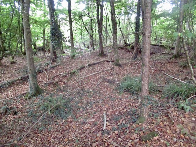
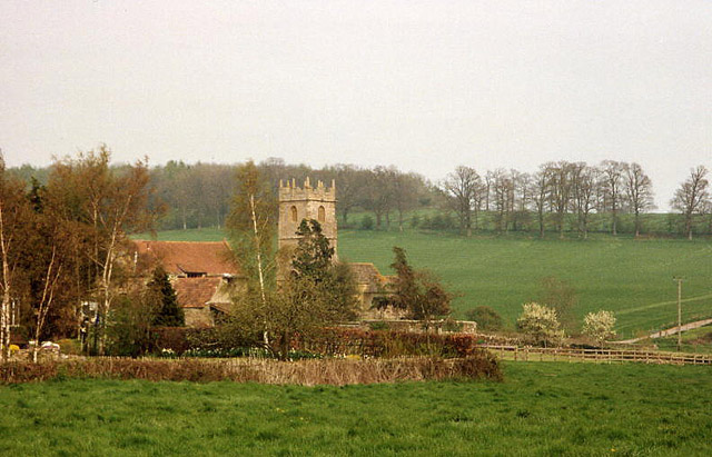
Lake Copse is a picturesque woodland nestled in the county of Dorset, England. Covering an area of approximately 100 acres, it is situated on the outskirts of the quaint village of Copse Hill. The woodland is known for its serene and tranquil atmosphere, making it a popular destination for nature enthusiasts and hikers.

The copse is predominantly made up of native deciduous trees, including oak, beech, and birch. These trees provide a stunning display of colors during the autumn months, attracting visitors from far and wide. The forest floor is adorned with a diverse range of wildflowers, such as bluebells, primroses, and foxgloves, adding to the beauty of the woodland.

At the heart of Lake Copse lies a small, enchanting lake. The crystal-clear waters of the lake reflect the surrounding trees, creating a magical ambiance. This picturesque feature is a habitat for various aquatic plants and animals, including water lilies and dragonflies, which thrive in the calm and undisturbed environment.

The copse is also home to a rich variety of wildlife. Visitors may spot deer, badgers, and foxes roaming freely among the trees, while birdwatchers can enjoy the melodious songs of various bird species, including woodpeckers and thrushes.

Lake Copse offers a network of well-maintained walking trails, allowing visitors to explore the woodland at their own pace. These trails are suitable for all abilities and offer stunning viewpoints overlooking the lake and surrounding countryside.

Overall, Lake Copse is a natural haven that showcases the beauty of Dorset's woodlands. Its tranquil atmosphere, diverse flora and fauna, and breathtaking views make it a must-visit destination for nature lovers and those seeking a peaceful retreat.

If you have any feedback on the listing, please let us know in the comments section below.

Lake Copse Images

Images are sourced within 2km of 50.922956/-2.5436152 or Grid Reference ST6113. Thanks to Geograph Open Source API. All images are credited.

Stile and gate, Windmill Hill
Fields, Windmill Hill Forage maize in the background.
Fields, Windmill Hill
Forage maize in the background.
Honeycombe Wood A lovely woodland and with complex contours. It has been quarried in the past.
Honeycombe Wood
A lovely woodland and with complex contours. It has been quarried in the past.
Path, Honeycombe Wood
Near the summit, Honeycombe  Tout Complex contouring in what was once a quarry.
Near the summit, Honeycombe Tout
Complex contouring in what was once a quarry.
Lenthay Common Taken during a mad dash to catch a train from Yeovil Junction. The line through Sherborne had closed due to shrinkage of the clay during a dry spell. The tracks on one embankment had been distorted. The path here (I had taken a wrong turn in Sherborne) had some big cracks in the clay too.
Lenthay Common
Taken during a mad dash to catch a train from Yeovil Junction. The line through Sherborne had closed due to shrinkage of the clay during a dry spell. The tracks on one embankment had been distorted. The path here (I had taken a wrong turn in Sherborne) had some big cracks in the clay too.
Gulls following the ploughing tractor, near Sherborne
Old Milestone north east of Thornford Metal plate attached to stone post by the UC road, in parish of Thornford (West Dorset District), just North East of the village, on grass verge by hedge, on North side of road. Dorset 4 (iron plated), erected by the Sherborne turnpike trust in the 19th century. New plate since 2014.

Inscription reads:-
3
SHERBORNE
YETMINSTER
2½ 
Carved benchmark centre of front face.

Milestone Society National ID: DO_SBYT03
Old Milestone north east of Thornford
Metal plate attached to stone post by the UC road, in parish of Thornford (West Dorset District), just North East of the village, on grass verge by hedge, on North side of road. Dorset 4 (iron plated), erected by the Sherborne turnpike trust in the 19th century. New plate since 2014. Inscription reads:- 3 SHERBORNE YETMINSTER 2½ Carved benchmark centre of front face. Milestone Society National ID: DO_SBYT03
Honeycombe Wood taken from Lenthay Common, Sherborne
Western tip of Sherborne taken from the Yeovil Sherborne mainline
Thornford: lane to the church
Lillington: church and hamlet The centre of a small parish south of Sherborne; Lower Farm and the church are the main features here. The parish is bordered by the even smaller Leweston, to the east, on the hill
Lillington: church and hamlet
The centre of a small parish south of Sherborne; Lower Farm and the church are the main features here. The parish is bordered by the even smaller Leweston, to the east, on the hill
Silverlake Cottages, near Sherborne, Dorset – view SE from above the Bradford Road.
Silverlake Cottages, near Sherborne, Dorset
– view SE from above the Bradford Road.
Bedmill Copse, Yeo valley, near Sherborne, Dorset
Railway underpass, Yeo valley, near Sherborne, Dorset for farm traffic.
Railway underpass, Yeo valley, near Sherborne, Dorset
for farm traffic.
Lenthay Copse, Yeo valley, near Sherborne, Dorset – view E, with new conservation hedgerow in the foreground.
Lenthay Copse, Yeo valley, near Sherborne, Dorset
– view E, with new conservation hedgerow in the foreground.
View towards Bedmill Farm, west of Sherborne, Dorset – looking N through an old hedgerow from the public footpath.
View towards Bedmill Farm, west of Sherborne, Dorset
– looking N through an old hedgerow from the public footpath.
Part of Windmill Hill Farm Spot the dog, just about to bark at me!
Part of Windmill Hill Farm
Spot the dog, just about to bark at me!
Show me another place!

Lake Copse is located at Grid Ref: ST6113 (Lat: 50.922956, Lng: -2.5436152)

Unitary Authority: Dorset

Police Authority: Dorset

What 3 Words

///cowboys.tenure.canal. Near Sherborne, Dorset

Related Wikis

Lillington, Dorset

Lillington is a hamlet and civil parish in north west Dorset, England, situated 3 miles (4.8 km) south of Sherborne. Dorset County Council estimate that...

Thornford

Thornford is a village and civil parish in north west Dorset, England, situated in the Yeo valley 4 miles (6.4 km) southwest of Sherborne. Dorset County...

Leweston School

Leweston School is an independent day and boarding school near Sherborne in Dorset, England. The school is co-educational in the Nursery and Preparatory...

Bradford Abbas Railway Cutting

Bradford Abbas Railway Cutting (grid reference ST592145) is a 1.4 hectare geological Site of Special Scientific Interest in Dorset, notified in 1990....

Nearby Amenities

Located within 500m of 50.922956,-2.5436152
Power: pole
Source: bing
Lat/Long: 50.926783/-2.5472832
Power: pole
Source: bing
Lat/Long: 50.925296/-2.5494625
Power: pole
Source: bing
Lat/Long: 50.9243543/-2.5497709
Power: pole
Source: bing
Lat/Long: 50.9221479/-2.5504603
Material: wood
Power: pole
Source: bing
Lat/Long: 50.9234041/-2.5500593
The data included in this document is from www.openstreetmap.org. The data is made available under ODbL.

Have you been to Lake Copse?

Leave your review of Lake Copse below (or comments, questions and feedback).