Sydling Woods

Wood, Forest in Dorset

England

Sydling Woods

Frome St. Quintin: parish church of St. Mary The reason this mainly 13th-century church's dedication does not match the name of the village is that the village name refers to the St. Quintin family, which owned the manor, rather than the saint.
Frome St. Quintin: parish church of St. Mary Credit: Chris Downer

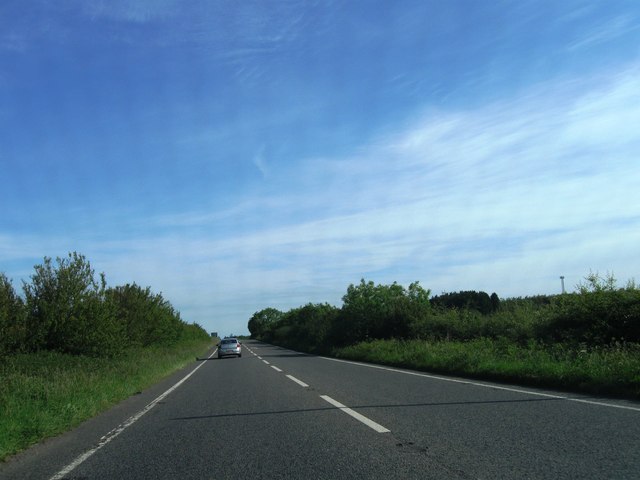
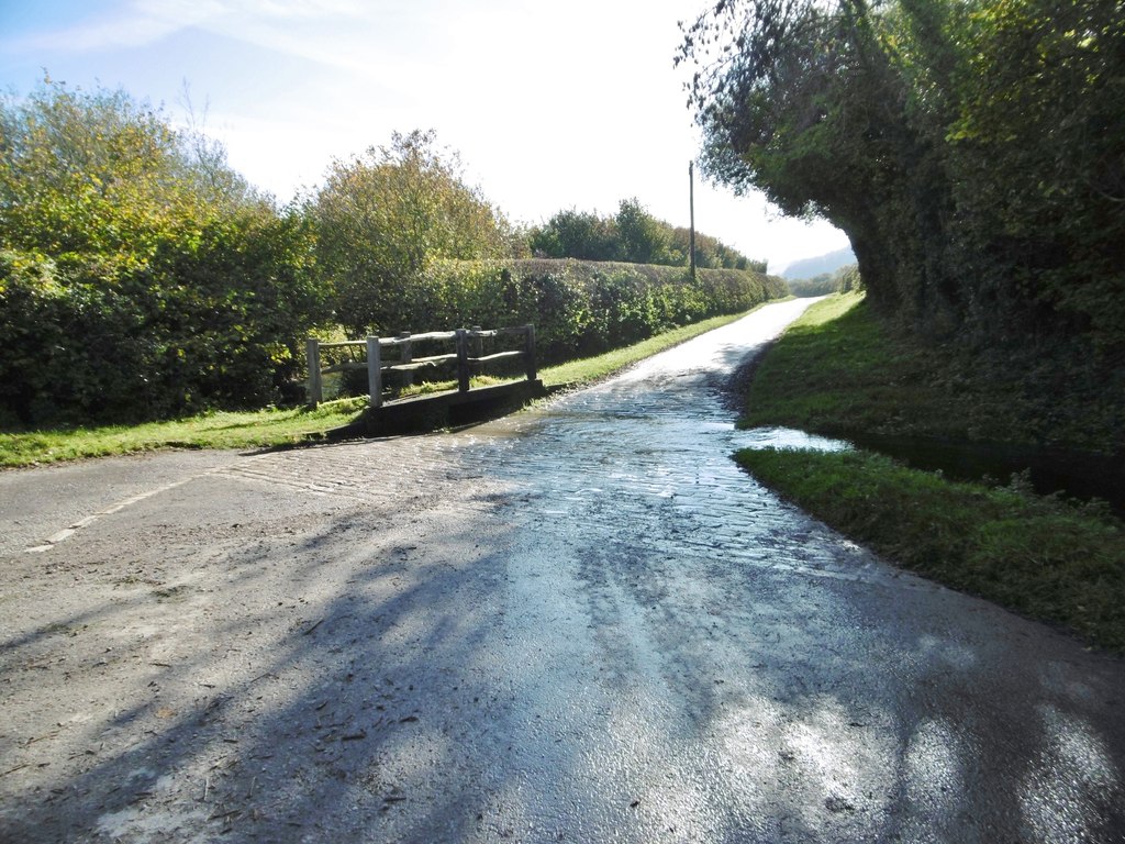
Sydling Woods, located in the county of Dorset, England, is a picturesque woodland area known for its natural beauty and rich biodiversity. Covering an expansive area, Sydling Woods is home to a diverse range of trees, including oak, beech, and ash, which create a dense canopy overhead. The woods are a haven for wildlife, supporting a variety of animal species such as deer, foxes, badgers, and a multitude of bird species.

The forest floor of Sydling Woods is adorned with a vibrant carpet of wildflowers and ferns, adding to its enchanting atmosphere. In spring, the woods come alive with a riot of colors as bluebells, primroses, and wood anemones bloom, creating a spectacle that attracts visitors from near and far.

The woods are crisscrossed by a network of footpaths and trails, making it a popular destination for outdoor enthusiasts and nature lovers. These paths provide ample opportunities for hiking, walking, and exploring the natural wonders of the area. Additionally, there are designated picnic areas and benches, allowing visitors to pause and enjoy the serene surroundings.

Sydling Woods also holds historical significance, as remnants of ancient settlements and archaeological sites can be found within its boundaries. These remnants serve as a reminder of the area's rich cultural heritage and provide a glimpse into the lives of past civilizations.

Overall, Sydling Woods offers a tranquil escape from the hustle and bustle of modern life, inviting visitors to immerse themselves in the beauty of nature and explore the wonders of this captivating forest.

If you have any feedback on the listing, please let us know in the comments section below.

Sydling Woods Images

Images are sourced within 2km of 50.8213/-2.5466497 or Grid Reference ST6102. Thanks to Geograph Open Source API. All images are credited.

Frome St. Quintin: parish church of St. Mary The reason this mainly 13th-century church's dedication does not match the name of the village is that the village name refers to the St. Quintin family, which owned the manor, rather than the saint.
Frome St. Quintin: parish church of St. Mary
The reason this mainly 13th-century church's dedication does not match the name of the village is that the village name refers to the St. Quintin family, which owned the manor, rather than the saint.
Parish Church of St Mary Frome St Quinton Partly C13, with a C14 tower, the church is undistinguished inside, due to a particularly ruthless restoration in 1879.
Parish Church of St Mary Frome St Quinton
Partly C13, with a C14 tower, the church is undistinguished inside, due to a particularly ruthless restoration in 1879.
Cottages, Frome St Quentin A view south along the road running through the centre of this tiny village.
Cottages, Frome St Quentin
A view south along the road running through the centre of this tiny village.
Fine House, Frome St Quintin This ornate house with its fine gateway stands on the main road in the centre of the village.
Fine House, Frome St Quintin
This ornate house with its fine gateway stands on the main road in the centre of the village.
Frome St. Quintin: phone box and shelter A traditional red telephone box stands alongside a small shelter - presumably the village has a bus service.
Frome St. Quintin: phone box and shelter
A traditional red telephone box stands alongside a small shelter - presumably the village has a bus service.
Frome St. Quintin: postbox № DT2 27 Frome St. Quintin's postbox is strapped to a wooden post despite a telegraph pole standing right alongside. It is from the Elizabeth II reign; more accurately it dates from post 1994 - we can tell that because it has ROYAL MAIL rather than POST OFFICE written above the slot. It is emptied at 9 o'clock on weekday and Saturday mornings.
Frome St. Quintin: postbox № DT2 27
Frome St. Quintin's postbox is strapped to a wooden post despite a telegraph pole standing right alongside. It is from the Elizabeth II reign; more accurately it dates from post 1994 - we can tell that because it has ROYAL MAIL rather than POST OFFICE written above the slot. It is emptied at 9 o'clock on weekday and Saturday mornings.
Frome St. Quintin: noticeboard and postbox The village noticeboard is affixed to a wall alongside <a href="https://www.geograph.org.uk/photo/2244507">ST5902 : Frome St. Quintin: postbox № DT2 27</a>.
Frome St. Quintin: noticeboard and postbox
The village noticeboard is affixed to a wall alongside ST5902 : Frome St. Quintin: postbox № DT2 27.
Frome St. Quintin: wall and hedge Above this wall, we see an intricately twined hedge obscuring a view of a large house.
Frome St. Quintin: wall and hedge
Above this wall, we see an intricately twined hedge obscuring a view of a large house.
Children's playground and the George Albert Hotel The hotel on Wardon Hill is family-run and opened in 2010.  It is very convenient for the Southern Counties shooting ranges at Clay Pigeon right beside it.  The Olympic shooting competitions could be held here next year (rumours) and this afternoon there was an international competition in progress.
Children's playground and the George Albert Hotel
The hotel on Wardon Hill is family-run and opened in 2010. It is very convenient for the Southern Counties shooting ranges at Clay Pigeon right beside it. The Olympic shooting competitions could be held here next year (rumours) and this afternoon there was an international competition in progress.
International flags - George Albert Hotel These flags line the entrance of the hotel and of the Southern Counties shooting ranges. International shooting competitions take place here and next year, rumour  has it, that this could be the venue for the Shooting Olympics.
International flags - George Albert Hotel
These flags line the entrance of the hotel and of the Southern Counties shooting ranges. International shooting competitions take place here and next year, rumour has it, that this could be the venue for the Shooting Olympics.
Long Ash Lane
Long Ash Lane
Lay-by complete with lorries
Construction of new Radar Dome The dome on this site has been a prominent land mark for many years being halfway between Yeovil and Dorchester close to the A37. The old dome has been completely replaced with new dome and new supporting steelwork. The old dome had triangular panels making up the dome and was known locally as the "golf ball" but the new one has a combination of pentagonal and  hexagonal GRP panels and even more resembles a golf ball. It is right next to the South Western Gun Club Complex.
Construction of new Radar Dome
The dome on this site has been a prominent land mark for many years being halfway between Yeovil and Dorchester close to the A37. The old dome has been completely replaced with new dome and new supporting steelwork. The old dome had triangular panels making up the dome and was known locally as the "golf ball" but the new one has a combination of pentagonal and hexagonal GRP panels and even more resembles a golf ball. It is right next to the South Western Gun Club Complex.
Wardon Hill Radar Dome This radar dome with a combination of pentagonal and hexagonal panels has replaced an earlier triangular patterned one. The new one also has a far more substantial support framework. On the right can also be seen the covered reservoir that sits next to the dome on top of the hill. The dome is at an altitude of 245m and is 16m high. The radar is used by the Met office to give information on rain.
Wardon Hill Radar Dome
This radar dome with a combination of pentagonal and hexagonal panels has replaced an earlier triangular patterned one. The new one also has a far more substantial support framework. On the right can also be seen the covered reservoir that sits next to the dome on top of the hill. The dome is at an altitude of 245m and is 16m high. The radar is used by the Met office to give information on rain.
A37 northbound
A37 northbound
Radar dome or giant golf
A37 northbound
A37 northbound
A37 northbound
A37 northbound
Show me another place!

Sydling Woods is located at Grid Ref: ST6102 (Lat: 50.8213, Lng: -2.5466497)

Unitary Authority: Dorset

Police Authority: Dorset

What 3 Words

///broached.minds.cheaply. Near Maiden Newton, Dorset

Related Wikis

Batcombe, Dorset

Batcombe is a small straggling village and civil parish in Dorset, England, situated 12 miles (19 km) north-west of Dorchester below the northern scarp...

Up Sydling

Up Sydling is a hamlet in west Dorset, England. It is situated at the head of Sydling Water, a tributary of the River Frome, ten miles north of Dorchester...

Batcombe Down

Batcombe Down (grid reference ST623040) is an 18.6 hectare biological Site of Special Scientific Interest in Dorset, England: notified in 1952. == Sources... ==

Frome St Quintin

Frome St Quintin is a village in the county of Dorset in southern England, situated approximately 11 miles (18 km) northwest of the county town Dorchester...

Nearby Amenities

Located within 500m of 50.8213,-2.5466497
tumuli
Historic: archaeological_site
Source: NPE
Lat/Long: 50.8218506/-2.5411873
The data included in this document is from www.openstreetmap.org. The data is made available under ODbL.

Have you been to Sydling Woods?

Leave your review of Sydling Woods below (or comments, questions and feedback).