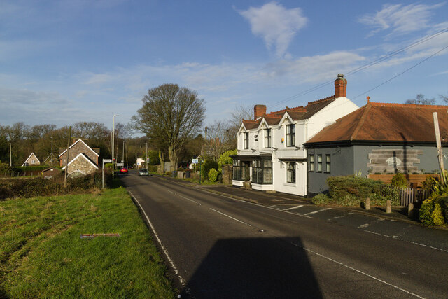
Copt Oak
Settlement in Leicestershire Hinckley and Bosworth
England
Copt Oak
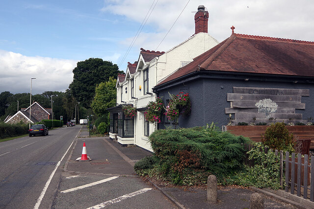
Copt Oak is a small village located in the county of Leicestershire, England. Situated on the western edge of Charnwood Forest, it is nestled between the larger towns of Loughborough and Coalville. The village is part of the Charnwood district and falls within the National Forest.
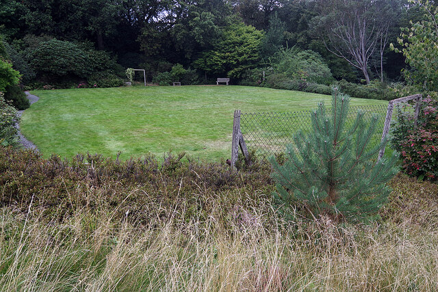
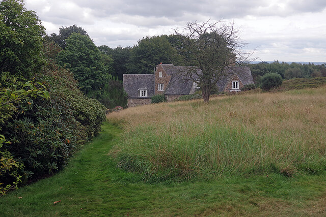
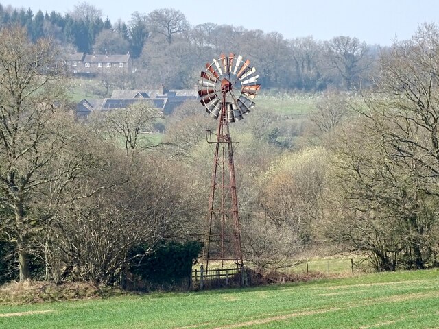
Copt Oak is renowned for its picturesque surroundings, with vast areas of woodland and rolling hills dominating the landscape. The village itself consists of a small cluster of houses, many of which are traditional stone-built cottages that exude charm and character. The local community is close-knit and friendly, with a strong sense of pride in their village.
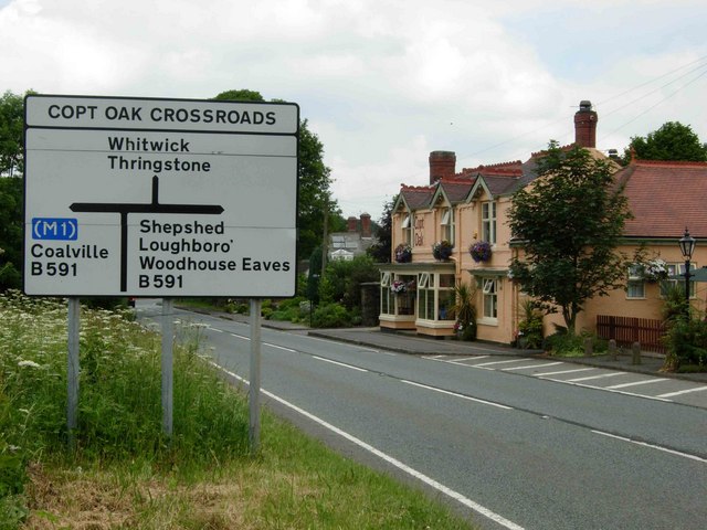
One notable feature of Copt Oak is its proximity to major transport links. The village lies just off the A512 road, which connects to the nearby M1 motorway, providing easy access to Leicester, Nottingham, and other major cities. This makes Copt Oak an attractive location for commuters looking to escape the hustle and bustle of urban life.
Despite its small size, Copt Oak boasts a number of amenities for its residents. The village has a primary school, a community center, and a pub, providing essential services and opportunities for social interaction. Additionally, the surrounding area offers plenty of recreational activities, including hiking and cycling trails in Charnwood Forest, which attract visitors from far and wide.
In summary, Copt Oak is a tranquil village with a rich natural beauty and a strong sense of community. Its location, nestled within Charnwood Forest and with excellent transport links, makes it an ideal place for those seeking a peaceful countryside lifestyle while maintaining access to urban amenities.
If you have any feedback on the listing, please let us know in the comments section below.
Copt Oak Images
Images are sourced within 2km of 52.711864/-1.287511 or Grid Reference SK4812. Thanks to Geograph Open Source API. All images are credited.
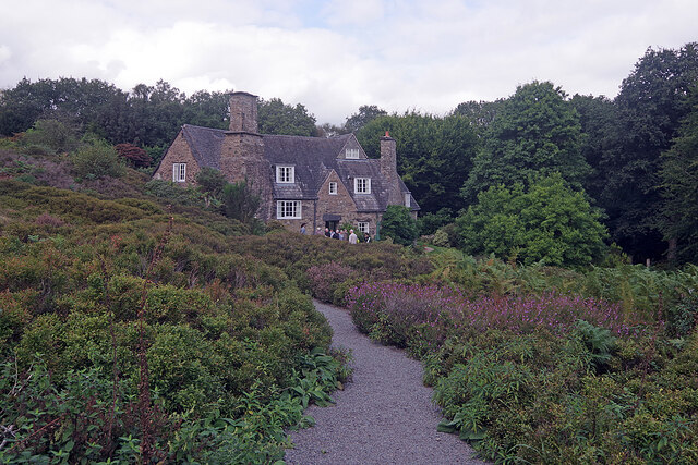

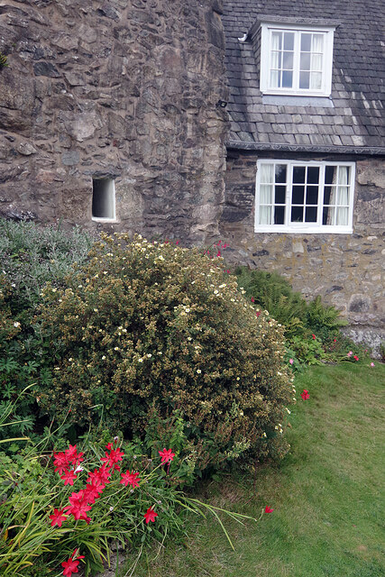
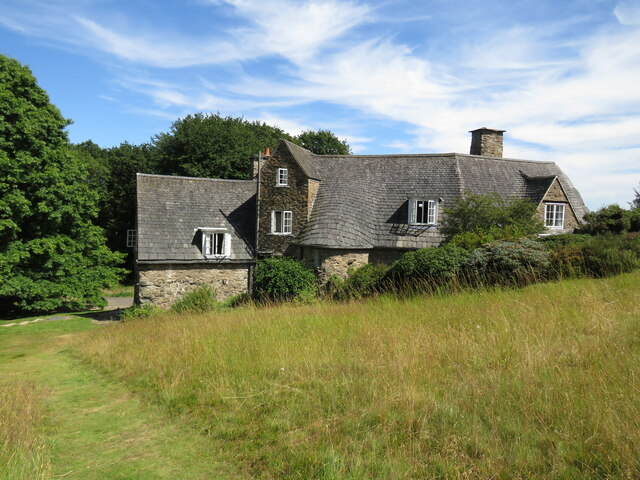
![Stoneywell [1] The cottage is seen from the garden.
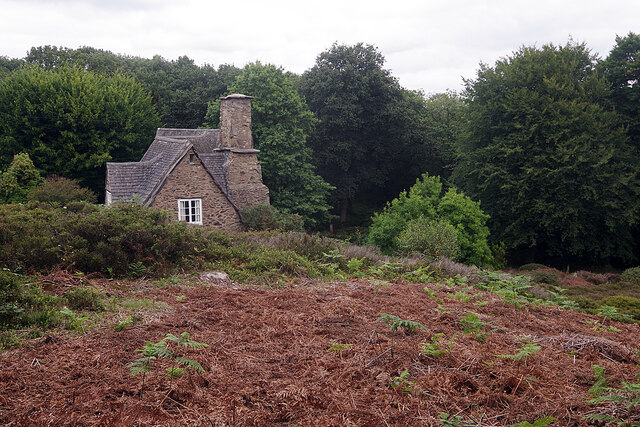
Stoneywell is a cottage, located near the village of Markfield. Some 7 miles northwest of Leicester. Designed and built in the Arts and Crafts style in 1899 by Ernest Gimson, for his brother Sydney. Ernest Gimson was one of the most inspiring and influential architect-designers of the Arts and Crafts movement, which had the ideal of ‘Nothing should be made by man’s labour which is not worth making, or must be made by labour degrading to the makers.’ The cottage is now owned by the National Trust. Listed, grade II, with details at: <span class="nowrap"><a title="https://historicengland.org.uk/listing/the-list/list-entry/1361102" rel="nofollow ugc noopener" href="https://historicengland.org.uk/listing/the-list/list-entry/1361102">Link</a><img style="margin-left:2px;" alt="External link" title="External link - shift click to open in new window" src="https://s1.geograph.org.uk/img/external.png" width="10" height="10"/></span>](https://s1.geograph.org.uk/geophotos/07/26/60/7266029_0b80d81b.jpg)
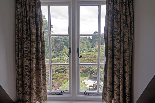
![Stoneywell [2] The interior of the cottage.
Stoneywell is a cottage, located near the village of Markfield. Some 7 miles northwest of Leicester. Designed and built in the Arts and Crafts style in 1899 by Ernest Gimson, for his brother Sydney. Ernest Gimson was one of the most inspiring and influential architect-designers of the Arts and Crafts movement, which had the ideal of ‘Nothing should be made by man’s labour which is not worth making, or must be made by labour degrading to the makers.’ The cottage is now owned by the National Trust.](https://s2.geograph.org.uk/geophotos/07/26/60/7266030_403de446.jpg)
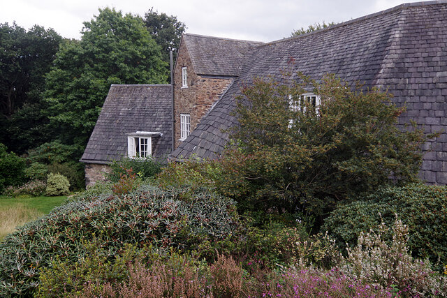
![Stoneywell [3] The interior of the cottage. A leaking chimney had required the removal of plaster from the wall, resulting in the wall construction being visible.
Stoneywell is a cottage, located near the village of Markfield. Some 7 miles northwest of Leicester. Designed and built in the Arts and Crafts style in 1899 by Ernest Gimson, for his brother Sydney. Ernest Gimson was one of the most inspiring and influential architect-designers of the Arts and Crafts movement, which had the ideal of ‘Nothing should be made by man’s labour which is not worth making, or must be made by labour degrading to the makers.’ The cottage is now owned by the National Trust.](https://s3.geograph.org.uk/geophotos/07/26/60/7266031_06385595.jpg)
![Stoneywell [4] The interior of the cottage.
Stoneywell is a cottage, located near the village of Markfield. Some 7 miles northwest of Leicester. Designed and built in the Arts and Crafts style in 1899 by Ernest Gimson, for his brother Sydney. Ernest Gimson was one of the most inspiring and influential architect-designers of the Arts and Crafts movement, which had the ideal of ‘Nothing should be made by man’s labour which is not worth making, or must be made by labour degrading to the makers.’ The cottage is now owned by the National Trust.](https://s0.geograph.org.uk/geophotos/07/26/60/7266032_1f7c4615.jpg)
Copt Oak is located at Grid Ref: SK4812 (Lat: 52.711864, Lng: -1.287511)
Administrative County: Leicestershire
District: Hinckley and Bosworth
Police Authority: Leicestershire
What 3 Words
///restless.reddish.mills. Near Markfield, Leicestershire
Nearby Locations
Related Wikis
Copt Oak
Copt Oak is a hamlet in Leicestershire, England. It is located in the North West Leicestershire district near the large village of Markfield and the rural...
Ulverscroft Nature Reserve
Ulverscroft is a 56-hectare (140-acre) nature reserve north of Markfield in Leicestershire, England. It is managed by the Leicestershire and Rutland Wildlife...

Ulverscroft Valley
Ulverscroft Valley is a 110.8 hectares (274 acres) biological Site of Special Scientific Interest north-west of Markfield in Leicestershire. The site is...
Rocky Plantation
Rocky Plantation is a 3.4-hectare (8.4-acre) nature reserve north of Markfield in Leicestershire. It is owned by the National Trust and managed by the...
Ulverscroft
Ulverscroft is a civil parish in the Charnwood district of Leicestershire. It has a population of about 100. The population in 2011 is included in the...

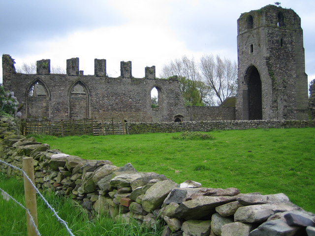
Charley Priory
Charley Priory was a small former priory in Leicestershire, England. == History == The exact date Charley Priory was established is unknown, but is at...
Ulverscroft Priory
Ulverscroft Priory is a former hermitage and priory in Ulverscroft, Leicestershire. == History == The priory was founded by Robert de Beaumont, 2nd Earl...
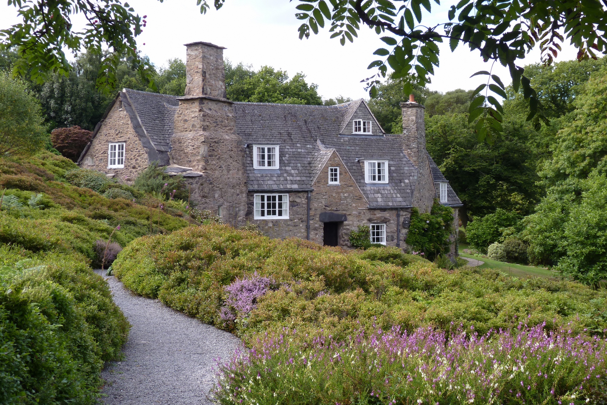
Stoneywell
Stoneywell is a National Trust property in Ulverscroft, a dispersed settlement near Coalville in Charnwood Forest, Leicestershire. Stoneywell is the largest...
Nearby Amenities
Located within 500m of 52.711864,-1.287511Have you been to Copt Oak?
Leave your review of Copt Oak below (or comments, questions and feedback).