Maw Skelly

Island in Angus

Scotland

Maw Skelly

Harvesting the Barley The combine harvester is just turning to cut a new swathe of barley, and the tractor is about to take a full load of grain to the farm.
Harvesting the Barley Credit: Anne Burgess

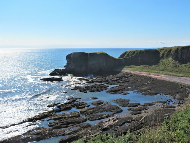
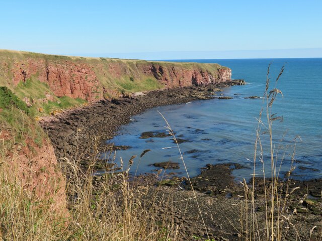
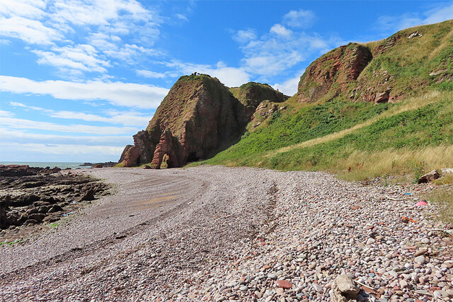
Maw Skelly, Angus is a small island located off the eastern coast of Scotland, in the North Sea. It is part of the Angus Council area and lies approximately 16 kilometers northeast of Arbroath. The island, also known as Maw Skelly Rock, is situated within the Bell Rock Lighthouse protection zone, which is known for its treacherous waters.

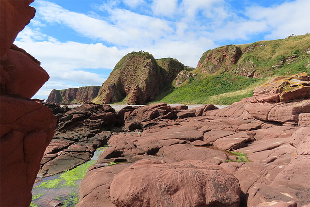
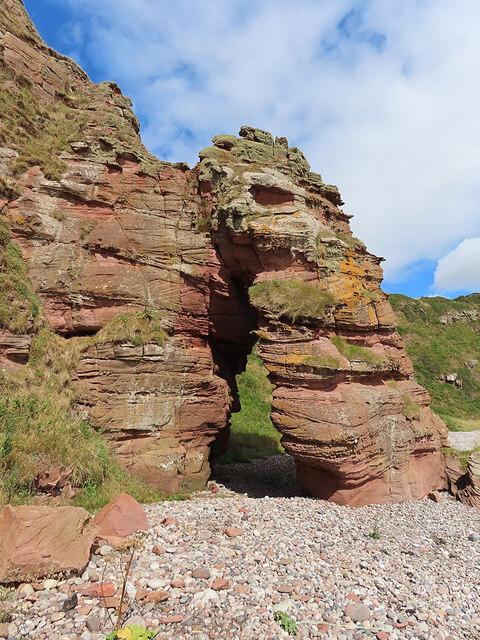
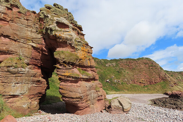
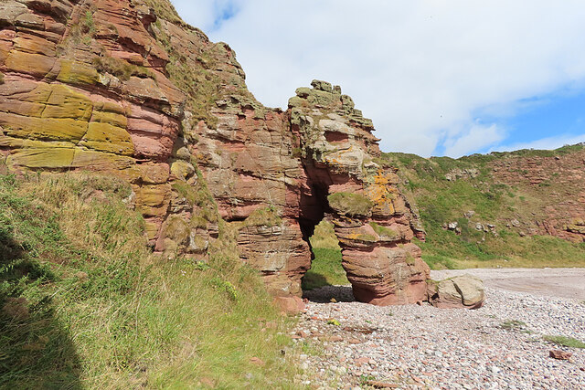
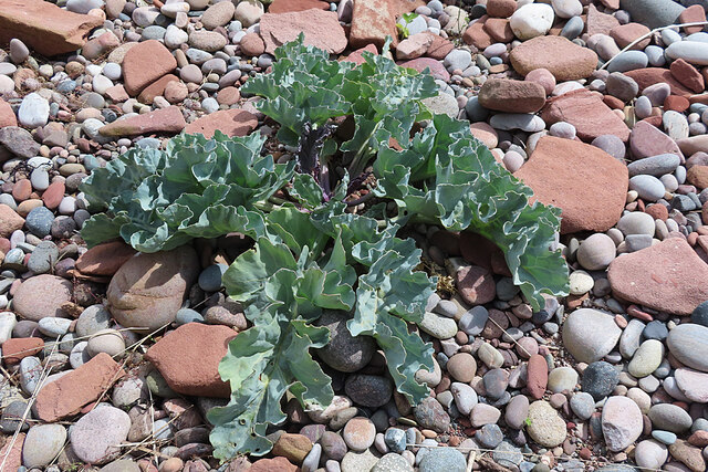
Maw Skelly is a rocky, uninhabited island with an area of around 0.03 hectares. It is characterized by its steep cliffs and rugged terrain, making it inaccessible for visitors. The island is covered in low-lying vegetation, mainly consisting of grass and mosses. It is a popular breeding ground for various seabirds, including gulls, puffins, and cormorants.

Due to its location near the Bell Rock Lighthouse, Maw Skelly has played a significant role in maritime history. The Bell Rock Lighthouse, often referred to as the "Wonder of the North Sea," was built between 1807 and 1810 on a treacherous reef, known as Bell Rock, which is visible from Maw Skelly. The lighthouse serves as a crucial navigational aid for ships in the area, warning them of the dangers posed by the surrounding rocks and reefs.

Maw Skelly, Angus, with its stunning coastal scenery and its connection to the historic Bell Rock Lighthouse, remains an intriguing landmark in the region's maritime heritage.

If you have any feedback on the listing, please let us know in the comments section below.
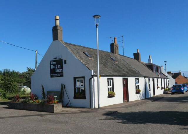
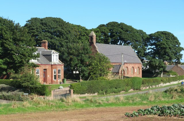
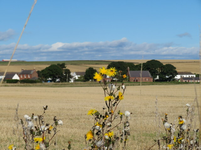
Maw Skelly Images

Images are sourced within 2km of 56.594741/-2.5126474 or Grid Reference NO6844. Thanks to Geograph Open Source API. All images are credited.

Harvesting the Barley The combine harvester is just turning to cut a new swathe of barley, and the tractor is about to take a full load of grain to the farm.
Harvesting the Barley
The combine harvester is just turning to cut a new swathe of barley, and the tractor is about to take a full load of grain to the farm.
A Field of Phacelia Phacelia is a 'green manure' that is grown to improve the soil and attract bees and other beneficial insects.
A Field of Phacelia
Phacelia is a 'green manure' that is grown to improve the soil and attract bees and other beneficial insects.
But n Ben restaurant, Auchmithie Restaurant in a traditional cottage style building at the start of the old part of the clifftop village.
But n Ben restaurant, Auchmithie
Restaurant in a traditional cottage style building at the start of the old part of the clifftop village.
St Peter's Church, Auchmithie Scottish Episcopal Church situated at the western end of the village.
St Peter's Church, Auchmithie
Scottish Episcopal Church situated at the western end of the village.
Across Castlesea Bay Looking south across the bay to the promontory of Lud Castle, which is an iron age fort.
Across Castlesea Bay
Looking south across the bay to the promontory of Lud Castle, which is an iron age fort.
Harvested field south of Auchmithie A view from the coast path looking inland across a recently cropped field towards Auchmithie church.
Harvested field south of Auchmithie
A view from the coast path looking inland across a recently cropped field towards Auchmithie church.
Devonian sandstone meets the North Sea The red cliffs of Angus are made from Devonian period sandstone - a sedimentary rock.
Devonian sandstone meets the North Sea
The red cliffs of Angus are made from Devonian period sandstone - a sedimentary rock.
Cliffs near West Mains There's a faint and daunting-looking steep path down the gully here, though at least it's not overgrown with whins. West Mains of Ethie is in the background.
Cliffs near West Mains
There's a faint and daunting-looking steep path down the gully here, though at least it's not overgrown with whins. West Mains of Ethie is in the background.
Sled from the Clifftop One of the rocks close to shore here is named on the map as Sled.
Sled from the Clifftop
One of the rocks close to shore here is named on the map as Sled.
Narrow-leaved Everlasting Pea (Lathyrus sylvestris) There's quite a lot of this in the East Den, though overall it is not common in northern Scotland.
Narrow-leaved Everlasting Pea (Lathyrus sylvestris)
There's quite a lot of this in the East Den, though overall it is not common in northern Scotland.
Narrow-leaved Everlasting Pea (Lathyrus sylvestris) These are the seed pods of <a href="https://www.geograph.org.uk/photo/7247694">NO6945 : Narrow-leaved Everlasting Pea (Lathyrus sylvestris)</a>.
Narrow-leaved Everlasting Pea (Lathyrus sylvestris)
Beach north of Rumness Rumness itself is more or less hidden behind the headland, but according to the old Ordnance Survey maps none of the other rock features here has a name.
Beach north of Rumness
Rumness itself is more or less hidden behind the headland, but according to the old Ordnance Survey maps none of the other rock features here has a name.
Old Red Sandstone The rocks in the foreground are sandstones of Devonian age, laid down in arid conditions some 420 million years ago when what is now Scotland was at the latitude of the present-day Sahara Desert.
Old Red Sandstone
The rocks in the foreground are sandstones of Devonian age, laid down in arid conditions some 420 million years ago when what is now Scotland was at the latitude of the present-day Sahara Desert.
Natural Arch The sea has carved a hole through a rocky headland to create a natural arch in the Old Red Sandstone.
Natural Arch
The sea has carved a hole through a rocky headland to create a natural arch in the Old Red Sandstone.
Natural Arch and Pebble Beach The sea has carved a hole through a rocky headland to create a natural arch in the Old Red Sandstone.
Natural Arch and Pebble Beach
The sea has carved a hole through a rocky headland to create a natural arch in the Old Red Sandstone.
Natural Arch and Pebble Beach The sea has carved a hole through a rocky headland to create a natural arch in the Old Red Sandstone.
Natural Arch and Pebble Beach
The sea has carved a hole through a rocky headland to create a natural arch in the Old Red Sandstone.
Sea Kale (Crambe maritima) This is quite common on coasts further south, but more unusual further north. We noted only two plants of it on this particular beach.
Sea Kale (Crambe maritima)
This is quite common on coasts further south, but more unusual further north. We noted only two plants of it on this particular beach.
Sea Kale (Crambe maritima) We were too late in the year to see the flowers of <a href="https://www.geograph.org.uk/photo/7247713">NO6945 : Sea Kale (Crambe maritima)</a>, but this plant has set seed.
Sea Kale (Crambe maritima)
We were too late in the year to see the flowers of NO6945 : Sea Kale (Crambe maritima), but this plant has set seed.
Show me another place!

Maw Skelly is located at Grid Ref: NO6844 (Lat: 56.594741, Lng: -2.5126474)

Unitary Authority: Angus

Police Authority: Tayside

What 3 Words

///habits.shapes.punters. Near Arbroath, Angus

Related Wikis

Auchmithie

Auchmithie is a small fishing village in Angus, Scotland, three miles north east of the town of Arbroath. It sits atop a cliff of red sandstone conglomerate...
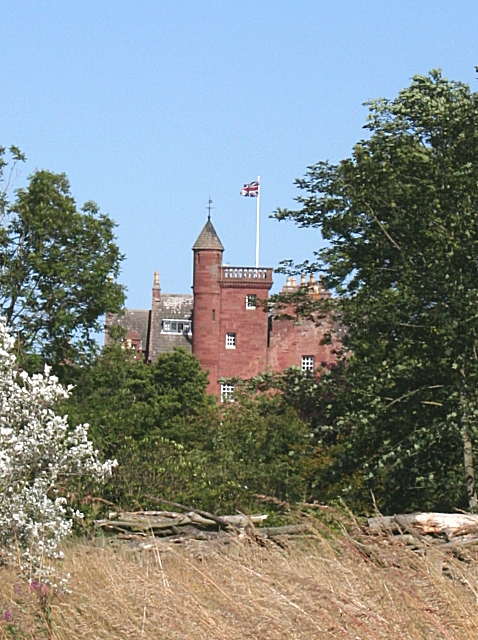
Ethie Castle

Ethie Castle is a 15,091 square feet (1,402.0 m2) 14th-century castle, situated around 3 miles north of the fishing town of Arbroath in Angus, Scotland...

Cauldcots railway station

Cauldcots railway station served the hamlet of Cauldcots, Angus, Scotland, from 1883 to 1930 on the North British, Arbroath and Montrose Railway. ��2...

Marywell

Marywell is a village in Angus, Scotland, that is north of Arbroath, in the parish of St Vigeans. == References == == Sources == Marywell in the Gazetteer...
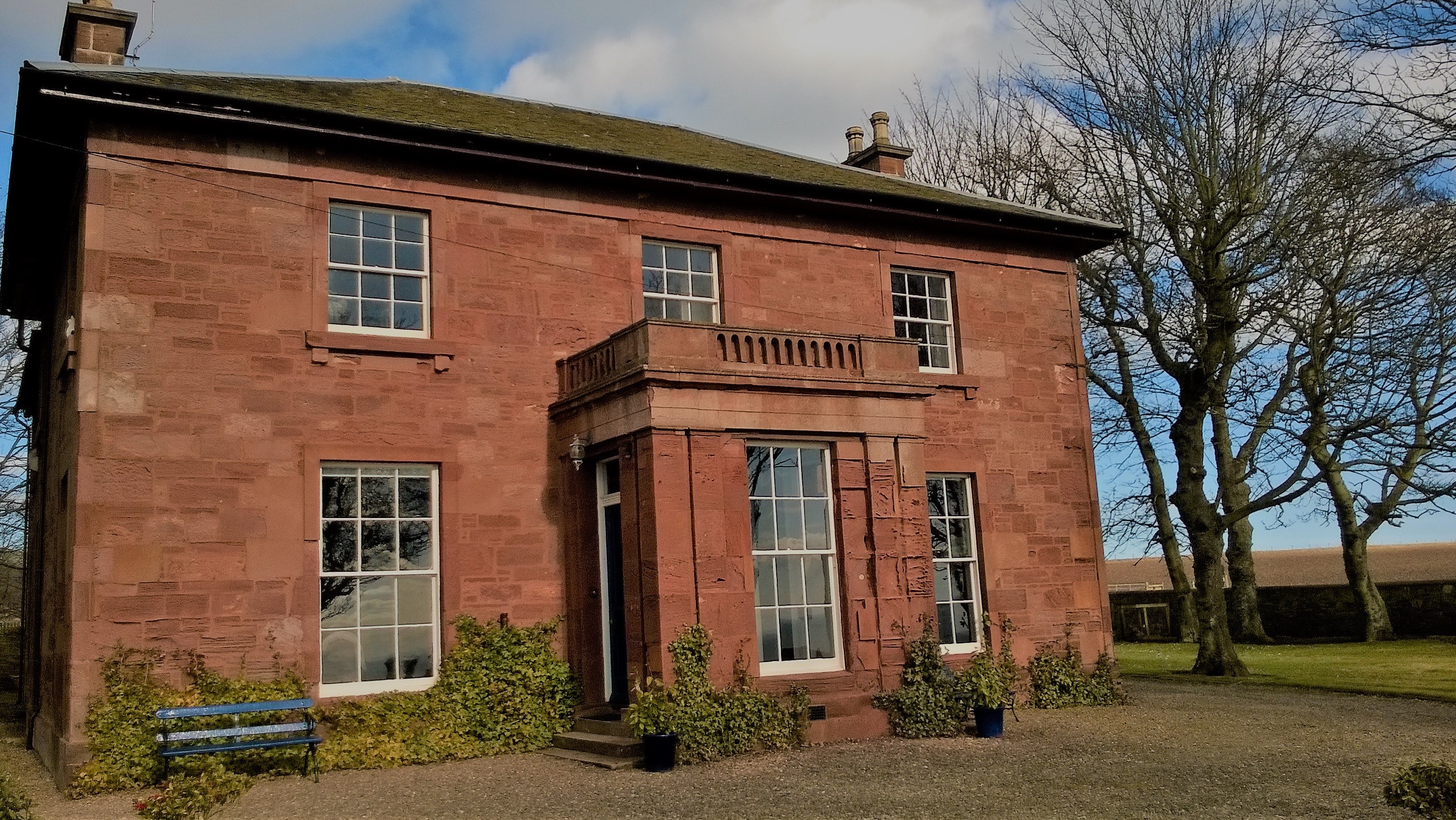
West Seaton House

West Seaton House is a listed building of late Regency design, situated approximately one mile (1.6 km) to the east of Arbroath in the parish of St. Vigeans...

Inverkeilor railway station

Inverkeilor railway station served the village of Inverkeilor, Angus, Scotland from 1883 to 1930 on the North British, Arbroath and Montrose Railway....

Inverkeilor

Inverkeilor is a village and parish in Angus, Scotland. It lies near the North Sea coast, midway between Arbroath and Montrose. The A92 road now bypasses...

Letham Grange railway station

Letham Grange railway station served the Letham Grange estate, Angus, Scotland from 1883 to 1959 on the North British, Arbroath and Montrose Railway....

Nearby Amenities

Located within 500m of 56.594741,-2.5126474
Source: PGS
Lat/Long: 56.5914981/-2.5182317
Created By: almien_coastlines
Source: PGS
Lat/Long: 56.591669/-2.518216
Source: PGS
Lat/Long: 56.5918541/-2.5180842
Created By: almien_coastlines
Source: PGS
Lat/Long: 56.592052/-2.517978
Created By: almien_coastlines
Source: PGS
Lat/Long: 56.59218/-2.517746
Created By: almien_coastlines
Source: PGS
Lat/Long: 56.592306/-2.517511
Created By: almien_coastlines
Source: PGS
Lat/Long: 56.592434/-2.517278
Created By: almien_coastlines
Source: PGS
Lat/Long: 56.593201/-2.517035
Source: PGS
Lat/Long: 56.5933813/-2.5166221
Source: PGS
Lat/Long: 56.5938179/-2.5161069
Created By: almien_coastlines
Source: PGS
Lat/Long: 56.594091/-2.515632
Created By: almien_coastlines
Source: PGS
Lat/Long: 56.59409/-2.515168
Created By: almien_coastlines
Source: PGS
Lat/Long: 56.594217/-2.514935
Created By: almien_coastlines
Source: PGS
Lat/Long: 56.594344/-2.5147
Created By: almien_coastlines
Source: PGS
Lat/Long: 56.594471/-2.514468
Created By: almien_coastlines
Source: PGS
Lat/Long: 56.594598/-2.514233
Created By: almien_coastlines
Source: PGS
Lat/Long: 56.594596/-2.513769
Created By: almien_coastlines
Source: PGS
Lat/Long: 56.594594/-2.513305
Source: PGS
Lat/Long: 56.5948709/-2.512544
Source: PGS
Lat/Long: 56.5949993/-2.5129274
Source: PGS
Lat/Long: 56.5954351/-2.5132514
Created By: almien_coastlines
Source: PGS
Lat/Long: 56.595871/-2.51236
Created By: almien_coastlines
Source: PGS
Lat/Long: 56.596123/-2.511429
Created By: almien_coastlines
Source: PGS
Lat/Long: 56.596251/-2.511196
Source: PGS
Lat/Long: 56.5965493/-2.5107113
Created By: almien_coastlines
Source: PGS
Lat/Long: 56.596758/-2.510028
Created By: almien_coastlines
Source: PGS
Lat/Long: 56.59727/-2.50979
Created By: almien_coastlines
Source: PGS
Lat/Long: 56.597396/-2.509555
Source: PGS
Lat/Long: 56.597557/-2.5078677
Source: PGS
Lat/Long: 56.597211/-2.5073801
Source: PGS
Lat/Long: 56.5969048/-2.5072142
Created By: almien_coastlines
Source: PGS
Lat/Long: 56.597515/-2.507002
Rumkemno
Place: locality
Lat/Long: 56.5989743/-2.5128137
Maw Skelly
Natural: cliff
Lat/Long: 56.5948575/-2.5129637
Natural: cave_entrance
Lat/Long: 56.59175/-2.5186906
The data included in this document is from www.openstreetmap.org. The data is made available under ODbL.

Have you been to Maw Skelly?

Leave your review of Maw Skelly below (or comments, questions and feedback).