Norley

Settlement in Lancashire

England

Norley

Oilseed rape brightening a dark day
Oilseed rape brightening a dark day Credit: Eirian Evans

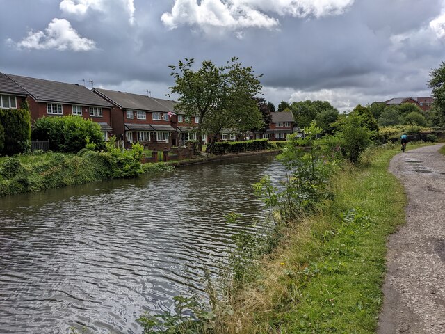
Norley is a small village located in the county of Lancashire, England. Situated within the borough of Cheshire West and Chester, it lies on the southern edge of the county, close to the border with Cheshire. Nestled within the picturesque countryside, Norley is surrounded by rolling hills, expansive fields, and charming woodland.

The village has a rich history that can be traced back to the Domesday Book of 1086, where it was recorded as "Northlegh." Throughout the centuries, Norley has evolved from a predominantly agricultural community into a peaceful residential area. Today, it is home to a close-knit community characterized by a strong sense of community spirit.

Norley boasts a range of amenities and facilities to cater to the needs of its residents. It has a primary school, village hall, church, and a local pub, providing a vibrant social hub for locals. The village also benefits from excellent transport links, with easy access to neighboring towns and cities such as Chester and Warrington.

The surrounding countryside offers numerous opportunities for outdoor activities, including scenic walks, cycling routes, and horse riding trails. Delamere Forest, a popular nearby attraction, provides additional recreational options with its vast woodland and lake.

Overall, Norley presents an idyllic rural setting, combining natural beauty with a strong community spirit. Its convenient location and range of amenities make it an attractive place to live for those seeking a peaceful village lifestyle within easy reach of urban centers.

If you have any feedback on the listing, please let us know in the comments section below.
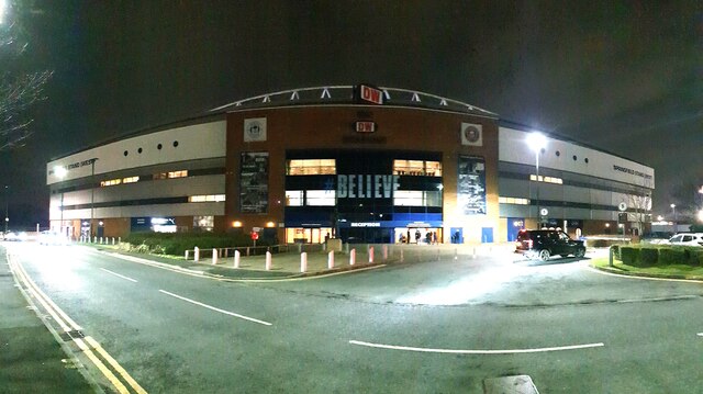
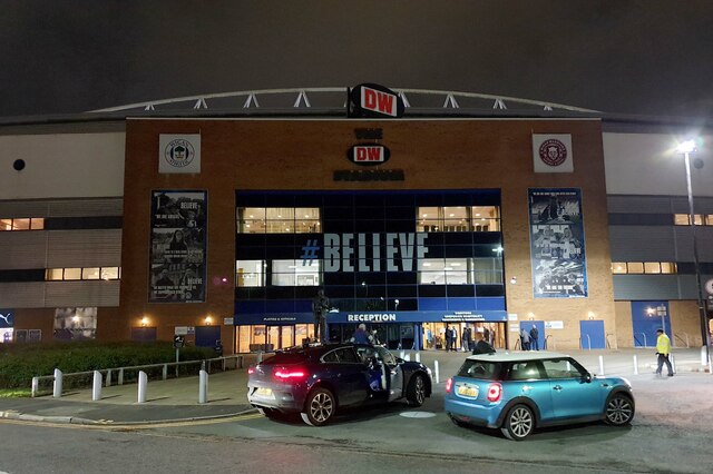
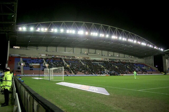
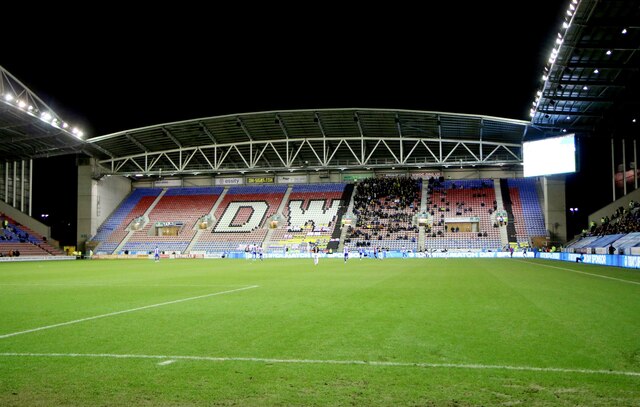
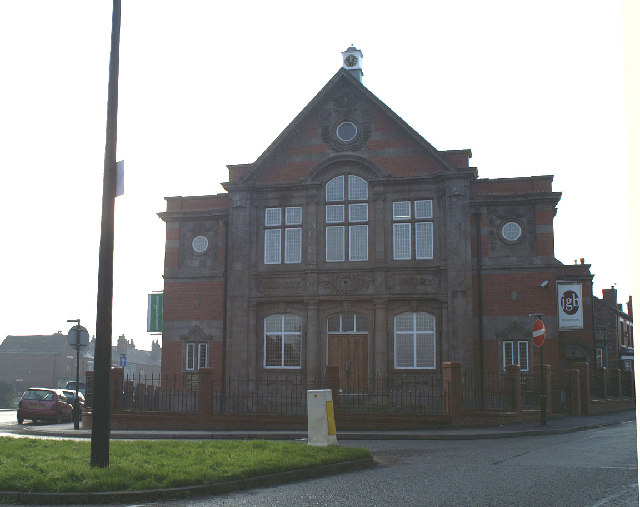
Norley Images

Images are sourced within 2km of 53.54275/-2.6747894 or Grid Reference SD5505. Thanks to Geograph Open Source API. All images are credited.

Oilseed rape brightening a dark day
The DW Stadium in Wigan The DW Stadium is home to Wigan Athletic F.C. and Wigan Warriors R.L.F.C.
The DW Stadium in Wigan
The DW Stadium is home to Wigan Athletic F.C. and Wigan Warriors R.L.F.C.
The main entrance to the DW Stadium The DW Stadium is home to Wigan Athletic F.C. and Wigan Warriors R.L.F.C.
The main entrance to the DW Stadium
The DW Stadium is home to Wigan Athletic F.C. and Wigan Warriors R.L.F.C.
The Springfield Stand at the DW Stadium The DW Stadium is home to Wigan Athletic F.C. and Wigan Warriors R.L.F.C.
The Springfield Stand at the DW Stadium
The DW Stadium is home to Wigan Athletic F.C. and Wigan Warriors R.L.F.C.
The North Stand at the DW Stadium The DW Stadium is home to Wigan Athletic F.C. and Wigan Warriors R.L.F.C.
The North Stand at the DW Stadium
The DW Stadium is home to Wigan Athletic F.C. and Wigan Warriors R.L.F.C.
The Boston Stand at the DW Stadium
The Leam Richardson Stand at the DW Stadium The DW Stadium is home to Wigan Athletic F.C. and Wigan Warriors R.L.F.C.
The Leam Richardson Stand at the DW Stadium
The DW Stadium is home to Wigan Athletic F.C. and Wigan Warriors R.L.F.C.
The North Stand at the DW Stadium The DW Stadium is home to Wigan Athletic F.C. and Wigan Warriors R.L.F.C.
The North Stand at the DW Stadium
The DW Stadium is home to Wigan Athletic F.C. and Wigan Warriors R.L.F.C.
River Douglas By the side of the DW Stadium with one of the car parks in the view to the right
River Douglas
By the side of the DW Stadium with one of the car parks in the view to the right
Leeds and Liverpool Canal Viewed from the footbridge of Pagefield lock No.88
Leeds and Liverpool Canal
Viewed from the footbridge of Pagefield lock No.88
Site of Crooke Lock On the Leeds and Liverpool Canal where mining subsidence made the lock unnecessary
Site of Crooke Lock
On the Leeds and Liverpool Canal where mining subsidence made the lock unnecessary
The Stag
The Stag
The Leeds & Liverpool Canal near Martland Mill
Houses by the Leeds & Liverpool Canal
A well paved towpath by the Leeds & Liverpool Canal
Canal side gardens in Beech Hill
Serious work on the canal side
A sportsfield beyond the crash barrier The River Douglas is also there, but hidden.
A sportsfield beyond the crash barrier
The River Douglas is also there, but hidden.
Show me another place!

Norley is located at Grid Ref: SD5505 (Lat: 53.54275, Lng: -2.6747894)

Unitary Authority: Wigan

Police Authority: Greater Manchester

What 3 Words

///whizzing.grit.audit. Near Wigan, Manchester

Nearby Locations

Norley Worsley Hall

Related Wikis

PEMBEC High School

PEMBEC High School (Pemberton Business and Enterprise College) was a state school in the Pemberton district of Wigan, Greater Manchester, with Business...

Kitt Green

Kitt Green is a suburb of Wigan. It is the location of a Heinz food processing plant. == References == == External links ==

Pemberton, Greater Manchester

Pemberton is an area of Wigan, in Greater Manchester, England. It lies on the southwestern bank of the River Douglas, and east of the M6 motorway. The...

St John the Divine's Church, Pemberton

St John the Divine's Church is in Church Street, Lamberhead Green, Pemberton, Wigan, Greater Manchester, England. It is an active Anglican parish church...

Related Videos

Welcome to UK Tourism Online!

Welcome to UK Tourism Online North West England! Within this channel you'll find many playlists about accommodation, ...

☀️ Pranic…Thursday..?? 🤣🤣 Walking barefoot 🦶 in the city 🌃 #barefoot #grounding #connecting

Addendum to last Pranic Sunday video! ✨ Meet and connect with others who are on the pranic path at PranicFamily.com ...

Blackpool to Fleetwood England Coastal Path Walk

Coast path walk from Blackpool to Fleetwood.

Nearby Amenities

Located within 500m of 53.54275,-2.6747894
Mini Roundabout
Direction: clockwise
Lat/Long: 53.5426317/-2.6707473
Mini Roundabout
Direction: clockwise
Lat/Long: 53.543496/-2.668365
Mini Roundabout
Direction: clockwise
Lat/Long: 53.5394541/-2.6756352
Mini Roundabout
Direction: clockwise
Lat/Long: 53.5392756/-2.675694
Bus Stop
Sherwood Drive/Sherwood Grove
Bus: yes
Naptan AtcoCode: 1800WK00451
Naptan Bearing: N
Naptan CommonName: Sherwood Drive/Sherwood Grove
Naptan Indicator: Nr House 156
Naptan Landmark: PLAYGROUND
Naptan NaptanCode: manpmgat
Naptan PlusbusZoneRef: MNCRPIC
Naptan ShortCommonName: Sherwood Grove
Naptan Street: SHERWOOD DRIVE
Naptan Verified: no
Network: TfGM
Public Transport: platform
Source: naptan_import
Lat/Long: 53.5419403/-2.6689314
Bus Stop
Montrose Avenue/Hodder Close
Bus: yes
Naptan AtcoCode: 1800WK01331
Naptan Bearing: W
Naptan CommonName: Montrose Avenue/Hodder Close
Naptan Indicator: Nr Open Land
Naptan Landmark: SCHOOL
Naptan NaptanCode: manpmjwm
Naptan PlusbusZoneRef: MNCRPIC
Naptan ShortCommonName: Hodder Close
Naptan Street: MONTROSE AVENUE
Naptan Verified: no
Network: TfGM
Public Transport: platform
Source: naptan_import
Lat/Long: 53.542665/-2.6702126
Bus Stop
Montrose Avenue/Montrose School
Bus: yes
Naptan AtcoCode: 1800WK01341
Naptan Bearing: E
Naptan CommonName: Montrose Avenue/Montrose School
Naptan Indicator: Os Montrose Sch
Naptan Landmark: SCHOOL
Naptan NaptanCode: manpmjwp
Naptan PlusbusZoneRef: MNCRPIC
Naptan ShortCommonName: Montrose School
Naptan Street: MONTROSE AVENUE
Naptan Verified: no
Network: TfGM
Public Transport: platform
Source: naptan_import
Lat/Long: 53.5427406/-2.6727642
Bus Stop
Helvellyn Road/Norley Hall Avenue
Bus: yes
Naptan AtcoCode: 1800WK01471
Naptan Bearing: E
Naptan CommonName: Helvellyn Road/Norley Hall Avenue
Naptan Indicator: Opp House 2
Naptan Landmark: FLATS
Naptan NaptanCode: manpmpdw
Naptan PlusbusZoneRef: MNCRPIC
Naptan ShortCommonName: Norley Hall Ave
Naptan Street: HELVELLYN ROAD
Naptan Verified: no
Network: TfGM
Public Transport: platform
Source: naptan_import
Lat/Long: 53.5420265/-2.6782459
Bus Stop
Montrose Avenue/City Road
Bus: yes
Naptan AtcoCode: 1800WK01481
Naptan Bearing: W
Naptan CommonName: Montrose Avenue/City Road
Naptan Indicator: Nr House 144
Naptan Landmark: SUB STATION
Naptan NaptanCode: manpmpga
Naptan PlusbusZoneRef: MNCRPIC
Naptan ShortCommonName: City Road
Naptan Street: MONTROSE AVENUE
Naptan Verified: no
Network: TfGM
Public Transport: platform
Source: naptan_import
Lat/Long: 53.5445366/-2.6816651
Bus Stop
Montrose Avenue/Montrose School
Bus: yes
Naptan AtcoCode: 1800WK06491
Naptan Bearing: W
Naptan CommonName: Montrose Avenue/Montrose School
Naptan Indicator: Opp School
Naptan Landmark: HOUSE 100A
Naptan NaptanCode: manptpma
Naptan PlusbusZoneRef: MNCRPIC
Naptan ShortCommonName: Montrose School
Naptan Street: MONTROSE AVENUE
Naptan Verified: no
Network: TfGM
Public Transport: platform
Source: naptan_import
Lat/Long: 53.5427369/-2.6750127
Bus Stop
Montrose Avenue/Falkirk Grove
Bus: yes
Naptan AtcoCode: 1800WK03821
Naptan Bearing: E
Naptan CommonName: Montrose Avenue/Falkirk Grove
Naptan Indicator: Adj School
Naptan Landmark: SCHOOL
Naptan NaptanCode: manptata
Naptan PlusbusZoneRef: MNCRPIC
Naptan ShortCommonName: Falkirk Grove
Naptan Street: MONTROSE AVENUE
Naptan Verified: no
Network: TfGM
Public Transport: platform
Source: naptan_import
Lat/Long: 53.5430787/-2.6758482
Bus Stop
Norley Hall Avenue/Thorburn Road
Bus: yes
Naptan AtcoCode: 1800WK04341
Naptan Bearing: N
Naptan CommonName: Norley Hall Avenue/Thorburn Road
Naptan Indicator: Os House 54
Naptan Landmark: HOUSE 54
Naptan NaptanCode: manptdpw
Naptan PlusbusZoneRef: MNCRPIC
Naptan ShortCommonName: Thorburn Road
Naptan Street: Norley Hall Avenue
Naptan Verified: no
Network: TfGM
Public Transport: platform
Source: naptan_import
Lat/Long: 53.5387882/-2.675478
Bus Stop
Norley Hall Avenue/Thorburn Road
Bus: yes
Naptan AtcoCode: 1800WK04351
Naptan Bearing: S
Naptan CommonName: Norley Hall Avenue/Thorburn Road
Naptan Indicator: Os house 57b
Naptan Landmark: HOUSE 57B
Naptan NaptanCode: manptdta
Naptan Notes: INDICATOR AMENDED
Naptan PlusbusZoneRef: MNCRPIC
Naptan ShortCommonName: Thorburn Road
Naptan Street: Norley Hall Avenue
Naptan Verified: no
Network: TfGM
Public Transport: platform
Source: naptan_import
Lat/Long: 53.5390672/-2.6754221
Bus Stop
Norley Hall Avenue/Ambleside
Bus: yes
Naptan AtcoCode: 1800WK04361
Naptan Bearing: N
Naptan CommonName: Norley Hall Avenue/Ambleside
Naptan Indicator: Op House 111
Naptan Landmark: HOUSE 96
Naptan NaptanCode: manptdtd
Naptan PlusbusZoneRef: MNCRPIC
Naptan ShortCommonName: Ambleside
Naptan Street: Norley Hall Avenue
Naptan Verified: no
Network: TfGM
Public Transport: platform
Source: naptan_import
Lat/Long: 53.5415725/-2.6774539
Bus Stop
Helvellyn Road/Borrowdale Road
Bus: yes
Naptan AtcoCode: 1800WK07061
Naptan Bearing: W
Naptan CommonName: Helvellyn Road/Borrowdale Road
Naptan Indicator: Opp House 17
Naptan Landmark: HOUSE 24
Naptan NaptanCode: manptwmp
Naptan PlusbusZoneRef: MNCRPIC
Naptan ShortCommonName: Borrowdale Road
Naptan Street: HELVELLYN ROAD
Naptan Verified: no
Network: TfGM
Public Transport: platform
Source: naptan_import
Lat/Long: 53.5413826/-2.6808161
Bus Stop
Helvellyn Road/Borrowdale Road
Bus: yes
Naptan AtcoCode: 1800WK07071
Naptan Bearing: E
Naptan CommonName: Helvellyn Road/Borrowdale Road
Naptan Indicator: Os House 15
Naptan Landmark: HOUSE 13
Naptan NaptanCode: manptwmt
Naptan PlusbusZoneRef: MNCRPIC
Naptan ShortCommonName: Borrowdale Road
Naptan Street: HELVELLYN ROAD
Naptan Verified: no
Network: TfGM
Public Transport: platform
Source: naptan_import
Lat/Long: 53.541684/-2.6799909
Bus Stop
Norley Hall Avenue/Post Office
Bus: yes
Naptan AtcoCode: 1800WK07171
Naptan Bearing: S
Naptan CommonName: Norley Hall Avenue/Post Office
Naptan Indicator: Betting Shop
Naptan Landmark: BETTING SHOP
Naptan NaptanCode: manptwpj
Naptan PlusbusZoneRef: MNCRPIC
Naptan ShortCommonName: Post Office
Naptan Street: Norley Hall Avenue
Naptan Verified: no
Network: TfGM
Public Transport: platform
Source: naptan_import
Lat/Long: 53.5416383/-2.6769419
Bus Stop
Sherwood Drive/Sherwood Grove
Bus: yes
Naptan AtcoCode: 1800WK07271
Naptan Bearing: S
Naptan CommonName: Sherwood Drive/Sherwood Grove
Naptan Indicator: Nr House 156
Naptan Landmark: HOUSE 103
Naptan NaptanCode: mantgmjg
Naptan PlusbusZoneRef: MNCRPIC
Naptan ShortCommonName: Sherwood Grove
Naptan Street: SHERWOOD DRIVE
Naptan Verified: no
Network: TfGM
Public Transport: platform
Source: naptan_import
Lat/Long: 53.5415133/-2.6688061
Crossing
Crossing: zebra
Crossing Island: no
Tactile Paving: yes
Lat/Long: 53.5426255/-2.6710561
Norley
Place: suburb
Lat/Long: 53.5399588/-2.6778434
Barrier: bollard
Bicycle: yes
Foot: yes
Horse: yes
Motor Vehicle: no
Lat/Long: 53.5429573/-2.680755
Generator Method: photovoltaic
Generator Output Electricity: yes
Generator Source: solar
Generator Type: solar_photovoltaic_panel
Location: roof
Power: generator
Lat/Long: 53.5471304/-2.676343
Generator Method: photovoltaic
Generator Output Electricity: yes
Generator Source: solar
Generator Type: solar_photovoltaic_panel
Location: roof
Power: generator
Lat/Long: 53.546928/-2.6754338
Generator Method: photovoltaic
Generator Output Electricity: yes
Generator Source: solar
Generator Type: solar_photovoltaic_panel
Location: roof
Power: generator
Lat/Long: 53.5468611/-2.6751307
Generator Method: photovoltaic
Generator Output Electricity: yes
Generator Source: solar
Generator Type: solar_photovoltaic_panel
Location: roof
Power: generator
Lat/Long: 53.546834/-2.6749939
Generator Method: photovoltaic
Generator Output Electricity: yes
Generator Source: solar
Generator Type: solar_photovoltaic_panel
Location: roof
Power: generator
Lat/Long: 53.5467623/-2.6746962
Generator Method: photovoltaic
Generator Output Electricity: yes
Generator Source: solar
Generator Type: solar_photovoltaic_panel
Location: roof
Power: generator
Lat/Long: 53.5467288/-2.6745433
Generator Method: photovoltaic
Generator Output Electricity: yes
Generator Source: solar
Generator Type: solar_photovoltaic_panel
Location: roof
Power: generator
Lat/Long: 53.5466922/-2.6743394
Generator Method: photovoltaic
Generator Output Electricity: yes
Generator Source: solar
Generator Type: solar_photovoltaic_panel
Location: roof
Power: generator
Lat/Long: 53.5468627/-2.6718959
Generator Method: photovoltaic
Generator Output Electricity: yes
Generator Source: solar
Generator Type: solar_photovoltaic_panel
Location: roof
Power: generator
Lat/Long: 53.5468579/-2.6726872
Generator Method: photovoltaic
Generator Output Electricity: yes
Generator Source: solar
Generator Type: solar_photovoltaic_panel
Location: roof
Power: generator
Lat/Long: 53.5468818/-2.672832
Generator Method: photovoltaic
Generator Output Electricity: yes
Generator Source: solar
Generator Type: solar_photovoltaic_panel
Location: roof
Power: generator
Lat/Long: 53.5470045/-2.6739424
Generator Method: photovoltaic
Generator Output Electricity: yes
Generator Source: solar
Generator Type: solar_photovoltaic_panel
Location: roof
Power: generator
Lat/Long: 53.5469902/-2.6740497
Generator Method: photovoltaic
Generator Output Electricity: yes
Generator Source: solar
Generator Type: solar_photovoltaic_panel
Location: roof
Power: generator
Lat/Long: 53.5468053/-2.673583
Generator Method: photovoltaic
Generator Output Electricity: yes
Generator Source: solar
Generator Type: solar_photovoltaic_panel
Location: roof
Power: generator
Lat/Long: 53.5467256/-2.6737601
Generator Method: photovoltaic
Generator Output Electricity: yes
Generator Source: solar
Generator Type: solar_photovoltaic_panel
Location: roof
Power: generator
Lat/Long: 53.5471607/-2.6749
Generator Method: photovoltaic
Generator Output Electricity: yes
Generator Source: solar
Generator Type: solar_photovoltaic_panel
Location: roof
Power: generator
Lat/Long: 53.54714/-2.674621
Generator Method: photovoltaic
Generator Output Electricity: yes
Generator Source: solar
Generator Type: solar_photovoltaic_panel
Location: roof
Power: generator
Lat/Long: 53.5411938/-2.6784269
Generator Method: photovoltaic
Generator Output Electricity: yes
Generator Source: solar
Generator Type: solar_photovoltaic_panel
Location: roof
Power: generator
Lat/Long: 53.5412209/-2.6783223
Generator Method: photovoltaic
Generator Output Electricity: yes
Generator Source: solar
Generator Type: solar_photovoltaic_panel
Location: roof
Power: generator
Lat/Long: 53.5412432/-2.6781292
Generator Method: photovoltaic
Generator Output Electricity: yes
Generator Source: solar
Generator Type: solar_photovoltaic_panel
Location: roof
Power: generator
Lat/Long: 53.5412655/-2.6780192
Generator Method: photovoltaic
Generator Output Electricity: yes
Generator Source: solar
Generator Type: solar_photovoltaic_panel
Location: roof
Power: generator
Lat/Long: 53.5413213/-2.677877
Generator Method: photovoltaic
Generator Output Electricity: yes
Generator Source: solar
Generator Type: solar_photovoltaic_panel
Location: roof
Power: generator
Lat/Long: 53.5413389/-2.6777456
Generator Method: photovoltaic
Generator Output Electricity: yes
Generator Source: solar
Generator Type: solar_photovoltaic_panel
Location: roof
Power: generator
Lat/Long: 53.5416959/-2.676029
Generator Method: photovoltaic
Generator Output Electricity: yes
Generator Source: solar
Generator Type: solar_photovoltaic_panel
Location: roof
Power: generator
Lat/Long: 53.5423303/-2.6755757
Generator Method: photovoltaic
Generator Output Electricity: yes
Generator Source: solar
Generator Type: solar_photovoltaic_panel
Location: roof
Power: generator
Lat/Long: 53.542351/-2.6754523
Generator Method: photovoltaic
Generator Output Electricity: yes
Generator Source: solar
Generator Type: solar_photovoltaic_panel
Location: roof
Power: generator
Lat/Long: 53.5422506/-2.6730008
Generator Method: photovoltaic
Generator Output Electricity: yes
Generator Source: solar
Generator Type: solar_photovoltaic_panel
Location: roof
Power: generator
Lat/Long: 53.5420577/-2.6717911
Generator Method: photovoltaic
Generator Output Electricity: yes
Generator Source: solar
Generator Type: solar_photovoltaic_panel
Location: roof
Power: generator
Lat/Long: 53.5421231/-2.6715014
Generator Method: photovoltaic
Generator Output Electricity: yes
Generator Source: solar
Generator Type: solar_photovoltaic_panel
Location: roof
Power: generator
Lat/Long: 53.5421788/-2.6712815
Generator Method: photovoltaic
Generator Output Electricity: yes
Generator Source: solar
Generator Type: solar_photovoltaic_panel
Location: roof
Power: generator
Lat/Long: 53.5422649/-2.6711179
Generator Method: photovoltaic
Generator Output Electricity: yes
Generator Source: solar
Generator Type: solar_photovoltaic_panel
Location: roof
Power: generator
Lat/Long: 53.541315/-2.6757903
Generator Method: photovoltaic
Generator Output Electricity: yes
Generator Source: solar
Generator Type: solar_photovoltaic_panel
Location: roof
Power: generator
Lat/Long: 53.5413405/-2.681946
Generator Method: photovoltaic
Generator Output Electricity: yes
Generator Source: solar
Generator Type: solar_photovoltaic_panel
Location: roof
Power: generator
Lat/Long: 53.5413676/-2.6818306
Generator Method: photovoltaic
Generator Output Electricity: yes
Generator Source: solar
Generator Type: solar_photovoltaic_panel
Location: roof
Power: generator
Lat/Long: 53.5415238/-2.6809562
Generator Method: photovoltaic
Generator Output Electricity: yes
Generator Source: solar
Generator Type: solar_photovoltaic_panel
Location: roof
Power: generator
Lat/Long: 53.5423494/-2.680975
Generator Method: photovoltaic
Generator Output Electricity: yes
Generator Source: solar
Generator Type: solar_photovoltaic_panel
Location: roof
Power: generator
Lat/Long: 53.5425932/-2.6811198
Generator Method: photovoltaic
Generator Output Electricity: yes
Generator Source: solar
Generator Type: solar_photovoltaic_panel
Location: roof
Power: generator
Lat/Long: 53.5425725/-2.6813881
Generator Method: photovoltaic
Generator Output Electricity: yes
Generator Source: solar
Generator Type: solar_photovoltaic_panel
Location: roof
Power: generator
Lat/Long: 53.5425661/-2.6814444
Generator Method: photovoltaic
Generator Output Electricity: yes
Generator Source: solar
Generator Type: solar_photovoltaic_panel
Location: roof
Power: generator
Lat/Long: 53.5431304/-2.6815785
Generator Method: photovoltaic
Generator Output Electricity: yes
Generator Source: solar
Generator Type: solar_photovoltaic_panel
Location: roof
Power: generator
Lat/Long: 53.5431319/-2.6816804
Generator Method: photovoltaic
Generator Output Electricity: yes
Generator Source: solar
Generator Type: solar_photovoltaic_panel
Location: roof
Power: generator
Lat/Long: 53.544611/-2.6779522
Generator Method: photovoltaic
Generator Output Electricity: yes
Generator Source: solar
Generator Type: solar_photovoltaic_panel
Location: roof
Power: generator
Lat/Long: 53.5446492/-2.6781211
Generator Method: photovoltaic
Generator Output Electricity: yes
Generator Source: solar
Generator Type: solar_photovoltaic_panel
Location: roof
Power: generator
Lat/Long: 53.5448899/-2.6773111
Generator Method: photovoltaic
Generator Output Electricity: yes
Generator Source: solar
Generator Type: solar_photovoltaic_panel
Location: roof
Power: generator
Lat/Long: 53.544713/-2.6765574
Generator Method: photovoltaic
Generator Output Electricity: yes
Generator Source: solar
Generator Type: solar_photovoltaic_panel
Location: roof
Power: generator
Lat/Long: 53.545054/-2.6757983
Generator Method: photovoltaic
Generator Output Electricity: yes
Generator Source: solar
Generator Type: solar_photovoltaic_panel
Location: roof
Power: generator
Lat/Long: 53.5450764/-2.6759137
Generator Method: photovoltaic
Generator Output Electricity: yes
Generator Source: solar
Generator Type: solar_photovoltaic_panel
Location: roof
Power: generator
Lat/Long: 53.5448389/-2.6759405
Generator Method: photovoltaic
Generator Output Electricity: yes
Generator Source: solar
Generator Type: solar_photovoltaic_panel
Location: roof
Power: generator
Lat/Long: 53.5451098/-2.6760505
Generator Method: photovoltaic
Generator Output Electricity: yes
Generator Source: solar
Generator Type: solar_photovoltaic_panel
Location: roof
Power: generator
Lat/Long: 53.5452676/-2.6767425
Generator Method: photovoltaic
Generator Output Electricity: yes
Generator Source: solar
Generator Type: solar_photovoltaic_panel
Location: roof
Power: generator
Lat/Long: 53.5452995/-2.6769088
Generator Method: photovoltaic
Generator Output Electricity: yes
Generator Source: solar
Generator Type: solar_photovoltaic_panel
Location: roof
Power: generator
Lat/Long: 53.5453314/-2.6770241
Crossing
Lat/Long: 53.5442829/-2.6795548
Crossing
Lat/Long: 53.5453134/-2.6806727
Give Way
Lat/Long: 53.5419183/-2.6773608
Traffic Calming: cushion
Lat/Long: 53.5411721/-2.6690709
Traffic Calming: cushion
Lat/Long: 53.5394427/-2.6696791
Traffic Calming: cushion
Lat/Long: 53.5403907/-2.6693689
Bus Stop
Sherwood Grove
Bus: yes
Naptan AtcoCode: 1800WKH1611
Naptan Bearing: S
Naptan CommonName: Sherwood Grove
Naptan Indicator: S-Bound
Naptan Street: Sherwood Grove
Naptan Verified: no
Network: TfGM
Public Transport: platform
Source: naptan;bing;naptan_compare_tool
Lat/Long: 53.5410363/-2.6680471
Bus Stop
Sherwood Grove
Bus: yes
Naptan AtcoCode: 1800WKH4721
Naptan Bearing: N
Naptan CommonName: Sherwood Grove
Naptan Indicator: N-bound
Naptan Street: Sherwood Grove
Naptan Verified: no
Network: TfGM
Public Transport: platform
Source: naptan;bing;naptan_compare_tool
Lat/Long: 53.5410444/-2.6682132
Bus Stop
Post Office
Bus: yes
Naptan AtcoCode: 1800WK13371
Naptan Bearing: N
Naptan CommonName: Post Office
Naptan Indicator: opp
Naptan Landmark: COMMUNITY CNTR
Naptan NaptanCode: MANTWAPG
Naptan Street: NORLEY HALL Avenue
Naptan Verified: no
Network: TfGM
Public Transport: platform
Source: naptan;bing;naptan_compare_tool
Lat/Long: 53.5404394/-2.6766842
Traffic Calming: cushion
Lat/Long: 53.5433278/-2.6768023
Traffic Calming: cushion
Lat/Long: 53.5429128/-2.6755712
Traffic Calming: cushion
Lat/Long: 53.5426964/-2.6735528
Traffic Calming: cushion
Lat/Long: 53.542648/-2.6723274
Advertising: board
Lat/Long: 53.5435942/-2.6680134
Post Box
Operator: Royal Mail
Operator Wikidata: Q638098
Post Box Type: lamp
Ref: WN5 207
Royal Cypher: EIIR
Lat/Long: 53.5396341/-2.6762032
Post Box
Operator: Royal Mail
Operator Wikidata: Q638098
Post Box Design: type_b
Post Box Type: pillar
Ref: WN5 220
Royal Cypher: yes
Lat/Long: 53.5407098/-2.676296
The data included in this document is from www.openstreetmap.org. The data is made available under ODbL.

Have you been to Norley?

Leave your review of Norley below (or comments, questions and feedback).