Downham Hythe

Settlement in Cambridgeshire East Cambridgeshire

England

Downham Hythe

Pill Boxes next to Adventurers' Drove near Oxlode There appear to be a number of these World War II pill boxes in this area of the fens near Oxlode and Pymoor.
Pill Boxes next to Adventurers' Drove near Oxlode Credit: Jeff Buck

Downham Hythe is a small village located in the county of Cambridgeshire, England. Situated along the banks of the River Great Ouse and surrounded by picturesque countryside, it offers a tranquil and idyllic setting. With a population of around 400 residents, the village has managed to maintain its traditional charm and character.

The village is primarily residential, with a mix of traditional cottages and more modern houses. The architecture reflects the village's history, with some buildings dating back several centuries. The River Great Ouse is a prominent feature of the area, providing opportunities for boating, fishing, and scenic walks along its banks.

Despite its small size, Downham Hythe boasts a close-knit community. The village has a local primary school, which serves the immediate area, and a village hall that hosts various community events throughout the year. There is also a pub, The Riverside Inn, which offers a welcoming atmosphere and serves traditional British pub food.

Downham Hythe benefits from its proximity to larger towns, such as Huntingdon and St Neots, which provide a wider range of amenities and services. It is well-connected to these towns and other nearby villages by road, making it convenient for residents to access shops, healthcare facilities, and employment opportunities.

Overall, Downham Hythe is a charming and peaceful village, perfect for those seeking a rural lifestyle while still being within reach of larger towns. Its natural beauty, friendly community, and convenient location make it a desirable place to live.

If you have any feedback on the listing, please let us know in the comments section below.

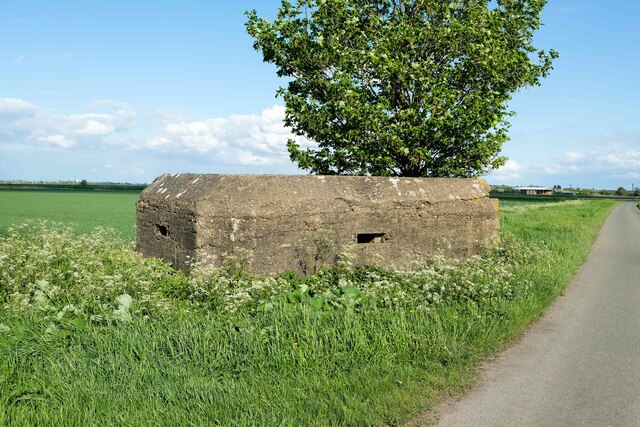
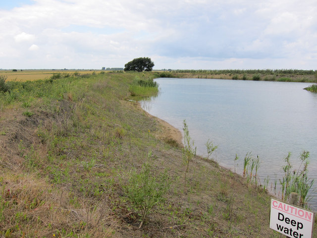
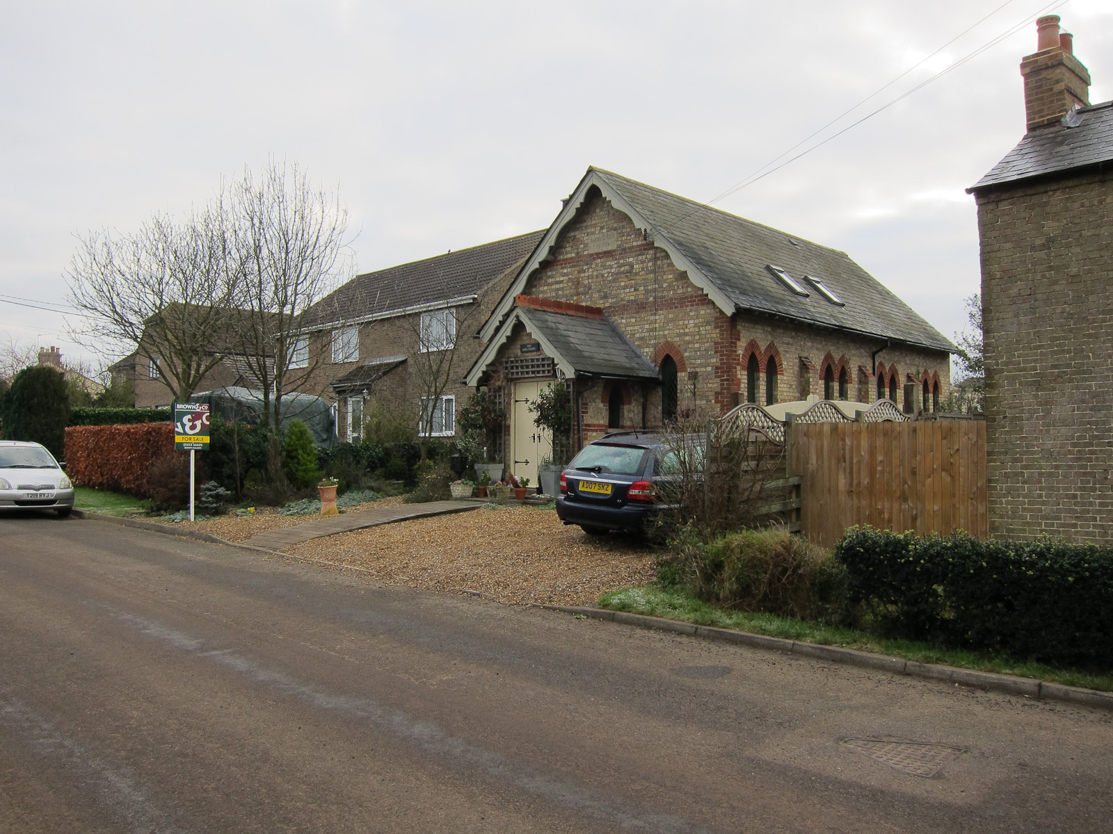
Downham Hythe Images

Images are sourced within 2km of 52.430947/0.20491853 or Grid Reference TL5083. Thanks to Geograph Open Source API. All images are credited.

Pill Boxes next to Adventurers' Drove near Oxlode There appear to be a number of these World War II pill boxes in this area of the fens near Oxlode and Pymoor.
Pill Boxes next to Adventurers' Drove near Oxlode
There appear to be a number of these World War II pill boxes in this area of the fens near Oxlode and Pymoor.
Bridge on Adventurers' Drove Bridge over a drain on Adventurers' Drove near Oxlode. Adventurers' Drove is named after the groups of English engineers and wealthy landowners, who funded large scale land drainage projects in the seventeenth century, in return for rights to some of the land reclaimed.

Wikipedia <span class="nowrap"><a title="https://en.wikipedia.org/wiki/Adventurers_(land_drainage)" rel="nofollow ugc noopener" href="https://en.wikipedia.org/wiki/Adventurers_(land_drainage)">Link</a><img style="margin-left:2px;" alt="External link" title="External link - shift click to open in new window" src="https://s1.geograph.org.uk/img/external.png" width="10" height="10"/></span>
Bridge on Adventurers' Drove
Bridge over a drain on Adventurers' Drove near Oxlode. Adventurers' Drove is named after the groups of English engineers and wealthy landowners, who funded large scale land drainage projects in the seventeenth century, in return for rights to some of the land reclaimed. Wikipedia LinkExternal link
Adventurers' Drove near Oxlode Adventurers' Drove is named after the groups of English engineers and wealthy landowners, who funded large scale land drainage projects in the seventeenth century, in return for rights to some of the land reclaimed.

Wikipedia <span class="nowrap"><a title="https://en.wikipedia.org/wiki/Adventurers_(land_drainage)" rel="nofollow ugc noopener" href="https://en.wikipedia.org/wiki/Adventurers_(land_drainage)">Link</a><img style="margin-left:2px;" alt="External link" title="External link - shift click to open in new window" src="https://s1.geograph.org.uk/img/external.png" width="10" height="10"/></span>
Adventurers' Drove near Oxlode
Adventurers' Drove is named after the groups of English engineers and wealthy landowners, who funded large scale land drainage projects in the seventeenth century, in return for rights to some of the land reclaimed. Wikipedia LinkExternal link
Pill Box next to Adventurers' Drove near Oxlode There appear to be a number of these World War II pill boxes in this area of the fens near Oxlode and Pymoor.
Adventurers' Drove is named after the groups of English engineers and wealthy landowners, who funded large scale land drainage projects in the seventeenth century, in return for rights to some of the land reclaimed.

Wikipedia <span class="nowrap"><a title="https://en.wikipedia.org/wiki/Adventurers_(land_drainage)" rel="nofollow ugc noopener" href="https://en.wikipedia.org/wiki/Adventurers_(land_drainage)">Link</a><img style="margin-left:2px;" alt="External link" title="External link - shift click to open in new window" src="https://s1.geograph.org.uk/img/external.png" width="10" height="10"/></span>
Pill Box next to Adventurers' Drove near Oxlode
There appear to be a number of these World War II pill boxes in this area of the fens near Oxlode and Pymoor. Adventurers' Drove is named after the groups of English engineers and wealthy landowners, who funded large scale land drainage projects in the seventeenth century, in return for rights to some of the land reclaimed. Wikipedia LinkExternal link
Pill Box next to Adventurers' Drove near Oxlode There appear to be a number of these World War II pill boxes in this area of the fens near Oxlode and Pymoor.
Pill Box next to Adventurers' Drove near Oxlode
There appear to be a number of these World War II pill boxes in this area of the fens near Oxlode and Pymoor.
Entrance to Pill Box next to Adventurers' Drove near Oxlode There appear to be a number of these World War II pill boxes in this area of the fens near Oxlode and Pymoor.
Entrance to Pill Box next to Adventurers' Drove near Oxlode
There appear to be a number of these World War II pill boxes in this area of the fens near Oxlode and Pymoor.
Adventurers' Drove near Oxlode Adventurers' Drove is named after the groups of English engineers and wealthy landowners, who funded large scale land drainage projects in the seventeenth century, in return for rights to some of the land reclaimed.

Wikipedia <span class="nowrap"><a title="https://en.wikipedia.org/wiki/Adventurers_(land_drainage)" rel="nofollow ugc noopener" href="https://en.wikipedia.org/wiki/Adventurers_(land_drainage)">Link</a><img style="margin-left:2px;" alt="External link" title="External link - shift click to open in new window" src="https://s1.geograph.org.uk/img/external.png" width="10" height="10"/></span>
Adventurers' Drove near Oxlode
Adventurers' Drove is named after the groups of English engineers and wealthy landowners, who funded large scale land drainage projects in the seventeenth century, in return for rights to some of the land reclaimed. Wikipedia LinkExternal link
Way Head Drove
Way Head Drove
House and field by Way Head Drove
Downham Hythe Drove, Way Head
Barn on Main Street, Coveney This was designed to look like a conversion but was actually begun in 2011 from new.
Barn on Main Street, Coveney
This was designed to look like a conversion but was actually begun in 2011 from new.
Hale Fen Farm On West Fen Road between Coveney and Ely.
Hale Fen Farm
On West Fen Road between Coveney and Ely.
New farm reservoir near Coveney
Footpath near Coveney Seemingly little used.
Footpath near Coveney
Seemingly little used.
Thatched house, Coveney
Footpath from Coveney
Barcham Farm The end of one of the poultry sheds and a large pile of straw bales.
Barcham Farm
The end of one of the poultry sheds and a large pile of straw bales.
Show me another place!

Downham Hythe is located at Grid Ref: TL5083 (Lat: 52.430947, Lng: 0.20491853)

Division: Isle of Ely

Administrative County: Cambridgeshire

District: East Cambridgeshire

Police Authority: Cambridgeshire

What 3 Words

///painted.vibrate.cemented. Near Witchford, Cambridgeshire

Nearby Locations

Downham Hythe

Related Wikis

Coveney, Cambridgeshire

Coveney is a village northwest of Ely in Cambridgeshire. Coveney is on a small Fen 'island' rising to 43 feet (13 m) above sea level, some 3.5 miles...

Little Downham

Situated in the east of Cambridgeshire, the village of Little Downham is located just 3 miles (5 km) north of the city of Ely. The Parish of Downham comprises...

Little Downham Local Nature Reserve

Little Downham Local Nature Reserve is a 6.6 hectare Local Nature Reserve in Little Downham in Cambridgeshire. It is owned by Little Downham Parish Council...

North West Cambridgeshire (UK Parliament constituency)

North West Cambridgeshire is a county constituency represented in the House of Commons of the Parliament of the United Kingdom since 2005 by Shailesh Vara...

Wardy Hill

Wardy Hill is a hamlet in Coveney civil parish, part of East Cambridgeshire, England. It is also the site of a former Iron Age Hill fort == References ==

Pymoor

Pymoor is a village in Cambridgeshire in the vicinity of Ely and in the parish of Little Downham. There are approximately 390 residents according to the...

Ouse Washes

Ouse Washes is a linear 2,513.6-hectare (6,211-acre) biological Site of Special Scientific Interest stretching from near St Ives in Cambridgeshire to Downham...

Ely Rural District

Ely Rural District was a rural district in England from 1894 to 1974. It was named after Ely, but did not include the city itself, instead covering the...

Related Videos

Walking the Dogs | Downham Community Orchard & Little Downham Local Nature Reserve.

A good long walk with Bella on Easter Bank Holiday Monday. This walk ended up being much longer than I originally planned but ...

What Have We Been Up To For The Last Month?

Greetings from Coveney, UK! What Have We Been Up To For The Past Month? We made a video about how to sign up for ...

The Smallest Village We’ve Ever Stayed In | Coveney UK

Greetings from Coveney, UK! This week we give you a tour around The Smallest Village We've Ever Stayed In | Coveney UK We ...

Barge life.

This is a peaceful short meditation, it's idyllic in its peacefulness, sailing on a barge up and down the canal looks so relaxing, ...

Nearby Amenities

Located within 500m of 52.430947,0.20491853
Otter Bush House
Landuse: residential
Lat/Long: 52.4272691/0.2091324
Hythe Farm
Landuse: farm
Note Retag: CS #48756035
Lat/Long: 52.4311479/0.2038454
Hollyoaks
Landuse: farm
Note Retag: CS #48756035
Lat/Long: 52.4289694/0.200381
Power: pole
Lat/Long: 52.4294749/0.2051782
Power: pole
Lat/Long: 52.4275835/0.2007659
Power: pole
Lat/Long: 52.4290497/0.2041697
Power: pole
Lat/Long: 52.4291503/0.2060848
Power: pole
Lat/Long: 52.4286277/0.2031719
Power: pole
Lat/Long: 52.4280439/0.2077102
Power: pole
Lat/Long: 52.4275687/0.208134
Power: pole
Lat/Long: 52.428102/0.2019609
Power: pole
Lat/Long: 52.4288175/0.2070034
Power: pole
Lat/Long: 52.4298616/0.2076994
Power: pole
Lat/Long: 52.429703/0.2065864
Power: pole
Lat/Long: 52.4300309/0.2088184
Power: pole
Lat/Long: 52.4303637/0.2110523
Power: pole
Lat/Long: 52.4305306/0.21216
Power: pole
Lat/Long: 52.4301855/0.2098587
Power: pole
Lat/Long: 52.4345674/0.2048336
Power: pole
Lat/Long: 52.4332575/0.2052816
Power: pole
Lat/Long: 52.4322428/0.2064363
Power: pole
Lat/Long: 52.4316386/0.2070961
Power: pole
Lat/Long: 52.4306225/0.2081913
Power: pole
Lat/Long: 52.4327727/0.2058274
Power: pole
Lat/Long: 52.4341507/0.2049954
Power: pole
Lat/Long: 52.4311115/0.2076709
Place: farm
Lat/Long: 52.4306805/0.202672
Place: farm
Lat/Long: 52.4298105/0.2086587
Building: yes
Lat/Long: 52.4346838/0.2039594
The data included in this document is from www.openstreetmap.org. The data is made available under ODbL.

Have you been to Downham Hythe?

Leave your review of Downham Hythe below (or comments, questions and feedback).