Coire nan Cnàimh

Corrie (Glacial Valley) in Argyllshire

Scotland

Coire nan Cnàimh

Redundant gate, Bealach an Easan The gate still stands on the Bealach an Easan ('pass of the little waterfall') although the fence evidently collapsed many years ago.
Redundant gate, Bealach an Easan Credit: Alan O'Dowd

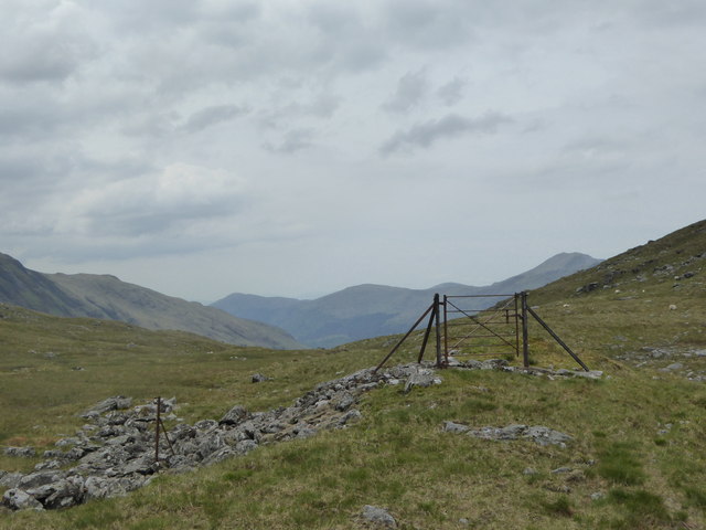
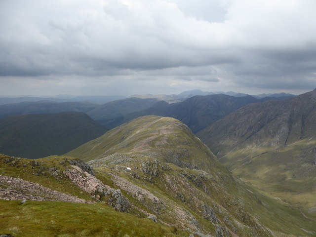
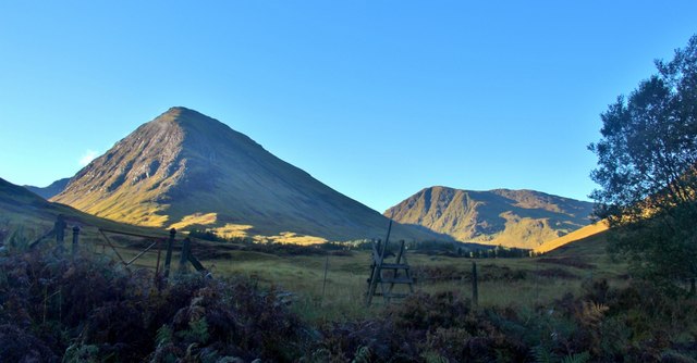
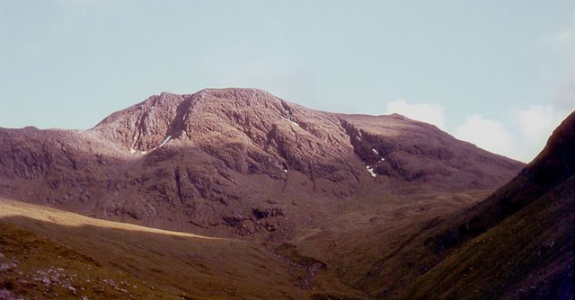
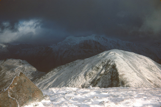
Coire nan Cnàimh, located in Argyllshire, Scotland, is a captivating glacial valley known for its awe-inspiring natural beauty and rich geological history. Nestled amidst the majestic mountains of the Scottish Highlands, this corrie, or cirque, showcases the remarkable forces of nature that shaped the landscape.

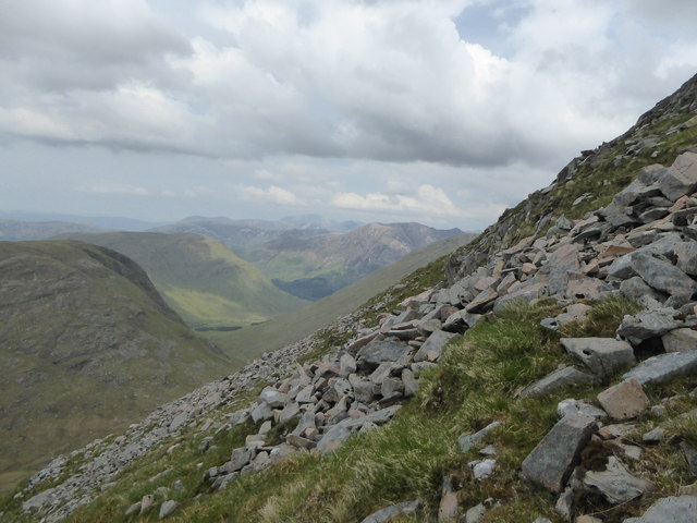
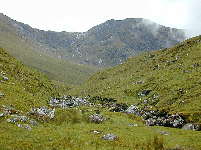
Characterized by its steep, U-shaped formation, Coire nan Cnàimh was sculpted by ancient glaciers thousands of years ago. The valley, approximately 500 meters in length, is bounded by towering cliffs and rocky slopes, which provide a dramatic backdrop to the picturesque scenery. The glacial action has left behind moraines, ridges, and striations, revealing the sheer power and movement of the ice masses that once dominated the area.

Coire nan Cnàimh is renowned for its diverse flora and fauna, making it a popular destination for nature enthusiasts and hikers. The valley is home to a variety of plant species, including heather, mosses, and wildflowers that blanket the rocky terrain. Wildlife such as red deer, golden eagles, and ptarmigans can often be spotted, adding to the allure of the area.

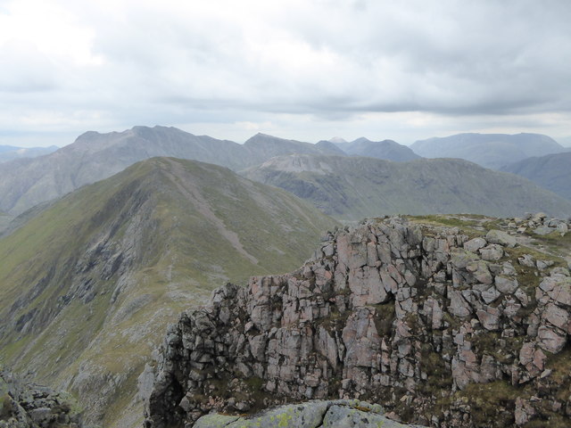
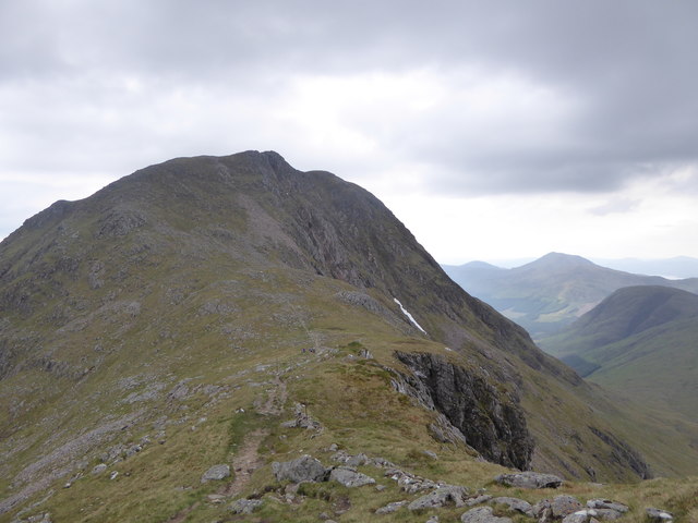
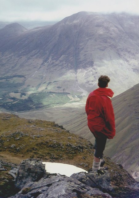
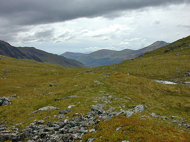
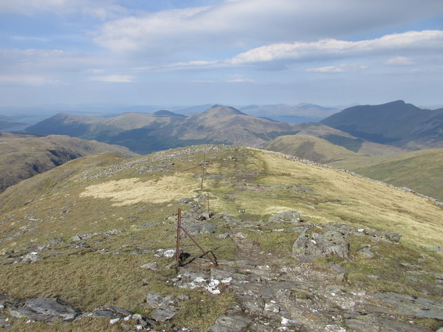
For adventurous souls, Coire nan Cnàimh offers an array of opportunities for outdoor activities. Hiking and mountaineering are particularly popular, with several trails leading to the corrie's summit, providing breathtaking panoramic views of the surrounding mountains and glens. The challenging terrain and rugged beauty of the area make it a favored location for climbers and nature photographers seeking to capture its untamed essence.

Overall, Coire nan Cnàimh is a captivating glacial valley that showcases the raw power of nature and offers an unforgettable experience for those who venture into its ethereal landscapes.

If you have any feedback on the listing, please let us know in the comments section below.

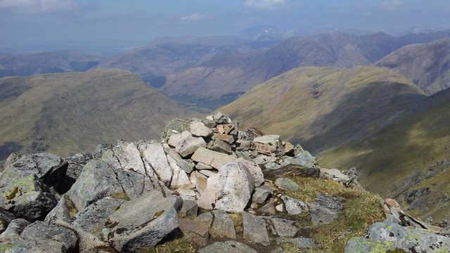
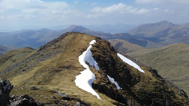
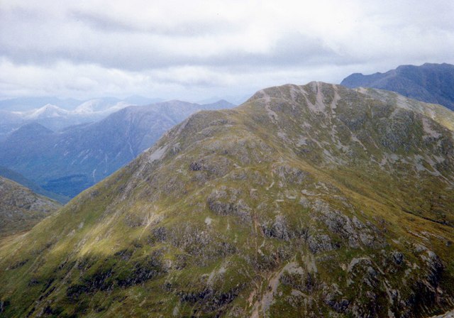
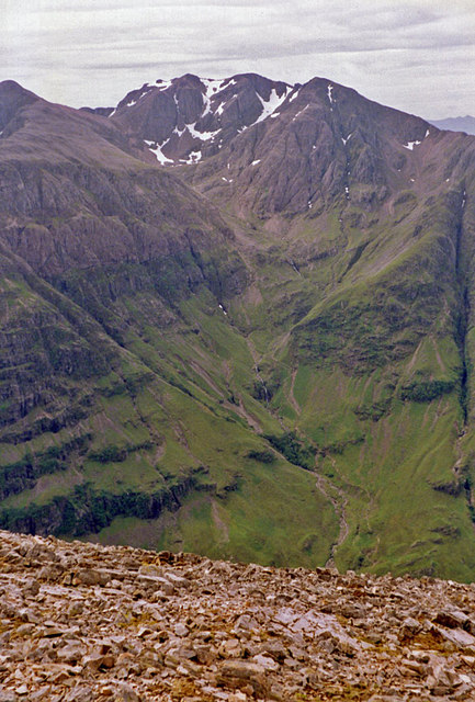
Coire nan Cnàimh Images

Images are sourced within 2km of 56.627099/-5.0627336 or Grid Reference NN1252. Thanks to Geograph Open Source API. All images are credited.

Redundant gate, Bealach an Easan The gate still stands on the Bealach an Easan ('pass of the little waterfall') although the fence evidently collapsed many years ago.
Redundant gate, Bealach an Easan
The gate still stands on the Bealach an Easan ('pass of the little waterfall') although the fence evidently collapsed many years ago.
Steep slopes on Corr na Beinne It's a steep slog up this slope from the bealach below!
Steep slopes on Corr na Beinne
It's a steep slog up this slope from the bealach below!
Top of Vixen Gully, Sgurr na h-Ulaidh Looking beyond the gully towards the satellite top of Stob an Fhuarain ('peak of the spring')
Top of Vixen Gully, Sgurr na h-Ulaidh
Looking beyond the gully towards the satellite top of Stob an Fhuarain ('peak of the spring')
Sgùrr na h-Ulaidh ('peak of the treasure') A view from the beginning of the climb to Stob an Fhuarain - if you look closely there are three walkers en route between the two summits.
Sgùrr na h-Ulaidh ('peak of the treasure')
A view from the beginning of the climb to Stob an Fhuarain - if you look closely there are three walkers en route between the two summits.
Aonach Dubh a' Ghlinne ('ridge of the black glen') This ridge continues in a direction roughly northwards from Stob an Fhuarain ('peak of the spring')
Aonach Dubh a' Ghlinne ('ridge of the black glen')
This ridge continues in a direction roughly northwards from Stob an Fhuarain ('peak of the spring')
Aonach Dubh a' Ghlinne Sgùrr na h-Ulaidh on the right.
Aonach Dubh a' Ghlinne
Sgùrr na h-Ulaidh on the right.
Summit of Aonach Dubh a' Ghlinne The Clachaig Gully is central in the distance.
Summit of Aonach Dubh a' Ghlinne
The Clachaig Gully is central in the distance.
Gleann Leac na Muidhe The backdrop is Sgùrr na h-Ulaidh.
Gleann Leac na Muidhe
The backdrop is Sgùrr na h-Ulaidh.
Stob an Fhuarain, Bidean nam Bian in distance
Looking up the Allt na Muide With Sgùrr na h-Ulaidh ahead.
Looking up the Allt na Muide
With Sgùrr na h-Ulaidh ahead.
Looking west along the Bealach Easan This is the col which separates Sgùrr na h-Ulaidh from Meall Lighiche to the north. The hill range on the north side of Glen Creran can be seen in the distance.
Looking west along the Bealach Easan
This is the col which separates Sgùrr na h-Ulaidh from Meall Lighiche to the north. The hill range on the north side of Glen Creran can be seen in the distance.
West side of Sgor na h-Ulaidh Looking along a line of old fenceposts from west of the summit of Sgor na h-Ulaidh.
West side of Sgor na h-Ulaidh
Looking along a line of old fenceposts from west of the summit of Sgor na h-Ulaidh.
Summit of Sgor na h-Ulaidh The summit cairn of Sgor na h-Ulaidh perched on the edge of the north face, with Ben Nevis in the distance.
Summit of Sgor na h-Ulaidh
The summit cairn of Sgor na h-Ulaidh perched on the edge of the north face, with Ben Nevis in the distance.
Sgor na h-Ulaidh Sgor na h-Ulaidh, viewed from Stob an Fhuarain.
Sgor na h-Ulaidh
Sgor na h-Ulaidh, viewed from Stob an Fhuarain.
Summit of Stob an Fhuarain The summit of Stob an Fhuarain, with Bidean nam Bian beyond.
Summit of Stob an Fhuarain
The summit of Stob an Fhuarain, with Bidean nam Bian beyond.
Rock rib on Aonach Dubh a' Ghlinne Rock rib protruding down the western side of Aonach Dubh a' Ghlinne.
Rock rib on Aonach Dubh a' Ghlinne
Rock rib protruding down the western side of Aonach Dubh a' Ghlinne.
On Sgurr na h-Ulaidh - view towards foot of Glencoe
On Sgurr na h-Ulaidh - view towards Corr na Beinne
Show me another place!

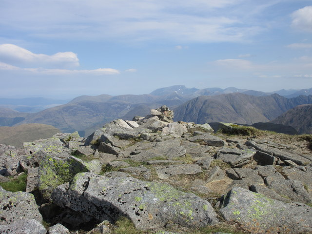
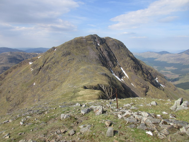
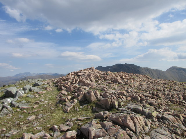
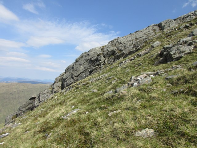
Coire nan Cnàimh is located at Grid Ref: NN1252 (Lat: 56.627099, Lng: -5.0627336)

Unitary Authority: Highland

Police Authority: Highlands and Islands

What 3 Words

///handfuls.speak.bulldozer. Near Glencoe, Highland

Nearby Locations

Coire nan Cnàimh

Related Wikis

Sgùrr na h-Ulaidh

Sgùrr na h-Ulaidh (also Sgòr na h-Ulaidh) ("Peak of the Treasure") is a mountain lying to the south of the village of Glencoe in the Scottish Highlands...

Bidean nam Bian

Bidean nam Bian (Scottish Gaelic: Bidean nam Beann, 'peak of the mountains') is the highest peak in a group of mountains south of Glen Coe and north of...

Stob Coire Sgreamhach

Stob Coire Sgreamhach (Scottish Gaelic for 'peak of the dreadful corrie') is a mountain in Lorn, south of Glen Coe in the Scottish Highlands. Its height...

Meall Mor (Glen Coe)

Meall Mor (676 m) is a mountain in the Grampian Mountains of Scotland. It lies above the Glencoe village at the foot of Glen Coe in Lochaber, Scotland...

Beinn Fhionnlaidh (Creran)

Beinn Fhionnlaidh is a mountain in the West Highlands of Scotland. It is situated between Glen Etive and Glen Creran, to the south of Glen Coe. == References ==

Clachaig Inn

The Clachaig Inn is a hotel and pub in Glen Coe, Lochaber, Highland, Scotland. It is popular with walkers and climbers who come to visit the surrounding...

Glen Etive

Glen Etive (Scottish Gaelic: Gleann Èite) is a glen in the Highlands of Scotland. The River Etive (Scottish Gaelic: Abhainn Èite) rises on the peaks surrounding...

Loch Achtriochtan

Loch Achtriochtan or Loch Trychardan is a small shallow freshwater loch located to the east of Glencoe village in Lochaber in the Scottish Highlands. It...

Nearby Amenities

Located within 500m of 56.627099,-5.0627336
Stob an Fhuarain
Ele: 968
Munro: no
Natural: peak
Lat/Long: 56.6247187/-5.0691159
Coire nan Cnaimh
Place: locality
Lat/Long: 56.6266309/-5.0640868
The data included in this document is from www.openstreetmap.org. The data is made available under ODbL.

Have you been to Coire nan Cnàimh?

Leave your review of Coire nan Cnàimh below (or comments, questions and feedback).