Coire Cruinn

Corrie (Glacial Valley) in Argyllshire

Scotland

Coire Cruinn

Bracken covered lower slopes of Beinn Trilleachan
Bracken covered lower slopes of Beinn Trilleachan Credit: Steven Brown

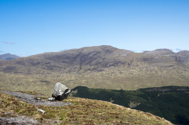
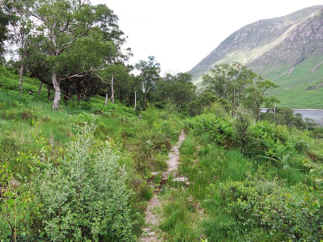
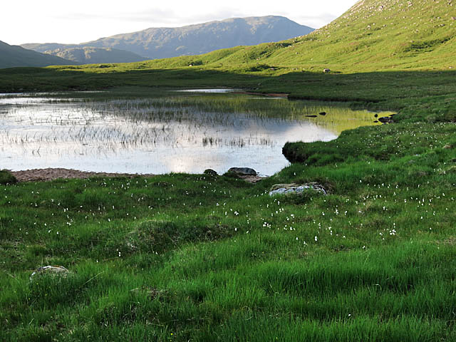
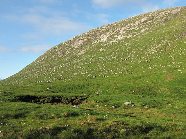
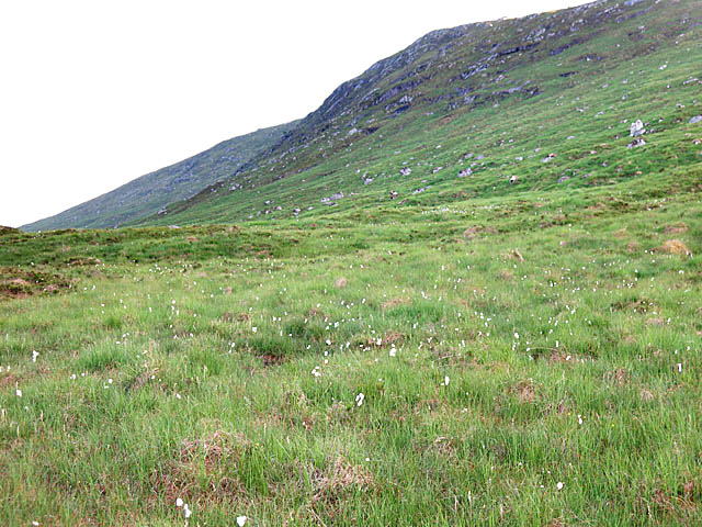
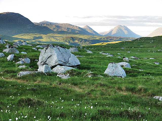
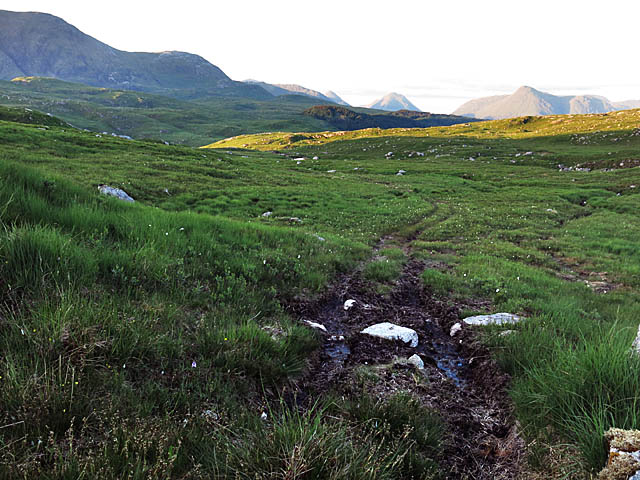
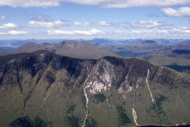
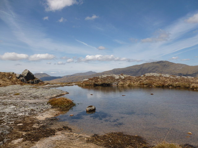
Coire Cruinn, also known as Corrie, is a glacial valley located in Argyllshire, Scotland. Situated in the southern part of the region, it is a popular destination for outdoor enthusiasts and nature lovers.

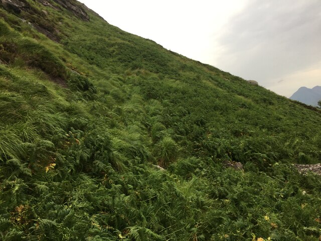
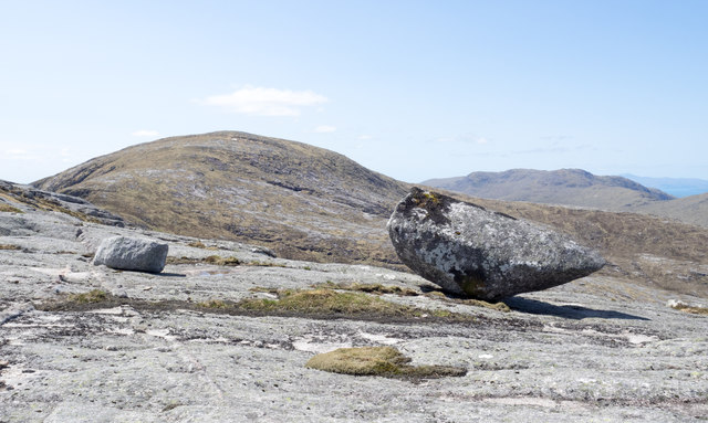
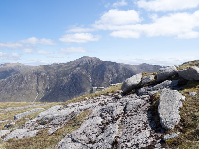
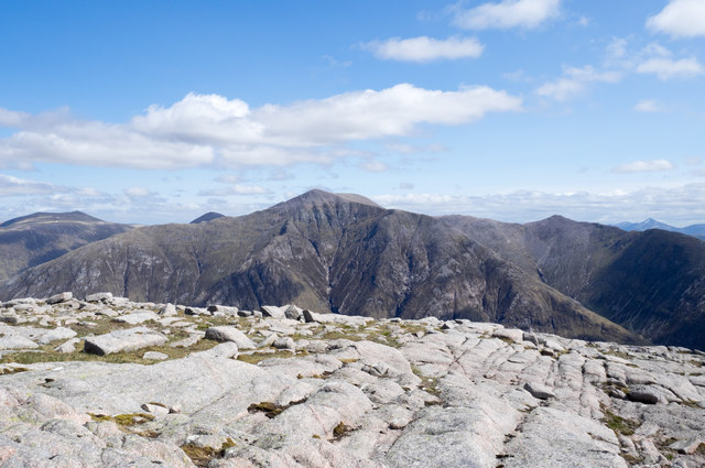
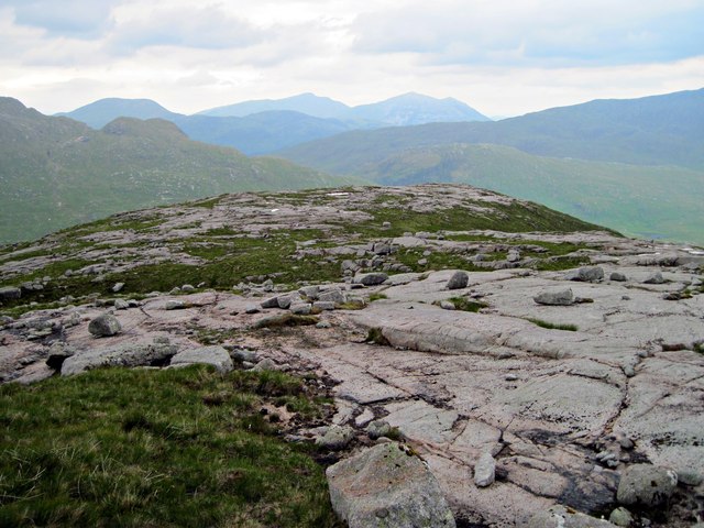
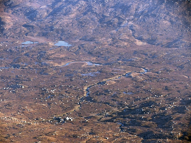
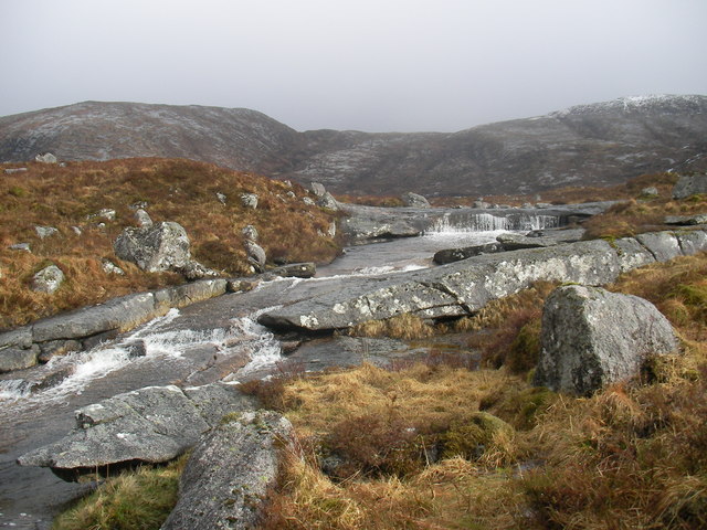
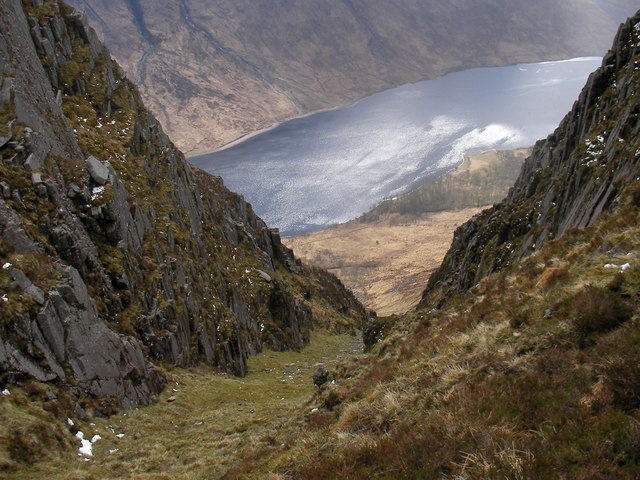
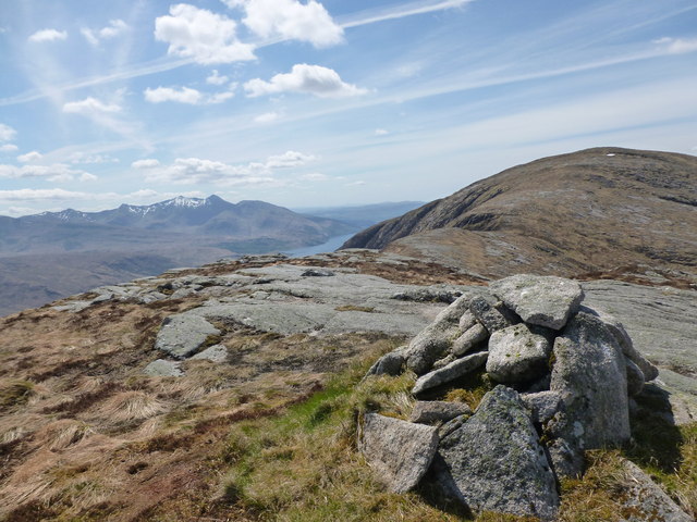
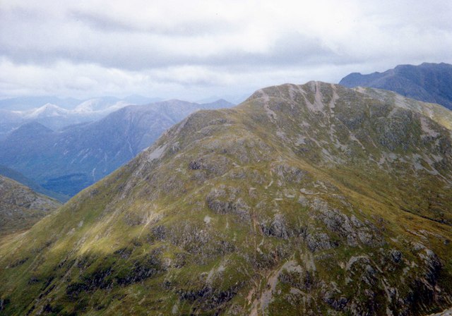
The valley is characterized by its stunning natural beauty, with rugged cliffs, majestic mountains, and a serene loch. Its name, Coire Cruinn, translates to "round corrie" in Gaelic, which accurately describes its shape. The valley was formed during the last Ice Age when glacial erosion carved out the landscape.

Coire Cruinn offers a range of activities for visitors to enjoy. Hiking is a popular choice, with several trails available for all skill levels. The surrounding mountains provide breathtaking views and opportunities for climbing and mountaineering. The loch is perfect for fishing, boating, and wildlife spotting.

Nature enthusiasts will be delighted by the diverse flora and fauna found in the area. The valley is home to a variety of plant species, including heather, mosses, and wildflowers. It is also a haven for wildlife, with red deer, otters, and various bird species frequently spotted.

The picturesque village of Corrie is located nearby, offering accommodation options, restaurants, and shops for visitors. The village maintains its traditional charm and provides a glimpse into local Scottish culture.

Coire Cruinn is a place of natural wonder, where visitors can immerse themselves in the beauty of the Scottish Highlands. Its breathtaking landscapes, outdoor activities, and abundant wildlife make it a must-visit destination for anyone exploring Argyllshire.

If you have any feedback on the listing, please let us know in the comments section below.

Coire Cruinn Images

Images are sourced within 2km of 56.552497/-5.1191982 or Grid Reference NN0844. Thanks to Geograph Open Source API. All images are credited.

Bracken covered lower slopes of Beinn Trilleachan
Perched boulder on rock slab The boulder sits on a sweep of rock to the north of the north-west top of Beinn Trilleachan; the summit of the mountain itself is in the distance.
Perched boulder on rock slab
The boulder sits on a sweep of rock to the north of the north-west top of Beinn Trilleachan; the summit of the mountain itself is in the distance.
Rock slabs and boulders on Beinn Trilleachan The rocks are on the eastern slope of Beinn Trilleachan, close to the summit. Ben Starav lies beyond.
Rock slabs and boulders on Beinn Trilleachan
The rocks are on the eastern slope of Beinn Trilleachan, close to the summit. Ben Starav lies beyond.
Rocks at summit of Beinn Trilleachan Beinn Trilleachan is an extraordinarily rocky mountain with, in particular, very extensive areas of rock slab exposed. The slabbiness extends right to the summit area as seen in this image recorded there.
Ben Starav lies beyond.
Rocks at summit of Beinn Trilleachan
Beinn Trilleachan is an extraordinarily rocky mountain with, in particular, very extensive areas of rock slab exposed. The slabbiness extends right to the summit area as seen in this image recorded there. Ben Starav lies beyond.
Perched boulder on rock slab of Meall nan Gobhar Meall nan Gobhar is a northern shoulder of Beinn Trilleachan. The distant peak is Beinn Fhionnlaidh.
Perched boulder on rock slab of Meall nan Gobhar
Meall nan Gobhar is a northern shoulder of Beinn Trilleachan. The distant peak is Beinn Fhionnlaidh.
Path on W side of Loch Etive Passing through a protected area of mixed woodland
Path on W side of Loch Etive
Passing through a protected area of mixed woodland
Lochan an Lair A moorland lochan between Ben Trilleachan and Beinn Mheadhonach
Lochan an Lair
A moorland lochan between Ben Trilleachan and Beinn Mheadhonach
NW Ridge of Beinn Trilleachan A rocky ridge that ends in a boggy moorland
NW Ridge of Beinn Trilleachan
A rocky ridge that ends in a boggy moorland
Moorland and rocks on Beinn Mheadhonach With some bog cotton in the foreground
Moorland and rocks on Beinn Mheadhonach
With some bog cotton in the foreground
Moorland boulders With bog cotton in the foreground and the Glen Etive hills in the background
Moorland boulders
With bog cotton in the foreground and the Glen Etive hills in the background
ATV track across the moor Between Beinn Trilleachan and Beinn Sgulaird
ATV track across the moor
Between Beinn Trilleachan and Beinn Sgulaird
Beinn Trilleachan with Beinn Sgulaird beyond from Ben Starav
Beinn Trilleachean's NW Ridge Beinn Trilleachean's NW Ridge is a wonderful highway of bare rock strewn with rocks & boulders.
Beinn Trilleachean's NW Ridge
Beinn Trilleachean's NW Ridge is a wonderful highway of bare rock strewn with rocks & boulders.
Bogs at the head of Glen Ure A high boggy place on acidic granite soils between Beinn Sgulaird and Loch Etive. Much of the surface water down there was frozen.
Bogs at the head of Glen Ure
A high boggy place on acidic granite soils between Beinn Sgulaird and Loch Etive. Much of the surface water down there was frozen.
Allt Coire Leacaich Burn flowing over slabs.
Allt Coire Leacaich
Burn flowing over slabs.
Steep Gully A steep sided gully on the east side of Beinn Trilleachan.
Steep Gully
A steep sided gully on the east side of Beinn Trilleachan.
Mountain pool, Meall nan Gobhar A small body of water on one of the subsidiary tops of Beinn Trilleachan.
Mountain pool, Meall nan Gobhar
A small body of water on one of the subsidiary tops of Beinn Trilleachan.
Cairn on 767 metre spot height En route to Beinn Trilleachan along its east ridge.
Cairn on 767 metre spot height
En route to Beinn Trilleachan along its east ridge.
Show me another place!

Coire Cruinn is located at Grid Ref: NN0844 (Lat: 56.552497, Lng: -5.1191982)

Unitary Authority: Argyll and Bute

Police Authority: Argyll and West Dunbartonshire

What 3 Words

///decoded.saloons.purest. Near Glencoe, Highland

Nearby Locations

Coire Cruinn

Related Wikis

Beinn Trilleachan

Beinn Trilleachean (840 m) is a mountain in the Grampian Mountains, north of the village of Taynuilt at the head of Loch Etive. It lies on the border of...

Beinn Sgulaird

Beinn Sgulaird or Beinn Sguiliaird is a mountain in the Lorn region of the Scottish Highlands, between Glen Creran and Glen Etive. It has a height of 937...

Ben Starav

Ben Starav (Scottish Gaelic: Beinn Starabh) is a mountain in the Lorn region of Argyll, in the Scottish Highlands. It is a Munro that rises 1,078 metres...

Beinn Fhionnlaidh (Creran)

Beinn Fhionnlaidh is a mountain in the West Highlands of Scotland. It is situated between Glen Etive and Glen Creran, to the south of Glen Coe. == References ==

Creach Bheinn (Loch Creran)

Creach Bheinn (810 m) is a mountain in the Grampian Mountains of Scotland. It rises above the head Loch Creran in Argyll. A large and sprawling peak, a...

Glas Bheinn Mhòr (Munro)

Glas Bheinn Mhor (997 m) is a mountain in the Grampian Mountains of Scotland, south of Glen Etive. The Argyll and Bute and Highland border straddles its...

Beinn nan Aighenan

Beinn nan Aighenan is a 960-metre (3,150 ft) high mountain in the Grampian Mountains of Scotland. It lies in Argyll and Bute, north of the village of Taynuilt...

Sgùrr na h-Ulaidh

Sgùrr na h-Ulaidh (also Sgòr na h-Ulaidh) ("Peak of the Treasure") is a mountain lying to the south of the village of Glencoe in the Scottish Highlands...

Have you been to Coire Cruinn?

Leave your review of Coire Cruinn below (or comments, questions and feedback).