Sgeir Bocaig

Island in Ross-shire

Scotland

Sgeir Bocaig

Crystal clear seas off North West coast of Na h-Eileanan an Iar View to about 3 metres depth from RIB floating in lagoon between Pabaigh Mor and Pabaigh Beag.  See also <a href="https://www.geograph.org.uk/photo/1120209">NB1038 : Lagoon on Pabbay Mor</a>
Crystal clear seas off North West coast of Na h-Eileanan an Iar Credit: Hazel Hambidge

Sgeir Bocaig is a small island located off the coast of Ross-shire, in the Highland region of Scotland. It is situated in the picturesque waters of the Inner Sound, between the mainland and the Isle of Skye. The island is known for its rugged and rocky terrain, with a distinct and striking landscape.

Sgeir Bocaig is relatively small in size, measuring only around 300 meters long and 150 meters wide. The island is uninhabited and lacks any significant structures or buildings. It is primarily composed of exposed rocks and grassy areas, with little vegetation due to the harsh climate and strong winds that frequently batter the island.

The island is a popular destination for wildlife enthusiasts and birdwatchers, as it serves as an important breeding ground and sanctuary for various seabird species. Visitors can often spot colonies of puffins, guillemots, and razorbills nesting along the cliffs and rocky outcrops. Seals can also be seen basking on the shores or swimming in the surrounding waters.

Access to Sgeir Bocaig is mainly limited to boat trips, as there are no ferries or regular transport services to the island. It is advisable for visitors to plan their trips during fair weather conditions and take necessary precautions due to the challenging nature of the terrain.

Overall, Sgeir Bocaig offers a unique and remote island experience, allowing visitors to immerse themselves in the natural beauty and wildlife of the Scottish coast.

If you have any feedback on the listing, please let us know in the comments section below.
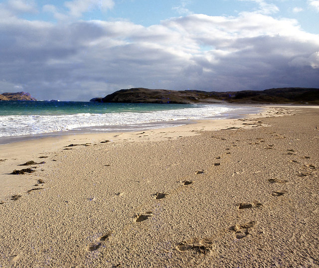
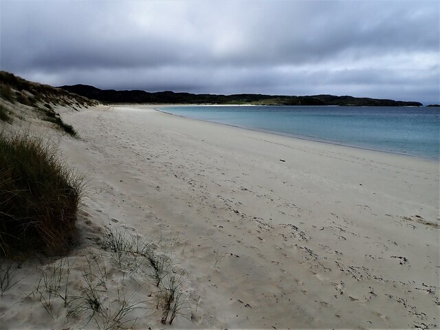
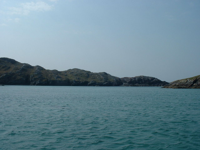
Sgeir Bocaig Images

Images are sourced within 2km of 58.231206/-6.9218397 or Grid Reference NB1137. Thanks to Geograph Open Source API. All images are credited.

Crystal clear seas off North West coast of Na h-Eileanan an Iar View to about 3 metres depth from RIB floating in lagoon between Pabaigh Mor and Pabaigh Beag.  See also <a href="https://www.geograph.org.uk/photo/1120209">NB1038 : Lagoon on Pabbay Mor</a>
Crystal clear seas off North West coast of Na h-Eileanan an Iar
View to about 3 metres depth from RIB floating in lagoon between Pabaigh Mor and Pabaigh Beag. See also NB1038 : Lagoon on Pabbay Mor
Berie Sands Caravan Park Busy site at Traigh na Beirigh with many caravans parked on the machair above the extensive sands.
Berie Sands Caravan Park
Busy site at Traigh na Beirigh with many caravans parked on the machair above the extensive sands.
Tràigh na Beirigh In the 1960's this was a deserted beach.  Now it has to be shared with caravanners.
Tràigh na Beirigh
In the 1960's this was a deserted beach. Now it has to be shared with caravanners.
Tràigh na Beirigh A perfect crescent beach
Tràigh na Beirigh
A perfect crescent beach
A rocky buttress contains Tràigh na Beirigh
Traigh na Berie
Traigh na Berie
Tràigh na Beirigh from the east
Sunrise, Gridig
Sunrise, Gridig
Tràigh Teinish
Tràigh Teinish
Beach at Pabaigh Mor
Geodh'an Tuill penetrates Pabaigh Mor Pabaigh More has a tidally flooded low-lying area in the middle of the island (at one time used for buffering lobsters) which connects to the open sea over a reef to the northwest, and through a couple of rocky channels heading northeast. It's clear that those channels must have started the same way as this cave, which has penetrated right to the lagoon (from which it is separated only by a storm beach thrown up by waves entering the cave) and, on a geological timescale, is just about at the end of its life. Although one of our group walked over the arch, and once we'd paddled round the island several of us entered the cave from the sea, it is not the most confidence-inspiring roof, especially at this landward end.
Geodh'an Tuill penetrates Pabaigh Mor
Pabaigh More has a tidally flooded low-lying area in the middle of the island (at one time used for buffering lobsters) which connects to the open sea over a reef to the northwest, and through a couple of rocky channels heading northeast. It's clear that those channels must have started the same way as this cave, which has penetrated right to the lagoon (from which it is separated only by a storm beach thrown up by waves entering the cave) and, on a geological timescale, is just about at the end of its life. Although one of our group walked over the arch, and once we'd paddled round the island several of us entered the cave from the sea, it is not the most confidence-inspiring roof, especially at this landward end.
Traigh na Berie
Traigh na Berie
Tràigh na Beirigh and Pabaigh Mòr
Tràigh na Beirigh
Tràigh na Beirigh
Traigh na Beirigh beach Lewis Looking out from the beach just in front of the Caravan site towards the headland at Kneep on the left and Pabaigh Mor on the right.
Traigh na Beirigh beach Lewis
Looking out from the beach just in front of the Caravan site towards the headland at Kneep on the left and Pabaigh Mor on the right.
Traigh na Beirigh beach Lewis Looking down the length of the beach towards Kneep.
Traigh na Beirigh beach Lewis
Looking down the length of the beach towards Kneep.
Lagoon between Pabaigh Mor and Pabaigh Beag View to west showing narrows between these two islands off the northwest coast off Na h-Eileanan an Iar (Outer Hebrides).
Lagoon between Pabaigh Mor and Pabaigh Beag
View to west showing narrows between these two islands off the northwest coast off Na h-Eileanan an Iar (Outer Hebrides).
Show me another place!

Sgeir Bocaig is located at Grid Ref: NB1137 (Lat: 58.231206, Lng: -6.9218397)

Unitary Authority: Na h-Eileanan an Iar

Police Authority: Highlands and Islands

What 3 Words

///deeper.unguarded.eyeful. Near Carloway, Na h-Eileanan Siar

Related Wikis

Vacsay

Vacsay (Scottish Gaelic: Bhacsaigh from Old Norse "bakkiey" meaning "peat bank island") is one of the Outer Hebrides. It is off the west coast of Lewis...

Pabaigh Mòr

Pabay Mòr or Pabaigh Mòr is an uninhabited island in the Outer Hebrides of Scotland. == History == The island's name comes from papey, an Old Norse name...

Kneep

Kneep (Scottish Gaelic: Cnìp) is a village on the Isle of Lewis, in the Outer Hebrides, Scotland. Kneep is within the parish of Uig.Various archaeological...

Loch na Berie

Loch Na Berie is a broch in the Outer Hebrides of Scotland, located approximately 400 yards from the shore, and is thought to have been located on an island...

Have you been to Sgeir Bocaig?

Leave your review of Sgeir Bocaig below (or comments, questions and feedback).