Cnoc na Cloiche

Hill, Mountain in Ross-shire

Scotland

Cnoc na Cloiche

Craft workshop in Kirkibost One of the old shellfish processing factories at Kirkibost (Circeabost) is now reborn as a craftshop.
Craft workshop in Kirkibost Credit: Gus Macdonald

Cnoc na Cloiche, located in Ross-shire, Scotland, is a prominent hill/mountain that stands at an elevation of approximately 464 meters (1,522 feet). It is situated near the town of Garve, in the picturesque region of the Scottish Highlands.

The name "Cnoc na Cloiche" translates to "Hill of the Stone" in the Gaelic language, which is aptly named due to the rocky terrain and large boulders scattered across its slopes. The hill/mountain is known for its rugged and wild beauty, with a mixture of grassy slopes, heather moorland, and scattered trees.

Cnoc na Cloiche offers breathtaking panoramic views of the surrounding landscape, including the nearby Loch Garve and the stunning mountains of the Scottish Highlands. On a clear day, visitors can enjoy vistas of rolling hills, deep valleys, and distant peaks. The hill/mountain is a popular destination for hikers and outdoor enthusiasts, providing a challenging yet rewarding ascent.

The route up Cnoc na Cloiche can be accessed from various points, with trails and footpaths leading to the summit. The hike offers a chance to witness the diverse flora and fauna of the region, including heather, gorse, and various bird species. It is advisable to bring appropriate hiking gear and be prepared for changing weather conditions, as the Scottish Highlands are known for their unpredictable climate.

Cnoc na Cloiche is a true gem of Ross-shire, offering visitors a chance to immerse themselves in the natural beauty and tranquility of the Scottish Highlands. Whether you are an avid hiker or simply looking for a place to enjoy stunning views, Cnoc na Cloiche is a must-visit destination.

If you have any feedback on the listing, please let us know in the comments section below.

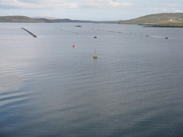
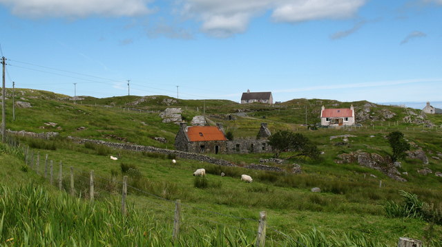
Cnoc na Cloiche Images

Images are sourced within 2km of 58.210832/-6.7934275 or Grid Reference NB1834. Thanks to Geograph Open Source API. All images are credited.

Craft workshop in Kirkibost One of the old shellfish processing factories at Kirkibost (Circeabost) is now reborn as a craftshop.
Craft workshop in Kirkibost
One of the old shellfish processing factories at Kirkibost (Circeabost) is now reborn as a craftshop.
Cleibh ghiomaich aig cidhe Chirceabost Lobster creels at Kirkibost harbour
Cleibh ghiomaich aig cidhe Chirceabost
Lobster creels at Kirkibost harbour
Telephone Box at Crulabhig Probably it's only the sheep that get calls here?
Telephone Box at Crulabhig
Probably it's only the sheep that get calls here?
View towards Circebost Pier
Crulivig: the telephone box Pictured during heavy rain, this phone box has Hebridean doors, to keep the wind at bay.
Crulivig: the telephone box
Pictured during heavy rain, this phone box has Hebridean doors, to keep the wind at bay.
Crulivig: postbox № HS2 91 This postbox stands on the opposite side of the road to <a href="https://www.geograph.org.uk/photo/3286743">NB1733 : Crulivig: the telephone box</a>. It is emptied each morning except Sunday at a quarter to nine.
Crulivig: postbox № HS2 91
This postbox stands on the opposite side of the road to NB1733 : Crulivig: the telephone box. It is emptied each morning except Sunday at a quarter to nine.
Mussel farm at Iarsiadar To the east of the Bernara Bridge between Great Bernera/Beàrnaraigh and the Isle of Lewis.
Mussel farm at Iarsiadar
To the east of the Bernara Bridge between Great Bernera/Beàrnaraigh and the Isle of Lewis.
Low cloud over Great Bernera A thin bank of cloud over the sea. Looking northeast from the B8059 near Lundale.
Low cloud over Great Bernera
A thin bank of cloud over the sea. Looking northeast from the B8059 near Lundale.
Croftland, Circebost, Great Bernera Looking across Loch Ròg an Ear (East Loch Roag) towards Eilean Chearstaigh.
Croftland, Circebost, Great Bernera
Looking across Loch Ròg an Ear (East Loch Roag) towards Eilean Chearstaigh.
Calanais/Callanish XV, Circebost, Great Bernera/Beàrnaraigh From Discovery and Excavation in Scotland, 1976: "On grassy ridge 100m N of road, 25m E of track through Croft 24, Kirkibost. A large prone slab approx. 3.55m x 1.35m, thickness varying from 0.25-0.45m, lying in peat on a grassy ridge. The lower end appears to be surrounded by packing stones and there is a void under the centre of the stone. This stone was brought to our notice by Mr Norman MacDonald of Kirkibost."
Calanais/Callanish XV, Circebost, Great Bernera/Beàrnaraigh
From Discovery and Excavation in Scotland, 1976: "On grassy ridge 100m N of road, 25m E of track through Croft 24, Kirkibost. A large prone slab approx. 3.55m x 1.35m, thickness varying from 0.25-0.45m, lying in peat on a grassy ridge. The lower end appears to be surrounded by packing stones and there is a void under the centre of the stone. This stone was brought to our notice by Mr Norman MacDonald of Kirkibost."
Possible fallen standing stone, Circebost, Great Bernera/Beàrnaraigh This stone lies approximately 80m ESE of <a href="https://www.geograph.org.uk/photo/5293759">NB1734 : Calanais/Callanish XV, Circebost, Great Bernera/Beàrnaraigh</a>.  The croft owner, who is the grandson of Norman MacDonald who originally brought Callanish XV to archaeologists' attention, believes it to be fallen standing stone.
Possible fallen standing stone, Circebost, Great Bernera/Beàrnaraigh
This stone lies approximately 80m ESE of NB1734 : Calanais/Callanish XV, Circebost, Great Bernera/Beàrnaraigh. The croft owner, who is the grandson of Norman MacDonald who originally brought Callanish XV to archaeologists' attention, believes it to be fallen standing stone.
Looking down at Circebost Circebost or Kirkibost is a tiny settlement on Great Bernera. This island is now connected to Lewis by a short pre-stressed concrete bridge. In 1953 when it was built it was and remains the first bridge of such material in Europe.  

The settlemenr is also important as it is the first planned crofting township in the Outer Hebrides, though I think town is a lofty description for such a small group of houses.
Looking down at Circebost
Circebost or Kirkibost is a tiny settlement on Great Bernera. This island is now connected to Lewis by a short pre-stressed concrete bridge. In 1953 when it was built it was and remains the first bridge of such material in Europe. The settlemenr is also important as it is the first planned crofting township in the Outer Hebrides, though I think town is a lofty description for such a small group of houses.
Phonebox on the road to Great Bernera
Ruined cottage on Great Bernera The ruin stands at the side of the minor road close to the north shore of Loch Barraglom.
Ruined cottage on Great Bernera
The ruin stands at the side of the minor road close to the north shore of Loch Barraglom.
End of the road at Tobhtaral Two houses at the end of the road in the SE corner of Great Bernera island.
End of the road at Tobhtaral
Two houses at the end of the road in the SE corner of Great Bernera island.
Am Port Mor A shallow bay on the south east coast of Great Bernera.
Am Port Mor
A shallow bay on the south east coast of Great Bernera.
Church ruin near Circebost. The ruin is presumed to be medieval, and is situated on a point of land on the north side of Am Port Mor.
Church ruin near Circebost.
The ruin is presumed to be medieval, and is situated on a point of land on the north side of Am Port Mor.
Circebost A crofting community in the south east of Great Bernera island.
Circebost
A crofting community in the south east of Great Bernera island.
Show me another place!

Cnoc na Cloiche is located at Grid Ref: NB1834 (Lat: 58.210832, Lng: -6.7934275)

Unitary Authority: Na h-Eileanan an Iar

Police Authority: Highlands and Islands

What 3 Words

///joys.bugs.yell. Near Carloway, Na h-Eileanan Siar

Related Wikis

Ceabhaigh

Ceabhaigh is a small island in an arm of Loch Ròg on the west coast of Lewis in the Outer Hebrides of Scotland. It is about 25 hectares (62 acres) in extent...

Eilean Chearstaidh

Eilean Kearstay (Scottish Gaelic: Eilean Chearstaigh) is an uninhabited island in Loch Roag in the Outer Hebrides of Scotland. It lies south east of Great...

Callanish VIII

The Callanish VIII stone setting is one of many megalithic structures around the better-known (and larger) Calanais I on the west coast of the Isle of...

Callanish

Callanish (Scottish Gaelic: Calanais) is a village (township) on the west side of the Isle of Lewis, in the Outer Hebrides (Western Isles), Scotland. Callanish...

Dun Bharabhat, Great Bernera

Dun Bharabhat (or Dun Baravat) is an Iron Age galleried dun or "semi-broch" situated on the island of Great Bernera near Lewis in Scotland (grid reference...

Callanish Stones

The Callanish Stones (or "Callanish I": Scottish Gaelic: Clachan Chalanais or Tursachan Chalanais) are an arrangement of standing stones placed in a cruciform...

Breasclete

Breasclete (Scottish Gaelic: Brèascleit) is a village and community on the west side of the Isle of Lewis, in the Outer Hebrides, Scotland. Breasclete...

Breaclete

Breacleit (or Roulanish; Scottish Gaelic: Breacleit; Old Norse: Breiðiklettr) is the central village on Great Bernera in the Outer Hebrides, Scotland....

Nearby Amenities

Located within 500m of 58.210832,-6.7934275
Passing Place
Lat/Long: 58.2137916/-6.7925529
Passing Place
Lat/Long: 58.2107217/-6.7921085
Bus Stop
Kirkibost
Bus: yes
Naptan AtcoCode: 6010731556
Naptan Bearing: W
Naptan BusStopType: CUS
Naptan CommonName: Kirkibost
Naptan Indicator: Village
Naptan Landmark: village road junction
Naptan NaptanCode: 94723878
Naptan Street: Village
Naptan Verified: no
Public Transport: platform
Source: naptan_import
Lat/Long: 58.2112633/-6.7898458
Barrier: cattle_grid
Source: OS_OpenData_StreetView
Lat/Long: 58.2103987/-6.8003204
Barrier: cattle_grid
Source: OS_OpenData_StreetView
Lat/Long: 58.2108609/-6.7972505
Passing Place
Lat/Long: 58.2103834/-6.794653
Passing Place
Lat/Long: 58.2096928/-6.7989988
Passing Place
Lat/Long: 58.2108205/-6.7880992
Passing Place
Lat/Long: 58.2078886/-6.7979049
Barrier: cattle_grid
Lat/Long: 58.207615/-6.7978025
Passing Place
Lat/Long: 58.2133121/-6.7924329
Passing Place
Lat/Long: 58.2125751/-6.7897991
Passing Place
Lat/Long: 58.21472/-6.7893777
Passing Place
Lat/Long: 58.2131075/-6.7890361
Passing Place
Lat/Long: 58.2096615/-6.8002847
Passing Place
Lat/Long: 58.2115452/-6.8012426
Circebost
Name En: Kirkibost
Name Gd: Circebost
Place: village
Lat/Long: 58.2125377/-6.7901299
Post Box
Collection Times: Mo-Fr 08:30; Sa 08:30
Operator: Royal Mail
Post Box Type: lamp
Ref: HS2 92
Royal Cypher: scottish_crown
Source: survey
Lat/Long: 58.2106562/-6.7995856
Post Box
Collection Times: Mo-Fr 08:30; Sa 08:30
Operator: Royal Mail
Post Box Type: lamp
Ref: HS2 87
Royal Cypher: scottish_crown
Source: survey
Lat/Long: 58.211159/-6.7898728
Fotologica
Addr City: Eilean Leòdhais
Addr City En: Isle of Lewis
Addr Country: GB
Addr Housenumber: 10
Addr Postcode: HS2 9LX
Addr Street: Circebost
Craft: photographer
Phone: +44 1851 612436
Website: https://fotologica.co.uk/index.html
Lat/Long: 58.2130012/-6.7863856
Bus Stop
Breaclete Junction
Naptan AtcoCode: 60101243
Naptan NaptanCode: 94727942
Lat/Long: 58.2105795/-6.8003174
Bus Stop
Dun Innes, Road End
Naptan AtcoCode: 60101246
Naptan NaptanCode: 94727946
Lat/Long: 58.2106629/-6.7995208
Power: pole
Lat/Long: 58.2112057/-6.7888052
Power: pole
Lat/Long: 58.2115683/-6.7882495
Power: pole
Lat/Long: 58.2120159/-6.7876969
Power: pole
Lat/Long: 58.2124507/-6.7871421
Power: pole
Lat/Long: 58.2128801/-6.7866054
Power: pole
Lat/Long: 58.2109881/-6.7898962
Power: pole
Lat/Long: 58.2106726/-6.7910773
Power: pole
Lat/Long: 58.2103246/-6.7924933
Power: pole
Lat/Long: 58.2100666/-6.793439
Power: pole
Lat/Long: 58.2099524/-6.7943147
Power: pole
Lat/Long: 58.2097776/-6.7955877
Power: pole
Lat/Long: 58.2096766/-6.7963619
Power: pole
Lat/Long: 58.2095553/-6.7972421
Power: pole
Lat/Long: 58.2093972/-6.7983955
Power: pole
Lat/Long: 58.2092128/-6.7997294
Power: pole
Lat/Long: 58.2091082/-6.8004788
Power: pole
Lat/Long: 58.2066822/-6.7967143
Power: pole
Lat/Long: 58.2074072/-6.7966576
Power: pole
Lat/Long: 58.2078424/-6.7965921
Power: pole
Lat/Long: 58.2084191/-6.7965402
Power: pole
Lat/Long: 58.2091516/-6.7964431
Power: pole
Lat/Long: 58.207796/-6.7883422
Power: pole
Lat/Long: 58.2083981/-6.7890094
Power: pole
Lat/Long: 58.2091336/-6.7898126
Power: pole
Lat/Long: 58.2094469/-6.7901623
Power: pole
Lat/Long: 58.2098937/-6.7906295
Power: pole
Lat/Long: 58.210384/-6.7908957
Power: pole
Lat/Long: 58.2107289/-6.7877568
Power: pole
Lat/Long: 58.2109786/-6.7882985
Power: pole
Lat/Long: 58.2111795/-6.7901774
Power: pole
Lat/Long: 58.2119643/-6.7915284
Power: pole
Lat/Long: 58.212598/-6.7914121
Power: pole
Lat/Long: 58.2129029/-6.7913565
Power: pole
Lat/Long: 58.2131769/-6.7912753
Power: pole
Lat/Long: 58.2138252/-6.7909937
Power: pole
Lat/Long: 58.2143514/-6.7908218
Power: pole
Lat/Long: 58.214654/-6.7906823
Power: pole
Lat/Long: 58.214746/-6.7914146
Barrier: cattle_grid
Lat/Long: 58.2095902/-6.8004727
Crossing
Lat/Long: 58.2069896/-6.7976183
Crossing
Lat/Long: 58.2071081/-6.7976155
Crossing
Lat/Long: 58.2074338/-6.7976487
The data included in this document is from www.openstreetmap.org. The data is made available under ODbL.

Have you been to Cnoc na Cloiche?

Leave your review of Cnoc na Cloiche below (or comments, questions and feedback).