Loch Mharcoil

Lake, Pool, Pond, Freshwater Marsh in Ross-shire

Scotland

Loch Mharcoil

Craft workshop in Kirkibost One of the old shellfish processing factories at Kirkibost (Circeabost) is now reborn as a craftshop.
Craft workshop in Kirkibost Credit: Gus Macdonald

Loch Mharcoil is a picturesque freshwater lake located in Ross-shire, Scotland. With its serene beauty and tranquil surroundings, it serves as a popular destination for both locals and tourists seeking a peaceful escape.

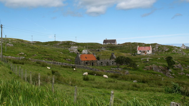
Covering an area of approximately 50 acres, Loch Mharcoil boasts crystal-clear waters, reflecting the stunning landscape that surrounds it. The lake is nestled amidst rolling hills, dense forests, and verdant meadows, creating a harmonious blend of natural elements.

The shoreline of Loch Mharcoil is dotted with a variety of plant species, including reeds, rushes, and water lilies, which provide a vibrant burst of color to the landscape. These aquatic plants also serve as habitats for a diverse range of wildlife, making the lake a haven for nature enthusiasts and birdwatchers. Visitors may catch glimpses of waterfowl such as swans, ducks, and geese, as well as smaller bird species that thrive in the marshy areas surrounding the lake.

Fishing enthusiasts are drawn to Loch Mharcoil for its abundant stocks of trout and pike. The lake's clear waters are ideal for angling, offering an enjoyable and rewarding experience for those looking to cast their lines.

For those seeking a leisurely stroll or picnic, Loch Mharcoil provides several walking trails and designated picnic areas. These allow visitors to fully immerse themselves in the breathtaking scenery while enjoying the tranquility of the surroundings.

Overall, Loch Mharcoil is a hidden gem in Ross-shire, offering a perfect blend of natural beauty and recreational opportunities. Whether one seeks solitude, wildlife encounters, or outdoor activities, this freshwater lake is sure to captivate and inspire all who visit.

If you have any feedback on the listing, please let us know in the comments section below.

Loch Mharcoil Images

Images are sourced within 2km of 58.208084/-6.7906535 or Grid Reference NB1834. Thanks to Geograph Open Source API. All images are credited.

Craft workshop in Kirkibost One of the old shellfish processing factories at Kirkibost (Circeabost) is now reborn as a craftshop.
Craft workshop in Kirkibost
One of the old shellfish processing factories at Kirkibost (Circeabost) is now reborn as a craftshop.
Cleibh ghiomaich aig cidhe Chirceabost Lobster creels at Kirkibost harbour
Cleibh ghiomaich aig cidhe Chirceabost
Lobster creels at Kirkibost harbour
Telephone Box at Crulabhig Probably it's only the sheep that get calls here?
Telephone Box at Crulabhig
Probably it's only the sheep that get calls here?
View towards Circebost Pier
Crulivig: the telephone box Pictured during heavy rain, this phone box has Hebridean doors, to keep the wind at bay.
Crulivig: the telephone box
Pictured during heavy rain, this phone box has Hebridean doors, to keep the wind at bay.
Crulivig: postbox № HS2 91 This postbox stands on the opposite side of the road to <a href="https://www.geograph.org.uk/photo/3286743">NB1733 : Crulivig: the telephone box</a>. It is emptied each morning except Sunday at a quarter to nine.
Crulivig: postbox № HS2 91
This postbox stands on the opposite side of the road to NB1733 : Crulivig: the telephone box. It is emptied each morning except Sunday at a quarter to nine.
Low cloud over Great Bernera A thin bank of cloud over the sea. Looking northeast from the B8059 near Lundale.
Low cloud over Great Bernera
A thin bank of cloud over the sea. Looking northeast from the B8059 near Lundale.
Rough pasture near Lundale Looking east towards Callanish, across Loch Ròg.
Rough pasture near Lundale
Looking east towards Callanish, across Loch Ròg.
Croftland, Circebost, Great Bernera Looking across Loch Ròg an Ear (East Loch Roag) towards Eilean Chearstaigh.
Croftland, Circebost, Great Bernera
Looking across Loch Ròg an Ear (East Loch Roag) towards Eilean Chearstaigh.
Calanais/Callanish XV, Circebost, Great Bernera/Beàrnaraigh From Discovery and Excavation in Scotland, 1976: "On grassy ridge 100m N of road, 25m E of track through Croft 24, Kirkibost. A large prone slab approx. 3.55m x 1.35m, thickness varying from 0.25-0.45m, lying in peat on a grassy ridge. The lower end appears to be surrounded by packing stones and there is a void under the centre of the stone. This stone was brought to our notice by Mr Norman MacDonald of Kirkibost."
Calanais/Callanish XV, Circebost, Great Bernera/Beàrnaraigh
From Discovery and Excavation in Scotland, 1976: "On grassy ridge 100m N of road, 25m E of track through Croft 24, Kirkibost. A large prone slab approx. 3.55m x 1.35m, thickness varying from 0.25-0.45m, lying in peat on a grassy ridge. The lower end appears to be surrounded by packing stones and there is a void under the centre of the stone. This stone was brought to our notice by Mr Norman MacDonald of Kirkibost."
Possible fallen standing stone, Circebost, Great Bernera/Beàrnaraigh This stone lies approximately 80m ESE of <a href="https://www.geograph.org.uk/photo/5293759">NB1734 : Calanais/Callanish XV, Circebost, Great Bernera/Beàrnaraigh</a>.  The croft owner, who is the grandson of Norman MacDonald who originally brought Callanish XV to archaeologists' attention, believes it to be fallen standing stone.
Possible fallen standing stone, Circebost, Great Bernera/Beàrnaraigh
This stone lies approximately 80m ESE of NB1734 : Calanais/Callanish XV, Circebost, Great Bernera/Beàrnaraigh. The croft owner, who is the grandson of Norman MacDonald who originally brought Callanish XV to archaeologists' attention, believes it to be fallen standing stone.
Looking down at Circebost Circebost or Kirkibost is a tiny settlement on Great Bernera. This island is now connected to Lewis by a short pre-stressed concrete bridge. In 1953 when it was built it was and remains the first bridge of such material in Europe.  

The settlemenr is also important as it is the first planned crofting township in the Outer Hebrides, though I think town is a lofty description for such a small group of houses.
Looking down at Circebost
Circebost or Kirkibost is a tiny settlement on Great Bernera. This island is now connected to Lewis by a short pre-stressed concrete bridge. In 1953 when it was built it was and remains the first bridge of such material in Europe. The settlemenr is also important as it is the first planned crofting township in the Outer Hebrides, though I think town is a lofty description for such a small group of houses.
Phonebox on the road to Great Bernera
Ruined cottage on Great Bernera The ruin stands at the side of the minor road close to the north shore of Loch Barraglom.
Ruined cottage on Great Bernera
The ruin stands at the side of the minor road close to the north shore of Loch Barraglom.
End of the road at Tobhtaral Two houses at the end of the road in the SE corner of Great Bernera island.
End of the road at Tobhtaral
Two houses at the end of the road in the SE corner of Great Bernera island.
Am Port Mor A shallow bay on the south east coast of Great Bernera.
Am Port Mor
A shallow bay on the south east coast of Great Bernera.
Church ruin near Circebost. The ruin is presumed to be medieval, and is situated on a point of land on the north side of Am Port Mor.
Church ruin near Circebost.
The ruin is presumed to be medieval, and is situated on a point of land on the north side of Am Port Mor.
Circebost A crofting community in the south east of Great Bernera island.
Circebost
A crofting community in the south east of Great Bernera island.
Show me another place!

Loch Mharcoil is located at Grid Ref: NB1834 (Lat: 58.208084, Lng: -6.7906535)

Unitary Authority: Na h-Eileanan an Iar

Police Authority: Highlands and Islands

What 3 Words

///relatives.scooped.tribal. Near Carloway, Na h-Eileanan Siar

Related Wikis

Ceabhaigh

Ceabhaigh is a small island in an arm of Loch Ròg on the west coast of Lewis in the Outer Hebrides of Scotland. It is about 25 hectares (62 acres) in extent...

Eilean Chearstaidh

Eilean Kearstay (Scottish Gaelic: Eilean Chearstaigh) is an uninhabited island in Loch Roag in the Outer Hebrides of Scotland. It lies south east of Great...

Callanish VIII

The Callanish VIII stone setting is one of many megalithic structures around the better-known (and larger) Calanais I on the west coast of the Isle of...

Callanish

Callanish (Scottish Gaelic: Calanais) is a village (township) on the west side of the Isle of Lewis, in the Outer Hebrides (Western Isles), Scotland. Callanish...

Callanish Stones

The Callanish Stones (or "Callanish I": Scottish Gaelic: Clachan Chalanais or Tursachan Chalanais) are an arrangement of standing stones placed in a cruciform...

Breasclete

Breasclete (Scottish Gaelic: Brèascleit) is a village and community on the west side of the Isle of Lewis, in the Outer Hebrides, Scotland. Breasclete...

Dun Bharabhat, Great Bernera

Dun Bharabhat (or Dun Baravat) is an Iron Age galleried dun or "semi-broch" situated on the island of Great Bernera near Lewis in Scotland (grid reference...

Breaclete

Breacleit (or Roulanish; Scottish Gaelic: Breacleit; Old Norse: Breiðiklettr) is the central village on Great Bernera in the Outer Hebrides, Scotland....

Nearby Amenities

Located within 500m of 58.208084,-6.7906535
Passing Place
Lat/Long: 58.2107217/-6.7921085
Bus Stop
Kirkibost
Bus: yes
Naptan AtcoCode: 6010731556
Naptan Bearing: W
Naptan BusStopType: CUS
Naptan CommonName: Kirkibost
Naptan Indicator: Village
Naptan Landmark: village road junction
Naptan NaptanCode: 94723878
Naptan Street: Village
Naptan Verified: no
Public Transport: platform
Source: naptan_import
Lat/Long: 58.2112633/-6.7898458
Barrier: cattle_grid
Source: OS_OpenData_StreetView
Lat/Long: 58.2108609/-6.7972505
Passing Place
Lat/Long: 58.2103834/-6.794653
Passing Place
Lat/Long: 58.2108205/-6.7880992
Passing Place
Lat/Long: 58.2078886/-6.7979049
Barrier: cattle_grid
Lat/Long: 58.207615/-6.7978025
Barrier: cattle_grid
Source: Bing
Lat/Long: 58.2074391/-6.7873601
Barrier: cattle_grid
Source: Bing
Lat/Long: 58.207499/-6.7871423
Circebost
Name En: Kirkibost
Name Gd: Circebost
Place: village
Lat/Long: 58.2125377/-6.7901299
Post Box
Collection Times: Mo-Fr 08:30; Sa 08:30
Operator: Royal Mail
Post Box Type: lamp
Ref: HS2 87
Royal Cypher: scottish_crown
Source: survey
Lat/Long: 58.211159/-6.7898728
Tobhtaral
Place: hamlet
Lat/Long: 58.2050209/-6.7845949
Power: pole
Lat/Long: 58.2112057/-6.7888052
Power: pole
Lat/Long: 58.2115683/-6.7882495
Power: pole
Lat/Long: 58.2120159/-6.7876969
Power: pole
Lat/Long: 58.2109881/-6.7898962
Power: pole
Lat/Long: 58.2106726/-6.7910773
Power: pole
Lat/Long: 58.2103246/-6.7924933
Power: pole
Lat/Long: 58.2100666/-6.793439
Power: pole
Lat/Long: 58.2099524/-6.7943147
Power: pole
Lat/Long: 58.2097776/-6.7955877
Power: pole
Lat/Long: 58.2096766/-6.7963619
Power: pole
Lat/Long: 58.2095553/-6.7972421
Power: pole
Lat/Long: 58.2093972/-6.7983955
Power: pole
Lat/Long: 58.2060078/-6.7967941
Power: pole
Lat/Long: 58.2066822/-6.7967143
Power: pole
Lat/Long: 58.2074072/-6.7966576
Power: pole
Lat/Long: 58.2078424/-6.7965921
Power: pole
Lat/Long: 58.2084191/-6.7965402
Power: pole
Lat/Long: 58.2091516/-6.7964431
Power: pole
Lat/Long: 58.2049266/-6.7854083
Power: pole
Lat/Long: 58.2054267/-6.7856318
Power: pole
Lat/Long: 58.205982/-6.7858518
Power: pole
Lat/Long: 58.2063055/-6.7859681
Power: pole
Lat/Long: 58.2065296/-6.7869533
Power: pole
Lat/Long: 58.2058203/-6.7861836
Power: pole
Lat/Long: 58.2072752/-6.7877613
Power: pole
Lat/Long: 58.207796/-6.7883422
Power: pole
Lat/Long: 58.2083981/-6.7890094
Power: pole
Lat/Long: 58.2091336/-6.7898126
Power: pole
Lat/Long: 58.2094469/-6.7901623
Power: pole
Lat/Long: 58.2098937/-6.7906295
Power: pole
Lat/Long: 58.210384/-6.7908957
Power: pole
Lat/Long: 58.2107289/-6.7877568
Power: pole
Lat/Long: 58.2109786/-6.7882985
Power: pole
Lat/Long: 58.2111795/-6.7901774
Power: pole
Lat/Long: 58.2119643/-6.7915284
Crossing
Lat/Long: 58.2069896/-6.7976183
Crossing
Lat/Long: 58.2071081/-6.7976155
Crossing
Lat/Long: 58.2074338/-6.7976487
Am Port Mor
Natural: bay
Lat/Long: 58.2084404/-6.7854228
The data included in this document is from www.openstreetmap.org. The data is made available under ODbL.

Have you been to Loch Mharcoil?

Leave your review of Loch Mharcoil below (or comments, questions and feedback).