The Hoe

Hill, Mountain in Inverness-shire

Scotland

The Hoe

How very odd! This is a primrose,flowering in the wild in early October. Things have really gone to pot!
How very odd! Credit: Carol Walker

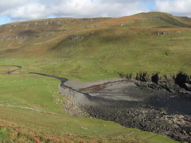
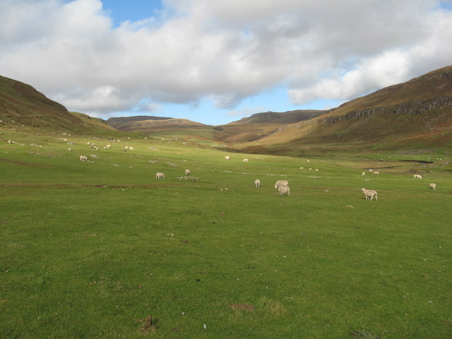
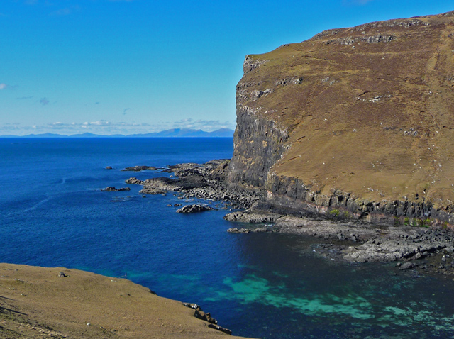
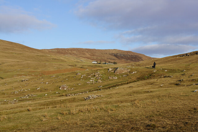
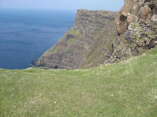
The Hoe, located in Inverness-shire, Scotland, is a prominent hill/mountain that offers stunning panoramic views of the surrounding landscape. Rising to a height of approximately 250 meters (820 feet), it is a popular destination for hikers and nature enthusiasts alike.

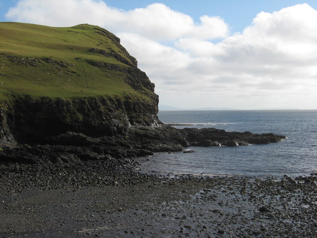
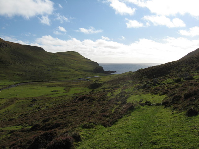
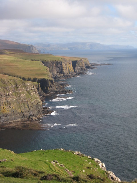
Situated on the eastern edge of Loch Ness, The Hoe stands as a distinctive landmark in the region. Its position provides visitors with breathtaking vistas of the loch, as well as the rolling hills and lush greenery of the Scottish Highlands. On clear days, one can even catch a glimpse of the distant Ben Wyvis mountain range.

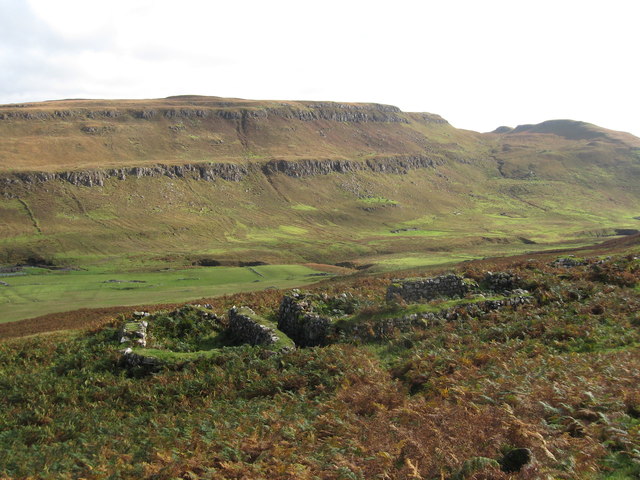
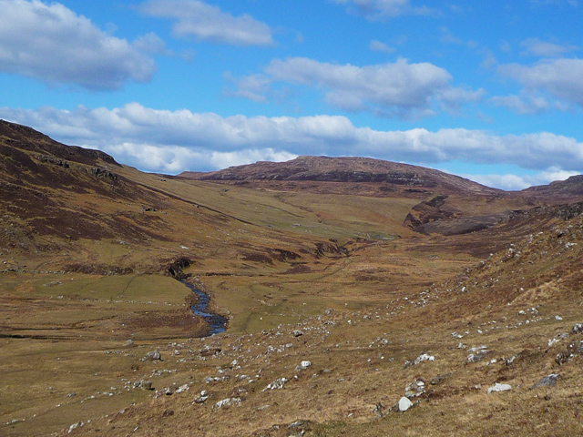
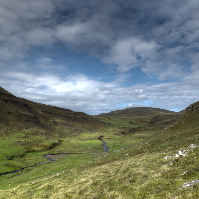
The ascent to The Hoe can be challenging, with steep and rugged terrain that demands a moderate level of fitness. However, the effort is rewarded with unparalleled views from the summit. As hikers make their way up, they are often accompanied by the sounds of native bird species, adding to the overall serenity and natural beauty of the area.

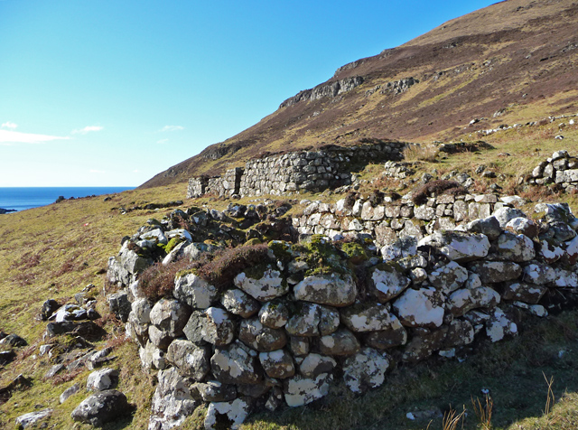
The hill/mountain is also known for its historical significance. It is believed to have played a role in ancient battles and was possibly utilized as a lookout point by clansmen. Today, remnants of its historical past can still be found, including remnants of old forts and defensive structures.

With its striking beauty, rich history, and captivating views, The Hoe in Inverness-shire offers a memorable experience for those seeking to immerse themselves in the natural wonders of the Scottish Highlands.

If you have any feedback on the listing, please let us know in the comments section below.

The Hoe Images

Images are sourced within 2km of 57.378853/-6.7195535 or Grid Reference NG1641. Thanks to Geograph Open Source API. All images are credited.

How very odd! This is a primrose,flowering in the wild in early October. Things have really gone to pot!
How very odd!
This is a primrose,flowering in the wild in early October. Things have really gone to pot!
River Lorgill entering Lorgill Bay At this point I am perched on a tiny path, suffering from vertigo, but what a great view.
River Lorgill entering Lorgill Bay
At this point I am perched on a tiny path, suffering from vertigo, but what a great view.
Cliffs below Cnoc Fuar
Across Lorgill valley This is a lovely view across the valley with Autumnal colours everywhere.
Across Lorgill valley
This is a lovely view across the valley with Autumnal colours everywhere.
Sheep grazing in Lorgill valley
Heather on valley sides at Lorgill
Along the coast This is looking along the coast in a south-easterly direction from The Hoe. The Maidens are just visible in the far distance.
Along the coast
This is looking along the coast in a south-easterly direction from The Hoe. The Maidens are just visible in the far distance.
Ruins in Lorgill Two of the houses from which the residents were removed in the clearance of 1830.
Ruins in Lorgill
Two of the houses from which the residents were removed in the clearance of 1830.
View across Lorgill Bay With South Uist on the horizon.
View across Lorgill Bay
With South Uist on the horizon.
Lorgill
Lorgill
The mouth of the Lorgill River The water of the river sinks into the shingle here, making this the easiest crossing point when the river is high.
The object in the foreground is the decomposing, very smelly, body of a minke whale.
The mouth of the Lorgill River
The water of the river sinks into the shingle here, making this the easiest crossing point when the river is high. The object in the foreground is the decomposing, very smelly, body of a minke whale.
Lorgill A similar view to <a href="https://www.geograph.org.uk/photo/3386864">NG1741 : Lorgill</a>, showing the difference in colours between March and August.
Lorgill
A similar view to NG1741 : Lorgill, showing the difference in colours between March and August.
Former farmland, Ramasaig In the 1800s, when Ramasaig was a thriving community with a population of maybe more than a hundred people, the land here would have been cultivated. Today, the homes are all ruins, and a few sheep graze the grass.
Former farmland, Ramasaig
In the 1800s, when Ramasaig was a thriving community with a population of maybe more than a hundred people, the land here would have been cultivated. Today, the homes are all ruins, and a few sheep graze the grass.
Fish Farm Pollution, Isle of Skye One of the largest pieces of litter you would ever expect to find on the coast, this enormous structure comprising plastic pipes was most likely once part of a fish farm.  Broken free, it now lies abandoned on a remote shoreline at Lorgill on the west coast of Skye.
Fish Farm Pollution, Isle of Skye
One of the largest pieces of litter you would ever expect to find on the coast, this enormous structure comprising plastic pipes was most likely once part of a fish farm. Broken free, it now lies abandoned on a remote shoreline at Lorgill on the west coast of Skye.
Hoe Rape Not so high as the cliff to the north and south of it, but still pretty impressive. Impossible to photograph sensibly "in square".
Hoe Rape
Not so high as the cliff to the north and south of it, but still pretty impressive. Impossible to photograph sensibly "in square".
Gob na Hoe Looking south along the cliff edge.
Gob na Hoe
Looking south along the cliff edge.
Ramasaig Bay The area in the foreground was once cultivated by the villagers of Ramasaig - before the Clearances. That, and the rocky shore beyond, are in the square.
Ramasaig Bay
The area in the foreground was once cultivated by the villagers of Ramasaig - before the Clearances. That, and the rocky shore beyond, are in the square.
Cliff at The Hoe Just below the summit of The Hoe (231m) are these sea cliffs.
Cliff at The Hoe
Just below the summit of The Hoe (231m) are these sea cliffs.
Show me another place!

The Hoe is located at Grid Ref: NG1641 (Lat: 57.378853, Lng: -6.7195535)

Unitary Authority: Highland

Police Authority: Highlands and Islands

What 3 Words

///flap.alienated.decent. Near Glendale, Highland

Nearby Locations

The Hoe

Related Wikis

Ramasaig

Ramasaig is a small township on the western shore of the Duirinish peninsula, on Dunvegan, Isle of Skye and is in the Scottish Highlands and is in the...
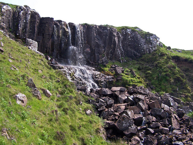
Eas Mòr, Durinish

Eas Mòr is a waterfall on the Duirinish peninsula of the island of Skye in Scotland. It lies on the Allt Mhicheil, a tributary of the Dibidal River below...

Borrodale

Borrodale (Scottish Gaelic: Borodail) is small hamlet on the Isle of Skye, in the Inner Hebrides of Scotland. Borrodale is part of Glendale and the Glendale...

Healabhal Bheag

Healabhal Bheag is a hill located on the Duirinish peninsula of the Isle of Skye in the Inner Hebrides, Scotland. It is also known as MacLeod's Table South...

Nearby Amenities

Located within 500m of 57.378853,-6.7195535
The Hoe
Ele: 231
Natural: peak
Lat/Long: 57.3785899/-6.7195503
The data included in this document is from www.openstreetmap.org. The data is made available under ODbL.

Have you been to The Hoe?

Leave your review of The Hoe below (or comments, questions and feedback).