Hock Cliff

Cliff, Slope in Gloucestershire Stroud

England

Hock Cliff

Shed on the bank of the River Severn at Awre Photographed on a wet and windy November. Much relieved by an excellent pub at the end of the walk.
Shed on the bank of the River Severn at Awre Credit: Jerry Fryman

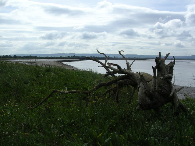
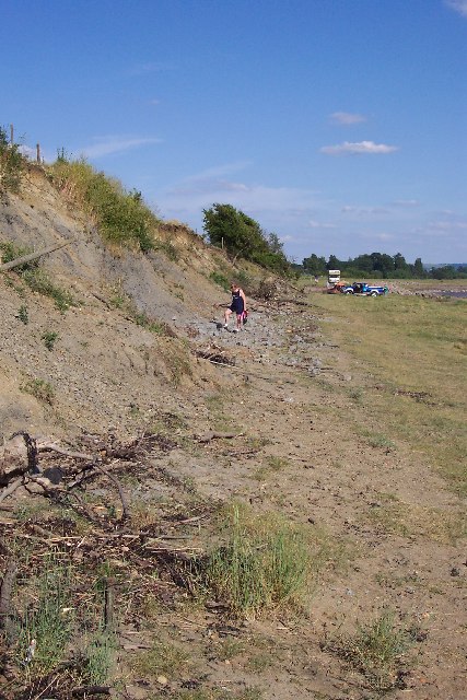
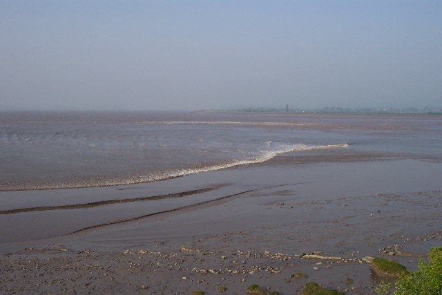
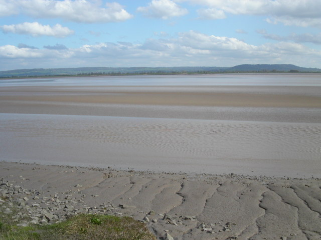
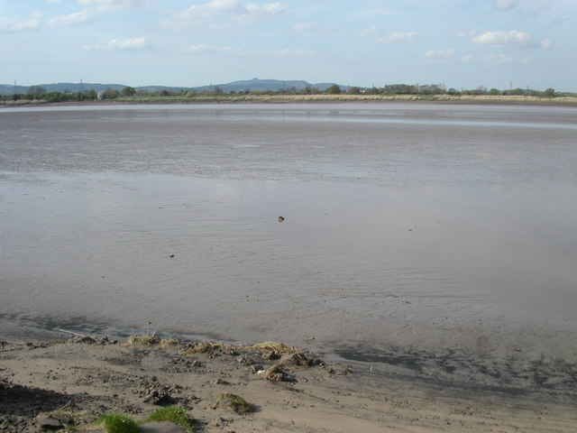
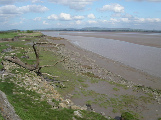
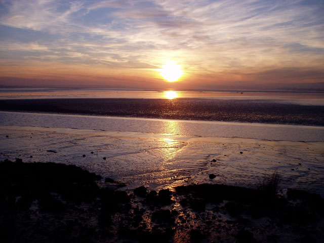
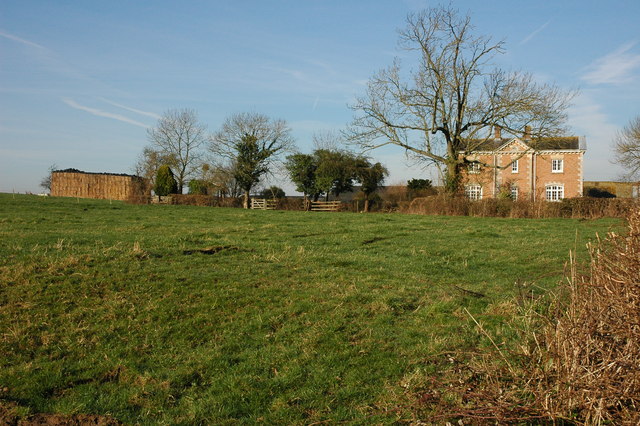
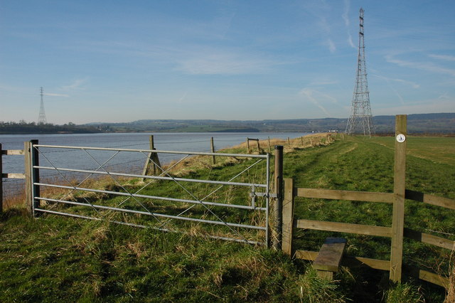
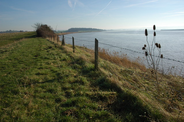
Hock Cliff is a prominent geological feature located in Gloucestershire, England. It is situated on the western side of the River Severn, approximately 5 miles north of the town of Lydney. This cliff is part of the larger Hock Cliff Nature Reserve, which covers an area of approximately 34 hectares.

The cliff itself is composed of layers of sedimentary rock, primarily limestone and sandstone, dating back to the Carboniferous period, around 310 million years ago. These layers provide valuable insights into the geological history of the region.

Rising to a height of around 60 meters, Hock Cliff offers stunning panoramic views of the surrounding landscape, including the River Severn and the Forest of Dean. It is a popular destination for hikers, nature enthusiasts, and photographers, who are drawn by its natural beauty and unique rock formations.

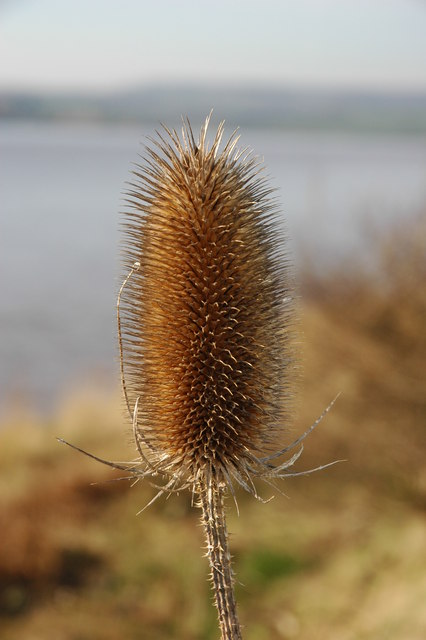
The cliff is also home to a diverse range of flora and fauna. The grassy slopes provide habitat for a variety of plant species, including wildflowers, mosses, and ferns. The reserve is also known for its birdlife, with species such as peregrine falcons, kestrels, and buzzards frequently spotted in the area.

Visitors to Hock Cliff are advised to exercise caution when exploring the site, as the terrain can be uneven and slippery. It is also important to respect the natural environment and adhere to any signage or guidelines provided by the nature reserve.

If you have any feedback on the listing, please let us know in the comments section below.
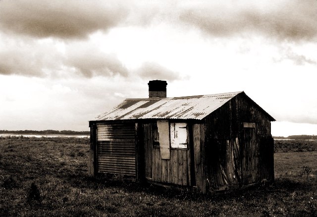
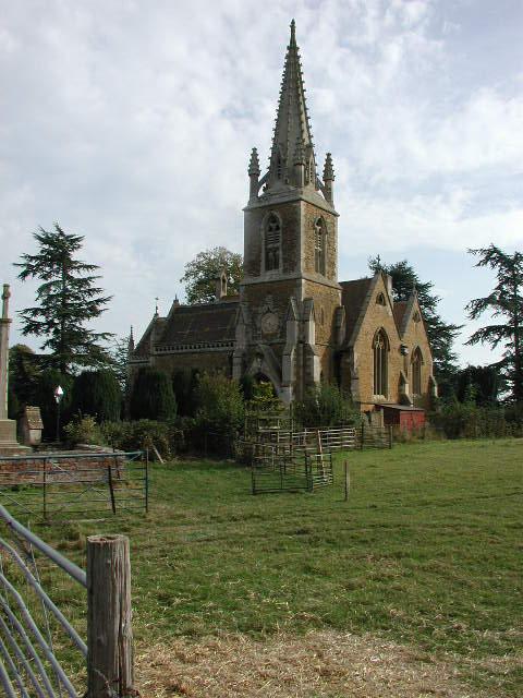
Hock Cliff Images

Images are sourced within 2km of 51.779629/-2.3955809 or Grid Reference SO7209. Thanks to Geograph Open Source API. All images are credited.

Shed on the bank of the River Severn at Awre Photographed on a wet and windy November. Much relieved by an excellent pub at the end of the walk.
Shed on the bank of the River Severn at Awre
Photographed on a wet and windy November. Much relieved by an excellent pub at the end of the walk.
Fretherne (Glos) St Mary's Church
Severn Estuary shoreline including Saul Warth Area prone to flooding around Saul Warth, may become managed realignment scheme.
Severn Estuary shoreline including Saul Warth
Area prone to flooding around Saul Warth, may become managed realignment scheme.
Hock Cliff Hock Cliff is stuffed with lower lias fossils like the devil's toenail (Gryphaea Oyster) and ammonites just waiting to be collected from the rubble at the base of the cliff. However they are grey and crumbly and so don't make great specimens. We found an Ichthysaurus vertebra this particular day. There are some hovercraft waiting to go skimming across the mudflats in the distance.
Hock Cliff
Hock Cliff is stuffed with lower lias fossils like the devil's toenail (Gryphaea Oyster) and ammonites just waiting to be collected from the rubble at the base of the cliff. However they are grey and crumbly and so don't make great specimens. We found an Ichthysaurus vertebra this particular day. There are some hovercraft waiting to go skimming across the mudflats in the distance.
Severn Bore This is the early stage of the Severn Bore where it is a broad whooshing wave travelling up the river that quickly covers the low tide mud and sand. Two fronts can be seen and these are travelling either side of a mudflat called "The Noose". This particular bore was early in the morning on Good Friday.
Severn Bore
This is the early stage of the Severn Bore where it is a broad whooshing wave travelling up the river that quickly covers the low tide mud and sand. Two fronts can be seen and these are travelling either side of a mudflat called "The Noose". This particular bore was early in the morning on Good Friday.
The Noose The section of the river Severn that is known as the Noose sits entirely in the grid square SO7207. The tide is on its way out leaving massive sand banks. The distance to the opposite bank is 2Km. The church at Frampton on Severn is just left of centre.
The Noose
The section of the river Severn that is known as the Noose sits entirely in the grid square SO7207. The tide is on its way out leaving massive sand banks. The distance to the opposite bank is 2Km. The church at Frampton on Severn is just left of centre.
River Severn The river Severn has nearly completed its journey around the large horseshoe bend by Newnham. From here it starts to open up into the Noose. A large tidal area of mud and sand. The tide is on its way out uncovering the dangerous sand banks. On the horizon is May hill.
River Severn
The river Severn has nearly completed its journey around the large horseshoe bend by Newnham. From here it starts to open up into the Noose. A large tidal area of mud and sand. The tide is on its way out uncovering the dangerous sand banks. On the horizon is May hill.
Bank of the river Severn Close to Awre this quiet section of the river Severn is a good area for wildlife spotting. The tide is on its way out revealing the massive sand banks. Large pieces of driftwood are deposited along the bank by the high tide.
Bank of the river Severn
Close to Awre this quiet section of the river Severn is a good area for wildlife spotting. The tide is on its way out revealing the massive sand banks. Large pieces of driftwood are deposited along the bank by the high tide.
Sunset over the Severn estuary The main channel of the River Severn is just beyond the bank of mud in the foreground. The extensive area of sandbanks known as The Noose is beyond.
Sunset over the Severn estuary
The main channel of the River Severn is just beyond the bank of mud in the foreground. The extensive area of sandbanks known as The Noose is beyond.
The Gloucester and Sharpness Canal, Frampton-on-Severn View south down the Gloucester and Sharpness Canal from Fretherne Bridge at Frampton-on-Severn.
The Gloucester and Sharpness Canal, Frampton-on-Severn
View south down the Gloucester and Sharpness Canal from Fretherne Bridge at Frampton-on-Severn.
Fretherne Church Fretherne church is dedicated to St Mary.
Fretherne Church
Fretherne church is dedicated to St Mary.
Roadside ditch at Fretherne
Overton Farm, Fretherne Attractive red brick farmhouse in Fretherne.
Overton Farm, Fretherne
Attractive red brick farmhouse in Fretherne.
Stile on the Severn Way, near Arlingham With the tide in the River Severn is very wide where it negotiates the large horseshoe opposite Newnham. Due to the river's width taller pylons are used to carry power cables across the river.
Stile on the Severn Way, near Arlingham
With the tide in the River Severn is very wide where it negotiates the large horseshoe opposite Newnham. Due to the river's width taller pylons are used to carry power cables across the river.
The River Severn near Arlingham View downstream from the bank of the River Severn to the south of Arlingham. The Cotswolds can be seen on the horizon.
The River Severn near Arlingham
View downstream from the bank of the River Severn to the south of Arlingham. The Cotswolds can be seen on the horizon.
Teasel on the banks of the River Severn Teasel on the banks of the River Severn near Arlingham.
Teasel on the banks of the River Severn
Teasel on the banks of the River Severn near Arlingham.
St Mary's church, Fretherne This building was constructed in the 1840's, replacing two earlier churches on the site. It is faced with Stinchcombe sandstone with Bath stone dressings.
St Mary's church, Fretherne
This building was constructed in the 1840's, replacing two earlier churches on the site. It is faced with Stinchcombe sandstone with Bath stone dressings.
St. Mary's church interior A very dark church indeed as all the ornate windows are at the extensions and porches to either side.
St. Mary's church interior
A very dark church indeed as all the ornate windows are at the extensions and porches to either side.
Show me another place!

Hock Cliff is located at Grid Ref: SO7209 (Lat: 51.779629, Lng: -2.3955809)

Administrative County: Gloucestershire

District: Stroud

Police Authority: Gloucestershire

What 3 Words

///cavalier.river.upstarts. Near Frampton on Severn, Gloucestershire

Related Wikis

Fretherne

Fretherne is a small village and former civil parish, now in the parish of Fretherne with Saul, in the Stroud district, in Gloucestershire, England, situated...

Fretherne Court

Fretherne Court was a residential sporting mansion with picturesque grounds and deer park estate of some 676 acres, situated in the Severn Vale between...

Overton, Gloucestershire

Overton is a hamlet in the civil parish of Arlingham, in the Stroud district, in the county of Gloucestershire, England. The name, first recorded in 1584...

Wick Court, Arlingham

Wick Court is a country house in the parish of Arlingham, Gloucestershire, England, 0.5 mile east of the hamlet of Overton. It was constructed between...

Related Videos

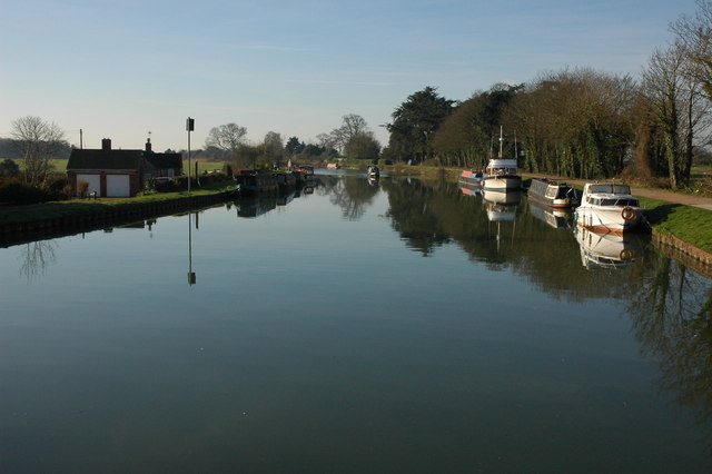
Walking a Cotswold Canal | The Stroudwater Navigation

Join us on a relaxing walk along the Stroudwater Canal here in the Cotswolds. After extensive restoration, the canal is a fantastic ...

Walking Around Framilode

Framilode is a delightful and unspoilt village lying on the bank of the lower reaches of the River Severn in Gloucestershire.

Walking the River Severn | Arlingham Horseshoe

Walking the River Severn around the Arlingham Horseshoe, we took in the peaceful views across to Newnham on Severn.

Nearby Amenities

Located within 500m of 51.779629,-2.3955809
Source: PGS
Lat/Long: 51.7815058/-2.4003621
Source: PGS
Lat/Long: 51.7808302/-2.3982209
Source: PGS
Lat/Long: 51.7798145/-2.3957501
Source: PGS
Lat/Long: 51.7792192/-2.3941481
Source: PGS
Lat/Long: 51.7786748/-2.3926695
Source: PGS
Lat/Long: 51.778261/-2.391637
Source: PGS
Lat/Long: 51.777611/-2.389993
Barrier: kissing_gate
Bicycle: yes
Foot: yes
Lat/Long: 51.7797223/-2.394232
Barrier: kissing_gate
Bicycle: yes
Foot: yes
Lat/Long: 51.7792631/-2.3937625
Barrier: stile
Bicycle: yes
Foot: yes
Lat/Long: 51.7785509/-2.3915232
Barrier: stile
Bicycle: yes
Foot: yes
Lat/Long: 51.7785959/-2.3916346
Barrier: kissing_gate
Bicycle: yes
Foot: yes
Lat/Long: 51.7812059/-2.3986896
Barrier: stile
Bicycle: yes
Foot: yes
Lat/Long: 51.7814891/-2.4000949
Barrier: stile
Bicycle: yes
Foot: yes
Lat/Long: 51.7815176/-2.4001826
Hock Cliff
Place: locality
Lat/Long: 51.7778017/-2.3900674
Barrier: stile
Material: wood
Stile: squeezer
Lat/Long: 51.7836792/-2.394029
The data included in this document is from www.openstreetmap.org. The data is made available under ODbL.

Have you been to Hock Cliff?

Leave your review of Hock Cliff below (or comments, questions and feedback).