Rubha Maoil Mhir an t-Salainn

Landscape Feature in Stirlingshire

Scotland

Rubha Maoil Mhir an t-Salainn

On Loch Katrine viewing Black Island To the right is the Black Island- obscured behind it, attached to the loch's shore, is the Clan McGregor burial ground. The smaller islet to the left is Eilean Ban. The peak is Meall na Boineide.
On Loch Katrine viewing Black Island Credit: Kim McGillivray

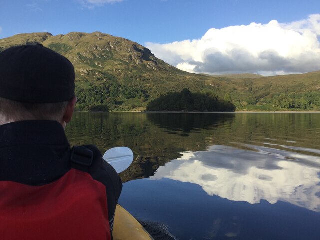
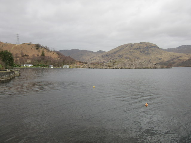
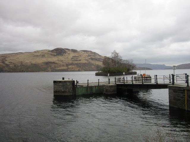
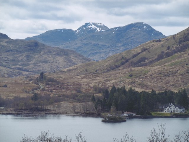
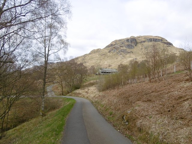
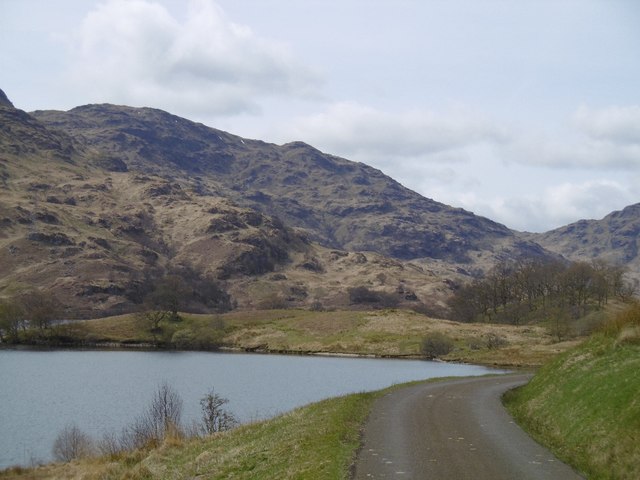
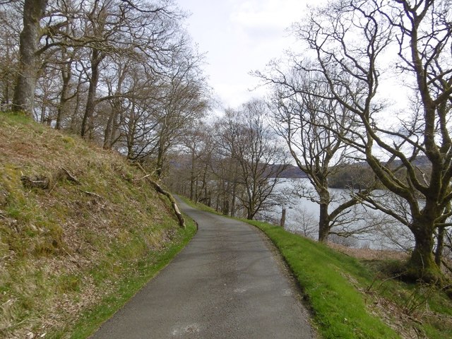
Rubha Maoil Mhir an t-Salainn, also known as Saline Point, is a prominent landscape feature located in Stirlingshire, Scotland. Situated on the western shores of Loch Lomond, this headland juts out into the water, offering breathtaking views and a unique natural environment.

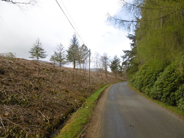
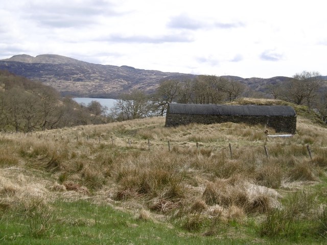
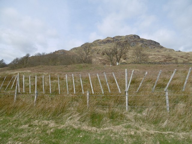
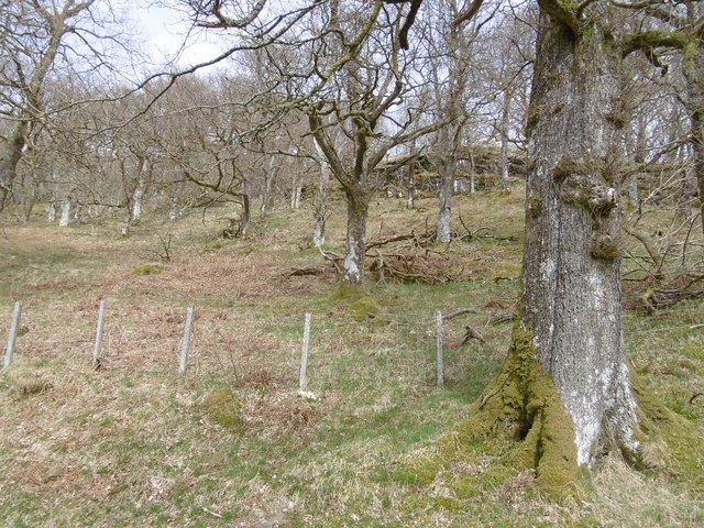
The name Rubha Maoil Mhir an t-Salainn translates to "the rounded headland of the big sea salt" in Gaelic, which aptly describes its physical characteristics. The point itself is a rocky outcrop, formed by ancient volcanic activity, and is covered in heather and grasses. The terrain is rugged and hilly, providing an undulating landscape that adds to its charm.

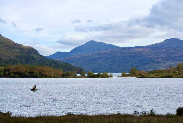
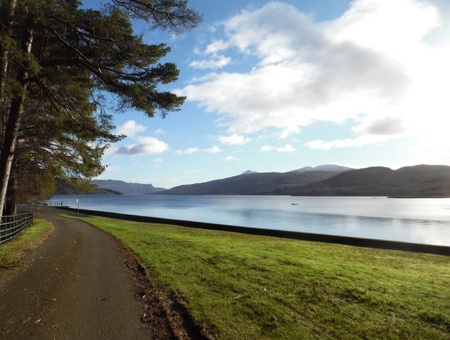
One of the most striking aspects of Rubha Maoil Mhir an t-Salainn is its panoramic views of Loch Lomond. From this vantage point, visitors can witness the expansive blue waters of the loch, surrounded by the majestic peaks of the Scottish Highlands. On clear days, it is even possible to see the distant snow-capped Ben Lomond, the highest mountain in the area.

The headland is also home to a variety of wildlife, including red deer, rabbits, and a wide array of bird species. The coastal waters around Rubha Maoil Mhir an t-Salainn are inhabited by seals, and lucky visitors may even spot dolphins or porpoises swimming in the loch.

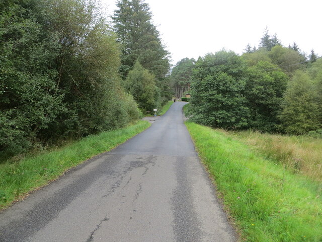
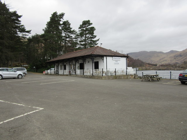
Due to its picturesque beauty and tranquil atmosphere, Rubha Maoil Mhir an t-Salainn has become a popular spot for outdoor activities such as hiking, birdwatching, and picnicking. It offers a peaceful escape from the bustling nearby towns and provides a unique opportunity to immerse oneself in the natural wonders of Stirlingshire.

If you have any feedback on the listing, please let us know in the comments section below.

Rubha Maoil Mhir an t-Salainn Images

Images are sourced within 2km of 56.270075/-4.5863236 or Grid Reference NN3911. Thanks to Geograph Open Source API. All images are credited.

On Loch Katrine viewing Black Island To the right is the Black Island- obscured behind it, attached to the loch's shore, is the Clan McGregor burial ground. The smaller islet to the left is Eilean Ban. The peak is Meall na Boineide.
On Loch Katrine viewing Black Island
To the right is the Black Island- obscured behind it, attached to the loch's shore, is the Clan McGregor burial ground. The smaller islet to the left is Eilean Ban. The peak is Meall na Boineide.
Minor road approaching Stronachlachar Looking north-eastward.
Minor road approaching Stronachlachar
Looking north-eastward.
Looking down Loch Katrine from the Glen Gyle end An autumnal view of a special place: Rob Roy country!  The Glen Gyle end of Loch Katrine is steeped in history, as is the whole area.  The fishing group in the boat appeared contented and the view down to Ben Venue is so good, there were many positives for me in this image. As is well known, Loch Katrine is a main source of water for the Glasgow conurbation. A natural loch, its level has been raised three times.
Looking down Loch Katrine from the Glen Gyle end
An autumnal view of a special place: Rob Roy country! The Glen Gyle end of Loch Katrine is steeped in history, as is the whole area. The fishing group in the boat appeared contented and the view down to Ben Venue is so good, there were many positives for me in this image. As is well known, Loch Katrine is a main source of water for the Glasgow conurbation. A natural loch, its level has been raised three times.
Loch Katrine at Stronachlachar
Pier Café, Stronachlachar
Stronachlachar pier and Eilean Dharag, Loch Katrine Eilean Dharag is also known as Factor's Island, where Rob Roy MacGregor held the Duke of Montrose's factor, Graham of Killearn, as prisoner following an attack on his wife and home.
Stronachlachar pier and Eilean Dharag, Loch Katrine
Eilean Dharag is also known as Factor's Island, where Rob Roy MacGregor held the Duke of Montrose's factor, Graham of Killearn, as prisoner following an attack on his wife and home.
Rhododendron clearance, Stronachlachar Contrast with the rhododendron choked other side of the road.
Rhododendron clearance, Stronachlachar
Contrast with the rhododendron choked other side of the road.
Stronachlachar Pier Not so far away, but the road still has about 10km to go, around the head of Loch Katrine.  Beinn Narnain forms the backdrop.
Stronachlachar Pier
Not so far away, but the road still has about 10km to go, around the head of Loch Katrine. Beinn Narnain forms the backdrop.
Coilachra Old walls with a corrugated iron roof. There is a house marked here on 19th century maps.
Coilachra
Old walls with a corrugated iron roof. There is a house marked here on 19th century maps.
Bridge on the Loch Katrine road Near Coilachra.
Bridge on the Loch Katrine road
Near Coilachra.
Oakwood, Loch Katrine
East Portnellan Old sheds from the days when sheep were run on the hillsides north of Loch Katrine (now wooded).
East Portnellan
Old sheds from the days when sheep were run on the hillsides north of Loch Katrine (now wooded).
Meall na Boineide Craggy hillside above Loch Katrine. The fence is surrounding a young plantation which has replaced the sheep walk here.
Meall na Boineide
Craggy hillside above Loch Katrine. The fence is surrounding a young plantation which has replaced the sheep walk here.
Loch Katrine road Nearing the head of the loch.
Loch Katrine road
Nearing the head of the loch.
Oak wood, Portnellan Woodland beside Loch Katrine.
Oak wood, Portnellan
Woodland beside Loch Katrine.
Road, Loch Katrine Passing through some fine oak woods by Portnellan.
Road, Loch Katrine
Passing through some fine oak woods by Portnellan.
Former telephone box, Stronachlachar Now carrying a defibrillator.  BT don't really care that there is heehaw mobile reception in much of the Highlands, but there is still a 'phone in the nearby cafe.
Former telephone box, Stronachlachar
Now carrying a defibrillator. BT don't really care that there is heehaw mobile reception in much of the Highlands, but there is still a 'phone in the nearby cafe.
Show me another place!

Rubha Maoil Mhir an t-Salainn is located at Grid Ref: NN3911 (Lat: 56.270075, Lng: -4.5863236)

Unitary Authority: Stirling

Police Authority: Forth Valley

What 3 Words

///history.recline.radically. Near Tyndrum, Stirling

Related Wikis

Loch Lomond and The Trossachs National Park

Loch Lomond and The Trossachs National Park (Scottish Gaelic: Pàirc Nàiseanta Loch Laomainn is nan Tròisichean) is a national park in Scotland centred...

Loch Arklet

Loch Arklet is a freshwater loch and reservoir in the Trossachs area of the Scottish Highlands. It is within the historic county and registration county...

Meall Mor (Loch Katrine)

Meall Mor (747 m) is a mountain in the Grampian Mountains of Scotland. It lies in the Stirling region, on the northern side of Loch Katrine in the Trossachs...

Loch Katrine

Loch Katrine (; Scottish Gaelic: Loch Ceiteirein [l̪ˠɔx ˈkʲʰeʰtʲɪɾʲɛɲ] or Loch Ceathairne) is a freshwater loch in the Trossachs area of the Scottish Highlands...

Nearby Amenities

Located within 500m of 56.270075,-4.5863236
Design: barrel
Power: tower
Lat/Long: 56.26633/-4.5879249
Design: barrel
Power: tower
Lat/Long: 56.2685777/-4.5916771
Power: pole
Lat/Long: 56.2661445/-4.5865282
Power: pole
Lat/Long: 56.2667219/-4.5875783
Power: pole
Lat/Long: 56.2672109/-4.5884443
Power: pole
Lat/Long: 56.2676384/-4.5892119
Power: pole
Lat/Long: 56.2680774/-4.5899817
Power: pole
Lat/Long: 56.2684178/-4.5906281
Power: pole
Lat/Long: 56.2688022/-4.5913372
Power: pole
Lat/Long: 56.2692622/-4.5921885
Power: pole
Lat/Long: 56.2696409/-4.5928683
Power: pole
Lat/Long: 56.2701287/-4.5937385
The data included in this document is from www.openstreetmap.org. The data is made available under ODbL.

Have you been to Rubha Maoil Mhir an t-Salainn?

Leave your review of Rubha Maoil Mhir an t-Salainn below (or comments, questions and feedback).