Sròn nan Saobhaidh

Landscape Feature in Ross-shire

Scotland

Sròn nan Saobhaidh

Orrin Embankment Dam One of two dams holding back the River Orrin, to the form Loch Orrin. It was built in 1961, as part of the Conon hydro electric scheme. The other dam is at the other side of a small hill, see <a href="https://www.geograph.org.uk/photo/4120797">NH4050 : Orrin Dam</a>.

Some of the Fairburn wind farm is visible on the hills beyond.
Orrin Embankment Dam Credit: Craig Wallace

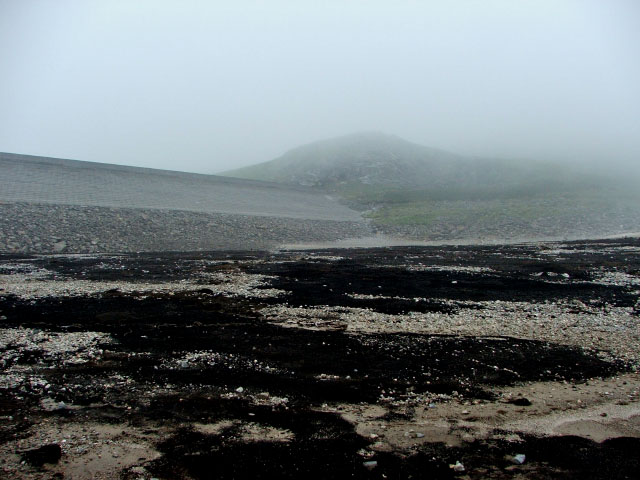
Sròn nan Saobhaidh is a prominent landscape feature located in Ross-shire, Scotland. Situated in the Northwest Highlands, it is part of the larger mountain range known as the Torridon Hills. The name "Sròn nan Saobhaidh" translates to "Nose of the Storms" in Gaelic, reflecting the challenging and dynamic weather conditions often experienced in this rugged area.

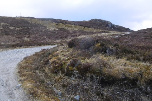
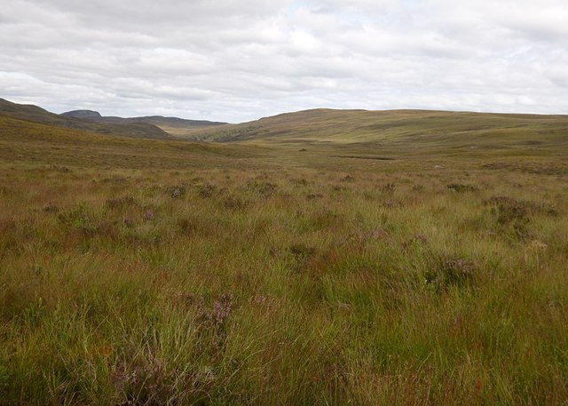
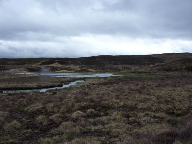
This distinctive feature is characterized by its steep and craggy slopes, which rise dramatically from the surrounding landscape. The terrain is predominantly rocky and barren, with occasional patches of heather and grasses. The elevation of Sròn nan Saobhaidh reaches approximately 3,016 feet (919 meters) at its highest point, offering breathtaking panoramic views of the surrounding peaks and glens.

The mountain is known for its challenging hiking trails and attracts experienced mountaineers and outdoor enthusiasts seeking adventure. Its remote location and exposed nature make it both a thrilling and demanding experience for those who attempt to conquer its slopes.

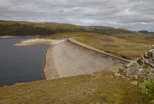
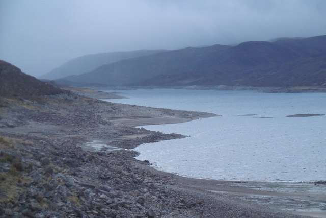
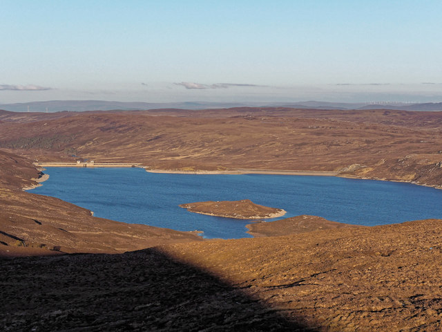
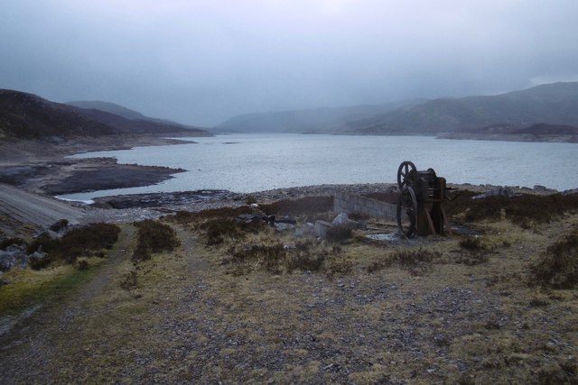
The landscape surrounding Sròn nan Saobhaidh is characterized by its wild and untamed beauty. The mountain overlooks Loch Maree, one of Scotland's largest freshwater lochs, which adds to the picturesque scenery. The area is also home to a diverse range of wildlife, including red deer, golden eagles, and rare plant species, adding to its ecological significance.

Overall, Sròn nan Saobhaidh is a striking landscape feature that exemplifies the rugged beauty of the Scottish Highlands. Its challenging terrain, stunning views, and rich biodiversity make it a captivating destination for nature lovers and outdoor adventurers alike.

If you have any feedback on the listing, please let us know in the comments section below.

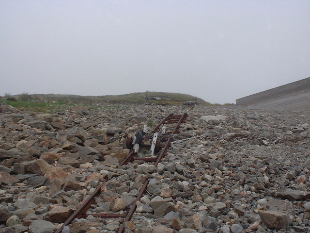
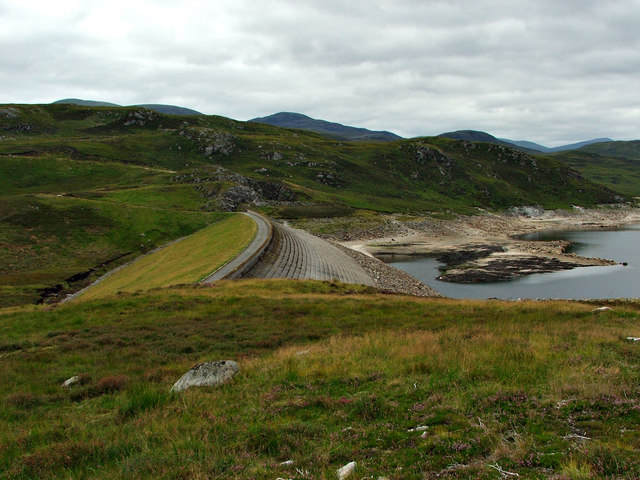
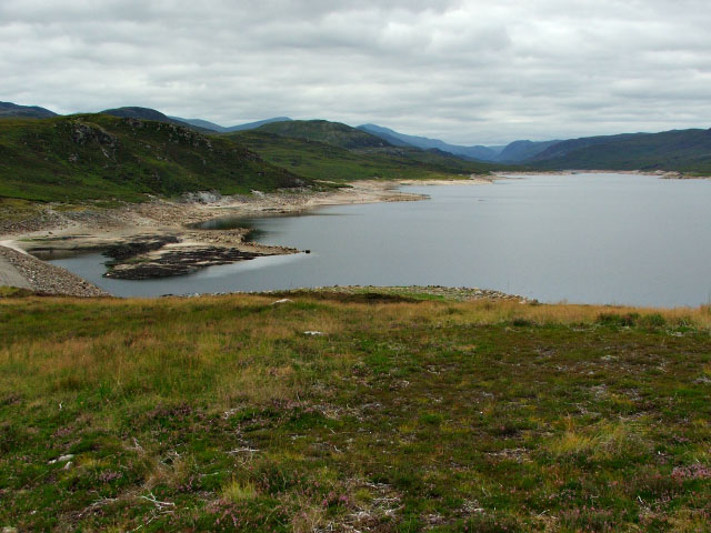
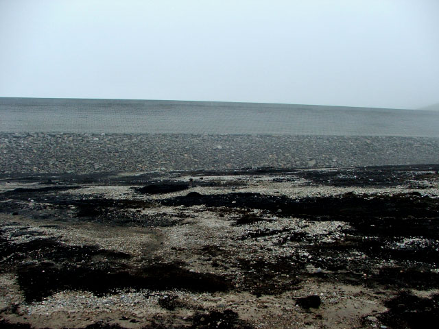
Sròn nan Saobhaidh Images

Images are sourced within 2km of 57.524887/-4.6635253 or Grid Reference NH4051. Thanks to Geograph Open Source API. All images are credited.

Orrin Embankment Dam One of two dams holding back the River Orrin, to the form Loch Orrin. It was built in 1961, as part of the Conon hydro electric scheme. The other dam is at the other side of a small hill, see <a href="https://www.geograph.org.uk/photo/4120797">NH4050 : Orrin Dam</a>.

Some of the Fairburn wind farm is visible on the hills beyond.
Orrin Embankment Dam
One of two dams holding back the River Orrin, to the form Loch Orrin. It was built in 1961, as part of the Conon hydro electric scheme. The other dam is at the other side of a small hill, see NH4050 : Orrin Dam. Some of the Fairburn wind farm is visible on the hills beyond.
Beach, Orrin Reservoir Beside the southern small dam. The Orrin Reservoir fluctuates a lot so it is common to see it drawn down. The fish pass within the main dam has four different levels to allow for this.
Beach, Orrin Reservoir
Beside the southern small dam. The Orrin Reservoir fluctuates a lot so it is common to see it drawn down. The fish pass within the main dam has four different levels to allow for this.
The southern Orrin Dam An embankment to the south of the main concrete dam, blocking off a low gap.
The southern Orrin Dam
An embankment to the south of the main concrete dam, blocking off a low gap.
Orrin Reservoir Covering the sites of Cabaan and Corriehallie Lodges and over 7km long this is one of the less known North of Scotland Hydroelectric Board reservoirs. It opened in 1961, at the end of the big hydroelectric building era. This part of Glen Orrin is notoriously bleak, but the scenery softens amongst the high hills to the west.
Orrin Reservoir
Covering the sites of Cabaan and Corriehallie Lodges and over 7km long this is one of the less known North of Scotland Hydroelectric Board reservoirs. It opened in 1961, at the end of the big hydroelectric building era. This part of Glen Orrin is notoriously bleak, but the scenery softens amongst the high hills to the west.
Hydro road, Glen Orrin Beyond the Orrin dams the road is no longer tarred. It serves a pipeline and intakes along Gleann Goibhre.
Hydro road, Glen Orrin
Beyond the Orrin dams the road is no longer tarred. It serves a pipeline and intakes along Gleann Goibhre.
Boggy moorland, by Orrin Embankment Dam An area of heather and rough grass, just down the hill from the embankment dam. It is all rather boggy, with a few pools of water.

Looking down the glen, with the slopes of Carn Doire Mhurchaidh to the right, and the rounded hill on the distant left is Cul Mòr.
Boggy moorland, by Orrin Embankment Dam
An area of heather and rough grass, just down the hill from the embankment dam. It is all rather boggy, with a few pools of water. Looking down the glen, with the slopes of Carn Doire Mhurchaidh to the right, and the rounded hill on the distant left is Cul Mòr.
Embankment dam at Orrin Reservoir The water level in Orrin Reservoir is normally within a couple of feet of the top of this structure but with the recent dry weather, it has dropped at least forty feet. You can now walk on the bed of Orrin Reservoir on ground that possibly hasn't seen the light of day for 50 years.
Embankment dam at Orrin Reservoir
The water level in Orrin Reservoir is normally within a couple of feet of the top of this structure but with the recent dry weather, it has dropped at least forty feet. You can now walk on the bed of Orrin Reservoir on ground that possibly hasn't seen the light of day for 50 years.
Old boathouse and winch for launch rigging at Orrin Reservoir The tracks and wheels are still half way down the launch rigging but are submerged for much of the year
Old boathouse and winch for launch rigging at Orrin Reservoir
The tracks and wheels are still half way down the launch rigging but are submerged for much of the year
Old boat launching equipment in Orrin Reservoir below Orrin Embankment Dam This site is normally submerged but with the recent dry weather, it is possible to go down and have a look. There are still a couple of wheels sitting on the tracks half way down.
Old boat launching equipment in Orrin Reservoir below Orrin Embankment Dam
This site is normally submerged but with the recent dry weather, it is possible to go down and have a look. There are still a couple of wheels sitting on the tracks half way down.
Orrin Embankment The reservoir at this time of year is very low. During the winter/spring the water level can rise to just below the wall of the embankment.
Orrin Embankment
The reservoir at this time of year is very low. During the winter/spring the water level can rise to just below the wall of the embankment.
Orrin Reservoir Looking west across the very low Orrin Reservoir.
Orrin Reservoir
Looking west across the very low Orrin Reservoir.
Orrin Embankment Looking up from the bed of the reservoir.
Orrin Embankment
Looking up from the bed of the reservoir.
Orrin Embankment Photo taken from the dry springy bed of the reservoir after a dry summer has lowered the water level significantly. Typical highland weather - very misty and damp, even in August. Creag a'Bhainne is the hill which can be seen through the mist above the embankment.
Orrin Embankment
Photo taken from the dry springy bed of the reservoir after a dry summer has lowered the water level significantly. Typical highland weather - very misty and damp, even in August. Creag a'Bhainne is the hill which can be seen through the mist above the embankment.
Loch an Fheoir Viewed from track to Orrin Reservoir from Strathconon.
Loch an Fheoir
Viewed from track to Orrin Reservoir from Strathconon.
Orrin Reservoir
Orrin Reservoir
Boathouse site, Orrin Reservoir There is a winch and railway here for launching boats on the widely fluctuating shoreline of the Orrin Reservoir.  The high hills at the head of the glen are obscured by another shower - it's April.  The boathouse marked on Ordnance Survey maps is ruined, very little remains.

Orrin was one of the last big North of Scotland Hydroelectric dams of the post war period forming a new loch and doing for a couple of isolated estate lodges: Cabaan and Corriehallie in 1961. There is a smaller dam just to the left of the picture as well as the massive concrete main dam <a href="https://www.geograph.org.uk/photo/5617681">NH4050 : Orrin Dam</a>.
Boathouse site, Orrin Reservoir
There is a winch and railway here for launching boats on the widely fluctuating shoreline of the Orrin Reservoir. The high hills at the head of the glen are obscured by another shower - it's April. The boathouse marked on Ordnance Survey maps is ruined, very little remains. Orrin was one of the last big North of Scotland Hydroelectric dams of the post war period forming a new loch and doing for a couple of isolated estate lodges: Cabaan and Corriehallie in 1961. There is a smaller dam just to the left of the picture as well as the massive concrete main dam NH4050 : Orrin Dam.
The smaller Orrin Dam To the south of the main dam (<a href="https://www.geograph.org.uk/photo/5617681">NH4050 : Orrin Dam</a>), this dam blocks  a gap beyond a small hill.  There was once a boathouse here - with the glen drowned, the deer forests of Cabaan and Corriehallie are tough to reach except by boat.
The smaller Orrin Dam
To the south of the main dam (NH4050 : Orrin Dam), this dam blocks a gap beyond a small hill. There was once a boathouse here - with the glen drowned, the deer forests of Cabaan and Corriehallie are tough to reach except by boat.
Boathouse remains, by Orrin Embankment Dam The OS maps show several boathouses here. It looks like they have fallen down a few years ago, just a few low brick walls remaining. There are also rails running down to the loch, and a winch, now rather rusty.
Boathouse remains, by Orrin Embankment Dam
The OS maps show several boathouses here. It looks like they have fallen down a few years ago, just a few low brick walls remaining. There are also rails running down to the loch, and a winch, now rather rusty.
Show me another place!

Sròn nan Saobhaidh is located at Grid Ref: NH4051 (Lat: 57.524887, Lng: -4.6635253)

Unitary Authority: Highland

Police Authority: Highlands and Islands

What 3 Words

///hence.swept.players. Near Strathpeffer, Highland

Nearby Locations

Sròn nan Saobhaidh

Related Wikis

Loch Achilty

Loch Achilty is a large picturesque lowland freshwater loch set within a sloping birch and oakwood forest, and located near to Contin in Ross-shire, Scottish...

Falls of Orrin

Falls of Orrin is a waterfall on the River Orrin, in the Highlands of Scotland. == See also == Waterfalls of Scotland == References ==

Fairburn Tower

Fairburn Tower is a recently restored Scottish castle near Inverness and Muir of Ord in the parish of Urray. The tower house on a hill above the River...

Contin Island

Contin Island is an inhabited riverine islet in Ross and Cromarty within the Highland council area of Scotland. Located in the Black Water, a tributary...

Contin

Contin (Gaelic: Cunndainn) is a Ross-shire village, and a civil parish and community council area between Strathpeffer and Garve in the Highland council...

Marybank

Marybank is a small village in Ross-shire, Scottish Highlands and is in the Scottish council area of Highland. The village of Muir of Ord lies 3 miles...

Black Water (Conon)

The Black Water (Scottish Gaelic: An t-Alltan Dubh) is a river in the Highlands of Scotland. It begins at the confluence of the Glascarnoch River with...
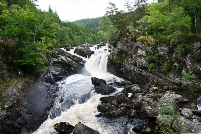
Rogie Falls

Rogie Falls (Gaelic: Eas Rothagaidh) are a series of waterfalls on the Black Water, a river in Ross-shire in the Highlands of Scotland. The falls are about...

Have you been to Sròn nan Saobhaidh?

Leave your review of Sròn nan Saobhaidh below (or comments, questions and feedback).