Walton Dam

Lake, Pool, Pond, Freshwater Marsh in Derbyshire Chesterfield

England

Walton Dam

Car park at Morrison's supermarket Chesterfield
Car park at Morrison's supermarket Chesterfield Credit: Rod Allday

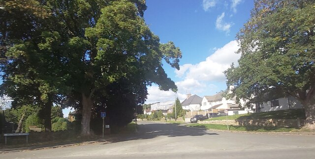
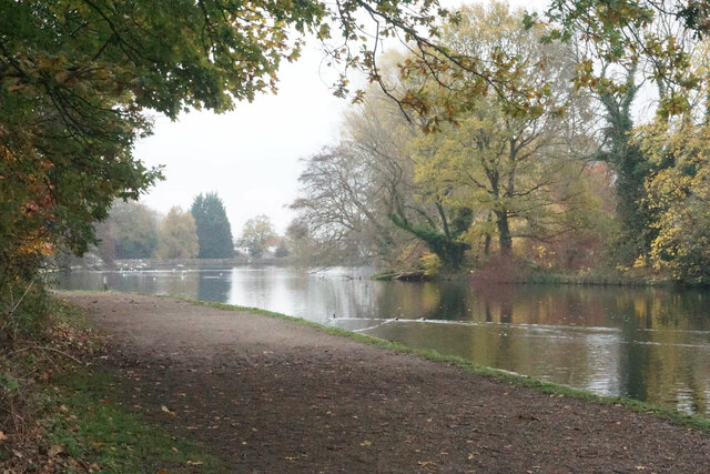
Walton Dam, located in Derbyshire, England, is a picturesque freshwater reservoir nestled in the heart of the beautiful Peak District National Park. This man-made dam was constructed in the 1960s to provide a reliable water supply for the local area.

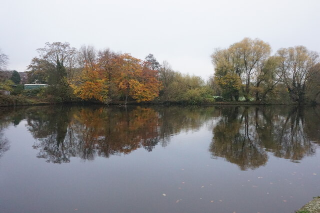
With a surface area of approximately 25 hectares, the dam is surrounded by rolling hills and verdant woodlands, creating a tranquil and idyllic setting. The crystal-clear waters of the dam are fed by natural springs and streams, ensuring a constant flow of fresh water. The dam acts as a vital habitat for a diverse range of wildlife, including various species of fish, waterfowl, and aquatic plants.

The dam itself is a concrete structure, carefully designed to withstand the pressures of holding such a large body of water. Its curved shape and sloping sides create a visually pleasing and harmonious appearance that blends seamlessly into the surrounding landscape. The reservoir is also used for recreational purposes, with visitors enjoying activities such as fishing, boating, and birdwatching.

Surrounding the dam, there is a network of footpaths and nature trails, providing opportunities for leisurely walks and exploration of the surrounding countryside. The area is a popular spot for bird enthusiasts, as the dam attracts a wide variety of waterfowl, including ducks, geese, and herons.

Overall, Walton Dam is a haven of natural beauty and tranquility, offering visitors the chance to immerse themselves in the breathtaking scenery of the Peak District while enjoying the diverse wildlife that calls this freshwater reservoir home.

If you have any feedback on the listing, please let us know in the comments section below.

Walton Dam Images

Images are sourced within 2km of 53.229322/-1.4569672 or Grid Reference SK3670. Thanks to Geograph Open Source API. All images are credited.

Car park at Morrison's supermarket Chesterfield
Loundsley Green, Brockwell Lane OS BM on bridge

Sk 3653 7218
Loundsley Green, Brockwell Lane
OS BM on bridge Sk 3653 7218
Loundsley Green, 12-15 Chiltern Court OS BM on 12-15 Chiltern Court

Sk3637 7190
Loundsley Green, 12-15 Chiltern Court
OS BM on 12-15 Chiltern Court Sk3637 7190
Former NUM Office The building is now occupied by commercial businesses, but it still has the statues of mining dignitaries outside.
Former NUM Office
The building is now occupied by commercial businesses, but it still has the statues of mining dignitaries outside.
Chesterfield Antiques Centre Retail opportunity in Chesterfield.
Chesterfield Antiques Centre
Retail opportunity in Chesterfield.
Queen's Park Park in Chesterfield.
Queen's Park
Park in Chesterfield.
Derbyshire v Yorkshire One Day Cup match at Queen's Park Derbyshire were put in on a pitch of variable bounce and dismissed for a paltry 109. This picture was taken during the first over of Yorkshire's reply and shows opening batsman Will Fraine turning a ball from the Derbyshire fast bowler Sam Conners to leg. Yorkshire fared little better than their hosts, but won a tense and hugely enjoyable match by one wicket. Conners had the best bowling figures of the match: 5 for 28.

Derbyshire 109, Yorkshire 110 for 9.
Derbyshire v Yorkshire One Day Cup match at Queen's Park
Derbyshire were put in on a pitch of variable bounce and dismissed for a paltry 109. This picture was taken during the first over of Yorkshire's reply and shows opening batsman Will Fraine turning a ball from the Derbyshire fast bowler Sam Conners to leg. Yorkshire fared little better than their hosts, but won a tense and hugely enjoyable match by one wicket. Conners had the best bowling figures of the match: 5 for 28. Derbyshire 109, Yorkshire 110 for 9.
A good crowd at Queen's Park About twenty minutes before the One Day Cup match between Derbyshire and Yorkshire began there was already a good crowd at one of the country's most delightful grounds. A pitch of variable bounce, though, was not to the liking of batters, and Yorkshire won a tense, low-scoring encounter by the narrowest of margins: Derbyshire 109, Yorkshire 110 for 9.

The seating arrangements at the Lake End - but not the atmosphere - have changed since I took <a href="https://www.geograph.org.uk/photo/3947481">SK3770 : A contented crowd at Queen's Park, July 1997</a> twenty-five years before.
A good crowd at Queen's Park
About twenty minutes before the One Day Cup match between Derbyshire and Yorkshire began there was already a good crowd at one of the country's most delightful grounds. A pitch of variable bounce, though, was not to the liking of batters, and Yorkshire won a tense, low-scoring encounter by the narrowest of margins: Derbyshire 109, Yorkshire 110 for 9. The seating arrangements at the Lake End - but not the atmosphere - have changed since I took SK3770 : A contented crowd at Queen's Park, July 1997 twenty-five years before.
Cricket at Queen's Park: members' enclosure Twenty minutes before the One Day Cup match between Derbyshire and Yorkshire began there was already a good crowd at one of the country's most delightful grounds. This is the members' enclosure next to the fine Victorian pavilion. A pitch of variable bounce, though, was not to the liking of batters, and Yorkshire won a tense, low-scoring encounter by the narrowest of margins: Derbyshire 109, Yorkshire 110 for 9.
Cricket at Queen's Park: members' enclosure
Twenty minutes before the One Day Cup match between Derbyshire and Yorkshire began there was already a good crowd at one of the country's most delightful grounds. This is the members' enclosure next to the fine Victorian pavilion. A pitch of variable bounce, though, was not to the liking of batters, and Yorkshire won a tense, low-scoring encounter by the narrowest of margins: Derbyshire 109, Yorkshire 110 for 9.
The Barrel Inn - Chesterfield
Pizza Hut - Chesterfield
Parade of Shops in Chesterfield
Chatsworth Road Medical Centre
Westbrook Drive - Brookside
Park Road Heading towards the centre of Chesterfield on a misty autumn day. Queen's Park is on the left and the dip is the valley of the River Hipper.
Park Road
Heading towards the centre of Chesterfield on a misty autumn day. Queen's Park is on the left and the dip is the valley of the River Hipper.
Chesterfield Town Hall Viewed on Remembrance Sunday, and there are two cascades of poppies by the front entrance.
Chesterfield Town Hall
Viewed on Remembrance Sunday, and there are two cascades of poppies by the front entrance.
Walton Dam A reservoir constructed to power a former corn mill. It is now a pleasant enclave amongst a lot of new housing in Walton.
Walton Dam
A reservoir constructed to power a former corn mill. It is now a pleasant enclave amongst a lot of new housing in Walton.
Path by Walton Dam A pleasant place for residents of Brampton and Walton, by the side of a former mill reservoir in the valley of the River Hipper. Autumn mist is still lingering into the afternoon.
Path by Walton Dam
A pleasant place for residents of Brampton and Walton, by the side of a former mill reservoir in the valley of the River Hipper. Autumn mist is still lingering into the afternoon.
Show me another place!

Walton Dam is located at Grid Ref: SK3670 (Lat: 53.229322, Lng: -1.4569672)

Administrative County: Derbyshire

District: Chesterfield

Police Authority: Derbyshire

What 3 Words

///woods.sound.chase. Near Walton, Derbyshire

Related Wikis

Ashgate, Derbyshire

Ashgate is an area in northeast Derbyshire, England, west of the town of Chesterfield. It is close to the town centre and local amenities. A leading place...

St Thomas' Church, Brampton

St Thomas’ Church, Brampton is a Grade II listed parish church in the Church of England: 150  in Brampton, Derbyshire. == History == The church was built...

Brampton, Derbyshire

Brampton is a suburb in the west of Chesterfield, Derbyshire. Originally a village known as New Brampton and separate from the town, it became absorbed...

Walton Hall, Chesterfield

Walton Hall is a late 18th-century country house, now a farmhouse, situated at Foljambe Avenue, Walton, Chesterfield. It is a Grade II listed building...

Brookfield Community School, Chesterfield

Brookfield Community School is an academy school located on Chatsworth Road (A619) in the west of Chesterfield, Derbyshire. The school's most recent Ofsted...

Somersall Hall

Somersall Hall is a small country house near Brampton, Chesterfield, Derbyshire. It is a Grade II listed building.The Clarke family owned the estate in...

Parkside Community School

Parkside Community School (formerly William Rhodes Secondary School) is a co-educational secondary school located in the Boythorpe area of Chesterfield...

Boythorpe

Boythorpe is a small suburb to the south-west of Chesterfield town centre in Derbyshire, England. It also borders Birdholme to its east, and Walton to...

Nearby Amenities

Located within 500m of 53.229322,-1.4569672
Traffic Signals
Crossing: no
Traffic Signals Direction: forward
Lat/Long: 53.2324107/-1.4530029
Crossing
Crossing: unmarked
Tactile Paving: yes
Lat/Long: 53.2321073/-1.453848
Speed Camera
Source: local_knowledge
Lat/Long: 53.2313883/-1.4586642
Turning Circle
Lat/Long: 53.2264736/-1.453493
Turning Circle
Lat/Long: 53.225215/-1.4578422
Turning Circle
Lat/Long: 53.2259292/-1.4578936
Brampton
Is In: Chesterfield, Derbyshire, England, UK
Place: suburb
Wikidata: Q7005631
Wikipedia: en:Brampton, Derbyshire
Lat/Long: 53.2319619/-1.458617
Crossing
Bicycle: yes
Crossing: traffic_signals
Crossing Ref: toucan
Horse: yes
Lat/Long: 53.2304163/-1.4541066
Barrier: cycle_barrier
Lat/Long: 53.2315372/-1.4507104
Crossing
Button Operated: yes
Crossing: traffic_signals
Crossing Island: no
Crossing Ref: pelican
Tactile Paving: yes
Lat/Long: 53.2316436/-1.4569548
Barrier: bollard
Bicycle: yes
Foot: yes
Motor Vehicle: no
Lat/Long: 53.2304291/-1.4620412
Barrier: cycle_barrier
Lat/Long: 53.2291065/-1.4613686
Turning Circle
Lat/Long: 53.2298423/-1.4611173
Ele: 86
Lat/Long: 53.2317395/-1.455739
Pub
Rose and Crown
Addr City: Chesterfield
Addr Country: GB
Addr Housenumber: 104
Addr Postcode: S40 2QT
Addr Street: Old Road
Ele: 86
Fhrs Id: 214997
Internet Access: wlan
Internet Access Fee: no
Operator: Brampton Brewery
Outdoor Seating: yes
Real Ale: At least 4 from Brampton and around 4 guests
Lat/Long: 53.2331846/-1.4535406
Turning Circle
Lat/Long: 53.230592/-1.453145
Turning Circle
Lat/Long: 53.2256852/-1.4558808
Post Box
Brand: Royal Mail
Brand Wikidata: Q638098
Brand Wikipedia: en:Royal Mail
Collection Times: Mo-Fr 09:00; Sa 07:00
Operator: Royal Mail
Operator Wikidata: Q638098
Post Box Type: wall
Postal Code: S40 3DN
Ref: S40 51D
Royal Cypher: GVIR
Royal Cypher Wikidata: Q33102169
Lat/Long: 53.232287/-1.4542007
Post Box
Brand: Royal Mail
Brand Wikidata: Q638098
Brand Wikipedia: en:Royal Mail
Operator: Royal Mail
Operator Wikidata: Q638098
Ref: S41 158
Lat/Long: 53.2316752/-1.4524731
Post Box
Brand: Royal Mail
Brand Wikidata: Q638098
Brand Wikipedia: en:Royal Mail
Collection Times: Mo-Fr 09:00; Sa 07:00
Operator: Royal Mail
Operator Wikidata: Q638098
Post Box Type: lamp
Postal Code: S40 3EZ
Ref: S40 371
Royal Cypher: EIIR
Royal Cypher Wikidata: Q33102113
Lat/Long: 53.225337/-1.4541009
Post Box
Brand: Royal Mail
Brand Wikidata: Q638098
Brand Wikipedia: en:Royal Mail
Collection Plate: missing
Operator: Royal Mail
Operator Wikidata: Q638098
Post Box Type: wall
Postal Code: S40 3DD
Ref: S40 258
Royal Cypher: EIIR
Royal Cypher Wikidata: Q33102113
Lat/Long: 53.2283861/-1.4541314
Bus Stop
Heaton Street
Bus: yes
Ele: 87.6051025
Naptan AtcoCode: 1000DBCR3108
Naptan NaptanCode: dbsagptg
Public Transport: platform
Lat/Long: 53.2315326/-1.457293
Ele: 88
Lat/Long: 53.2314191/-1.4580363
Bus Stop
Vincent Crescent
Bus: yes
Ele: 95.2956543
Naptan AtcoCode: 1000DBCR3109
Naptan NaptanCode: dbsagptj
Public Transport: platform
Lat/Long: 53.2310044/-1.463745
Ele: 86
Lat/Long: 53.2325025/-1.453265
Pub
The Star
Addr City: Chesterfield
Addr Housenumber: 422
Addr Postcode: S40 3BD
Addr Street: Chatsworth Road
Beer Garden: yes
Car Park: yes
Fhrs Id: 842134
Real Ale: Deauchars IPA, Theakstons Best
Source Addr: FHRS Open Data
Lat/Long: 53.2315279/-1.4568236
Bus Stop
Bus: yes
Ele: 78.0000000
Public Transport: platform
Lat/Long: 53.231079/-1.4525269
Bench
Ele: 87.0000000
Lat/Long: 53.2299902/-1.4558077
Bench
Backrest: yes
Ele: 87.0000000
Lat/Long: 53.2296322/-1.4575041
Bench
Ele: 87.0000000
Lat/Long: 53.2290327/-1.4590276
Bus Stop
Bus: yes
Public Transport: platform
Lat/Long: 53.2310067/-1.4525617
Ele: 81
Lat/Long: 53.2324403/-1.4535181
Ele: 81.0000000
Removed Amenity: telephone
Lat/Long: 53.2322157/-1.4542971
Ele: 90
Lat/Long: 53.2298572/-1.4637903
Traffic Signals
Crossing: no
Traffic Signals Direction: backward
Lat/Long: 53.2333346/-1.4541648
Cycleway: asl
Lat/Long: 53.2333339/-1.4541018
Bench
Lat/Long: 53.2286233/-1.4631532
Bus Stop
Bus: yes
Ele: 65
Naptan AtcoCode: 1000DWMV6735
Naptan NaptanCode: dbsdawpj
Public Transport: platform
Lat/Long: 53.2284391/-1.4541661
Bus Stop
Bus: yes
Naptan AtcoCode: 1000DWMV6734
Naptan NaptanCode: dbsdawpg
Public Transport: platform
Lat/Long: 53.2283668/-1.4541044
Barrier: cycle_barrier
Lat/Long: 53.2252395/-1.459863
Bus Stop
Bus: yes
Public Transport: platform
Lat/Long: 53.2280619/-1.4531682
Chatsworth Travel
Shop: travel_agency
Lat/Long: 53.2325638/-1.4518657
Bus Stop
Bus: yes
Naptan AtcoCode: 1000DWMV6737
Naptan NaptanCode: dbsdawpm
Public Transport: platform
Lat/Long: 53.2271185/-1.4590169
Barrier: cycle_barrier
Lat/Long: 53.2267487/-1.4572356
Barrier: bollard
Lat/Long: 53.2257408/-1.4557472
Toilets
Opening Hours: Mo-Sa 07:00-22:00; Su 10:00-16:00
Source: Sign on main road ("communutyy toilet scheme")
Lat/Long: 53.2314973/-1.4523457
Bus Stop
Bus: yes
Naptan AtcoCode: 1000DWMV6740
Naptan NaptanCode: dbsdawpw
Public Transport: platform
Lat/Long: 53.2266793/-1.4610137
Bus Stop
Bus: yes
Naptan AtcoCode: 1000DWMV6739
Naptan NaptanCode: dbsdawpt
Public Transport: platform
Lat/Long: 53.2265941/-1.4609627
Bus Stop
Bus: yes
Naptan AtcoCode: 1000DWMO6738
Naptan NaptanCode: dbsdmtdp
Public Transport: platform
Lat/Long: 53.227882/-1.457154
Barrier: cycle_barrier
Lat/Long: 53.2271639/-1.456051
Fast Food
Dolly's Lunch Box
Cuisine: sandwich
Lat/Long: 53.2332626/-1.4540302
Real Ale Corner
Addr City: Chesterfield
Addr Housenumber: 415
Addr Postcode: S40 3AD
Addr Street: Chatsworth Road
Check Date: 2024-02-20
Fhrs Id: 1199849
Real Ale: A couple on handpumps, lots of bottle-conditioned
Shop: alcohol
Lat/Long: 53.2321086/-1.4547632
Chatsworth Hair and Beauty
Shop: hairdresser
Lat/Long: 53.2312614/-1.4630919
Gossip Boutique
Note: yes Boutique but hair & beauty
Old Name: JJS Flowers
Old Shop: florist
Shop: beauty
Source: survey
Lat/Long: 53.2314847/-1.4570918
Libbys
Shop: homewares
Lat/Long: 53.2316371/-1.458119
Total Bathrooms
Shop: bathroom
Lat/Long: 53.2316548/-1.4579071
Fishwick and Co
Shop: estate_agent
Lat/Long: 53.2316805/-1.4577516
Restaurant
Koo
Addr City: Chesterfield
Addr Country: GB
Addr Housenumber: 475A
Addr Postcode: S40 3AD
Addr Street: Chatsworth Road
Fhrs Id: 1015501
Note: "bistro and coffee bar"
Operator: Koo Chesterfield Ltd
Lat/Long: 53.2316901/-1.4576416
Dansies
Shop: stationery
Lat/Long: 53.2322597/-1.4541085
Curtain Studio
Check Date: 2024-02-20
Shop: curtain
Lat/Long: 53.2323872/-1.4519433
Dan Ashcroft Design
Check Date: 2024-02-20
Shop: kitchen
Lat/Long: 53.2325285/-1.4520453
Shop: battery
Lat/Long: 53.230126/-1.4507972
Information: board
Tourism: information
Lat/Long: 53.2295303/-1.4577621
Crossing
Crossing: unmarked
Crossing Island: yes
Tactile Paving: yes
Lat/Long: 53.2312428/-1.4542447
Crossing
Crossing: traffic_signals
Crossing Island: no
Crossing Ref: puffin
Tactile Paving: yes
Lat/Long: 53.2316992/-1.4541489
Mini Roundabout
Direction: clockwise
Lat/Long: 53.2313609/-1.4542285
Crossing
Crossing: unmarked
Crossing Island: yes
Tactile Paving: yes
Lat/Long: 53.2313698/-1.4539351
Crossing
Crossing: traffic_signals
Crossing Island: no
Crossing Ref: puffin
Tactile Paving: yes
Lat/Long: 53.2317638/-1.4542546
Crossing
Button Operated: yes
Crossing: traffic_signals
Crossing Island: no
Crossing Ref: pelican
Tactile Paving: yes
Lat/Long: 53.2319175/-1.4552307
Barrier: bollard
Motor Vehicle: no
Lat/Long: 53.2327076/-1.4555135
Halfords Autocentre
Brand: Halfords Autocentre
Brand Wikidata: Q5641894
Brand Wikipedia: en:Halfords Autocentre
Check Date: 2024-02-20
Shop: car_repair
Website: https://www.halfords.com/locations/chesterfield-autocentre/
Lat/Long: 53.2316823/-1.4546922
Screwfix
Brand: Screwfix
Brand Wikidata: Q7439115
Brand Wikipedia: en:Screwfix
Shop: doityourself
Website: https://www.screwfix.com/stores/EB6/chesterfield-brampton
Lat/Long: 53.2313419/-1.4547736
Denmans
Check Date: 2024-02-20
Shop: electrical
Lat/Long: 53.2315358/-1.4547693
Hair Heart and Soul
Check Date: 2024-02-20
Shop: hairdresser
Lat/Long: 53.2323091/-1.4538982
Hakka-San
Check Date: 2024-02-20
Cuisine: chinese
Disused Amenity: fast_food
Lat/Long: 53.2324953/-1.4531171
Peak Home Improvements
Fixme: Is this a shop?
Lat/Long: 53.2325518/-1.4528706
Cafe
Blu
Addr City: Chesterfield
Addr Country: GB
Addr Housenumber: 370
Addr Postcode: S40 2DQ
Addr Street: Chatsworth Road
Cuisine: coffee_shop
Fhrs Id: 990266
Lat/Long: 53.232381/-1.4525914
Access: private
Door: hinged
Entrance: home
Lat/Long: 53.2320494/-1.4569453
Access: private
Door: hinged
Entrance: home
Lat/Long: 53.2320642/-1.4568528
Access: private
Door: hinged
Entrance: home
Lat/Long: 53.2320789/-1.4567609
Access: private
Door: hinged
Entrance: home
Lat/Long: 53.2320931/-1.4566731
Access: private
Door: hinged
Entrance: home
Lat/Long: 53.2321083/-1.4565792
Access: private
Door: hinged
Entrance: home
Lat/Long: 53.2322867/-1.4566212
Access: private
Door: hinged
Entrance: home
Lat/Long: 53.2322373/-1.4566363
Access: private
Door: hinged
Entrance: home
Lat/Long: 53.2323859/-1.4567009
Access: private
Door: hinged
Entrance: home
Lat/Long: 53.2323969/-1.4567927
Access: private
Door: hinged
Entrance: home
Lat/Long: 53.232334/-1.4564312
Access: private
Door: hinged
Entrance: home
Lat/Long: 53.2323909/-1.4564105
Access: private
Door: hinged
Entrance: home
Lat/Long: 53.2324441/-1.456391
Access: private
Door: hinged
Entrance: home
Lat/Long: 53.2323716/-1.4560654
Access: private
Door: hinged
Entrance: home
Lat/Long: 53.2323146/-1.4560845
Access: private
Door: hinged
Entrance: home
Lat/Long: 53.2322612/-1.4561026
Access: private
Door: hinged
Entrance: home
Lat/Long: 53.2323271/-1.4556307
Access: private
Door: hinged
Entrance: home
Lat/Long: 53.2323241/-1.4557278
Access: private
Door: hinged
Entrance: home
Lat/Long: 53.2323213/-1.4558187
Access: private
Door: hinged
Entrance: home
Lat/Long: 53.232246/-1.4562118
Access: private
Door: hinged
Entrance: home
Lat/Long: 53.2322551/-1.4563044
Access: private
Door: hinged
Entrance: home
Lat/Long: 53.2326239/-1.4560337
Access: private
Door: hinged
Entrance: home
Lat/Long: 53.2325683/-1.4560533
Access: private
Door: hinged
Entrance: home
Lat/Long: 53.2324145/-1.4556389
Access: private
Door: hinged
Entrance: home
Lat/Long: 53.2324688/-1.4556463
Access: private
Door: hinged
Entrance: home
Lat/Long: 53.2325235/-1.4556532
Access: private
Door: hinged
Entrance: home
Lat/Long: 53.2325824/-1.4556615
Access: private
Door: hinged
Entrance: home
Lat/Long: 53.2326374/-1.4556693
Crossing
Crossing: unmarked
Tactile Paving: yes
Lat/Long: 53.2322237/-1.4542201
Crossing
Crossing: unmarked
Tactile Paving: yes
Lat/Long: 53.232159/-1.4539125
Crossing
Crossing: unmarked
Tactile Paving: yes
Lat/Long: 53.2320888/-1.4544105
Crossing
Crossing: unmarked
Tactile Paving: yes
Lat/Long: 53.2320304/-1.4544225
Traffic Signals
Crossing: no
Lat/Long: 53.2317358/-1.4541382
Traffic Signals
Crossing: no
Lat/Long: 53.2317285/-1.4542642
Crossing
Crossing: traffic_signals
Crossing Island: no
Tactile Paving: yes
Lat/Long: 53.2333292/-1.4539504
Crossing
Crossing: traffic_signals
Crossing Island: no
Tactile Paving: yes
Lat/Long: 53.2334022/-1.4538029
Crossing
Crossing: traffic_signals
Crossing Island: no
Tactile Paving: yes
Lat/Long: 53.2333348/-1.4536352
Crossing
Crossing: traffic_signals
Crossing Island: no
Tactile Paving: yes
Lat/Long: 53.2332345/-1.453878
Cycleway: asl
Lat/Long: 53.233163/-1.4539008
Traffic Signals
Crossing: no
Lat/Long: 53.2331317/-1.4539102
Traffic Signals
Crossing: no
Traffic Signals Direction: backward
Lat/Long: 53.2324341/-1.4529057
Crossing
Crossing: traffic_signals
Crossing Island: no
Tactile Paving: yes
Lat/Long: 53.2324237/-1.4529526
Traffic Signals
Crossing: no
Traffic Signals Direction: backward
Lat/Long: 53.2303855/-1.4540979
Traffic Signals
Crossing: no
Traffic Signals Direction: forward
Lat/Long: 53.2304602/-1.4541113
Generator Method: photovoltaic
Generator Output Electricity: yes
Generator Source: solar
Generator Type: solar_photovoltaic_panel
Location: roof
Power: generator
Lat/Long: 53.2319924/-1.462853
Generator Method: photovoltaic
Generator Output Electricity: yes
Generator Source: solar
Generator Type: solar_photovoltaic_panel
Location: roof
Power: generator
Lat/Long: 53.2321385/-1.4611002
Generator Method: photovoltaic
Generator Output Electricity: yes
Generator Source: solar
Generator Type: solar_photovoltaic_panel
Location: roof
Power: generator
Lat/Long: 53.2318985/-1.4603827
Generator Method: photovoltaic
Generator Output Electricity: yes
Generator Source: solar
Generator Type: solar_photovoltaic_panel
Location: roof
Power: generator
Lat/Long: 53.2320048/-1.4569361
Generator Method: photovoltaic
Generator Output Electricity: yes
Generator Source: solar
Generator Type: solar_photovoltaic_panel
Location: roof
Power: generator
Lat/Long: 53.2320385/-1.4566491
Generator Method: photovoltaic
Generator Output Electricity: yes
Generator Source: solar
Generator Type: solar_photovoltaic_panel
Location: roof
Power: generator
Lat/Long: 53.2320498/-1.4565579
Generator Method: photovoltaic
Generator Output Electricity: yes
Generator Source: solar
Generator Type: solar_photovoltaic_panel
Location: roof
Power: generator
Lat/Long: 53.2321894/-1.4562387
Generator Method: photovoltaic
Generator Output Electricity: yes
Generator Source: solar
Generator Type: solar_photovoltaic_panel
Location: roof
Power: generator
Lat/Long: 53.2321975/-1.4563379
Generator Method: photovoltaic
Generator Output Electricity: yes
Generator Source: solar
Generator Type: solar_photovoltaic_panel
Location: roof
Power: generator
Lat/Long: 53.2324158/-1.4567188
Generator Method: photovoltaic
Generator Output Electricity: yes
Generator Source: solar
Generator Type: solar_photovoltaic_panel
Location: roof
Power: generator
Lat/Long: 53.2324286/-1.4568046
Generator Method: photovoltaic
Generator Output Electricity: yes
Generator Source: solar
Generator Type: solar_photovoltaic_panel
Location: roof
Power: generator
Lat/Long: 53.2322713/-1.455839
Generator Method: photovoltaic
Generator Output Electricity: yes
Generator Source: solar
Generator Type: solar_photovoltaic_panel
Location: roof
Power: generator
Lat/Long: 53.2322713/-1.4557237
Generator Method: photovoltaic
Generator Output Electricity: yes
Generator Source: solar
Generator Type: solar_photovoltaic_panel
Location: roof
Power: generator
Lat/Long: 53.2322761/-1.4556298
Generator Method: photovoltaic
Generator Output Electricity: yes
Generator Source: solar
Generator Type: solar_photovoltaic_panel
Location: roof
Power: generator
Lat/Long: 53.2327144/-1.4560509
Generator Method: photovoltaic
Generator Output Electricity: yes
Generator Source: solar
Generator Type: solar_photovoltaic_panel
Location: roof
Power: generator
Lat/Long: 53.2303393/-1.4610244
Generator Method: photovoltaic
Generator Output Electricity: yes
Generator Source: solar
Generator Type: solar_photovoltaic_panel
Location: roof
Power: generator
Lat/Long: 53.2306479/-1.4605577
Generator Method: photovoltaic
Generator Output Electricity: yes
Generator Source: solar
Generator Type: solar_photovoltaic_panel
Location: roof
Power: generator
Lat/Long: 53.2302398/-1.4631958
Generator Method: photovoltaic
Generator Output Electricity: yes
Generator Source: solar
Generator Type: solar_photovoltaic_panel
Location: roof
Power: generator
Lat/Long: 53.2303182/-1.4634533
Generator Method: photovoltaic
Generator Output Electricity: yes
Generator Source: solar
Generator Type: solar_photovoltaic_panel
Location: roof
Power: generator
Lat/Long: 53.2302765/-1.4632468
Generator Method: photovoltaic
Generator Output Electricity: yes
Generator Source: solar
Generator Type: solar_photovoltaic_panel
Location: roof
Power: generator
Lat/Long: 53.2302733/-1.4641977
Generator Method: photovoltaic
Generator Output Electricity: yes
Generator Source: solar
Generator Type: solar_photovoltaic_panel
Location: roof
Power: generator
Lat/Long: 53.2302348/-1.4642406
Generator Method: photovoltaic
Generator Output Electricity: yes
Generator Source: solar
Generator Type: solar_photovoltaic_panel
Location: roof
Power: generator
Lat/Long: 53.2304459/-1.4638704
Generator Method: photovoltaic
Generator Output Electricity: yes
Generator Source: solar
Generator Type: solar_photovoltaic_panel
Location: roof
Power: generator
Lat/Long: 53.2304451/-1.4639174
Generator Method: photovoltaic
Generator Output Electricity: yes
Generator Source: solar
Generator Type: solar_photovoltaic_panel
Location: roof
Power: generator
Lat/Long: 53.2304563/-1.4637108
Generator Method: photovoltaic
Generator Output Electricity: yes
Generator Source: solar
Generator Type: solar_photovoltaic_panel
Location: roof
Power: generator
Lat/Long: 53.2304571/-1.463676
Generator Method: photovoltaic
Generator Output Electricity: yes
Generator Source: solar
Generator Type: solar_photovoltaic_panel
Location: roof
Power: generator
Lat/Long: 53.2293339/-1.4616965
Generator Method: photovoltaic
Generator Output Electricity: yes
Generator Source: solar
Generator Type: solar_photovoltaic_panel
Location: roof
Power: generator
Lat/Long: 53.2296309/-1.4614605
Generator Method: photovoltaic
Generator Output Electricity: yes
Generator Source: solar
Generator Type: solar_photovoltaic_panel
Location: roof
Power: generator
Lat/Long: 53.2296245/-1.4613961
Generator Method: photovoltaic
Generator Output Electricity: yes
Generator Source: solar
Generator Type: solar_photovoltaic_panel
Location: roof
Power: generator
Lat/Long: 53.2292183/-1.4607577
Generator Method: photovoltaic
Generator Output Electricity: yes
Generator Source: solar
Generator Type: solar_photovoltaic_panel
Location: roof
Power: generator
Lat/Long: 53.2310486/-1.4603634
Generator Method: photovoltaic
Generator Output Electricity: yes
Generator Source: solar
Generator Type: solar_photovoltaic_panel
Location: roof
Power: generator
Lat/Long: 53.2307114/-1.4544438
Generator Method: photovoltaic
Generator Output Electricity: yes
Generator Source: solar
Generator Type: solar_photovoltaic_panel
Location: roof
Power: generator
Lat/Long: 53.2307098/-1.4545162
Generator Method: photovoltaic
Generator Output Electricity: yes
Generator Source: solar
Generator Type: solar_photovoltaic_panel
Location: roof
Power: generator
Lat/Long: 53.2309956/-1.4535614
Generator Method: photovoltaic
Generator Output Electricity: yes
Generator Source: solar
Generator Type: solar_photovoltaic_panel
Location: roof
Power: generator
Lat/Long: 53.2307564/-1.4530759
Generator Method: photovoltaic
Generator Output Electricity: yes
Generator Source: solar
Generator Type: solar_photovoltaic_panel
Location: roof
Power: generator
Lat/Long: 53.2301607/-1.4531134
Generator Method: photovoltaic
Generator Output Electricity: yes
Generator Source: solar
Generator Type: solar_photovoltaic_panel
Location: roof
Power: generator
Lat/Long: 53.2301623/-1.4528291
Generator Method: photovoltaic
Generator Output Electricity: yes
Generator Source: solar
Generator Type: solar_photovoltaic_panel
Location: roof
Power: generator
Lat/Long: 53.2306938/-1.4520379
Generator Method: photovoltaic
Generator Output Electricity: yes
Generator Source: solar
Generator Type: solar_photovoltaic_panel
Location: roof
Power: generator
Lat/Long: 53.2297337/-1.4531429
Generator Method: photovoltaic
Generator Output Electricity: yes
Generator Source: solar
Generator Type: solar_photovoltaic_panel
Location: roof
Power: generator
Lat/Long: 53.2295827/-1.4520218
Generator Method: photovoltaic
Generator Output Electricity: yes
Generator Source: solar
Generator Type: solar_photovoltaic_panel
Location: roof
Power: generator
Lat/Long: 53.2296566/-1.452172
Generator Method: photovoltaic
Generator Output Electricity: yes
Generator Source: solar
Generator Type: solar_photovoltaic_panel
Location: roof
Power: generator
Lat/Long: 53.2276158/-1.4573138
Generator Method: photovoltaic
Generator Output Electricity: yes
Generator Source: solar
Generator Type: solar_photovoltaic_panel
Location: roof
Power: generator
Lat/Long: 53.2275998/-1.4573594
Generator Method: photovoltaic
Generator Output Electricity: yes
Generator Source: solar
Generator Type: solar_photovoltaic_panel
Location: roof
Power: generator
Lat/Long: 53.226654/-1.4614363
Generator Method: photovoltaic
Generator Output Electricity: yes
Generator Source: solar
Generator Type: solar_photovoltaic_panel
Location: roof
Power: generator
Lat/Long: 53.2263634/-1.4604895
Generator Method: photovoltaic
Generator Output Electricity: yes
Generator Source: solar
Generator Type: solar_photovoltaic_panel
Location: roof
Power: generator
Lat/Long: 53.2268933/-1.4628874
Generator Method: photovoltaic
Generator Output Electricity: yes
Generator Source: solar
Generator Type: solar_photovoltaic_panel
Location: roof
Power: generator
Lat/Long: 53.2262408/-1.4586597
Generator Method: photovoltaic
Generator Output Electricity: yes
Generator Source: solar
Generator Type: solar_photovoltaic_panel
Location: roof
Power: generator
Lat/Long: 53.2261092/-1.4593169
Generator Method: photovoltaic
Generator Output Electricity: yes
Generator Source: solar
Generator Type: solar_photovoltaic_panel
Location: roof
Power: generator
Lat/Long: 53.225894/-1.4595261
Generator Method: photovoltaic
Generator Output Electricity: yes
Generator Source: solar
Generator Type: solar_photovoltaic_panel
Location: roof
Power: generator
Lat/Long: 53.2258779/-1.4595931
Generator Method: photovoltaic
Generator Output Electricity: yes
Generator Source: solar
Generator Type: solar_photovoltaic_panel
Location: roof
Power: generator
Lat/Long: 53.2254734/-1.4577236
Generator Method: photovoltaic
Generator Output Electricity: yes
Generator Source: solar
Generator Type: solar_photovoltaic_panel
Location: roof
Power: generator
Lat/Long: 53.2263357/-1.4582601
Generator Method: photovoltaic
Generator Output Electricity: yes
Generator Source: solar
Generator Type: solar_photovoltaic_panel
Location: roof
Power: generator
Lat/Long: 53.2263405/-1.4581957
Generator Method: photovoltaic
Generator Output Electricity: yes
Generator Source: solar
Generator Type: solar_photovoltaic_panel
Location: roof
Power: generator
Lat/Long: 53.2263244/-1.4579919
Generator Method: photovoltaic
Generator Output Electricity: yes
Generator Source: solar
Generator Type: solar_photovoltaic_panel
Location: roof
Power: generator
Lat/Long: 53.2266006/-1.4574608
Generator Method: photovoltaic
Generator Output Electricity: yes
Generator Source: solar
Generator Type: solar_photovoltaic_panel
Location: roof
Power: generator
Lat/Long: 53.2266391/-1.4573159
Generator Method: photovoltaic
Generator Output Electricity: yes
Generator Source: solar
Generator Type: solar_photovoltaic_panel
Location: roof
Power: generator
Lat/Long: 53.226485/-1.4578953
Generator Method: photovoltaic
Generator Output Electricity: yes
Generator Source: solar
Generator Type: solar_photovoltaic_panel
Location: roof
Power: generator
Lat/Long: 53.2267098/-1.457088
Generator Method: photovoltaic
Generator Output Electricity: yes
Generator Source: solar
Generator Type: solar_photovoltaic_panel
Location: roof
Power: generator
Lat/Long: 53.2267612/-1.4569378
Generator Method: photovoltaic
Generator Output Electricity: yes
Generator Source: solar
Generator Type: solar_photovoltaic_panel
Location: roof
Power: generator
Lat/Long: 53.2270309/-1.4563718
Generator Method: photovoltaic
Generator Output Electricity: yes
Generator Source: solar
Generator Type: solar_photovoltaic_panel
Location: roof
Power: generator
Lat/Long: 53.2250029/-1.4560768
Generator Method: photovoltaic
Generator Output Electricity: yes
Generator Source: solar
Generator Type: solar_photovoltaic_panel
Location: roof
Power: generator
Lat/Long: 53.2249595/-1.4560553
Generator Method: photovoltaic
Generator Output Electricity: yes
Generator Source: solar
Generator Type: solar_photovoltaic_panel
Location: roof
Power: generator
Lat/Long: 53.2253/-1.4538961
Generator Method: photovoltaic
Generator Output Electricity: yes
Generator Source: solar
Generator Type: solar_photovoltaic_panel
Location: roof
Power: generator
Lat/Long: 53.2272846/-1.4537862
Generator Method: photovoltaic
Generator Output Electricity: yes
Generator Source: solar
Generator Type: solar_photovoltaic_panel
Location: roof
Power: generator
Lat/Long: 53.2272878/-1.4538478
Generator Method: photovoltaic
Generator Output Electricity: yes
Generator Source: solar
Generator Type: solar_photovoltaic_panel
Location: roof
Power: generator
Lat/Long: 53.2298135/-1.4508947
Generator Method: photovoltaic
Generator Output Electricity: yes
Generator Source: solar
Generator Type: solar_photovoltaic_panel
Location: roof
Power: generator
Lat/Long: 53.2288614/-1.4501786
Generator Method: photovoltaic
Generator Output Electricity: yes
Generator Source: solar
Generator Type: solar_photovoltaic_panel
Location: roof
Power: generator
Lat/Long: 53.2278868/-1.4499452
Traffic Signals
Crossing: no
Traffic Signals Direction: backward
Lat/Long: 53.2319035/-1.4553036
Traffic Signals
Crossing: no
Traffic Signals Direction: forward
Lat/Long: 53.2319308/-1.4551614
Traffic Signals
Crossing: no
Traffic Signals Direction: backward
Lat/Long: 53.2316331/-1.4570215
Traffic Signals
Crossing: no
Traffic Signals Direction: forward
Lat/Long: 53.231652/-1.4568844
Traffic Signals
Crossing: no
Traffic Signals Direction: backward
Lat/Long: 53.2311554/-1.4619622
Traffic Signals
Crossing: no
Traffic Signals Direction: forward
Lat/Long: 53.2311618/-1.4618348
Crossing
Button Operated: yes
Crossing: traffic_signals
Crossing Island: no
Tactile Paving: yes
Lat/Long: 53.2311578/-1.4619005
Historic: memorial
Memorial: war_memorial
Lat/Long: 53.2315086/-1.4587864
Bus Stop
Vincent Crescent
Bus: yes
Naptan AtcoCode: 1000DBCR3094
Naptan NaptanCode: dbsagpmg
Public Transport: platform
Lat/Long: 53.2311369/-1.4627601
Bus Stop
Heaton Street
Bus: yes
Public Transport: platform
Lat/Long: 53.2314901/-1.4584109
Bus Stop
Walton Road End
Bus: yes
Naptan AtcoCode: 1000DBCRW117
Naptan NaptanCode: dbsjadwj
Public Transport: platform
Shelter: yes
Lat/Long: 53.2322535/-1.4534086
Bus Stop
Walton Road End
Bus: yes
Public Transport: platform
Shelter: yes
Lat/Long: 53.2325843/-1.4524323
Brampton Picture Framing
Shop: art
Lat/Long: 53.2326925/-1.453598
Barton Galleries
Shop: art
Lat/Long: 53.2326163/-1.45348
Defibrillator
Access: yes
Defibrillator Location: On the outside wall of the pub.
Emergency: defibrillator
Indoor: no
Lat/Long: 53.2331432/-1.453647
Only The Vape
Check Date: 2024-02-20
Shop: e-cigarette
Lat/Long: 53.2319181/-1.4545833
The data included in this document is from www.openstreetmap.org. The data is made available under ODbL.

Have you been to Walton Dam?

Leave your review of Walton Dam below (or comments, questions and feedback).