Beech Copse

Wood, Forest in Gloucestershire Cotswold

England

Beech Copse

Fields to west of Church Farm Viewed from railway line
Fields to west of Church Farm Credit: Clint Mann

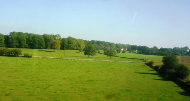
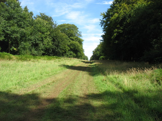
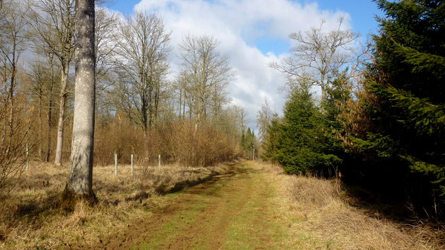
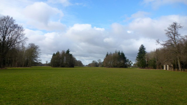
Beech Copse is a stunning woodland area located in Gloucestershire, England. Spread over an area of approximately 100 acres, it is known for its dense beech tree population, creating a captivating forest landscape that is a haven for nature enthusiasts.

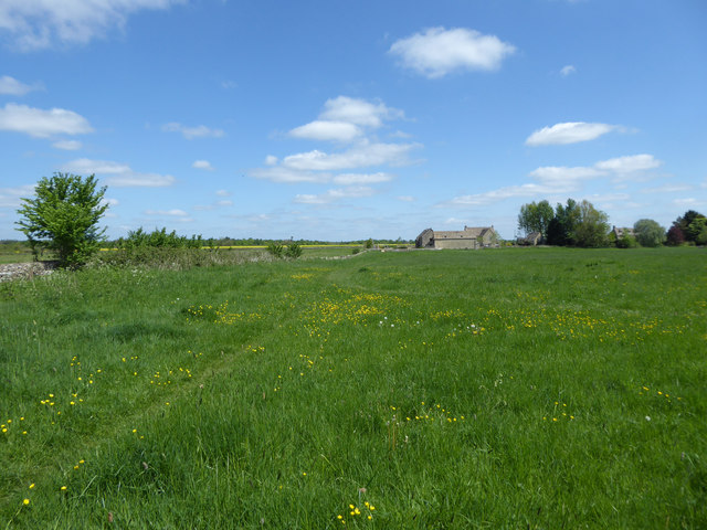
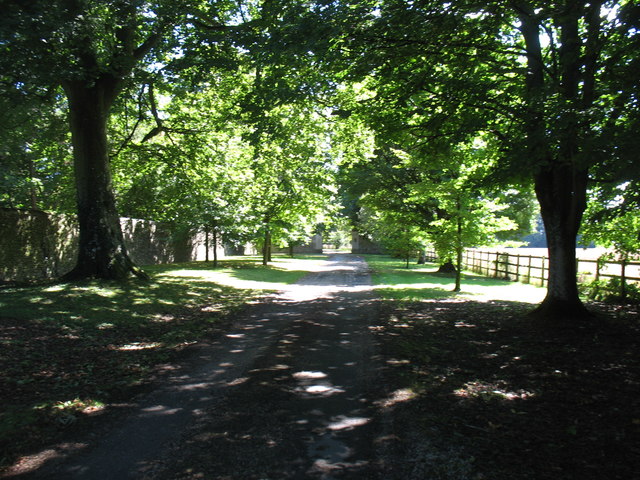
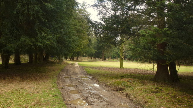
The copse is situated in a rural setting, surrounded by picturesque countryside, and is easily accessible by foot or bicycle through a network of well-maintained trails. The woodland is owned and managed by a local conservation organization, ensuring its preservation and protection for future generations.

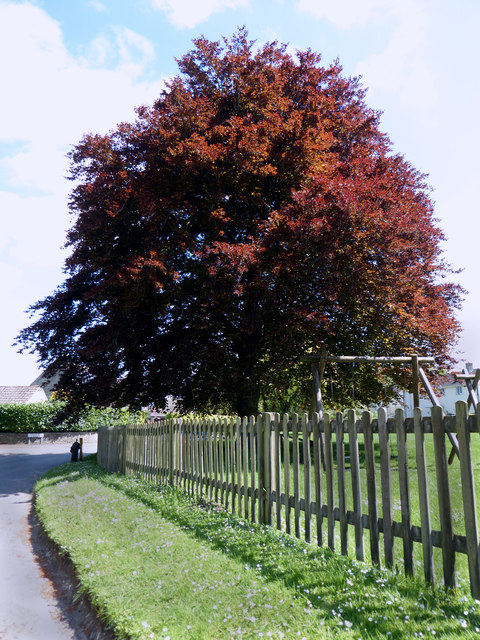
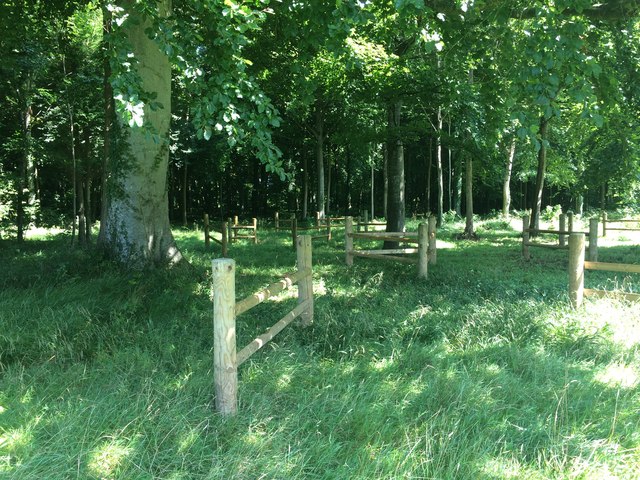
One of the most striking features of Beech Copse is the abundance of beech trees that dominate the landscape. These majestic trees, with their smooth silver-grey bark and vibrant green leaves, provide a tranquil and serene atmosphere. In autumn, the copse comes alive with a riot of colors as the beech leaves turn various shades of yellow, orange, and red, creating a breathtaking sight.

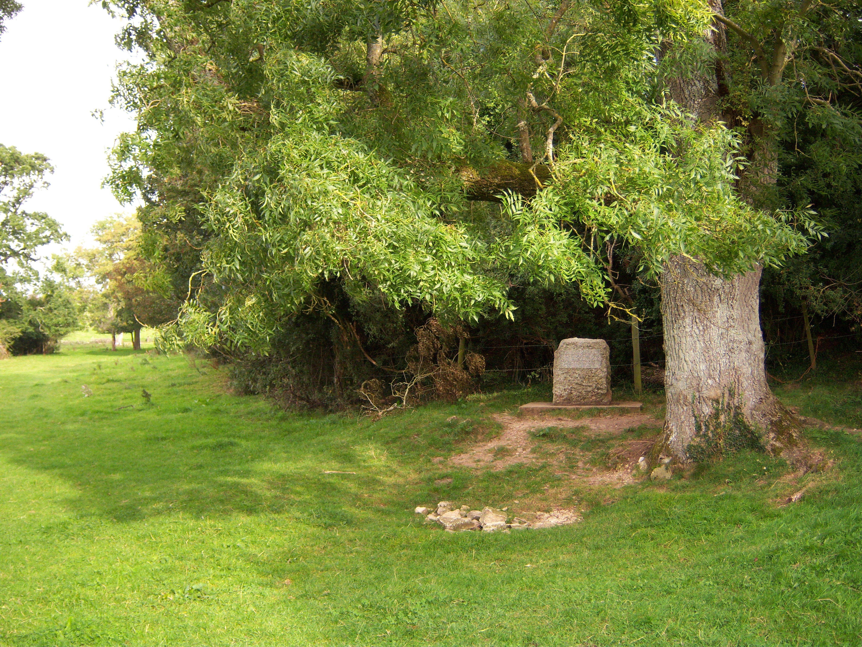
The woodland is also home to a diverse range of flora and fauna. Various species of wildflowers, such as bluebells and primroses, carpet the forest floor during spring, while ferns and mosses thrive in the shaded areas. The copse is a haven for birds, including woodpeckers, owls, and various songbirds, which can be heard singing their melodious tunes throughout the year.

Visitors to Beech Copse can enjoy a peaceful and serene environment, perfect for walking, hiking, or simply immersing oneself in nature. The copse offers a sense of tranquility and a chance to escape the hustle and bustle of everyday life, making it a popular destination for nature lovers and outdoor enthusiasts alike.

If you have any feedback on the listing, please let us know in the comments section below.
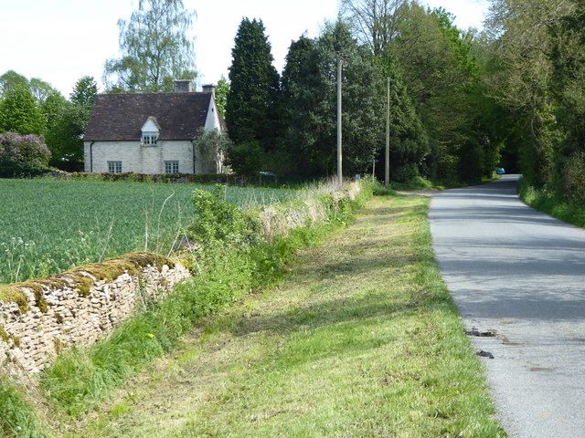
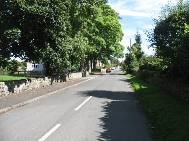
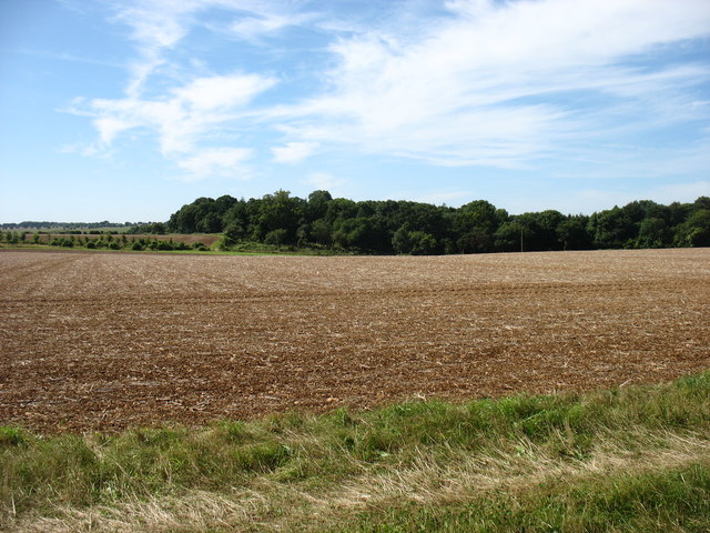
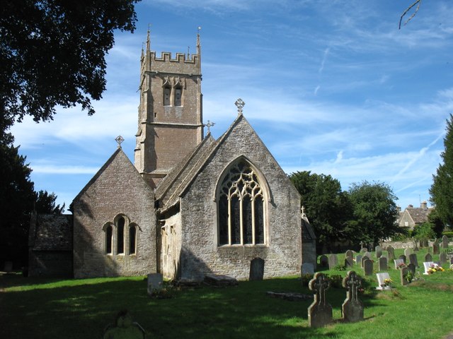
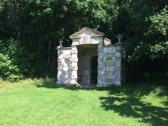
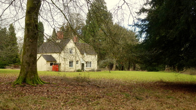
Beech Copse Images

Images are sourced within 2km of 51.716096/-2.0240529 or Grid Reference SO9801. Thanks to Geograph Open Source API. All images are credited.

Fields to west of Church Farm Viewed from railway line
Fields to west of Church Farm
Viewed from railway line
Village pump, Coates The village pump stands in the shade of a magnificent copper beech tree. See also <a href="https://www.geograph.org.uk/photo/1517887">SO9801 : Pump and hydrant, Quaker Row, Coates</a>.
Village pump, Coates
The village pump stands in the shade of a magnificent copper beech tree. See also SO9801 : Pump and hydrant, Quaker Row, Coates.
1-6 Bathurst Row, Coates Grade II Listed early to mid-19th century Cotswold stone cottages. The listing is for three identical pairs of cottages in a row (the others are outside the picture to the left). <span class="nowrap"><a title="http://www.britishlistedbuildings.co.uk/en-129299-1-6-bathurst-row-coates-gloucestershire#.Vzt9EpD2aUk" rel="nofollow ugc noopener" href="http://www.britishlistedbuildings.co.uk/en-129299-1-6-bathurst-row-coates-gloucestershire#.Vzt9EpD2aUk">Link</a><img style="margin-left:2px;" alt="External link" title="External link - shift click to open in new window" src="https://s1.geograph.org.uk/img/external.png" width="10" height="10"/></span> An ER postbox is set into the wall in front of the cottages. A public footpath to the right of the cottages leads to the fields.
1-6 Bathurst Row, Coates
Grade II Listed early to mid-19th century Cotswold stone cottages. The listing is for three identical pairs of cottages in a row (the others are outside the picture to the left). LinkExternal link An ER postbox is set into the wall in front of the cottages. A public footpath to the right of the cottages leads to the fields.
The Setts Buildings, Coates
Fosse Hill Lodge Cotswold stone house beside country lane. The Monarch's Way long distance footpath runs alongside the Lodge. <span class="nowrap"><a title="http://www.monarchsway.50megs.com/index.html" rel="nofollow ugc noopener" href="http://www.monarchsway.50megs.com/index.html">Link</a><img style="margin-left:2px;" alt="External link" title="External link - shift click to open in new window" src="https://s1.geograph.org.uk/img/external.png" width="10" height="10"/></span>
Fosse Hill Lodge
Cotswold stone house beside country lane. The Monarch's Way long distance footpath runs alongside the Lodge. LinkExternal link
Coates village Looking along the main street.
Coates village
Looking along the main street.
Fields and woods west of Coates
St Matthew's church, Coates
Overley Ride, Oakley Wood Within Cirencester Park. The land is private, but the public are allowed to walk, and ride horses, freely through the Park during the day. Dogs, however, are not permitted, a constraint which I find very reasonable and adds to my pleasure, though I know that many would disagree.
Overley Ride, Oakley Wood
Within Cirencester Park. The land is private, but the public are allowed to walk, and ride horses, freely through the Park during the day. Dogs, however, are not permitted, a constraint which I find very reasonable and adds to my pleasure, though I know that many would disagree.
The drive to Bledisloe
Coates church on the horizon Taken beside the road from Tarlton.
Coates church on the horizon
Taken beside the road from Tarlton.
Pope's Seat
Pope's Seat
Fences by Pope's Seat If anybody can give some information about these unusual fences please comment.
Fences by Pope's Seat
If anybody can give some information about these unusual fences please comment.
The Wood House Aptly-named (gamekeeper's?) cottage in the middle of Oakley Wood, part of the Earl of Bathurst's Cirencester Park Estate.
The Wood House
Aptly-named (gamekeeper's?) cottage in the middle of Oakley Wood, part of the Earl of Bathurst's Cirencester Park Estate.
Rutted track in Oakley Wood. Part of the Earl of Bathurst's Cirencester Park Estate.
Rutted track in Oakley Wood.
Part of the Earl of Bathurst's Cirencester Park Estate.
A ride in Oakley Wood Part of the Earl of Bathurst's Cirencester Park Estate.
A ride in Oakley Wood
Part of the Earl of Bathurst's Cirencester Park Estate.
Cirencester Park, 7 Looking west from just into the grid square (and myriad).
The wide area of the Broad Ride includes seven radiating rides and up ahead still further is the Polo field and events area. For example the Cotswold Show is held here every July. See <span class="nowrap"><a title="http://www.cotswoldshow.co.uk/" rel="nofollow ugc noopener" href="http://www.cotswoldshow.co.uk/">Link</a><img style="margin-left:2px;" alt="External link" title="External link - shift click to open in new window" src="https://s1.geograph.org.uk/img/external.png" width="10" height="10"/></span>
Cirencester Park, 7
Looking west from just into the grid square (and myriad). The wide area of the Broad Ride includes seven radiating rides and up ahead still further is the Polo field and events area. For example the Cotswold Show is held here every July. See LinkExternal link
Show me another place!

Beech Copse is located at Grid Ref: SO9801 (Lat: 51.716096, Lng: -2.0240529)

Administrative County: Gloucestershire

District: Cotswold

Police Authority: Gloucestershire

What 3 Words

///besotted.pulled.thumb. Near Coates, Gloucestershire

Related Wikis

Coates, Gloucestershire

Coates is a village and civil parish situated in Cotswold District, Gloucestershire, England. It is around 3 miles (4.8 km) west of Cirencester and close...

A419 road

The A419 road is a primary route between Chiseldon near Swindon at junction 15 of the M4 with the A346 road, and Whitminster in Gloucestershire, England...

Alfred's Hall

Alfred's Hall is a ruined folly in Cirencester Park, Gloucestershire, England. The Grade II* listed building dates from 1721 and is "probably the first...

Thames Head

Thames Head is a group of seasonal springs that arise near the village of Coates in the Cotswolds, about three miles south-west of the town of Cirencester...

Cirencester Deer Park School

Cirencester Deer Park School is a secondary school Park. == History == Founded in 1966, the school combined Cirencester Grammar School with the town's...

Cirencester College

Cirencester College is a sixth form college based in the town of Cirencester in the South Cotswolds. It is a specialist sixth form provider serving communities...

Cirencester Park

Cirencester Park is a cricket ground in Cirencester, Gloucestershire. The first recorded match on the ground was in 1853, when Cirencester played an All...

Sapperton Canal Tunnel

The Sapperton Canal Tunnel is a tunnel on the Thames and Severn Canal near Cirencester in Gloucestershire, England. With a length of 3,817 yards (3,490...

Nearby Amenities

Located within 500m of 51.716096,-2.0240529
The data included in this document is from www.openstreetmap.org. The data is made available under ODbL.

Have you been to Beech Copse?

Leave your review of Beech Copse below (or comments, questions and feedback).