Biggins Wood

Wood, Forest in Westmorland South Lakeland

England

Biggins Wood

Pit Lane near Biggins, Kirkby Lonsdale Looking northward in dawn sunlight.
Pit Lane near Biggins, Kirkby Lonsdale Credit: Peter Wood

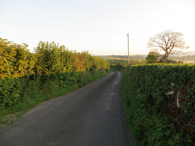
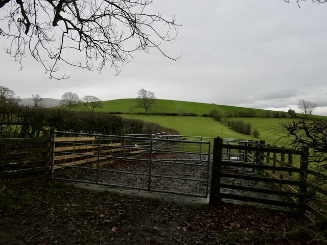
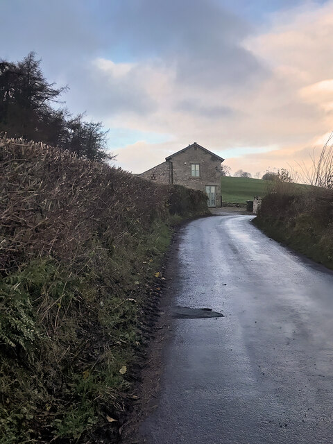
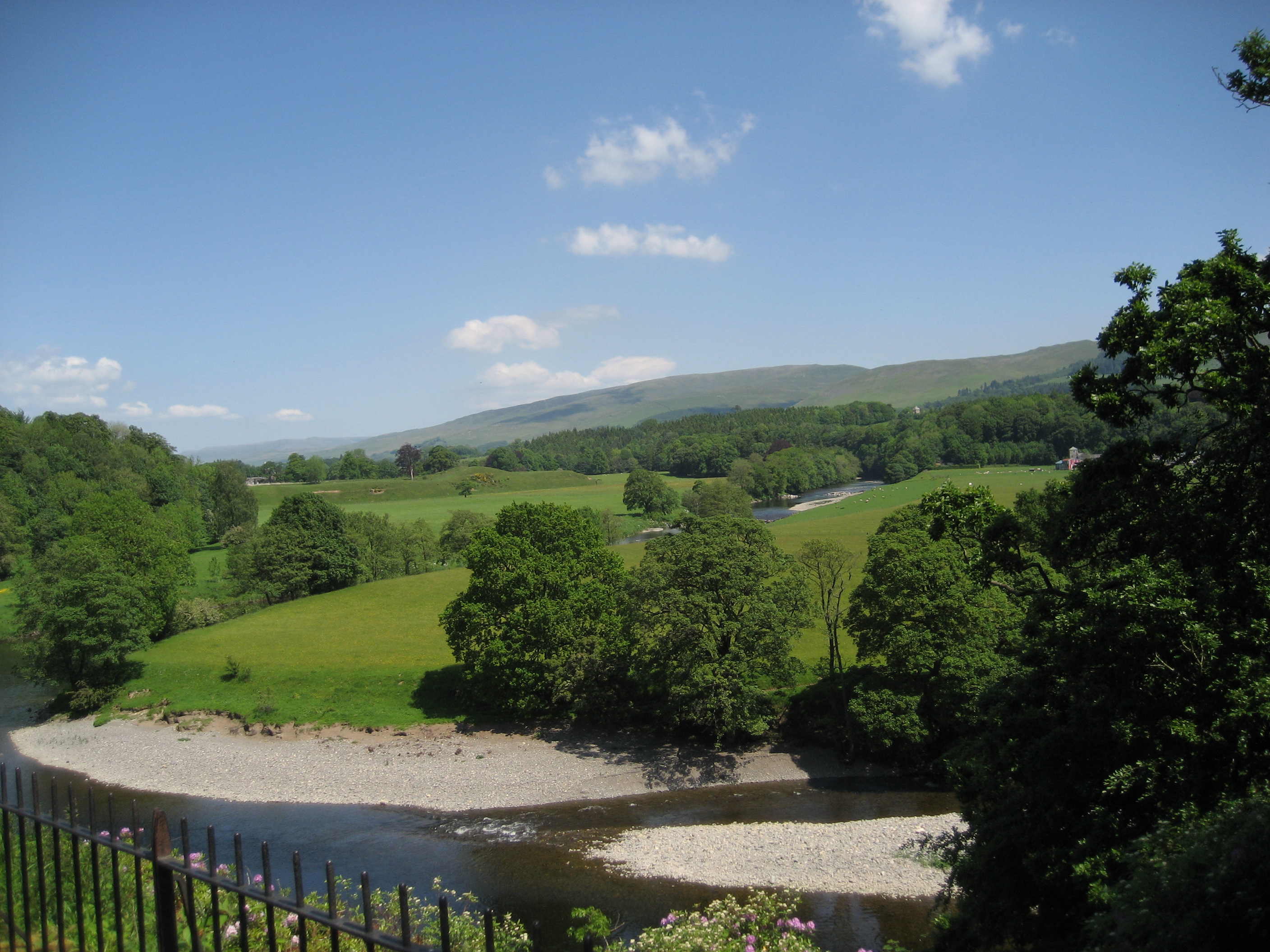
Biggins Wood is a picturesque woodland located in Westmorland, a historic county in northwestern England. Situated near the village of Biggins, the wood covers an area of approximately 100 acres and is an important natural habitat for various flora and fauna species.

The wood is predominantly composed of broadleaf trees, including oak, beech, and ash, which create a dense canopy, providing a shady and tranquil environment for visitors. The forest floor is covered in a rich carpet of bluebells during the spring season, creating a stunning spectacle and attracting nature enthusiasts and photographers.

Biggins Wood is known for its diverse wildlife population. The wood is home to numerous bird species, including woodpeckers, nuthatches, and owls, making it a haven for birdwatchers. The wood's dense undergrowth provides shelter for various mammals, such as deer, badgers, and foxes, which can occasionally be spotted by lucky visitors.

There are several well-maintained walking paths that wind their way through the wood, allowing visitors to explore its beauty at their own pace. These paths are suitable for all ages and offer a peaceful and serene experience in nature.

As an important ecological site, Biggins Wood is protected and managed by a local conservation organization. They work tirelessly to preserve the woodland's natural beauty, promote biodiversity, and ensure the sustainability of the ecosystem.

Overall, Biggins Wood in Westmorland is a cherished natural treasure, offering visitors a chance to immerse themselves in the beauty of a traditional English woodland, while also providing vital habitats for a range of plant and animal species.

If you have any feedback on the listing, please let us know in the comments section below.

Biggins Wood Images

Images are sourced within 2km of 54.196483/-2.5952102 or Grid Reference SD6178. Thanks to Geograph Open Source API. All images are credited.

Pit Lane near Biggins, Kirkby Lonsdale Looking northward in dawn sunlight.
Pit Lane near Biggins, Kirkby Lonsdale
Looking northward in dawn sunlight.
Dykes off Gallowber Road Limestone walls.
Dykes off Gallowber Road
Limestone walls.
Sheep pens, Hosticle Lane
Hosticle Lane Passing Hagg Wood.
Hosticle Lane
Passing Hagg Wood.
Hosticle Lane
Hosticle Lane
Footpath heading for Pit Lane Very short public footpath leading from the A65 towards Pit Lane, crossing the corner of a pasture.
Footpath heading for Pit Lane
Very short public footpath leading from the A65 towards Pit Lane, crossing the corner of a pasture.
Gallowber Lane
Gallowber Lane
Biggins, Pit Lane
Biggins, Pit Lane
Field off Biggins Lane
Biggins Lane
Biggins Lane
High Biggins Manor A modest country residence, recently rebuilt on the site of Biggins Home Farm. Also see <a href="https://www.geograph.org.uk/photo/4914896">SD5978 : High Biggins Manor</a> & <a href="https://www.geograph.org.uk/photo/5413193">SD5977 : Biggins Home Farm</a>.
High Biggins Manor
A modest country residence, recently rebuilt on the site of Biggins Home Farm. Also see SD5978 : High Biggins Manor & SD5977 : Biggins Home Farm.
The Devil's Bridge over the River Lune
Wandales Lane This was a Roman road.
Wandales Lane
This was a Roman road.
Field north of Well Lane Looking towards the settlement of High Casterton (the name of which probably relates to there being a Roman road nearby).
Field north of Well Lane
Looking towards the settlement of High Casterton (the name of which probably relates to there being a Roman road nearby).
Former railway bridge, Well Lane The railway was the LMS route one between the 'Little North Western' line at Clapham and their main line to Scotland at Lowgill, via Ingleton. It last saw regular trains in 1954 and the track was lifted in 1967. See <a href="https://www.geograph.org.uk/photo/390005">SD6278 : Disused railway bridge in High Casterton</a> for the other side.
Former railway bridge, Well Lane
The railway was the LMS route one between the 'Little North Western' line at Clapham and their main line to Scotland at Lowgill, via Ingleton. It last saw regular trains in 1954 and the track was lifted in 1967. See SD6278 : Disused railway bridge in High Casterton for the other side.
The Pheasant, Casterton
River Lune, Stanley Bridge at Kirkby Lonsdale The bridge carrying the A65 over the River Lune at Kirkby Lonsdale was commissioned by Westmorland County Council and was opened by the Mayor of Kirkby Lonsdale, Oliver Stanley, on 3rd December 1932 to replace the mediæval bridge which is approximately 100 metres further upstream. The bridge is named for the mayor.
River Lune, Stanley Bridge at Kirkby Lonsdale
The bridge carrying the A65 over the River Lune at Kirkby Lonsdale was commissioned by Westmorland County Council and was opened by the Mayor of Kirkby Lonsdale, Oliver Stanley, on 3rd December 1932 to replace the mediæval bridge which is approximately 100 metres further upstream. The bridge is named for the mayor.
River Lune at Kirkby Lonsdale Looking upstream from Devil's Bridge
River Lune at Kirkby Lonsdale
Looking upstream from Devil's Bridge
Show me another place!

Biggins Wood is located at Grid Ref: SD6178 (Lat: 54.196483, Lng: -2.5952102)

Administrative County: Cumbria

District: South Lakeland

Police Authority: Cumbria

What 3 Words

///estimates.condensed.torched. Near Kirkby Lonsdale, Cumbria

Related Wikis

Kirkby Lonsdale

Kirkby Lonsdale () is a town and civil parish in the Westmorland and Furness district of Cumbria, England, on the River Lune. Historically in Westmorland...

St Mary's Church, Kirkby Lonsdale

St Mary's Church is in the town of Kirkby Lonsdale, Cumbria, England. It is an active Anglican parish church in the deanery of Kendal, the archdeaconry...

Queen Elizabeth School, Kirkby Lonsdale

Queen Elizabeth School, also abbreviated to as QES, is a coeducational, comprehensive secondary school and sixth form with academy status. It is located...

Kirkby Lonsdale railway station

Kirkby Lonsdale railway station was located in Lancashire, England, on the Ingleton Branch Line, 2 miles (3 km) from the town of Kirkby Lonsdale in Westmorland...

Nearby Amenities

Located within 500m of 54.196483,-2.5952102
Speed Camera
Lat/Long: 54.1983516/-2.5934043
Post Box
Brand: Royal Mail
Brand Wikidata: Q638098
Brand Wikipedia: en:Royal Mail
Collection Times: Mo-Fr 09:00; Sa 07:00
Operator: Royal Mail
Operator Wikidata: Q638098
Post Box Type: wall
Ref: LA6 141
Royal Cypher: GR
Royal Cypher Wikidata: Q33102273
Lat/Long: 54.1984809/-2.5947736
Barrier: bollard
Bicycle: yes
Bollard: fixed
Foot: yes
Lat/Long: 54.1984642/-2.5910744
Barrier: bollard
Bicycle: yes
Bollard: fixed
Foot: yes
Lat/Long: 54.1983761/-2.5903503
Bench
Backrest: yes
Check Date: 2022-06-05
Note: Quite Low
Lat/Long: 54.1987562/-2.5911141
Barrier: kissing_gate
Lat/Long: 54.1985845/-2.5913499
Toilets
Access: yes
Changing Table: yes
Fee: yes
Fixme: Light in disabled toilet not working-06/09/2019- This has not been fixed-18/10/2019- Light still not working 17/12/2019
Unisex: yes
Wheelchair: yes
Lat/Long: 54.1987075/-2.5920605
Barrier: stile
Material: stone
Source: survey;gps
Stile: squeezer
Lat/Long: 54.2002281/-2.5931468
Bench
Backrest: yes
Lat/Long: 54.1996791/-2.5930705
Bench
Backrest: yes
Lat/Long: 54.2001675/-2.5931181
Bench
Backrest: yes
Lat/Long: 54.1996412/-2.5953523
Lune - Access/Egress
Sport: canoe
Lat/Long: 54.1982865/-2.5903702
Barrier: entrance
Lat/Long: 54.1972512/-2.5916828
Barrier: kissing_gate
Source: survey;gps
Lat/Long: 54.1980343/-2.5928931
Barrier: stile
Material: stone
Stile: squeezer
Lat/Long: 54.19846/-2.5914343
Cherry Tree House
Addr Housename: Cherry Tree House
Building: house
Lat/Long: 54.1994165/-2.5944117
The Book Lounge
Addr City: Kirkby Lonsdale
Addr Housenumber: 12
Addr Postcode: LA6 2AE
Addr Street: Main Street
Internet Access: wlan
Opening Hours: Mo-Sa 10:00-17:00; Su 11:00-16:00
Payment Cash: yes
Payment Coins: yes
Payment Credit Cards: yes
Payment Debit Cards: yes
Phone: +44 15242 73747
Shop: books
Website: https://thebooklounge.shop
Lat/Long: 54.2008976/-2.5966336
Addr City: Kirkby Lonsdale
Addr Housenumber: 1
Addr Street: Main Street
Lat/Long: 54.2006971/-2.5961894
Addr Housenumber: 1-4
Addr Street: Green Square
Lat/Long: 54.2000495/-2.5955446
Addr Housenumber: 11-16
Addr Street: Green Square
Lat/Long: 54.2004243/-2.5954769
Addr Housenumber: 17-20
Addr Street: Green Square
Lat/Long: 54.2004439/-2.5958309
Addr City: Kirkby Lonsdale
Addr Housenumber: 5
Addr Street: Main Street
Lat/Long: 54.2007525/-2.5962029
Addr Housenumber: 5-10
Addr Street: Green Square
Lat/Long: 54.2002479/-2.595333
Addr City: Kirkby Lonsdale
Addr Housenumber: 7
Addr Street: Main Street
Lat/Long: 54.2008105/-2.5962255
Addr Housenumber: 8
Lat/Long: 54.200498/-2.5960451
Addr City: Kirkby Lonsdale
Addr Housenumber: 9
Addr Street: Main Street
Lat/Long: 54.2008831/-2.5963427
Lunefield
Power: substation
Lat/Long: 54.199795/-2.5953529
Milestone
Man Made: milestone
Lat/Long: 54.200573/-2.5961757
Wyck House
Addr City: Kirkby Lonsdale
Addr Housenumber: 4
Addr Postcode: LA6 2AE
Addr Street: Main Street
Phone: +44 15242 71953
Tourism: guest_house
Lat/Long: 54.2006602/-2.5964419
Bench
Backrest: yes
Lat/Long: 54.1995813/-2.5951951
Bus Stop
Lunefield Drive
Bench: no
Bin: no
Bus: yes
Lit: yes
Naptan AtcoCode: 090079405090
Naptan Bearing: S
Naptan BusStopType: MKD
Naptan CommonName: Lunefield Drive
Naptan Indicator: at
Naptan Landmark: Lunefield Drive
Naptan LocalityCode: E0044902
Naptan Street: Main Street
Naptan Verified: no
Public Transport: platform
Shelter: no
Source: survey
Tactile Paving: no
Lat/Long: 54.199737/-2.595486
Bus Stop
Lunefield Drive
Bench: no
Bin: no
Bus: yes
Check Date Shelter: 2022-04-02
Lit: yes
Naptan AtcoCode: 090079405064
Naptan Bearing: N
Naptan BusStopType: MKD
Naptan CommonName: Lunefield Drive
Naptan Indicator: opp
Naptan Landmark: Near number 2
Naptan LocalityCode: E0044902
Naptan Street: Main Street
Naptan Verified: no
Public Transport: platform
Shelter: no
Source: survey
Tactile Paving: no
Lat/Long: 54.1999598/-2.5958467
Building: house
Lat/Long: 54.2006707/-2.5961105
Kerb: no
Lat/Long: 54.1985091/-2.5914337
Barrier: kissing_gate
Source: survey;gps
Lat/Long: 54.197501/-2.602234
Barrier: kissing_gate
Source: survey;gps
Lat/Long: 54.1974953/-2.6007797
Barrier: kissing_gate
Source: survey;gps
Lat/Long: 54.1977068/-2.5944929
Barrier: kissing_gate
Source: survey;gps
Lat/Long: 54.1978287/-2.5938464
Barrier: kissing_gate
Source: survey;gps
Lat/Long: 54.1979708/-2.5931619
Give Way
Direction: backward
Lat/Long: 54.1983575/-2.5948185
Davis and Bowring
Addr City: Kirkby Lonsdale
Addr Housenumber: 6-8
Addr Postcode: LA6 2AE
Addr Street: Main Street
Office: estate_agent
Phone: +44 15242 74445
Website: https://www.davis-bowring.co.uk/
Lat/Long: 54.2007398/-2.5964919
Lunefield Drive
Bus: yes
Public Transport: stop_position
Lat/Long: 54.1997324/-2.5956068
Give Way
Direction: forward
Lat/Long: 54.1972905/-2.5899403
Give Way
Direction: forward
Lat/Long: 54.1983296/-2.5898058
Lunefield Drive
Bus: yes
Public Transport: stop_position
Lat/Long: 54.1999743/-2.5957742
Bench
Backrest: yes
Lat/Long: 54.1999872/-2.5975099
Give Way
Direction: backward
Lat/Long: 54.2000202/-2.5978064
Give Way
Direction: forward
Lat/Long: 54.1999031/-2.5972436
Parking
Access: yes
Capacity: 5
Fee: no
Park Ride: no
Parking: surface
Supervised: no
Surface: asphalt
Lat/Long: 54.1996543/-2.5964204
Crossing
Crossing: uncontrolled
Crossing Island: yes
Kerb: flush
Tactile Paving: no
Lat/Long: 54.1996364/-2.5960107
Give Way
Direction: forward
Lat/Long: 54.1996005/-2.5956015
Crossing
Crossing: uncontrolled
Crossing Island: yes
Kerb: flush
Tactile Paving: no
Lat/Long: 54.1996294/-2.5955958
Give Way
Direction: backward
Lat/Long: 54.1998921/-2.5956481
Give Way
Direction: forward
Lat/Long: 54.1993682/-2.5950372
Give Way
Direction: backward
Lat/Long: 54.198999/-2.5939626
Barrier: kissing_gate
Lat/Long: 54.1971831/-2.5901406
Speed Camera
Lat/Long: 54.1972196/-2.5891951
Barrier: kissing_gate
Lat/Long: 54.1971069/-2.5886899
Noexit: yes
Lat/Long: 54.2006729/-2.5957641
Pipeline: manhole
Lat/Long: 54.1936337/-2.5965625
Pipeline: manhole
Lat/Long: 54.1934349/-2.5963033
Pipeline: manhole
Lat/Long: 54.1968654/-2.6003282
Generator Method: photovoltaic
Generator Orientation: south
Generator Output Electricity: yes
Generator Solar Modules: 8
Generator Source: solar
Generator Type: solar_photovoltaic_panel
Location: roof
Power: generator
Lat/Long: 54.1999982/-2.5934081
Generator Method: photovoltaic
Generator Orientation: south
Generator Output Electricity: yes
Generator Solar Modules: 8
Generator Source: solar
Generator Type: solar_photovoltaic_panel
Location: roof
Power: generator
Lat/Long: 54.2000301/-2.5933142
Generator Method: photovoltaic
Generator Orientation: south_east
Generator Output Electricity: yes
Generator Solar Modules: 8
Generator Source: solar
Generator Type: solar_photovoltaic_panel
Location: roof
Power: generator
Lat/Long: 54.1999122/-2.5935174
Generator Method: photovoltaic
Generator Orientation: south_east
Generator Output Electricity: yes
Generator Solar Modules: 8
Generator Source: solar
Generator Type: solar_photovoltaic_panel
Location: roof
Power: generator
Lat/Long: 54.1998611/-2.593582
Generator Method: photovoltaic
Generator Orientation: south_east
Generator Output Electricity: yes
Generator Solar Modules: 8
Generator Source: solar
Generator Type: solar_photovoltaic_panel
Location: roof
Power: generator
Lat/Long: 54.1997877/-2.5936861
Generator Method: photovoltaic
Generator Orientation: south_east
Generator Output Electricity: yes
Generator Solar Modules: 8
Generator Source: solar
Generator Type: solar_photovoltaic_panel
Location: roof
Power: generator
Lat/Long: 54.1997366/-2.5937507
Generator Method: photovoltaic
Generator Orientation: west
Generator Output Electricity: yes
Generator Solar Modules: 8
Generator Source: solar
Generator Type: solar_photovoltaic_panel
Location: roof
Power: generator
Lat/Long: 54.1998789/-2.5945305
Generator Method: photovoltaic
Generator Orientation: west
Generator Output Electricity: yes
Generator Solar Modules: 8
Generator Source: solar
Generator Type: solar_photovoltaic_panel
Location: roof
Power: generator
Lat/Long: 54.1998236/-2.5944767
Generator Method: photovoltaic
Generator Orientation: west
Generator Output Electricity: yes
Generator Solar Modules: 8
Generator Source: solar
Generator Type: solar_photovoltaic_panel
Location: roof
Power: generator
Lat/Long: 54.1996822/-2.5943523
Generator Method: photovoltaic
Generator Orientation: south
Generator Output Electricity: yes
Generator Solar Modules: 8
Generator Source: solar
Generator Type: solar_photovoltaic_panel
Location: roof
Power: generator
Lat/Long: 54.1996772/-2.5940017
Generator Method: photovoltaic
Generator Orientation: west
Generator Output Electricity: yes
Generator Solar Modules: 15
Generator Source: solar
Generator Type: solar_photovoltaic_panel
Location: roof
Power: generator
Lat/Long: 54.2008895/-2.5944984
Generator Method: photovoltaic
Generator Orientation: west
Generator Output Electricity: yes
Generator Solar Modules: 5
Generator Source: solar
Generator Type: solar_photovoltaic_panel
Location: roof
Power: generator
Lat/Long: 54.2006789/-2.5931262
Generator Method: photovoltaic
Generator Orientation: east
Generator Output Electricity: yes
Generator Solar Modules: 7
Generator Source: solar
Generator Type: solar_photovoltaic_panel
Location: roof
Power: generator
Lat/Long: 54.2006892/-2.5930748
Generator Method: photovoltaic
Generator Orientation: west
Generator Output Electricity: yes
Generator Solar Modules: 8
Generator Source: solar
Generator Type: solar_photovoltaic_panel
Location: roof
Power: generator
Lat/Long: 54.200422/-2.5962752
Generator Method: photovoltaic
Generator Orientation: east
Generator Output Electricity: yes
Generator Solar Modules: 8
Generator Source: solar
Generator Type: solar_photovoltaic_panel
Location: roof
Power: generator
Lat/Long: 54.2004332/-2.5962304
Motor Bike Meet Devil's Bridge
Name De: Motorradtreff Devil's Bridge
Source: https://bitaboutbritain.com/kirkby-lonsdales-devils-bridge/
Lat/Long: 54.1983759/-2.5899039
Information: guidepost
Tourism: information
Lat/Long: 54.1974007/-2.5917239
Barrier: stile
Material: wood
Stile: stepover
Lat/Long: 54.1965988/-2.5881187
The data included in this document is from www.openstreetmap.org. The data is made available under ODbL.

Have you been to Biggins Wood?

Leave your review of Biggins Wood below (or comments, questions and feedback).