Foxleaze Withy Bed

Wood, Forest in Dorset

England

Foxleaze Withy Bed

Sheep and lambs near Compton Valence Chalky downland, springtime.
Sheep and lambs near Compton Valence Credit: Sheila Russell

Foxleaze Withy Bed is a picturesque woodland located in the county of Dorset, England. Spanning over an area of approximately 10 acres, it is a designated Site of Special Scientific Interest (SSSI) due to its unique ecological features and diverse flora and fauna.

The woodland is characterized by its dense canopy of predominantly native tree species, including oak, birch, beech, and hazel. These trees provide a rich habitat for a wide variety of wildlife, including birds, mammals, and insects. The forest floor is covered with a thick carpet of moss, ferns, and wildflowers, adding to the enchanting atmosphere of the woodland.

Foxleaze Withy Bed is also known for its abundance of withy beds, which are areas where willow trees are cultivated for various purposes. Withy beds were traditionally used for basket weaving and the production of withies (flexible willow stems). This cultural heritage can still be observed in the woodland, as some local artisans continue to practice the ancient craft of basket making.

The woodland is a popular destination for nature enthusiasts, hikers, and photographers. A network of well-maintained trails and footpaths allows visitors to explore the wood, providing opportunities to spot wildlife and appreciate the natural beauty. The tranquil atmosphere and serene surroundings make it an ideal place for relaxation and contemplation.

Overall, Foxleaze Withy Bed is a cherished natural gem in Dorset, offering a glimpse into the region's rich biodiversity and cultural history. It serves as a haven for both wildlife and humans, providing a peaceful escape from the hustle and bustle of everyday life.

If you have any feedback on the listing, please let us know in the comments section below.

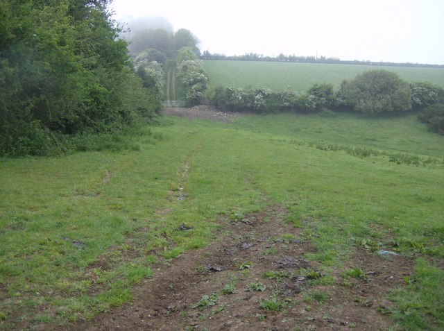
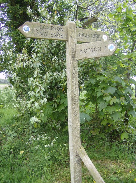
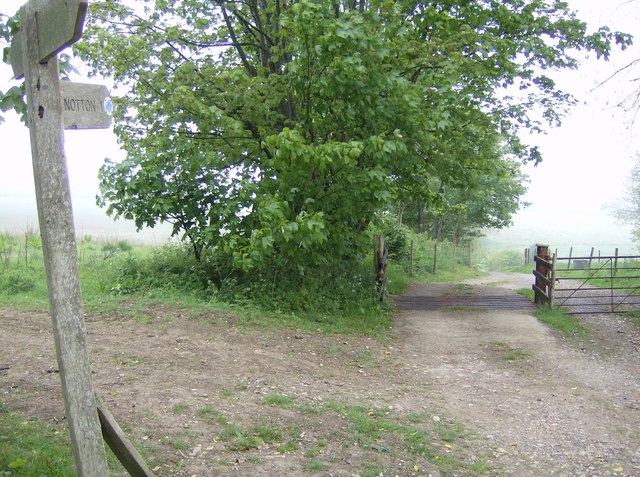
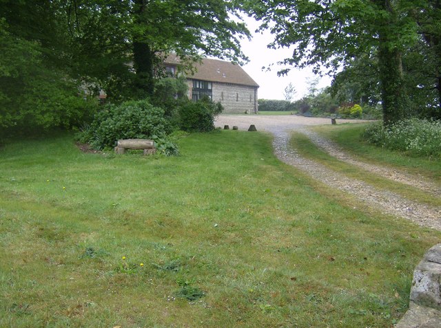
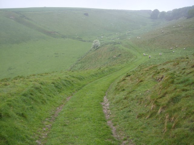
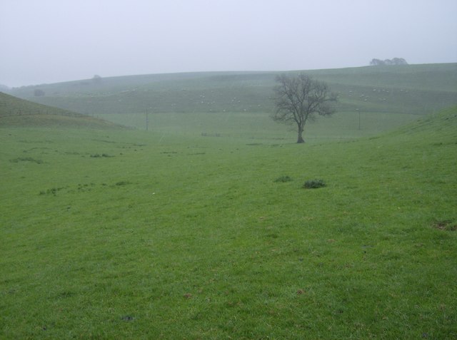
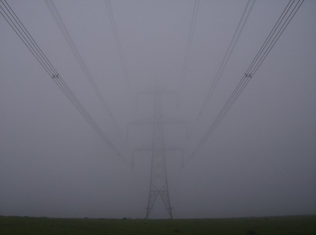
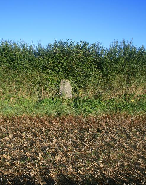
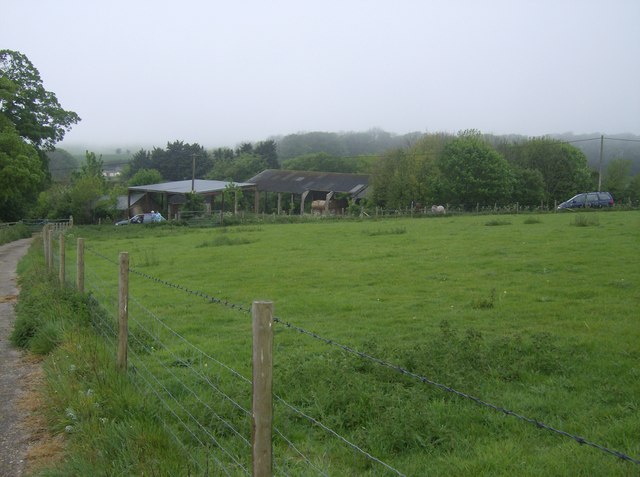
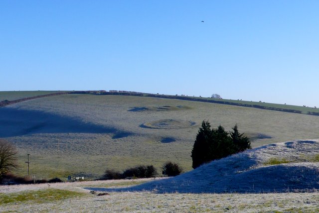
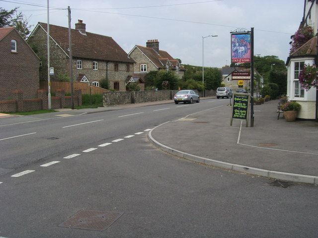
Foxleaze Withy Bed Images

Images are sourced within 2km of 50.735824/-2.5673772 or Grid Reference SY6093. Thanks to Geograph Open Source API. All images are credited.

Sheep and lambs near Compton Valence Chalky downland, springtime.
Sheep and lambs near Compton Valence
Chalky downland, springtime.
Roman Road near Compton Valence This minor road follows the Roman route from Durnovaria (Dorchester - on the outskirts of Poundbury) to Eggardon Hill near Powerstock. The picture shows that it is not quite as straight as it is shown on the map.
Roman Road near Compton Valence
This minor road follows the Roman route from Durnovaria (Dorchester - on the outskirts of Poundbury) to Eggardon Hill near Powerstock. The picture shows that it is not quite as straight as it is shown on the map.
Power pylons near Kingston Russell, looking west. The power pylons are about the most prominent feature in this square, both on the map and on the ground, so this picture is hereby offered as a representative Geograph!. 
Although pylons can detract from an otherwise idyllic view, they can also look quite impressive and striking, especially close-up. This one was making fearsome fizzing noises in the dewy morning air.
Power pylons near Kingston Russell, looking west.
The power pylons are about the most prominent feature in this square, both on the map and on the ground, so this picture is hereby offered as a representative Geograph!. Although pylons can detract from an otherwise idyllic view, they can also look quite impressive and striking, especially close-up. This one was making fearsome fizzing noises in the dewy morning air.
Footpath towards Notton Hill Barn Looking north, this footpath crosses the eastern part of the square.  Here looking north across an east-west dry valley to the right where another footpath comes up to join us.  Notton Hill Barn is about 200 metres further along the track in the distance.
Footpath towards Notton Hill Barn
Looking north, this footpath crosses the eastern part of the square. Here looking north across an east-west dry valley to the right where another footpath comes up to join us. Notton Hill Barn is about 200 metres further along the track in the distance.
Footpath here somewhere In appalling weather conditions (Bank Holiday Monday) this is the line of the footpath running from a minor road (roman road) towards Compton Valence.  It skirts to the right hand side of this field of barley.  Looking north.
Footpath here somewhere
In appalling weather conditions (Bank Holiday Monday) this is the line of the footpath running from a minor road (roman road) towards Compton Valence. It skirts to the right hand side of this field of barley. Looking north.
Signpost at SY599948 Dorset County footpath signposts have the grid reference marked on them.  Useful to confirm where you are, in this case easy to position on Geograph at SY599948.
Signpost at SY599948
Dorset County footpath signposts have the grid reference marked on them. Useful to confirm where you are, in this case easy to position on Geograph at SY599948.
View from SY599948 The signpost helpfully displays a grid reference on the other side.  This would be a view in better weather.  Choice of paths here.
View from SY599948
The signpost helpfully displays a grid reference on the other side. This would be a view in better weather. Choice of paths here.
Notton Hill Barn Now converted into a private residence.
Notton Hill Barn
Now converted into a private residence.
Descent to Compton Valence The Macmillan Way path descends into the Compton Valence valley in typical downland scenery, if you can see it through the lashing rain and heading directly into a strong south-westerly wind.
Descent to Compton Valence
The Macmillan Way path descends into the Compton Valence valley in typical downland scenery, if you can see it through the lashing rain and heading directly into a strong south-westerly wind.
Lone tree on the descent to Compton Valence A bleak landscape in wet weather, but beautiful when dry.  The excitement is enlivened by this lone tree.
Lone tree on the descent to Compton Valence
A bleak landscape in wet weather, but beautiful when dry. The excitement is enlivened by this lone tree.
Entering Compton Valence The descent from the downs to the north enters Compton Valence on an easy-walking farm track and arrives at this gate at the end of the village.
Entering Compton Valence
The descent from the downs to the north enters Compton Valence on an easy-walking farm track and arrives at this gate at the end of the village.
Compton Valence Church The small church was substantially rebuilt in 1838 by Benjamin Ferrey using Dorset and Ham stone.  The parish has a population of just 63 (2001 census).  Link here: <span class="nowrap"><a title="http://www.thedorsetpage.com/locations/place/C330.htm" rel="nofollow ugc noopener" href="http://www.thedorsetpage.com/locations/place/C330.htm">Link</a><img style="margin-left:2px;" alt="External link" title="External link - shift click to open in new window" src="https://s1.geograph.org.uk/img/external.png" width="10" height="10"/></span>
Compton Valence Church
The small church was substantially rebuilt in 1838 by Benjamin Ferrey using Dorset and Ham stone. The parish has a population of just 63 (2001 census). Link here: LinkExternal link
Pond at Compton Valence House Although the house cannot be seen, this attractive pond in the grounds is adjacent to the footpath that climbs south from the village.
Pond at Compton Valence House
Although the house cannot be seen, this attractive pond in the grounds is adjacent to the footpath that climbs south from the village.
Track above Tout Hill The Macmillan Way ascends this track above Tout Hill out of Compton Valence.
Track above Tout Hill
The Macmillan Way ascends this track above Tout Hill out of Compton Valence.
Above Tout Hill The footpath above Tout Hill is very overgrown.  There are tantalising views eastwards, or there would be on a fine day!
Above Tout Hill
The footpath above Tout Hill is very overgrown. There are tantalising views eastwards, or there would be on a fine day!
The power of mist On the ridge between Compton Valence and Kingston Russell a three-way intersection occurs.  The Macmillan Way (a 290-mile coast to coast walk from Lincolnshire to Dorset) crosses the Jubilee Way (a 90-mile regional path within Dorset).  Neither is seen here, but overhead runs a high voltage power line running east-west across most of Dorset from Weymouth to Exeter.  Here it appears surreally out of the mist.
The power of mist
On the ridge between Compton Valence and Kingston Russell a three-way intersection occurs. The Macmillan Way (a 290-mile coast to coast walk from Lincolnshire to Dorset) crosses the Jubilee Way (a 90-mile regional path within Dorset). Neither is seen here, but overhead runs a high voltage power line running east-west across most of Dorset from Weymouth to Exeter. Here it appears surreally out of the mist.
Compton Valence: parish church of St. Thomas à Becket Like many Dorset churches, the tower is 15th-century and the remainder was rebuilt in the 19th.
Compton Valence: parish church of St. Thomas à Becket
Like many Dorset churches, the tower is 15th-century and the remainder was rebuilt in the 19th.
Trig pillar Trig pillar above Compton Valence.  The use of GPS technology means that trig pillars are little used today - as can clearly be seen in this case.
Trig pillar
Trig pillar above Compton Valence. The use of GPS technology means that trig pillars are little used today - as can clearly be seen in this case.
Show me another place!

Foxleaze Withy Bed is located at Grid Ref: SY6093 (Lat: 50.735824, Lng: -2.5673772)

Unitary Authority: Dorset

Police Authority: Dorset

What 3 Words

///knees.body.presides. Near Maiden Newton, Dorset

Related Wikis

Compton Valence

Compton Valence is a small village and civil parish in the county of Dorset in southern England. It lies approximately 7 miles (11 km) west of the county...

Kingston Russell

Kingston Russell is a settlement and civil parish 7 miles (11 km) west of Dorchester, in the Dorset district, in the county of Dorset, England. In 2001...

Poor Lot Barrow Cemetery

Poor Lot Barrow Cemetery is an archaeological site, a group of Bronze Age round barrows, near the A35 road about 2 miles (3.2 km) west of Winterbourne...

Nunnery Mead

Nunnery Mead is a nature reserve of the Dorset Wildlife Trust, near Frampton and about 2 miles south-east of Maiden Newton, in Dorset, England. It is a...

Nine Stones, Winterbourne Abbas

The Nine Stones, also known as the Devil's Nine Stones, the Nine Ladies, or Lady Williams and her Dog, is a stone circle located near to the village of...

Eggerton Hundred

Eggerton Hundred or Eggardon Hundred was a hundred in the county of Dorset, England, containing the following parishes: Askerswell Hooke Long Bredy Powerstock...

Winterbourne Abbas

Winterbourne Abbas is a village and civil parish in south west Dorset, England, situated in a valley on the A35 road 5 miles (8.0 km) west of Dorchester...

Frampton, Dorset

Frampton is a village and civil parish in the county of Dorset in southern England, situated approximately 5 miles (8.0 km) northwest of the county town...

Have you been to Foxleaze Withy Bed?

Leave your review of Foxleaze Withy Bed below (or comments, questions and feedback).