Melling Green

Wood, Forest in Lancashire Lancaster

England

Melling Green

Lune Valley Ramble This lovely trail continues northwards from here. It is clearly well rambled, and deserves to be. It passes through glorious woodland, which today were full of a marvellous variety of trees, wildflowers and wildlife. We must preserve these woodlands, not cut them down to make more room for yet more roads and building developments.
Lune Valley Ramble Credit: Andrew Shannon

Melling Green is a small village located in the county of Lancashire, England. Situated in the Wood area of the Forest district, it is surrounded by lush greenery and picturesque landscapes. The village is known for its rural charm and tranquil atmosphere, making it an ideal destination for those seeking a peaceful retreat.

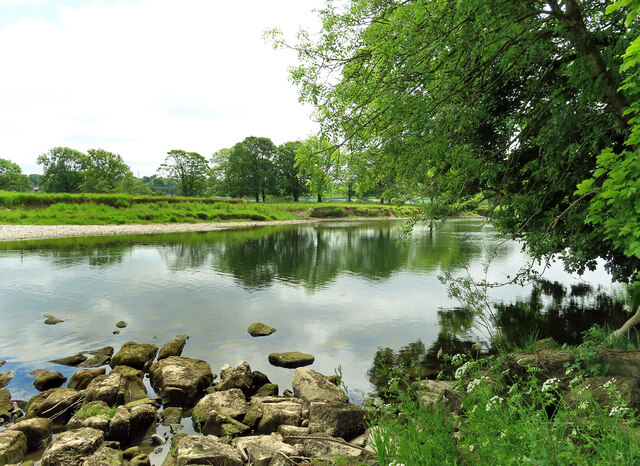
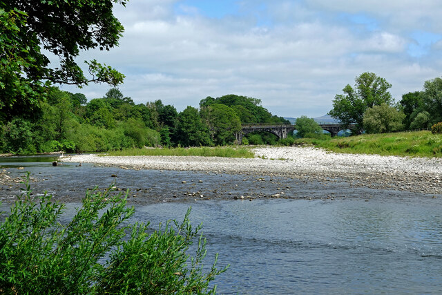
Melling Green is home to a close-knit community of residents who take pride in their village and its natural surroundings. The area is characterized by rolling hills, dense woodlands, and open fields, providing ample opportunities for outdoor activities such as hiking, cycling, and bird-watching.

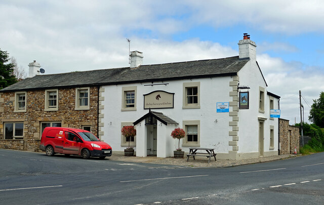
The village itself is relatively small, with a handful of traditional stone houses and cottages scattered throughout. There is a quaint village hall which serves as a gathering place for community events and social activities. The local pub, known for its warm hospitality and traditional British fare, is a popular spot for both locals and visitors alike.

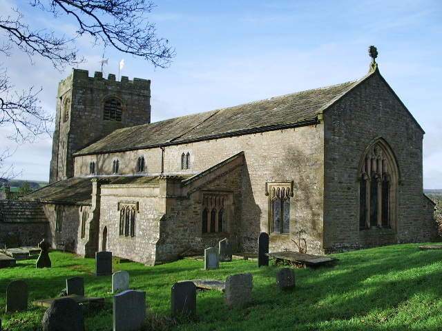
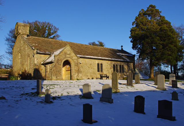
Melling Green is also rich in history, with several historic landmarks and buildings to explore. The village church, dating back several centuries, is a prominent feature and is known for its beautiful stained glass windows and intricate architectural details.

In terms of amenities, Melling Green has limited facilities within the village itself, with the nearest shops, schools, and medical services located in the nearby towns. However, the village's peaceful and rural setting more than compensates for any lack of amenities, attracting those seeking a slower pace of life and a closer connection to nature.

If you have any feedback on the listing, please let us know in the comments section below.

Melling Green Images

Images are sourced within 2km of 54.133124/-2.6177014 or Grid Reference SD5970. Thanks to Geograph Open Source API. All images are credited.

Lune Valley Ramble This lovely trail continues northwards from here. It is clearly well rambled, and deserves to be. It passes through glorious woodland, which today were full of a marvellous variety of trees, wildflowers and wildlife. We must preserve these woodlands, not cut them down to make more room for yet more roads and building developments.
Lune Valley Ramble
This lovely trail continues northwards from here. It is clearly well rambled, and deserves to be. It passes through glorious woodland, which today were full of a marvellous variety of trees, wildflowers and wildlife. We must preserve these woodlands, not cut them down to make more room for yet more roads and building developments.
The Bay Horse Inn at Arkholme Located on the B6254 on the edge of the village.
The Bay Horse Inn at Arkholme
Located on the B6254 on the edge of the village.
A River Lune View Looking downstream from the riverside footpath at Arkholme.
A River Lune View
Looking downstream from the riverside footpath at Arkholme.
River Lune near Arkholme Looking upstream from the Lune Valley Ramble path towards the railway viaduct, which lies in the next square.
River Lune near Arkholme
Looking upstream from the Lune Valley Ramble path towards the railway viaduct, which lies in the next square.
Ford at Melling This ford is found on Vicar Lane at Melling.
Ford at Melling
This ford is found on Vicar Lane at Melling.
Old Milestone by the A683, Main Street, Melling Carved stone post by the A683, in parish of MELLING WITH WRAYTON (LANCASTER District), Main Street at junction with road to Bentham, 100m from Church, opposite Crow Tree Farmhouse, on the verge beside stone wall of large house, on East side of road. Melling hand, erected by the Richmond & Lancaster, Western District turnpike trust in the 19th century. 

Inscription reads:-
: To / Lancaster / To {hand->} / KʸLonsdale / {<-hand} or / Ingleton : : To / Bentham / {hand->} : 

Grade II listed. 
List Entry Number: 1362540 <span class="nowrap"><a title="https://historicengland.org.uk/listing/the-list/list-entry/1362540" rel="nofollow ugc noopener" href="https://historicengland.org.uk/listing/the-list/list-entry/1362540">Link</a><img style="margin-left:2px;" alt="External link" title="External link - shift click to open in new window" src="https://s1.geograph.org.uk/img/external.png" width="10" height="10"/></span>

Milestone Society National ID: LA_LAKL11a.
Old Milestone by the A683, Main Street, Melling
Carved stone post by the A683, in parish of MELLING WITH WRAYTON (LANCASTER District), Main Street at junction with road to Bentham, 100m from Church, opposite Crow Tree Farmhouse, on the verge beside stone wall of large house, on East side of road. Melling hand, erected by the Richmond & Lancaster, Western District turnpike trust in the 19th century. Inscription reads:- : To / Lancaster / To {hand->} / KʸLonsdale / {<-hand} or / Ingleton : : To / Bentham / {hand->} : Grade II listed. List Entry Number: 1362540 LinkExternal link Milestone Society National ID: LA_LAKL11a.
House behind the church, Tatham One of two houses marked on map as &amp;#039;The Rectory&amp;#039; behind St James the Less, Tatham.
House behind the church, Tatham
One of two houses marked on map as 'The Rectory' behind St James the Less, Tatham.
St James The Less Churchyard, Tatham The grave to the left of the bush is that of &amp;#039;Perpetual&amp;#039; Arthur Burrow, once owner of Blands near Wennington. This colourful man got his name, not from the fact that he fathered thirteen children, but from his quest to develop a perpetual motion machine. It is said that he claimed he would return from the dead and was buried in a glass fronted coffin. I hung around a while but he didn&amp;#039;t show up.
St James The Less Churchyard, Tatham
The grave to the left of the bush is that of 'Perpetual' Arthur Burrow, once owner of Blands near Wennington. This colourful man got his name, not from the fact that he fathered thirteen children, but from his quest to develop a perpetual motion machine. It is said that he claimed he would return from the dead and was buried in a glass fronted coffin. I hung around a while but he didn't show up.
Muddy footpath approaching Park House
Grazing land, Tatham The River Wenning flood plain.
Grazing land, Tatham
The River Wenning flood plain.
Carved stone, Tatham An otter indicating a public footpath.
Carved stone, Tatham
An otter indicating a public footpath.
St James the Less church, Tatham
St.James The Less Church Tatham
Raw Riding Farm, Tatham From the churchyard of St. James the Less. The hill in the background is Ingleborough.
Raw Riding Farm, Tatham
From the churchyard of St. James the Less. The hill in the background is Ingleborough.
Church of St. James the Less, Tatham Church of England parish church.
Church of St. James the Less, Tatham
Church of England parish church.
Church of St. James the Less, Tatham Attractive parish church located within the very small and scattered community of Tatham
Church of St. James the Less, Tatham
Attractive parish church located within the very small and scattered community of Tatham
Show me another place!

Melling Green is located at Grid Ref: SD5970 (Lat: 54.133124, Lng: -2.6177014)

Administrative County: Lancashire

District: Lancaster

Police Authority: Lancashire

What 3 Words

///clustered.blatantly.units. Near High Bentham, North Yorkshire

Related Wikis

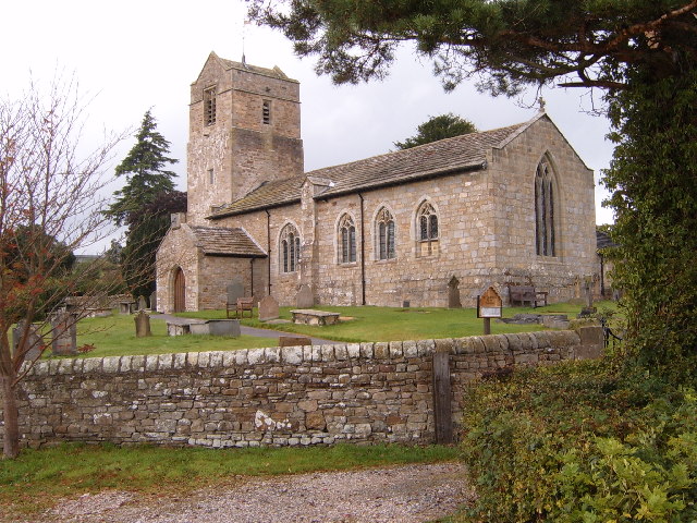
St Wilfrid's Church, Melling

St Wilfrid's Church is in Main Street, Melling, Lancashire, England. It is recorded in the National Heritage List for England as a designated Grade I listed...

Melling-with-Wrayton

Melling-with-Wrayton is a civil parish in the City of Lancaster in the English county of Lancashire. It includes the village of Melling and the hamlet...

Melling railway station (Lancashire)

Melling railway station served the village of Melling, Lancashire, England, from 1867 to 1952 on the Furness and Midland Joint Railway. == History == The...

St John the Baptist's Church, Arkholme

St John the Baptist's Church, is in the village of Arkholme, Lancaster, Lancashire, England. It is an active Anglican parish church in the deanery of Tunstall...

Tatham, Lancashire

Tatham is a village and civil parish in the City of Lancaster district in Lancashire, England. In 2001, it had a population of 393, increasing slightly...

Church of St James the Less, Tatham

The Church of St James the Less is in the village of Tatham, Lancashire, England. It is an active Anglican parish church in the deanery of Tunstall, the...

Wennington Hall

Wennington Hall is a former country house in Wennington, a village in the City of Lancaster district in Lancashire, England. The house is a Grade II listed...

Arkholme for Kirkby Lonsdale railway station

Arkholme for Kirkby Lonsdale railway station served the village of Arkholme in Lancashire, England. It is situated on what is now the Leeds–Morecambe line...

Nearby Amenities

Located within 500m of 54.133124,-2.6177014
Post Box
Post Box Type: wall
Ref: LA6 131
Lat/Long: 54.1352719/-2.6154401
St Wilfrids Church
Bus: yes
Naptan AtcoCode: 2500922
Naptan Bearing: NE
Naptan BusStopType: CUS
Naptan CommonName: St WilfrIds Church
Naptan Indicator: opp
Naptan Landmark: St WilfrIds Church
Naptan LocalityCode: E0047439
Naptan NaptanCode: landajam
Naptan Street: Melling Road
Naptan Verified: no
Public Transport: stop_position
Ref: landajam
Lat/Long: 54.1351444/-2.6164802
St Wilfrids Church
Bus: yes
Naptan AtcoCode: 2500LAA07361
Naptan Bearing: SW
Naptan BusStopType: MKD
Naptan CommonName: St WilfrIds Church
Naptan Indicator: by
Naptan Landmark: St WilfrIds Church
Naptan LocalityCode: E0047439
Naptan NaptanCode: lanjpadw
Naptan Street: Melling Road
Naptan Verified: no
Public Transport: stop_position
Ref: lanjpadw
Lat/Long: 54.1351571/-2.6164575
Melling Hall Hotel
Bus: yes
Naptan AtcoCode: 250012476
Naptan Bearing: S
Naptan BusStopType: CUS
Naptan CommonName: Melling Hall Hotel
Naptan Indicator: o/s
Naptan Landmark: Hall Hotel
Naptan LocalityCode: E0047439
Naptan NaptanCode: lanajdpa
Naptan Street: Melling Road
Naptan Verified: no
Public Transport: stop_position
Ref: lanajdpa
Lat/Long: 54.1358306/-2.615943
Bus Stop
Melling Hall Hotel
Bus: yes
Naptan AtcoCode: 250012476
Naptan NaptanCode: lanajdpa
Public Transport: platform
Lat/Long: 54.1358202/-2.6158782
Bus Stop
Melling (Gillison Close)
Bench: no
Bin: yes
Bus: yes
Naptan AtcoCode: 2500LAA07478
Naptan NaptanCode: lanjpgmd
Public Transport: platform
Shelter: no
Tactile Paving: no
Lat/Long: 54.1352677/-2.615396
Bus Stop
Melling (Gillison Close)
Bench: no
Bin: no
Bus: yes
Naptan AtcoCode: 2500923
Naptan NaptanCode: landajap
Public Transport: platform
Shelter: no
Tactile Paving: no
Lat/Long: 54.1351619/-2.615327
Melling (Gillison Close)
Bus: yes
Public Transport: stop_position
Lat/Long: 54.1352159/-2.6154279
Melling (Gillison Close)
Bus: yes
Public Transport: stop_position
Lat/Long: 54.1351895/-2.6153177
Generator Method: photovoltaic
Generator Orientation: south_east
Generator Output Electricity: yes
Generator Solar Modules: 16
Generator Source: solar
Generator Type: solar_photovoltaic_panel
Location: roof
Power: generator
Lat/Long: 54.1337022/-2.6179245
Speed Camera
Lat/Long: 54.1305892/-2.621768
Defibrillator
Defibrillator Location: On outside wall, facing road
Emergency: defibrillator
Indoor: no
Ref GB The Circuit: 7ADEC2DD-8E7E-4AD3-9760-B1090121E137
Lat/Long: 54.1337172/-2.6178295
Entrance: main
Level: 0
Wheelchair: yes
Lat/Long: 54.1336539/-2.617953
Give Way
Direction: forward
Lat/Long: 54.1339435/-2.6174586
Waste Basket
Lat/Long: 54.1337206/-2.6178153
The data included in this document is from www.openstreetmap.org. The data is made available under ODbL.

Have you been to Melling Green?

Leave your review of Melling Green below (or comments, questions and feedback).