Bishop's Wood

Wood, Forest in Herefordshire

England

Bishop's Wood

Lodgegrove Brook The brook runs alongside a small track with a public footpath, as well as acting as the border between Herefordshire and Gloucestershire.
Lodgegrove Brook Credit: Pebble

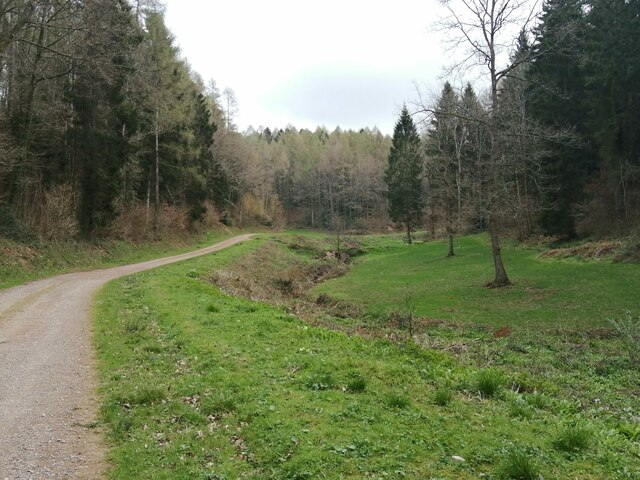
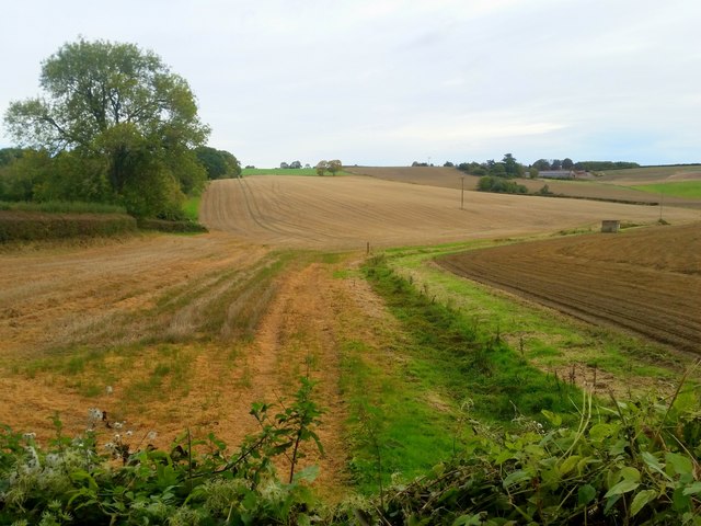
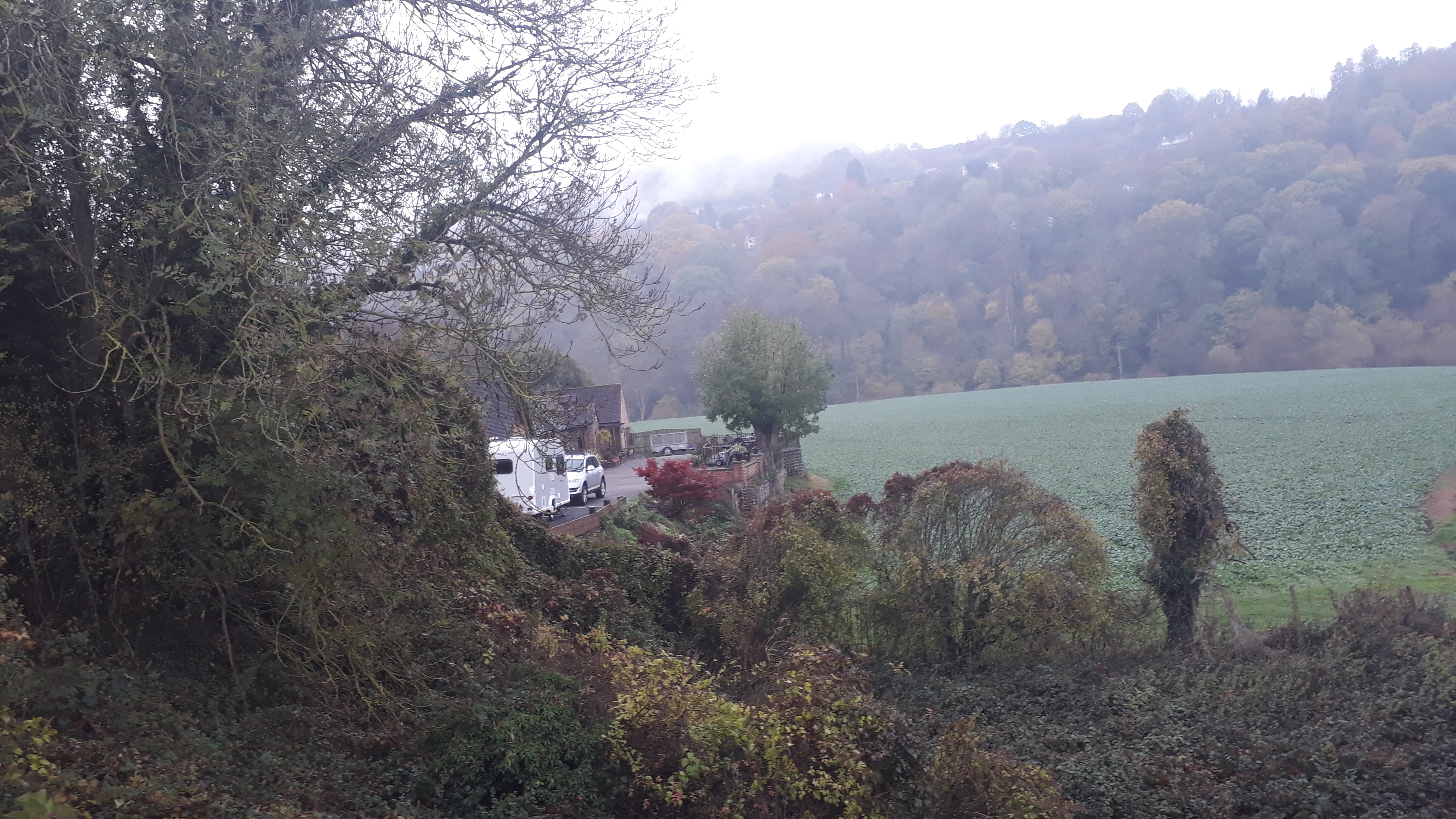
Bishop's Wood is a picturesque forest located in Herefordshire, England. Stretching over an area of approximately 100 acres, this woodland is a haven for nature enthusiasts and those seeking tranquility in the midst of nature. The wood is located near the village of Bishop's Frome, and its accessibility makes it a popular destination for both locals and tourists.

Bishop's Wood is primarily composed of native tree species such as oak, birch, and beech, which create a diverse and enchanting landscape. The forest floor is adorned with a rich carpet of bluebells during the spring, adding a burst of color to the surroundings. The wood is also home to a variety of wildlife, including deer, badgers, and numerous bird species.

The wood is crisscrossed with a network of well-maintained footpaths, allowing visitors to explore its natural wonders at their own pace. These paths lead to hidden clearings, babbling brooks, and secluded ponds, providing opportunities for peaceful reflection and a chance to connect with nature. The wood also offers several picnic spots, inviting visitors to relax and enjoy a meal amidst the serene surroundings.

Bishop's Wood is managed by the Forestry Commission, ensuring its preservation and conservation for future generations. It is open to the public throughout the year, with no admission fee. The woodland is an ideal destination for hikers, nature lovers, and families looking to escape the hustle and bustle of everyday life and immerse themselves in the beauty of the natural world.

If you have any feedback on the listing, please let us know in the comments section below.

Bishop's Wood Images

Images are sourced within 2km of 51.868651/-2.5885258 or Grid Reference SO5919. Thanks to Geograph Open Source API. All images are credited.

Lodgegrove Brook The brook runs alongside a small track with a public footpath, as well as acting as the border between Herefordshire and Gloucestershire.
Lodgegrove Brook
The brook runs alongside a small track with a public footpath, as well as acting as the border between Herefordshire and Gloucestershire.
Ragman's Lane Farm name sign, Gloucestershire Located here <a title="https://www.geograph.org.uk/photo/1427535" href="https://www.geograph.org.uk/photo/1427535">Link</a>
Ragman's Lane Farm name sign, Gloucestershire
Located here Link
Forge Cottage, B4234, Lydbrook Extended ex-Toll House shown on the 1877 map as Bishopswood Gate in an area called Wyelands. Erected by the Forest of Dean Turnpike Trust in the 19ᵗʰ C, typical of designs in about 1827. The road is the route from the Forest to Ross-on-Wye.

Milestone Society National ID: GL.WYE
Forge Cottage, B4234, Lydbrook
Extended ex-Toll House shown on the 1877 map as Bishopswood Gate in an area called Wyelands. Erected by the Forest of Dean Turnpike Trust in the 19ᵗʰ C, typical of designs in about 1827. The road is the route from the Forest to Ross-on-Wye. Milestone Society National ID: GL.WYE
Wheat field near Great Howle Farm A fine distant view to the Black Mountains.
Wheat field near Great Howle Farm
A fine distant view to the Black Mountains.
Track and footpath Track and footpath at Kiln Green above the Wye valley.
Track and footpath
Track and footpath at Kiln Green above the Wye valley.
South Herefordshire countryside Arable land near Kiln Green. A dry seasonal watercourse in the foreground.
South Herefordshire countryside
Arable land near Kiln Green. A dry seasonal watercourse in the foreground.
Kiln Green Rolling countryside viewed from near Great Howle farm on a cold crisp morning.
In the distance are The Skirrid and Sugarloaf, well over 20km distant.
Kiln Green
Rolling countryside viewed from near Great Howle farm on a cold crisp morning. In the distance are The Skirrid and Sugarloaf, well over 20km distant.
Arable field above Bishopswood The crop is fodder beet.
Arable field above Bishopswood
The crop is fodder beet.
Oak trees above Suff Wood Cottages and houses of Kiln Green can be seen beyond the oaks.
Oak trees above Suff Wood
Cottages and houses of Kiln Green can be seen beyond the oaks.
Atlas Farm and The Dam An early morning view across late summer fields and woodland on the edge of Herefordshire and the Forest of Dean.
Atlas Farm and The Dam
An early morning view across late summer fields and woodland on the edge of Herefordshire and the Forest of Dean.
Rolling stubble land near Kiln Green The house centre right is The Dam.
Rolling stubble land near Kiln Green
The house centre right is The Dam.
Boundary at  Courtfield
Boundary at Courtfield
Crop of rape near Howle Hill Commencing flowering in April 2020.
Crop of rape near Howle Hill
Commencing flowering in April 2020.
Grassy field near Ragman's Lane Farm Mixed woodland and pastoral fields on the edge of the Forest of Dean.
Grassy field near Ragman's Lane Farm
Mixed woodland and pastoral fields on the edge of the Forest of Dean.
Crop of rape near Howle Hill, July 2020 Follow-on photo from <a href="https://www.geograph.org.uk/photo/6444811">SO6119 : Crop of rape near Howle Hill</a>.
The three trees were starting to leaf up in April, now dark green in July four months later.
The crop is approaching harvest.
Crop of rape near Howle Hill, July 2020
Follow-on photo from SO6119 : Crop of rape near Howle Hill. The three trees were starting to leaf up in April, now dark green in July four months later. The crop is approaching harvest.
Copse in a barren field Howle Green Farm is beyond.
Copse in a barren field
Howle Green Farm is beyond.
Approach to Walford
Approach to Walford
Water company installation on the River Wye I don't know what it is or what it does but I like their little fountain.
Water company installation on the River Wye
I don't know what it is or what it does but I like their little fountain.
Show me another place!

Bishop's Wood is located at Grid Ref: SO5919 (Lat: 51.868651, Lng: -2.5885258)

Unitary Authority: County of Herefordshire

Police Authority: West Mercia

What 3 Words

///defected.soda.jaws. Near Walford, Herefordshire

Nearby Locations

Bishop's Wood

Related Wikis

Kerne Bridge

Kerne Bridge is a hamlet in south Herefordshire, England, about 3.5 miles (6 km) south of the market town of Ross-on-Wye on the B4234 Ross-on-Wye to Coleford...

Kerne Bridge (River Wye crossing)

Kerne Bridge was built over the River Wye in the County of Herefordshire, England in 1825–28, on the site of an ancient ford crossing known as Flanesford...

Kerne Bridge railway station

Kerne Bridge railway station is a disused railway station on the Ross and Monmouth Railway constructed in the Herefordshire hamlet of Kerne Bridge which...

Welsh Bicknor

Welsh Bicknor (Welsh: Llangystennin Garth Brenni) is an area in the far south of the English county of Herefordshire. Despite its name, it is not now in...

Nearby Amenities

Located within 500m of 51.868651,-2.5885258
The data included in this document is from www.openstreetmap.org. The data is made available under ODbL.

Have you been to Bishop's Wood?

Leave your review of Bishop's Wood below (or comments, questions and feedback).