Birchhill Inclosure

Wood, Forest in Gloucestershire Forest of Dean

England

Birchhill Inclosure

A pithead mine wheel A pithead mine wheel at Hopewell Colliery Museum.
A pithead mine wheel Credit: Philip Halling

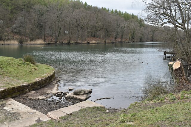
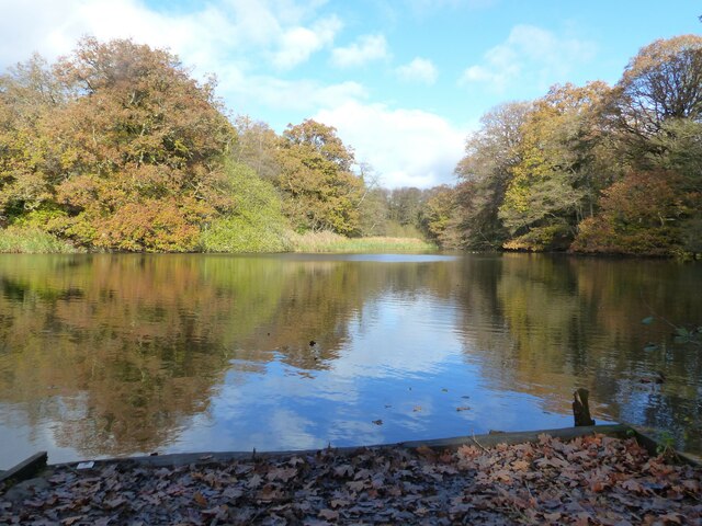
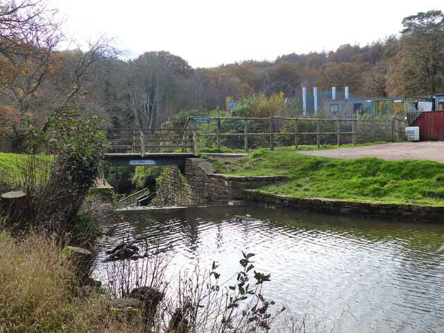
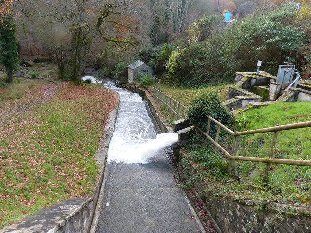
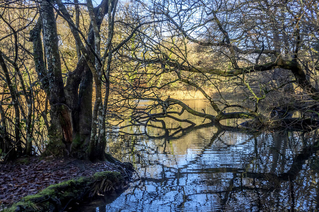
Birchhill Inclosure is a picturesque woodland located in Gloucestershire, England. Covering an area of approximately 100 acres, it is renowned for its natural beauty and diverse ecosystem. The inclosure is primarily composed of birch trees, which dominate the landscape and give it its name.

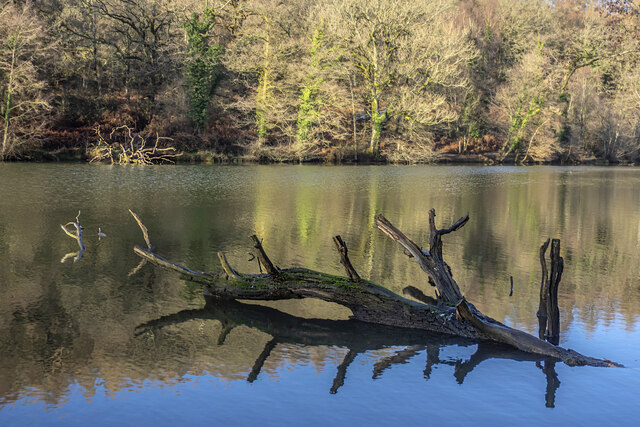
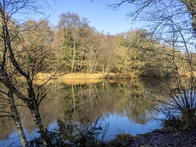
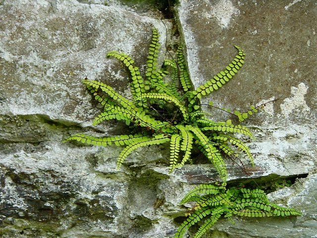
The woodland is a haven for wildlife, attracting a wide range of species. Visitors can expect to spot various birds, including woodpeckers and owls, as well as small mammals such as squirrels and rabbits. The dense undergrowth provides shelter for numerous insects and reptiles, making it an ideal habitat for biodiversity.

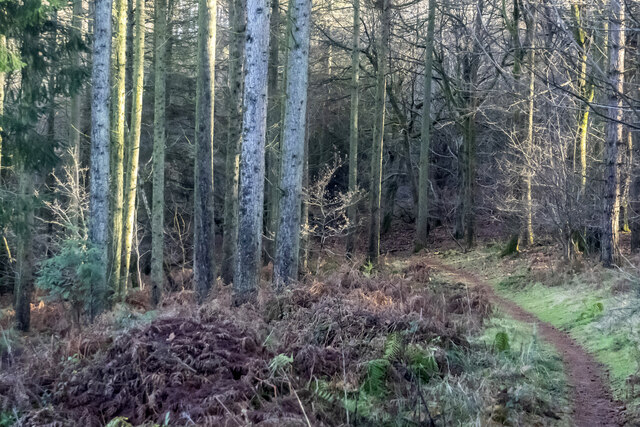
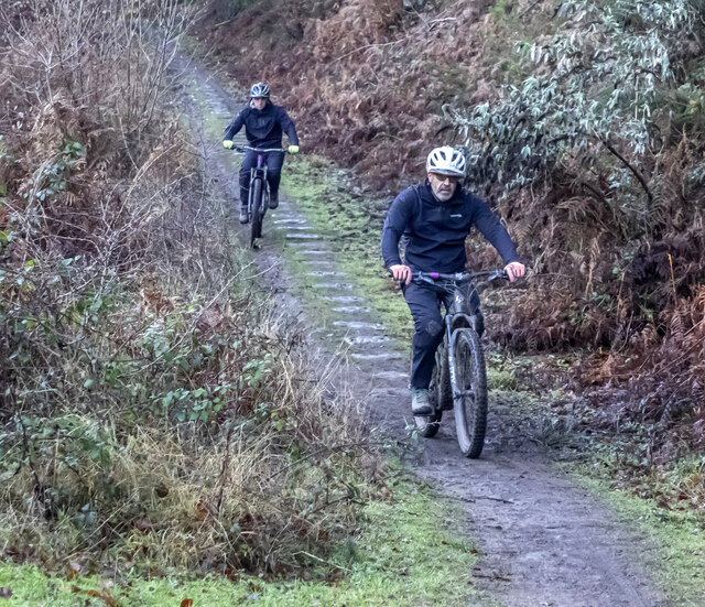
Birchhill Inclosure offers a network of well-maintained footpaths, allowing visitors to explore the woodland at their own pace. These paths wind through the trees, offering glimpses of sunlight filtering through the canopy and creating a magical atmosphere. The inclosure is a popular destination for walkers, joggers, and nature enthusiasts, who come to enjoy the tranquility of the surroundings.

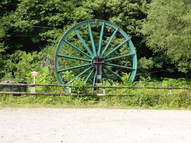
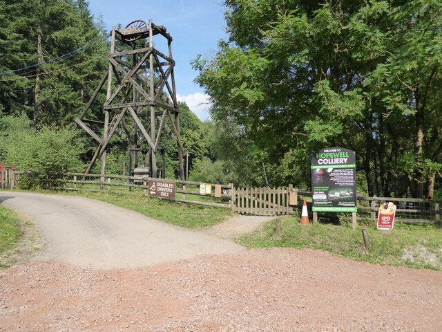
Beyond its natural beauty, Birchhill Inclosure holds historical significance as well. The woodland has been managed by the Forestry Commission since the early 20th century, contributing to the preservation of the area's natural heritage. It also serves as an important educational resource, with interpretive signs and information boards scattered throughout the inclosure, providing insights into the local flora and fauna.

Overall, Birchhill Inclosure in Gloucestershire is a remarkable woodland that offers visitors a chance to immerse themselves in nature. With its stunning landscapes, diverse wildlife, and rich history, it is a place that captivates both locals and tourists alike.

If you have any feedback on the listing, please let us know in the comments section below.

Birchhill Inclosure Images

Images are sourced within 2km of 51.786906/-2.5952895 or Grid Reference SO5909. Thanks to Geograph Open Source API. All images are credited.

A pithead mine wheel A pithead mine wheel at Hopewell Colliery Museum.
A pithead mine wheel
A pithead mine wheel at Hopewell Colliery Museum.
Hopewell Colliery Museum In the winter Hopewell Colliery is a working mine, in the summer it is a tourist attraction offering underground tours of the mine.
Hopewell Colliery Museum
In the winter Hopewell Colliery is a working mine, in the summer it is a tourist attraction offering underground tours of the mine.
Southern end of Cannop Ponds
The lower and larger pond, Cannop Ponds, Forest of Dean The photo was taken from fishing stage no. 1. 
See also <a href="https://www.geograph.org.uk/photo/7345362">SO6010 : The upper pond, Cannop Ponds, Forest of Dean</a>
The lower and larger pond, Cannop Ponds, Forest of Dean
The photo was taken from fishing stage no. 1. See also SO6010 : The upper pond, Cannop Ponds, Forest of Dean
Footbridge and weir, Cannop Ponds, Forest of Dean See also <a href="https://www.geograph.org.uk/photo/7345362">SO6010 : The upper pond, Cannop Ponds, Forest of Dean</a>
Footbridge and weir, Cannop Ponds, Forest of Dean
A "Mandarin Tree" - roosting mandarin ducks, Cannop Ponds, Forest of Dean See also <a href="https://www.geograph.org.uk/photo/7345362">SO6010 : The upper pond, Cannop Ponds, Forest of Dean</a>
A "Mandarin Tree" - roosting mandarin ducks, Cannop Ponds, Forest of Dean
Looking down the channel from the lower pond at Cannop Ponds, Forest of Dean See also <a href="https://www.geograph.org.uk/photo/7345362">SO6010 : The upper pond, Cannop Ponds, Forest of Dean</a>
Looking down the channel from the lower pond at Cannop Ponds, Forest of Dean
Drowned trees On either side of the lower pond at Cannop.
Drowned trees
On either side of the lower pond at Cannop.
Winter reflections, Cannop Ponds, 1 A bright Boxing Day morning.
Winter reflections, Cannop Ponds, 1
A bright Boxing Day morning.
Winter reflections, Cannop Ponds, 2 Spot the anglers.
Winter reflections, Cannop Ponds, 2
Spot the anglers.
Winter reflections, Cannop Ponds, 3 Spot the anglers!
Winter reflections, Cannop Ponds, 3
Spot the anglers!
Winter reflections, Cannop Ponds, 4 The branch framework is revealed in winter light.
Winter reflections, Cannop Ponds, 4
The branch framework is revealed in winter light.
Winter reflections, Cannop Ponds, 5 A fallen tree gradually succumbing to the water.
Winter reflections, Cannop Ponds, 5
A fallen tree gradually succumbing to the water.
Barnhill Plantation On steeply sloping land to the west of Cannop Upper Pond.
Barnhill Plantation
On steeply sloping land to the west of Cannop Upper Pond.
Steep footpath The forested hillside to the west of Cannop Upper Pond.
Steep footpath
The forested hillside to the west of Cannop Upper Pond.
Forest path Looking eastwards into a stand of mature conifers.
Forest path
Looking eastwards into a stand of mature conifers.
Cyclists on the old tramway The Bix Slade porting of the Forest of Dean is full of old stone and coal workings.
This remnant of a horse-drawn tramway was finally decommissioned in 1946 and is now part of the extensive path and cycleway network in the forest.
Cyclists on the old tramway
The Bix Slade porting of the Forest of Dean is full of old stone and coal workings. This remnant of a horse-drawn tramway was finally decommissioned in 1946 and is now part of the extensive path and cycleway network in the forest.
Show me another place!

Birchhill Inclosure is located at Grid Ref: SO5909 (Lat: 51.786906, Lng: -2.5952895)

Administrative County: Gloucestershire

District: Forest of Dean

Police Authority: Gloucestershire

What 3 Words

///cages.cashiers.iterative. Near Coleford, Gloucestershire

Nearby Locations

Birchhill Inclosure

Related Wikis

Coalway

Coalway is a village in the West Forest of Dean region of Gloucestershire, England, approximately one mile south-east of the town of Coleford. Within the...

Gorsty Knoll

Gorsty Knoll is a small hamlet, located in the Forest of Dean, Gloucestershire, England. The internationally important remains of Darkhill Ironworks and...

Milkwall railway station

Milkwall railway station is a disused station on the former Severn and Wye Railway. It served the village of Milkwall, Gloucestershire, England. The station...

Spion Kop Quarry

Spion Kop Quarry (grid reference SO598103) is a 0.7-hectare (1.7-acre) nature reserve in Gloucestershire in the Forest of Dean.The site is managed by the...

Oakiron railway station

Oakiron railway station is the terminus of the 15 in (381 mm) gauge Perrygrove Railway. The line was opened in 1996 and is now open as a heritage railway...

St Briavels Hundred

St Briavels was an ancient hundred of Gloucestershire, England. It comprised the extra-parochial area of the Forest of Dean, and the ancient parishes...

Broadwell, Forest of Dean

Broadwell is a village about 1 mile (1.6 km) east of Coleford, Gloucestershire, England. It is at the western edge of the Forest of Dean, in the civil...

Heywood railway station (Perrygrove Railway)

Heywood railway station is a request stop on the 15 in (381 mm) gauge Perrygrove Railway. The line was opened in 1996 and is a heritage railway. There...

Nearby Amenities

Located within 500m of 51.786906,-2.5952895
Bus Stop
Eskimarket
Bus: yes
Naptan AtcoCode: 1600GL1379
Naptan Bearing: S
Naptan CommonName: Eskimarket
Naptan Indicator: Opp
Naptan NaptanCode: gloagaja
Naptan Street: New Rd
Naptan Verified: no
Public Transport: platform
Source: naptan_import
Lat/Long: 51.7905311/-2.598736
Bus Stop
Eskimarket
Bus: yes
Naptan AtcoCode: 1600GL1380
Naptan Bearing: N
Naptan CommonName: Eskimarket
Naptan NaptanCode: gloagagw
Naptan Street: New Rd
Naptan Verified: no
Public Transport: platform
Source: naptan_import
Lat/Long: 51.7904037/-2.5990243
Bus Stop
Coalway Jnr School
Bus: yes
Naptan AtcoCode: 1600GL9172
Naptan Bearing: E
Naptan CommonName: Coalway Jnr School
Naptan NaptanCode: gloagadj
Naptan Street: Coalway Rd
Naptan Verified: no
Public Transport: platform
Source: naptan_import
Lat/Long: 51.7902824/-2.5998926
Bus Stop
Crown Meadow
Bus: yes
Naptan AtcoCode: 1600GLA06084
Naptan Bearing: N
Naptan CommonName: Crown Meadow
Naptan NaptanCode: glogpdmp
Naptan Street: Edenwall Rd
Naptan Verified: no
Public Transport: platform
Source: naptan_import
Lat/Long: 51.7887184/-2.5997994
Bus Stop
Palmers Flat
Bus: yes
Naptan AtcoCode: 1600GLA06085
Naptan Bearing: S
Naptan CommonName: Palmers Flat
Naptan NaptanCode: glogpdmt
Naptan Street: Edenwall Rd
Naptan Verified: no
Public Transport: platform
Source: naptan_import
Lat/Long: 51.785796/-2.5998331
Bus Stop
Crown Meadow
Bus: yes
Naptan AtcoCode: 1600GLF207
Naptan Bearing: S
Naptan CommonName: Crown Meadow
Naptan NaptanCode: gloagadm
Naptan Street: Edenwall Rd
Naptan Verified: no
Public Transport: platform
Source: naptan_import
Lat/Long: 51.788719/-2.5996834
Bus Stop
Palmers Flat
Bus: yes
Naptan AtcoCode: 1600GLF208
Naptan Bearing: N
Naptan CommonName: Palmers Flat
Naptan NaptanCode: gloagada
Naptan Street: Edenwall Rd
Naptan Verified: no
Public Transport: platform
Source: naptan_import
Lat/Long: 51.7858135/-2.5999348
Bus Stop
Parkend Rd
Bus: yes
Naptan AtcoCode: 1600GLF624
Naptan Bearing: SE
Naptan CommonName: Parkend Rd
Naptan NaptanCode: gloagagj
Naptan Street: B4431
Naptan Verified: no
Public Transport: platform
Source: naptan_import
Lat/Long: 51.7899907/-2.5989173
Bus Stop
Lower Palmers Flat
Bus: yes
Naptan AtcoCode: 1600GLF869
Naptan Bearing: N
Naptan CommonName: Lower Palmers Flat
Naptan NaptanCode: glogjwtp
Naptan Street: B4431
Naptan Verified: no
Public Transport: platform
Source: naptan_import
Lat/Long: 51.7834122/-2.5965107
Bus Stop
Lower Palmers Flat
Bus: yes
Naptan AtcoCode: 1600GLF870
Naptan Bearing: S
Naptan CommonName: Lower Palmers Flat
Naptan NaptanCode: glogjwtw
Naptan Street: B4431
Naptan Verified: no
Public Transport: platform
Source: naptan_import
Lat/Long: 51.7833949/-2.59638
Give Way
Direction: backward
Lat/Long: 51.7901016/-2.5991691
Give Way
Direction: forward
Lat/Long: 51.7900249/-2.5992293
Post Box
Brand: Royal Mail
Brand Wikidata: Q638098
Operator: Royal Mail
Operator Wikidata: Q638098
Post Box Type: wall
Royal Cypher: GR
Royal Cypher Wikidata: Q33102273
Lat/Long: 51.7899989/-2.5993422
Give Way
Direction: backward
Lat/Long: 51.7889061/-2.5996969
Give Way
Direction: forward
Lat/Long: 51.7860499/-2.5996742
Post Box
Brand: Royal Mail
Brand Wikidata: Q638098
Operator: Royal Mail
Operator Wikidata: Q638098
Post Box Type: wall
Royal Cypher: EIIR
Royal Cypher Wikidata: Q33102113
Lat/Long: 51.7843519/-2.6004928
Give Way
Direction: forward
Lat/Long: 51.7890795/-2.5981161
Give Way
Direction: backward
Lat/Long: 51.7894662/-2.5983752
Give Way
Direction: forward
Lat/Long: 51.7903082/-2.5989533
Power: pole
Lat/Long: 51.7829904/-2.5936773
Power: pole
Lat/Long: 51.7835878/-2.5936157
Power: pole
Lat/Long: 51.7844249/-2.5935017
Power: pole
Lat/Long: 51.7853159/-2.5933984
Power: pole
Lat/Long: 51.786197/-2.593389
Power: pole
Lat/Long: 51.7877193/-2.5933206
Power: pole
Lat/Long: 51.7885953/-2.5933018
Power: pole
Lat/Long: 51.7894812/-2.5932241
Power: pole
Lat/Long: 51.7903622/-2.5931543
The data included in this document is from www.openstreetmap.org. The data is made available under ODbL.

Have you been to Birchhill Inclosure?

Leave your review of Birchhill Inclosure below (or comments, questions and feedback).