Sheershill Common

Wood, Forest in Herefordshire

England

Sheershill Common

Old trackway lined with hawthorns The landscape up here is in decay a little, with plenty of evidence of old use.
Old trackway lined with hawthorns Credit: Jeremy Bolwell

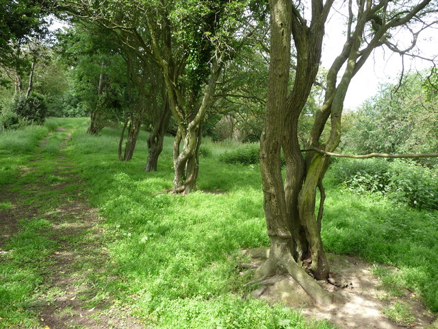
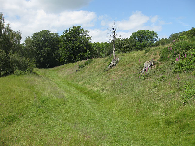
Sheershill Common is a scenic woodland area located in Herefordshire, England. Covering an expanse of approximately 200 acres, it is known for its diverse range of flora and fauna, making it a popular destination for nature enthusiasts and hikers.

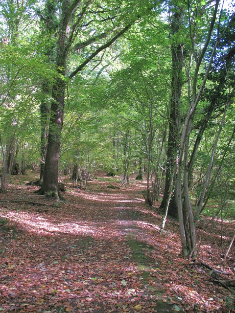
The common is predominantly made up of deciduous trees, including oak, ash, and beech, which create a lush and vibrant canopy during the summer months. The woodland floor is adorned with an array of wildflowers, such as bluebells and primroses, adding splashes of color to the landscape.

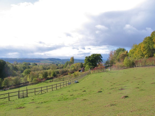
Several walking trails crisscross the common, offering visitors the opportunity to explore and immerse themselves in the natural beauty of the area. These paths wind through the trees, providing glimpses of the occasional stream and small ponds, home to various aquatic species.

Sheershill Common is also home to a diverse range of wildlife. Birdwatchers can spot a variety of species, including woodpeckers, owls, and warblers, while small mammals like squirrels and rabbits are a common sight. More elusive creatures, such as deer and foxes, can sometimes be spotted in the early morning or evening hours.

The woodland is managed by local conservation organizations, who work to preserve and protect the delicate ecosystem. They organize educational programs and events to raise awareness about the importance of sustainable practices and encourage visitors to respect the natural environment.

Overall, Sheershill Common offers a tranquil and picturesque setting for those seeking solace in nature. Its rich biodiversity and well-maintained trails make it a delightful place to explore and appreciate the wonders of the natural world.

If you have any feedback on the listing, please let us know in the comments section below.

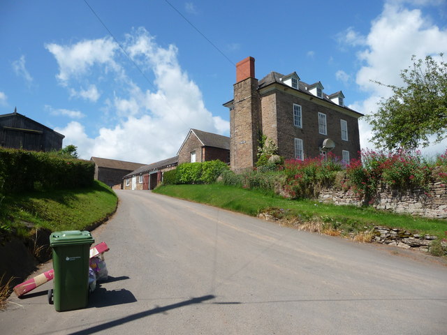
Sheershill Common Images

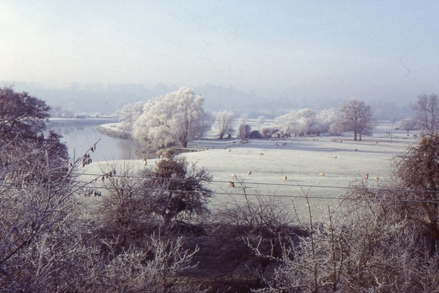
Images are sourced within 2km of 52.008732/-2.6039408 or Grid Reference SO5834. Thanks to Geograph Open Source API. All images are credited.

Old trackway lined with hawthorns The landscape up here is in decay a little, with plenty of evidence of old use.
Old trackway lined with hawthorns
The landscape up here is in decay a little, with plenty of evidence of old use.
Farm buildings Rural farm and outbuildings.
Farm buildings
Rural farm and outbuildings.
Farmland at Terrace Farm
Buckenhill Wood
Buckenhill Wood
Sutton Hill
Sutton Hill
Galanthus nivalis, Common Snowdrop Lovely specimen by the lane north of Lower Buckenhill.
Galanthus nivalis, Common Snowdrop
Lovely specimen by the lane north of Lower Buckenhill.
Fields, Wessington Near Woolhope.
Fields, Wessington
Near Woolhope.
Oak tree in a field Oak tree in a field near the village of Woolhope.
Oak tree in a field
Oak tree in a field near the village of Woolhope.
Oast House Single square kiln oast house.
Oast House
Single square kiln oast house.
Clearing in Haugh Wood An open area with grasses and sedges in Haugh Wood.
Clearing in Haugh Wood
An open area with grasses and sedges in Haugh Wood.
Rural view at Common Hill South facing hillside at Common Hill near Fownhope.
Rural view at Common Hill
South facing hillside at Common Hill near Fownhope.
Path through Lea Wood Bridleway through Lea Wood, which is a local nature reserve noted for orchids in spring and summer. The path here is part of the Wye Valley Walk.
Path through Lea Wood
Bridleway through Lea Wood, which is a local nature reserve noted for orchids in spring and summer. The path here is part of the Wye Valley Walk.
River Wye, near Fownhope
St Mary's church, Fownhope, from the lych-gate
Fownhope: The Green Man
Fownhope from Common Hill
View towards Fownhope village A postie is having a quiet skive here hidden from the road and village by the sports centre. When I say quiet skive I mean carefully planning out his itinerary, re-prioritising his morning, taking a well earned allocated break, responding to customer needs, communicating with colleagues on a matter of urgency etc.
View towards Fownhope village
A postie is having a quiet skive here hidden from the road and village by the sports centre. When I say quiet skive I mean carefully planning out his itinerary, re-prioritising his morning, taking a well earned allocated break, responding to customer needs, communicating with colleagues on a matter of urgency etc.
Tump Farm I assume the obvious reason for its name.
Tump Farm
I assume the obvious reason for its name.
Show me another place!

Sheershill Common is located at Grid Ref: SO5834 (Lat: 52.008732, Lng: -2.6039408)

Unitary Authority: County of Herefordshire

Police Authority: West Mercia

What 3 Words

///kebab.relished.dustbin. Near Brockhampton, Herefordshire

Related Wikis

St Cuthbert's Church, Holme Lacy

St Cuthbert's Church is a redundant Anglican church about 1 mile (1.6 km) to the southeast of the village of Holme Lacy, Herefordshire, England. It stands...

Capler Camp

Capler Camp is an Iron Age hill fort located 2.5 km south of Fownhope, Herefordshire. The Camp is on a hill top above the River Wye. It has a double layer...

Fiddler's Green, Herefordshire

Fiddler's Green is a hamlet in the English county of Herefordshire. It is located near the River Wye on the B4224 road that connects Hereford and Ross...

All Saints' Church, Brockhampton

The Church of All Saints is a Church of England parish church at Brockhampton in the English county of Herefordshire. The church was commissioned by Alice...

Nearby Amenities

Located within 500m of 52.008732,-2.6039408
Telephone
Booth: K6
Disused: yes
Man Made: telephone_box
Tourism: information
Lat/Long: 52.0089682/-2.5991645
Bus Stop
Church Croft
Naptan AtcoCode: 2090A20030
Naptan Bearing: N
Naptan CommonName: Church Croft
Naptan Indicator: Junct Church Croft and Nover wood drive
Naptan Landmark: Road Junction
Naptan NaptanCode: heramwdg
Naptan Street: Nover Wood Drive
Naptan Verified: no
Source: naptan_import
Lat/Long: 52.0074177/-2.6109212
Post Box
Collection Times: Mo-Fr 10:15; Sa 10:15
Post Box Design: hovis
Post Box Mounting: wooden_post
Post Box Type: lamp
Ref: HR1 269
Royal Cypher: GR
Royal Cypher Wikidata: Q33102273
Lat/Long: 52.0089618/-2.5992931
Turning Circle
Source: bing
Lat/Long: 52.0087807/-2.6102641
Barrier: stile
Bicycle: yes
Foot: yes
Lat/Long: 52.0101391/-2.5992007
Leisure: picnic_table
Lat/Long: 52.0072882/-2.6095044
Generator Method: photovoltaic
Generator Output Electricity: yes
Generator Source: solar
Generator Type: solar_photovoltaic_panel
Location: roof
Power: generator
Lat/Long: 52.0080617/-2.6110393
Generator Method: photovoltaic
Generator Output Electricity: yes
Generator Source: solar
Generator Type: solar_photovoltaic_panel
Location: roof
Power: generator
Lat/Long: 52.0085983/-2.6112351
Generator Method: photovoltaic
Generator Output Electricity: yes
Generator Source: solar
Generator Type: solar_photovoltaic_panel
Location: roof
Power: generator
Lat/Long: 52.0086297/-2.6109293
Generator Method: photovoltaic
Generator Output Electricity: yes
Generator Source: solar
Generator Type: solar_photovoltaic_panel
Location: roof
Power: generator
Lat/Long: 52.0088534/-2.6096378
Generator Method: photovoltaic
Generator Output Electricity: yes
Generator Source: solar
Generator Type: solar_photovoltaic_panel
Location: roof
Power: generator
Lat/Long: 52.008699/-2.5987199
Generator Method: photovoltaic
Generator Output Electricity: yes
Generator Source: solar
Generator Type: solar_photovoltaic_panel
Location: roof
Power: generator
Lat/Long: 52.009565/-2.6006028
Generator Method: photovoltaic
Generator Output Electricity: yes
Generator Source: solar
Generator Type: solar_photovoltaic_panel
Location: roof
Power: generator
Lat/Long: 52.0095765/-2.6004848
Shelter
Lat/Long: 52.0090372/-2.5991952
Power: pole
Source: bing
Lat/Long: 52.0046208/-2.605239
Power: pole
Source: bing
Lat/Long: 52.0044252/-2.6022403
Power: pole
Source: bing
Lat/Long: 52.0044615/-2.6028156
Power: pole
Source: bing
Lat/Long: 52.0045119/-2.6036726
Nash Farm
Power: pole
Ref: 751062
Source: wpd_opendata
Transformer: distribution
Lat/Long: 52.0045804/-2.6046342
Power: pole
Source: bing
Lat/Long: 52.0046943/-2.6061992
Generator Method: photovoltaic
Generator Output Electricity: yes
Generator Source: solar
Generator Type: solar_photovoltaic_panel
Location: roof
Power: generator
Lat/Long: 52.0085777/-2.610126
Generator Method: photovoltaic
Generator Output Electricity: yes
Generator Source: solar
Generator Type: solar_photovoltaic_panel
Location: roof
Power: generator
Lat/Long: 52.0100743/-2.5983015
Horn Cottage
Power: pole
Transformer: distribution
Voltage Primary: 11000
Lat/Long: 52.0128466/-2.6050432
Power: pole
Lat/Long: 52.0127715/-2.6038469
Power: pole
Lat/Long: 52.0126889/-2.6024582
Power: pole
Lat/Long: 52.0125895/-2.6008918
Power: pole
Lat/Long: 52.0118738/-2.5998102
Power: pole
Lat/Long: 52.0111581/-2.5998028
Power: pole
Lat/Long: 52.0106084/-2.5998008
Power: pole
Lat/Long: 52.0102559/-2.5978193
Power: pole
Lat/Long: 52.010189/-2.5986649
Common Hill West
Power: pole
Transformer: distribution
Voltage Primary: 11000
Lat/Long: 52.0094894/-2.6024636
Power: pole
Lat/Long: 52.009411/-2.6013974
Power: pole
Lat/Long: 52.0096599/-2.6007564
Power: pole
Lat/Long: 52.0099447/-2.6
Power: pole
Lat/Long: 52.0101251/-2.5995279
Power: pole
Lat/Long: 52.01/-2.5994662
Common Hill
Power: pole
Transformer: distribution
Voltage Primary: 11000
Lat/Long: 52.0095319/-2.5992463
Power: pole
Lat/Long: 52.0088947/-2.5989197
Power: pole
Lat/Long: 52.0085426/-2.5989023
Power: pole
Lat/Long: 52.0062505/-2.5983632
Power: pole
Lat/Long: 52.0081897/-2.6034433
Nover Wood North
Power: pole
Transformer: distribution
Voltage Primary: 11000
Lat/Long: 52.0120137/-2.6084288
Power: pole
Lat/Long: 52.0110632/-2.6080553
Power: pole
Lat/Long: 52.0103186/-2.6078589
Nover Wood East
Power: pole
Transformer: distribution
Voltage Primary: 11000
Lat/Long: 52.0099967/-2.6073834
Power: pole
Lat/Long: 52.0095753/-2.6067819
Power: pole
Lat/Long: 52.0091993/-2.6062502
Power: pole
Lat/Long: 52.0087081/-2.6055528
Power: pole
Lat/Long: 52.0085013/-2.6047321
Power: pole
Lat/Long: 52.0083329/-2.6040226
Nash Hill North
Power: pole
Transformer: distribution
Voltage Primary: 11000
Lat/Long: 52.0080283/-2.6028042
Power: pole
Lat/Long: 52.0079247/-2.6023804
Power: pole
Lat/Long: 52.0077872/-2.6018158
Power: pole
Lat/Long: 52.0076609/-2.6013029
Common Hill South
Power: pole
Transformer: distribution
Voltage Primary: 11000
Lat/Long: 52.0074905/-2.6006001
Power: pole
Lat/Long: 52.0077625/-2.5995527
Power: pole
Lat/Long: 52.0080357/-2.5984812
Power: pole
Lat/Long: 52.007076/-2.5984208
Barrier: stile
Source: survey;gps
Lat/Long: 52.0044911/-2.6039114
The data included in this document is from www.openstreetmap.org. The data is made available under ODbL.

Have you been to Sheershill Common?

Leave your review of Sheershill Common below (or comments, questions and feedback).