Bear's Wood

Wood, Forest in Herefordshire

England

Bear's Wood

View to Backbury Hill Old cider orchards can be seen with plenty of mistletoe.
View to Backbury Hill Credit: Jonathan Billinger

Bear's Wood is a picturesque woodland located in Herefordshire, England. Covering an area of approximately 100 acres, this enchanting forest is a haven for nature lovers and outdoor enthusiasts alike. The wood is nestled within the beautiful Herefordshire countryside, boasting rolling hills and stunning vistas.

The woodland is predominantly comprised of native broadleaf trees, including oak, birch, and beech, which create a dense canopy overhead. This lush vegetation provides a perfect habitat for a diverse array of wildlife, including deer, foxes, badgers, and a wide variety of bird species. The tranquil atmosphere of Bear's Wood makes it an ideal spot for birdwatching, with the chance to spot species such as woodpeckers, owls, and buzzards.

Visitors to Bear's Wood can explore its numerous winding paths and trails, allowing them to immerse themselves in the peaceful ambiance of this natural paradise. The wood is particularly renowned for its carpet of bluebells that bloom in the spring, creating a stunning display of vibrant blue hues.

The wood also holds great historical significance, with traces of Iron Age settlements and ancient burial grounds discovered within its boundaries. These archaeological remnants provide a fascinating insight into the area's rich past.

Bear's Wood is a popular destination for both locals and tourists, offering a serene escape from the hustle and bustle of modern life. Its natural beauty, abundant wildlife, and historical intrigue make it a must-visit destination for anyone seeking a peaceful retreat in the heart of Herefordshire.

If you have any feedback on the listing, please let us know in the comments section below.
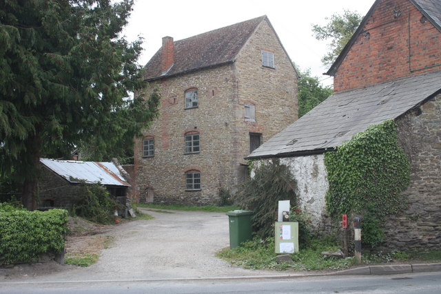
Bear's Wood Images

Images are sourced within 2km of 52.036938/-2.6070472 or Grid Reference SO5837. Thanks to Geograph Open Source API. All images are credited.

View to Backbury Hill Old cider orchards can be seen with plenty of mistletoe.
View to Backbury Hill
Old cider orchards can be seen with plenty of mistletoe.
Muddy orchard at Checkley Livestock feeding at this feeder has made this corner of this mature orchard muddy.
Muddy orchard at Checkley
Livestock feeding at this feeder has made this corner of this mature orchard muddy.
Farmland near Checkley
A steaming muck bury A muck bury steaming on a cold January day in farmland near Checkley.
A steaming muck bury
A muck bury steaming on a cold January day in farmland near Checkley.
Muck bury in a field Muck bury in a field, left to rot down before being spread on the land.
Muck bury in a field
Muck bury in a field, left to rot down before being spread on the land.
Sharpnage Wood Footpath entering Sharpnage Wood near Woolhope.
Sharpnage Wood
Footpath entering Sharpnage Wood near Woolhope.
Tree in an arable field Tree in an arable field near Checkley.
Tree in an arable field
Tree in an arable field near Checkley.
Mordiford Mill Utilising all four floors (including the attic space), this 1840s building extends an earlier mill.
When new roller mills producing white flour became popular old mills were used to mill animal feed and eventually went out of business in the early 20th century.
During WWII it was adapted to be used by the home guard by adding gun firing slits in the third floor - two can be seen either side of the window.
<a href="https://www.geograph.org.uk/photo/2409369">SO5737 : Mordiford Mill</a>
<a href="https://www.geograph.org.uk/photo/2409358">SO5737 : Mordiford Mill, ground floor</a>
<a href="https://www.geograph.org.uk/photo/2409468">SO5737 : Mordiford Mill, second floor</a>
<a href="https://www.geograph.org.uk/photo/2409439">SO5737 : Mordiford Mill, third floor</a>
<a href="https://www.geograph.org.uk/photo/2409405">SO5737 : Mordiford Mill, fourth floor</a>
Mordiford Mill
Utilising all four floors (including the attic space), this 1840s building extends an earlier mill. When new roller mills producing white flour became popular old mills were used to mill animal feed and eventually went out of business in the early 20th century. During WWII it was adapted to be used by the home guard by adding gun firing slits in the third floor - two can be seen either side of the window. SO5737 : Mordiford Mill SO5737 : Mordiford Mill, ground floor SO5737 : Mordiford Mill, second floor SO5737 : Mordiford Mill, third floor SO5737 : Mordiford Mill, fourth floor
Mordiford Mill, ground floor The two large cog wheels have wooden teeth made from apple trees because of their hardness.
The small wheel is cast iron complete with teeth.
The arch on the right wall suggests this may be an earlier mill that was then adapted to the four storey building we see today.
The mill is slowly undergoing a total restoration so the hopper and the millstones are being stored down here.
<a href="https://www.geograph.org.uk/photo/2409325">SO5737 : Mordiford Mill</a>
Mordiford Mill, ground floor
The two large cog wheels have wooden teeth made from apple trees because of their hardness. The small wheel is cast iron complete with teeth. The arch on the right wall suggests this may be an earlier mill that was then adapted to the four storey building we see today. The mill is slowly undergoing a total restoration so the hopper and the millstones are being stored down here. SO5737 : Mordiford Mill
Mordiford Mill The rear of the building showing the overshot wheel.
Notice the WWII gun slots from which the Home Guard could delay the invading enemy.
<a href="https://www.geograph.org.uk/photo/2409325">SO5737 : Mordiford Mill</a>
Mordiford Mill
The rear of the building showing the overshot wheel. Notice the WWII gun slots from which the Home Guard could delay the invading enemy. SO5737 : Mordiford Mill
Mordiford Mill, fourth floor The large wooden wheel could be lifted to tighten the wheel on to a leather drive belt to raise sacks of corn from the ground floor up to for storage or feeding into the mill machinery.
<a href="https://www.geograph.org.uk/photo/2409325">SO5737 : Mordiford Mill</a>
Mordiford Mill, fourth floor
The large wooden wheel could be lifted to tighten the wheel on to a leather drive belt to raise sacks of corn from the ground floor up to for storage or feeding into the mill machinery. SO5737 : Mordiford Mill
Mordiford Mill, fourth floor, hoist wheel Detail of the wheel which when raised tightened onto a leather drive belt to raise sacks from the ground floor.
<a href="https://www.geograph.org.uk/photo/2409405">SO5737 : Mordiford Mill, fourth floor</a>
Mordiford Mill, fourth floor, hoist wheel
Detail of the wheel which when raised tightened onto a leather drive belt to raise sacks from the ground floor. SO5737 : Mordiford Mill, fourth floor
Mordiford Mill, third floor Now being used to story a variety of tools and equipment.
The cupboard on the right as used to separate the fine ground flour from the coarse by passing the ground flour through a rotating near horizontal drum with varying mesh hessian coverings to sieve the flour.
Notice the WWII defensive gun slots by which the Home Guard would delay the advance of invading troops.
<a href="https://www.geograph.org.uk/photo/2409325">SO5737 : Mordiford Mill</a>
Mordiford Mill, third floor
Now being used to story a variety of tools and equipment. The cupboard on the right as used to separate the fine ground flour from the coarse by passing the ground flour through a rotating near horizontal drum with varying mesh hessian coverings to sieve the flour. Notice the WWII defensive gun slots by which the Home Guard would delay the advance of invading troops. SO5737 : Mordiford Mill
Mordiford Mill, second floor The mill has two grindstones driven from the floor below.
The vertical oak shaft fed power to two horizontal shafts.
The one on the left drove a leather belt up to the top floor to hoist sacks up from the ground floor.
The one on the right drove a belt to the rotating flour sieve "cupboard" that was against the right hand wall.
The curved wooden panel on the end wall was part of a lever system to control the flow of water over the wheel - located the other side of the wall.
<a href="https://www.geograph.org.uk/photo/2409325">SO5737 : Mordiford Mill</a>
Mordiford Mill, second floor
The mill has two grindstones driven from the floor below. The vertical oak shaft fed power to two horizontal shafts. The one on the left drove a leather belt up to the top floor to hoist sacks up from the ground floor. The one on the right drove a belt to the rotating flour sieve "cupboard" that was against the right hand wall. The curved wooden panel on the end wall was part of a lever system to control the flow of water over the wheel - located the other side of the wall. SO5737 : Mordiford Mill
Mordiford Mill water wheel Undergoing complete restoration.
The buckets have been removed using an angle grinder to cut through the completely corroded bolts.
New axle bearings are being made.
White limestone from the leet water has covered some of the iron.
<a href="https://www.geograph.org.uk/photo/2409369">SO5737 : Mordiford Mill</a>
Mordiford Mill water wheel
Undergoing complete restoration. The buckets have been removed using an angle grinder to cut through the completely corroded bolts. New axle bearings are being made. White limestone from the leet water has covered some of the iron. SO5737 : Mordiford Mill
Mordiford Mill mill wheel bucket The owner of the mill explaining the restoration work.
The water wheel, when restored will have many of these metal "buckets" around the circumference to drive the wheel by the weight of the water.
<a href="https://www.geograph.org.uk/photo/2409369">SO5737 : Mordiford Mill</a>
Mordiford Mill mill wheel bucket
The owner of the mill explaining the restoration work. The water wheel, when restored will have many of these metal "buckets" around the circumference to drive the wheel by the weight of the water. SO5737 : Mordiford Mill
Mordiford Mill, seed blower A wooden fan driven from the water wheel blows air through the vertically falling seed to remove dust and other contaminants out of the building.
<a href="https://www.geograph.org.uk/photo/2409325">SO5737 : Mordiford Mill</a>
Mordiford Mill, seed blower
A wooden fan driven from the water wheel blows air through the vertically falling seed to remove dust and other contaminants out of the building. SO5737 : Mordiford Mill
Mordiford Mill This is the floor above the stone floor and shows the defensive loopholes inserted for the home guard so that the bridge could be defended - see <a href="https://www.geograph.org.uk/photo/1454021">SO5737 : Loopholes in a former corn mill</a>. This watermill was open for National Mills weekend.
Mordiford Mill
This is the floor above the stone floor and shows the defensive loopholes inserted for the home guard so that the bridge could be defended - see SO5737 : Loopholes in a former corn mill. This watermill was open for National Mills weekend.
Show me another place!

Bear's Wood is located at Grid Ref: SO5837 (Lat: 52.036938, Lng: -2.6070472)

Unitary Authority: County of Herefordshire

Police Authority: West Mercia

What 3 Words

///ballpoint.facing.averages. Near Lugwardine, Herefordshire

Related Wikis

Mordiford

Mordiford is a village and civil parish in Herefordshire, England on the B4224 Hereford to Mitcheldean road 4 miles (6 km) east-southeast of the city of...

River Lugg

The River Lugg (Welsh: Afon Llugwy) rises near Llangynllo in Radnorshire, Wales. It flows through the border town of Presteigne and then through Herefordshire...

Dormington

Dormington is a village and civil parish in Herefordshire, in the West Midlands of England. Dormington village is at the north of its parish, 5 miles...

Fiddler's Green, Herefordshire

Fiddler's Green is a hamlet in the English county of Herefordshire. It is located near the River Wye on the B4224 road that connects Hereford and Ross...

Nearby Amenities

Located within 500m of 52.036938,-2.6070472
Barrier: stile
Bicycle: yes
Foot: yes
Lat/Long: 52.0385509/-2.600611
Barrier: stile
Bicycle: yes
Foot: yes
Lat/Long: 52.0372202/-2.6018873
Warslaw
Power: pole
Transformer: distribution
Voltage Primary: 11000
Lat/Long: 52.0402565/-2.6028974
Power: pole
Lat/Long: 52.0372524/-2.6000798
Power: pole
Lat/Long: 52.0378571/-2.6007443
Power: pole
Lat/Long: 52.0384864/-2.6013941
Power: pole
Lat/Long: 52.039314/-2.6022497
The data included in this document is from www.openstreetmap.org. The data is made available under ODbL.

Have you been to Bear's Wood?

Leave your review of Bear's Wood below (or comments, questions and feedback).