Ashen Coppice

Wood, Forest in Herefordshire

England

Ashen Coppice

Fly-tipping in a plantation, Five Bridge Another example of those with no respect or responsibility.  A sofa dumped in a plantation off the A438 to the west of Dormington.
Fly-tipping in a plantation, Five Bridge Credit: Philip Halling

Ashen Coppice is a picturesque woodland located in the county of Herefordshire, England. Situated in the heart of the countryside, this enchanting forest covers an area of approximately 200 acres, providing a serene and tranquil escape for nature enthusiasts and outdoor adventurers alike.

The coppice is primarily composed of a diverse array of deciduous trees, including oak, beech, birch, and ash, which lend their namesake to this charming woodland. These trees create a rich and vibrant canopy, allowing dappled sunlight to filter through, casting mesmerizing patterns on the forest floor.

The forest boasts a variety of walking trails, ranging from easy strolls to more challenging hikes. Visitors can explore the woodland's meandering pathways, immersing themselves in the sights and sounds of nature. Along the way, they may encounter an abundance of wildlife, such as deer, squirrels, and a myriad of bird species.

Ashen Coppice is also home to a small stream, which adds to the natural beauty of the woodland. The babbling brook provides a soothing soundtrack as it winds its way through the forest, while also creating a habitat for aquatic plants and creatures.

The woodland is open to the public year-round, allowing visitors to experience its ever-changing beauty with each passing season. In spring, the forest comes alive with a burst of vibrant wildflowers, while autumn paints the landscape in a breathtaking array of fiery hues.

Overall, Ashen Coppice is a hidden gem in Herefordshire, offering a tranquil retreat for those seeking solace in nature's embrace.

If you have any feedback on the listing, please let us know in the comments section below.

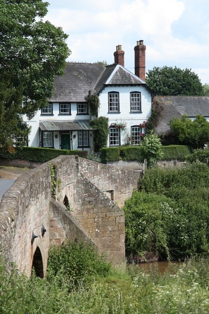
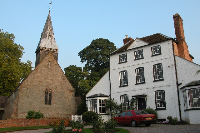
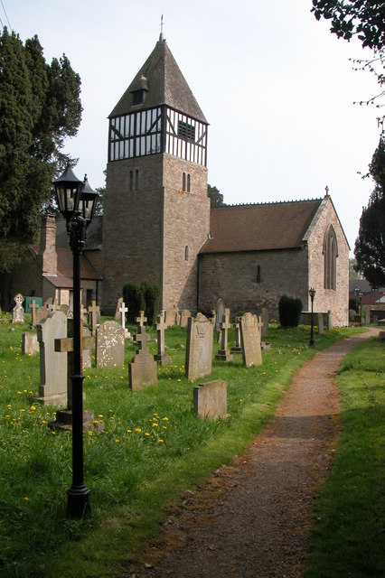
Ashen Coppice Images

Images are sourced within 2km of 52.045137/-2.6175691 or Grid Reference SO5738. Thanks to Geograph Open Source API. All images are credited.

Fly-tipping in a plantation, Five Bridge Another example of those with no respect or responsibility.  A sofa dumped in a plantation off the A438 to the west of Dormington.
Fly-tipping in a plantation, Five Bridge
Another example of those with no respect or responsibility. A sofa dumped in a plantation off the A438 to the west of Dormington.
The A438 between Dormington and Bartestree
Dormington church St Peter's church, Dormington dates from the 13th century and was heavily restored in the 19th century.
Dormington church
St Peter's church, Dormington dates from the 13th century and was heavily restored in the 19th century.
Hereford and Ledbury road signs
Dormington Church St Peter's church and an impressive Georgian house adjacent to it.
Dormington Church
St Peter's church and an impressive Georgian house adjacent to it.
Plantation, Five Bridges Marshy area with the road to Hereford requiring five bridges to cope with the waters of the River Frome.
Plantation, Five Bridges
Marshy area with the road to Hereford requiring five bridges to cope with the waters of the River Frome.
St Peter, Dormington
Interior, St Peter, Dormington
Footpath to Upper Dormington From the graveyard of St. Peter's Church
Footpath to Upper Dormington
From the graveyard of St. Peter's Church
St. Peter's Church, Dormington With a carpet of snowdrops on the churchyard floor in the late January sunshine.
St. Peter's Church, Dormington
With a carpet of snowdrops on the churchyard floor in the late January sunshine.
Spire detail, St. Peter's Church, Dormington A shingled bell turret with leaded spire.
Spire detail, St. Peter's Church, Dormington
A shingled bell turret with leaded spire.
GR postbox outside St. Peter's Church, Dormington
Bus shelter at Dormington With Shucknall Hill in the distance.
Bus shelter at Dormington
With Shucknall Hill in the distance.
Short footpath from Dormington
Churchyard,  St. Peter's Church, Dormington With many old gravestones against the wall.
Churchyard, St. Peter's Church, Dormington
With many old gravestones against the wall.
View over farmland at Bartestree The roof of the former Convent of Our Lady of Charity & Refuge can just be seen in the middle distance. Has been converted into luxury apartments. Backbury Hill is prominent in the distance.
View over farmland at Bartestree
The roof of the former Convent of Our Lady of Charity & Refuge can just be seen in the middle distance. Has been converted into luxury apartments. Backbury Hill is prominent in the distance.
See the wood for the trees A plantation of poplar possibly destined for chipboard manufacture. It is one of the few species that will take the regular flooding of the River Frome valley floor. View north of the A438 between Bartestree and Dormington.
Compare with the winter scene; <a href="https://www.geograph.org.uk/photo/152286">SO5740 : Plantation, Five Bridges</a>.
See the wood for the trees
A plantation of poplar possibly destined for chipboard manufacture. It is one of the few species that will take the regular flooding of the River Frome valley floor. View north of the A438 between Bartestree and Dormington. Compare with the winter scene; SO5740 : Plantation, Five Bridges.
Herefordshire hop garden South of the A438 at Five Bridges looking towards Tower Hill beyond Dormington.
Herefordshire hop garden
South of the A438 at Five Bridges looking towards Tower Hill beyond Dormington.
Show me another place!

Ashen Coppice is located at Grid Ref: SO5738 (Lat: 52.045137, Lng: -2.6175691)

Unitary Authority: County of Herefordshire

Police Authority: West Mercia

What 3 Words

///unguarded.mixer.wildfires. Near Lugwardine, Herefordshire

Related Wikis

Mordiford

Mordiford is a village and civil parish in Herefordshire, England on the B4224 Hereford to Mitcheldean road 4 miles (6 km) east-southeast of the city of...

Dormington

Dormington is a village and civil parish in Herefordshire, in the West Midlands of England. Dormington village is at the north of its parish, 5 miles...

Hampton Bishop

Hampton Bishop is a village and civil parish south-east of Hereford, in Herefordshire, England. The population of the civil parish at the 2011 Census was...

River Lugg

The River Lugg (Welsh: Afon Llugwy) rises near Llangynllo in Radnorshire, Wales. It flows through the border town of Presteigne and then through Herefordshire...

Nearby Amenities

Located within 500m of 52.045137,-2.6175691
Prior's Frome
Place: hamlet
Wikidata: Q105444217
Lat/Long: 52.0483385/-2.6192914
Bus Stop
Yew Tree Inn
Naptan AtcoCode: 2090A130000
Naptan Bearing: N
Naptan BusStopType: CUS
Naptan CommonName: Yew Tree Inn
Naptan Indicator: adj
Naptan Landmark: Yew Tree Inn
Naptan NaptanCode: heradwta
Naptan Street: N/K
Naptan Verified: no
Source: naptan_import
Lat/Long: 52.048009/-2.6198405
Bus Stop
Yew Tree Inn
Naptan AtcoCode: 2090A19720
Naptan Bearing: S
Naptan BusStopType: CUS
Naptan CommonName: Yew Tree Inn
Naptan Indicator: opp
Naptan Landmark: Yew Tree Inn
Naptan NaptanCode: heramjaw
Naptan Street: N/K
Naptan Verified: no
Source: naptan_import
Lat/Long: 52.0480016/-2.6197486
Power: pole
Lat/Long: 52.0418288/-2.6176761
Power: pole
Lat/Long: 52.0434673/-2.6164668
Power: pole
Lat/Long: 52.0439816/-2.6162978
Power: pole
Lat/Long: 52.0455713/-2.6164784
Power: pole
Lat/Long: 52.0465687/-2.6165736
Power: pole
Lat/Long: 52.0474977/-2.616689
Power: pole
Lat/Long: 52.0485579/-2.6168192
Power: pole
Lat/Long: 52.0495668/-2.6169342
Barrier: stile
Bicycle: yes
Foot: yes
Lat/Long: 52.0436067/-2.6149172
Barrier: stile
Lat/Long: 52.0463021/-2.6107358
Generator Method: photovoltaic
Generator Output Electricity: yes
Generator Source: solar
Generator Type: solar_photovoltaic_panel
Power: generator
Lat/Long: 52.0458215/-2.6209849
Pub
Lat/Long: 52.0480022/-2.6201347
Barrier: kissing_gate
Lat/Long: 52.0437393/-2.6164091
Sufton
Place: hamlet
Lat/Long: 52.0443678/-2.6227416
Tourism: picnic_site
Lat/Long: 52.0436281/-2.6171057
Power: pole
Lat/Long: 52.0425072/-2.6171802
Power: pole
Lat/Long: 52.044934/-2.6164024
Addr Housenumber: 20
Lat/Long: 52.0443006/-2.6232195
Addr Housenumber: 18
Lat/Long: 52.0444144/-2.6234661
Addr Housenumber: 27
Lat/Long: 52.044185/-2.6225139
Addr Housenumber: 13
Lat/Long: 52.0442345/-2.6242333
Addr Housenumber: 15
Lat/Long: 52.0443748/-2.6239033
Power: pole
Lat/Long: 52.0420098/-2.6221235
Old Sufton
Power: pole
Transformer: distribution
Voltage Primary: 11000
Lat/Long: 52.0428792/-2.6215093
Power: pole
Lat/Long: 52.0432768/-2.6114658
Power: pole
Lat/Long: 52.0432414/-2.6122959
Power: pole
Lat/Long: 52.04321/-2.6130925
Cock Shoot
Power: pole
Transformer: distribution
Voltage Primary: 11000
Lat/Long: 52.0431836/-2.6138784
Power: pole
Lat/Long: 52.0428693/-2.6148118
Power: pole
Lat/Long: 52.040977/-2.6155199
Power: pole
Lat/Long: 52.0419578/-2.6155937
Power: pole
Lat/Long: 52.0426087/-2.6155883
Power: pole
Lat/Long: 52.0423249/-2.6164332
Power: pole
Lat/Long: 52.0419067/-2.6176576
Power: pole
Lat/Long: 52.0423546/-2.6199623
Power: pole
Lat/Long: 52.0427972/-2.6206563
Power: pole
Lat/Long: 52.041929/-2.6192945
Power: pole
Lat/Long: 52.0431828/-2.6212907
Power: pole
Lat/Long: 52.0434121/-2.621115
Sufton Rise
Power: pole
Transformer: distribution
Voltage Primary: 11000
Lat/Long: 52.0440184/-2.6221892
Power: pole
Lat/Long: 52.0440275/-2.6209514
Power: pole
Lat/Long: 52.044623/-2.6208226
Power: pole
Lat/Long: 52.0452952/-2.6206416
Old Sufton Lane
Power: pole
Transformer: distribution
Voltage Primary: 11000
Lat/Long: 52.0458718/-2.6207918
Power: pole
Lat/Long: 52.0462075/-2.6211713
Power: pole
Lat/Long: 52.046417/-2.6214127
Priors Frome South
Power: pole
Transformer: distribution
Voltage Primary: 11000
Lat/Long: 52.0467807/-2.6201051
Power: pole
Lat/Long: 52.0467461/-2.6213242
Power: pole
Lat/Long: 52.0473371/-2.6211968
Yew Tree Inn
Power: pole
Transformer: distribution
Voltage Primary: 11000
Lat/Long: 52.048187/-2.6209165
Priors Frome
Power: pole
Transformer: distribution
Voltage Primary: 11000
Lat/Long: 52.0491198/-2.6198275
Power: pole
Lat/Long: 52.0488485/-2.6206429
The data included in this document is from www.openstreetmap.org. The data is made available under ODbL.

Have you been to Ashen Coppice?

Leave your review of Ashen Coppice below (or comments, questions and feedback).