Blackhorse Wood

Wood, Forest in Gloucestershire

England

Blackhorse Wood

Escalators at John Lewis, Cribbs Causeway
Escalators at John Lewis, Cribbs Causeway Credit: Roger Cornfoot

Blackhorse Wood is a picturesque forest located in Gloucestershire, England. Covering an area of approximately 200 acres, this woodland is a popular destination for nature enthusiasts and outdoor enthusiasts alike. The wood is named after the nearby Blackhorse Cottage and is situated within the Cotswolds Area of Outstanding Natural Beauty.

The wood is characterized by a diverse range of tree species, including oak, beech, and ash, which create a dense canopy overhead. These ancient trees provide a tranquil and shady atmosphere, making it an ideal place for peaceful walks and picnics. The forest floor is adorned with a vibrant carpet of wildflowers during the spring and summer months, further enhancing its natural beauty.

Blackhorse Wood is home to a rich variety of wildlife, including deer, badgers, and a multitude of bird species. Birdwatchers will be delighted by the presence of woodpeckers, owls, and various songbirds that can be spotted throughout the year. Nature lovers can also find a diverse range of insects and fungi, making it an excellent location for wildlife photography and exploration.

The wood is intersected by several well-maintained trails, allowing visitors to explore its hidden treasures at their own pace. These trails offer breathtaking views of the surrounding countryside and provide opportunities for cycling, horse riding, and dog walking. Additionally, there are designated picnic areas and benches scattered throughout the wood, providing visitors with the perfect spot to rest and enjoy the serenity of their surroundings.

Overall, Blackhorse Wood is a captivating natural haven that offers a peaceful escape from the hustle and bustle of everyday life. Its diverse ecosystem, scenic beauty, and recreational opportunities make it a must-visit destination for both locals and tourists alike.

If you have any feedback on the listing, please let us know in the comments section below.

Blackhorse Wood Images

Images are sourced within 2km of 51.53217/-2.6166983 or Grid Reference ST5781. Thanks to Geograph Open Source API. All images are credited.

Escalators at John Lewis, Cribbs Causeway
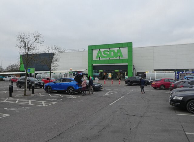
Asda, Patchway
Asda, Patchway
The Mall at Cribbs Causeway The Mall. A large indoor shopping centre on the Northern edge of Bristol. Jct. 17 M5
The Mall at Cribbs Causeway
The Mall. A large indoor shopping centre on the Northern edge of Bristol. Jct. 17 M5
John Lewis, The Mall, Cribbs Causeway The western entrance to the Mall and John Lewis store at Cribbs Causeway, a mecca for shoppers
John Lewis, The Mall, Cribbs Causeway
The western entrance to the Mall and John Lewis store at Cribbs Causeway, a mecca for shoppers
Compton Greenfield (Glos) All Saints Church
Mercedes-Benz at Cribbs Just one of the many 'sheds' at Cribbs Causeway  shopping centre.
Mercedes-Benz at Cribbs
Just one of the many 'sheds' at Cribbs Causeway shopping centre.
Morrisons store, Cribbs Causeway A view looking west to the illuminated towers of the Morrisons store at Cribbs Causeway Regional Shopping Centre.
Morrisons store, Cribbs Causeway
A view looking west to the illuminated towers of the Morrisons store at Cribbs Causeway Regional Shopping Centre.
Wyck Beck Road, Henbury Behind the hedge beyond the roundabout is Clifton Rugby Ground. The row of trees on the horizon is the M5.
Wyck Beck Road, Henbury
Behind the hedge beyond the roundabout is Clifton Rugby Ground. The row of trees on the horizon is the M5.
Berwick
Berwick
Man Made Structure I don't know what this structure is that is marked on the OS Map running along the side of the road.
Man Made Structure
I don't know what this structure is that is marked on the OS Map running along the side of the road.
Man Made Embankment The end of the man-made embankment looking south-east. 
The map and the actual ground features seem slightly different as the footpath actually starts by the end of the structure. Another photo of the structure is <a href="https://www.geograph.org.uk/photo/118651">ST5580 : Man Made Structure</a> in the neighbouring grid square.
Man Made Embankment
The end of the man-made embankment looking south-east. The map and the actual ground features seem slightly different as the footpath actually starts by the end of the structure. Another photo of the structure is ST5580 : Man Made Structure in the neighbouring grid square.
End of the road This road used to go to Vimpenny's Common according to the 1940's OS Map, now the M49 blocks the way and Vimpenny's Common is no longer there. The M49 is on the horizon.
End of the road
This road used to go to Vimpenny's Common according to the 1940's OS Map, now the M49 blocks the way and Vimpenny's Common is no longer there. The M49 is on the horizon.
Road by Brook Farm
Road by Brook Farm
Compton Greenfield Junction leading into Compton Greenfield, looking north-west.
"Compton" is derived from the words 'combe' meaning valley, and 'ton' meaning settlement.
Compton Greenfield
Junction leading into Compton Greenfield, looking north-west. "Compton" is derived from the words 'combe' meaning valley, and 'ton' meaning settlement.
Steep winding road The road is narrow and climbs between the steep banks.
Steep winding road
The road is narrow and climbs between the steep banks.
Bridge under the M5 by Hollywood Tower The entrance to Hollywood Tower is on the left just before the bridge. On the other side of the bridge is the Cribbs Causeway Shopping Centre.
Bridge under the M5 by Hollywood Tower
The entrance to Hollywood Tower is on the left just before the bridge. On the other side of the bridge is the Cribbs Causeway Shopping Centre.
Lollipop by Boots Immediately outside Boots and beside the play area is this structure.
Lollipop by Boots
Immediately outside Boots and beside the play area is this structure.
Water feature at the Mall A view of the dancing waters feature at The Mall, which periodically shoots a large jet of water into the air.
Water feature at the Mall
A view of the dancing waters feature at The Mall, which periodically shoots a large jet of water into the air.
Show me another place!

Blackhorse Wood is located at Grid Ref: ST5781 (Lat: 51.53217, Lng: -2.6166983)

Unitary Authority: South Gloucestershire

Police Authority: Avon and Somerset

What 3 Words

///tower.drape.stiff. Near Almondsbury, Gloucestershire

Nearby Locations

Blackhorse Wood

Related Wikis

Easter Compton

Easter Compton is a village in the civil parish of Almondsbury, South Gloucestershire, England. It is situated at the bottom of a hill (known as Blackhorse...

Wild Place Project

Bristol Zoo Project, formerly known as Wild Place Project, is a wildlife conservation park in South Gloucestershire, United Kingdom. It is run by Bristol...

Compton Greenfield

Compton Greenfield is a small hamlet of farms and spread out houses to the south west of Easter Compton, in South Gloucestershire. The parish church of...

Catbrain

Catbrain Hill, simply known as Catbrain, is a small village in England north of the city of Bristol, within the county of South Gloucestershire. It is...

The Wave (company)

The Wave is a firm building artificial wave pools for surfing in England. The Wave: Bristol was opened in 2019, on the northern outskirts of the city....

Cribbs Causeway

Cribbs Causeway is both a road in South Gloucestershire, England, running north of the city of Bristol, and the adjacent area which is notable for its...

Over, South Gloucestershire

Over is a village in the civil parish of Almondsbury in South Gloucestershire, England, 6 miles (10 km) north of Bristol. It lies on the B4055, a road...

Berwick, Gloucestershire

Berwick is a hamlet in the South Gloucestershire district, in the English county of Gloucestershire. Nearby settlements include the city of Bristol and...

Nearby Amenities

Located within 500m of 51.53217,-2.6166983
Bus Stop
Hollywood Lane
Naptan AtcoCode: 0170SGB20578
Naptan Bearing: SE
Naptan CommonName: Hollywood Lane
Naptan Crossing: Bowstreet Lane
Naptan NaptanCode: sglagda
Naptan Street: Berwick Lane
Naptan Verified: no
Shelter: no
Source: naptan_import
Lat/Long: 51.533727/-2.6226746
Power: tower
Lat/Long: 51.5359689/-2.6196765
Power: tower
Lat/Long: 51.5359656/-2.6159018
Passing Place
Passing Place: right
Lat/Long: 51.5287465/-2.614991
Toilets
Lat/Long: 51.5308364/-2.6121842
Guest Information
Information: office
Tourism: information
Lat/Long: 51.5306377/-2.6123745
Ice Cream
Berries & Nuts
Outdoor Seating: yes
Lat/Long: 51.5332761/-2.6107429
Toilets
Access: customers
Fee: no
Unisex: yes
Lat/Long: 51.5333771/-2.6104783
Cafe
Base Camp Pizzeria
Cuisine: pizza
Outdoor Seating: yes
Lat/Long: 51.5328322/-2.6124313
Toilets
Access: customers
Fee: no
Toilets Disposal: chemical
Toilets Position: seated
Unisex: yes
Wheelchair: no
Lat/Long: 51.532415/-2.613743
Entrance: yes
Lat/Long: 51.5302892/-2.6128229
Barrier: bollard
Bollard: removable
Material: steel
Lat/Long: 51.5309091/-2.6204203
Entrance: yes
Lat/Long: 51.5296598/-2.6146278
Entrance: yes
Lat/Long: 51.529458/-2.6147353
Entrance: main
Lat/Long: 51.5293677/-2.6147751
Bear Wood
Natural: wood
Lat/Long: 51.5340268/-2.6110822
Blackhorse Wood
Natural: wood
Lat/Long: 51.532128/-2.6161301
Leisure: bird_hide
Lat/Long: 51.5309442/-2.6159102
Ice Cream
Ice Cream Parlour
Lat/Long: 51.5301916/-2.6152102
Secret Congo
Attraction: animal
Lat/Long: 51.5305615/-2.6140532
Leisure: picnic_table
Lat/Long: 51.5323382/-2.6140246
Leisure: picnic_table
Lat/Long: 51.532294/-2.6140286
Leisure: picnic_table
Lat/Long: 51.532294/-2.6139522
Leisure: picnic_table
Lat/Long: 51.5323391/-2.6139575
Bristol Bulldog
Artwork Type: sculpture
Tourism: artwork
Lat/Long: 51.5304514/-2.6141649
Leisure: picnic_table
Lat/Long: 51.5293331/-2.6158458
Leisure: picnic_table
Lat/Long: 51.5293782/-2.615819
Leisure: picnic_table
Lat/Long: 51.5294266/-2.6155186
Geollect
Level: 1
Office: company
Lat/Long: 51.5294986/-2.6146563
BCI Stone Ltd
Level: 0
Office: company
Lat/Long: 51.5296209/-2.6147349
Carter Schwartz
Level: 0
Office: employment_agency
Lat/Long: 51.5294122/-2.6147787
Addr Housename: The Brake
Building: yes
Fixme: approximate
Lat/Long: 51.5364885/-2.615701
Addr Housename: Beanacre
Building: yes
Fixme: approximate
Lat/Long: 51.5364694/-2.6162038
Entrance: yes
Lat/Long: 51.5339644/-2.6106892
Leisure: picnic_table
Lat/Long: 51.5325084/-2.6113316
Leisure: picnic_table
Lat/Long: 51.5325351/-2.6114014
Leisure: picnic_table
Lat/Long: 51.5325468/-2.611337
Camp Baboon
Tourism: camp_site
Lat/Long: 51.5328238/-2.6101166
Leisure: picnic_table
Lat/Long: 51.5327212/-2.6118855
Barrier: block
Lat/Long: 51.5327112/-2.6116844
Barrier: block
Lat/Long: 51.5327629/-2.6116884
Barrier: block
Lat/Long: 51.5327812/-2.6117407
Barrier: block
Lat/Long: 51.5327145/-2.6117863
Barrier: block
Lat/Long: 51.5327746/-2.6118252
Artwork Type: sculpture
Tourism: artwork
Lat/Long: 51.5318051/-2.6128269
Leisure: picnic_table
Lat/Long: 51.5300189/-2.6155722
Leisure: picnic_table
Lat/Long: 51.5300656/-2.6155373
Leisure: picnic_table
Lat/Long: 51.5299272/-2.6156138
Clock
Lat/Long: 51.5298139/-2.6171875
Leisure: picnic_table
Lat/Long: 51.5306104/-2.6167242
Leisure: picnic_table
Lat/Long: 51.5306447/-2.6167028
Webb's Brake
Natural: wood
Lat/Long: 51.5316375/-2.6121095
Leisure: picnic_table
Lat/Long: 51.5311911/-2.6118547
Addr Housename: Lyde House
Building: yes
Fixme: approximate
Lat/Long: 51.5337014/-2.6230797
Marker: post
Utility: oil
Lat/Long: 51.5347525/-2.61876
Marker: post
Utility: oil
Lat/Long: 51.53476/-2.6185575
Barrier: block
Lat/Long: 51.5337948/-2.6203923
Barrier: kissing_gate
Lat/Long: 51.5351822/-2.6155903
Barrier: kissing_gate
Lat/Long: 51.535236/-2.6156782
Marker: post
Utility: oil
Lat/Long: 51.5350328/-2.6159799
Marker: post
Utility: oil
Lat/Long: 51.5350812/-2.6160738
Barrier: bollard
Lat/Long: 51.5345987/-2.6183425
Passing Place
Passing Place: left
Lat/Long: 51.5286243/-2.614977
Barrier: kissing_gate
Lat/Long: 51.536152/-2.613652
Marker: post
Utility: oil
Lat/Long: 51.5351129/-2.6149838
Marker: post
Utility: oil
Lat/Long: 51.5351308/-2.6155815
Barrier: kissing_gate
Lat/Long: 51.5345427/-2.6181632
Addr Housename: The Ranger
Building: yes
Fixme: approximate
Lat/Long: 51.5365236/-2.6167242
Traffic Mirror
Lat/Long: 51.5306463/-2.6106745
Power: substation
Lat/Long: 51.5304878/-2.6109628
Marker: post
Utility: oil
Lat/Long: 51.5350646/-2.6114657
Marker: post
Utility: oil
Lat/Long: 51.5350796/-2.6112203
Toilets
Access: customers
Fee: no
Unisex: yes
Lat/Long: 51.533409/-2.6106591
Entrance: yes
Lat/Long: 51.5335814/-2.6102517
Marker: post
Utility: oil
Lat/Long: 51.5350312/-2.6122168
Marker: post
Utility: oil
Lat/Long: 51.5351125/-2.6125994
Marker: post
Utility: oil
Lat/Long: 51.5350812/-2.6154401
Bureau Veritas
Level: 1
Office: company
Lat/Long: 51.5295695/-2.6147723
Empower
Level: 1
Office: company
Lat/Long: 51.529635/-2.6146957
Toilets
Level: 1
Lat/Long: 51.5295916/-2.6146602
Toilets
Level: 0
Lat/Long: 51.529555/-2.614749
Toilets
Level: 1
Lat/Long: 51.5296707/-2.6146752
Bench
Lat/Long: 51.5320792/-2.6121792
Leisure: bird_hide
Lat/Long: 51.5318577/-2.6121967
Bench
Lat/Long: 51.5305812/-2.615473
Leisure: picnic_table
Lat/Long: 51.5301107/-2.6144819
Leisure: picnic_table
Lat/Long: 51.5301357/-2.6143813
Bench
Lat/Long: 51.5301658/-2.6143491
Leisure: picnic_table
Lat/Long: 51.5304344/-2.6138113
Bench
Lat/Long: 51.5301103/-2.6139978
Bench
Lat/Long: 51.53022/-2.6141104
Access: no
Barrier: bollard
Bicycle: yes
Bollard: fixed
Foot: yes
Horse: yes
Lat/Long: 51.5282782/-2.6159358
Direction: 140
Generator Method: photovoltaic
Generator Output Electricity: yes
Generator Solar Modules: 20
Generator Source: solar
Generator Type: solar_photovoltaic_panel
Location: roof
Power: generator
Lat/Long: 51.5362818/-2.6152369
Material: wood
Power: pole
Lat/Long: 51.5360121/-2.6202666
Material: wood
Power: pole
Lat/Long: 51.5354456/-2.6205796
Material: wood
Power: pole
Lat/Long: 51.534883/-2.6208987
Material: wood
Power: pole
Lat/Long: 51.5342836/-2.6212301
Power: pole
Lat/Long: 51.5337677/-2.6215309
Direction: 160
Generator Method: photovoltaic
Generator Output Electricity: yes
Generator Solar Modules: 4
Generator Source: solar
Generator Type: solar_photovoltaic_panel
Location: roof
Power: generator
Lat/Long: 51.5331299/-2.6222528
Direction: 200
Generator Method: photovoltaic
Generator Output Electricity: yes
Generator Solar Modules: 10
Generator Source: solar
Generator Type: solar_photovoltaic_panel
Location: roof
Power: generator
Lat/Long: 51.5330485/-2.6221984
Direction: 235
Generator Method: photovoltaic
Generator Output Electricity: yes
Generator Solar Modules: 21
Generator Source: solar
Generator Type: solar_photovoltaic_panel
Location: roof
Power: generator
Lat/Long: 51.5335888/-2.6234433
The data included in this document is from www.openstreetmap.org. The data is made available under ODbL.

Have you been to Blackhorse Wood?

Leave your review of Blackhorse Wood below (or comments, questions and feedback).