Connel Park

Settlement in Ayrshire

Scotland

Connel Park

South Boig Farm Viewed from Connel Park, looking in the Cumnock direction.
South Boig Farm Credit: Mary and Angus Hogg

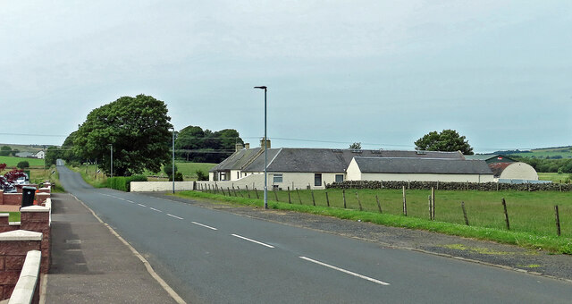
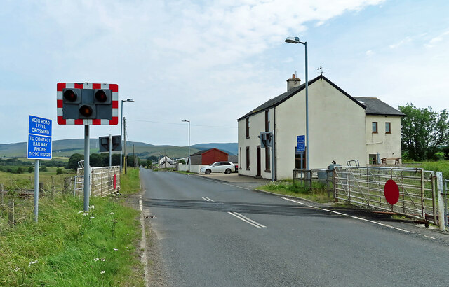
Connel Park is a small village located in the county of Ayrshire, Scotland. Situated just outside the town of Kilmarnock, it is surrounded by picturesque countryside and offers a tranquil setting for its residents. The village itself is home to a close-knit community that takes pride in its beautiful surroundings.

One of the notable features of Connel Park is its abundance of green spaces. The village is surrounded by well-maintained parks and gardens, providing residents with ample opportunities for outdoor activities and leisurely walks. Additionally, the nearby Irvine Valley offers stunning views and scenic hiking trails for nature enthusiasts.

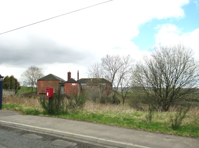
Connel Park offers a range of amenities and facilities to cater to the needs of its residents. The village has a primary school, providing education for local children, and a community center that hosts various events and activities throughout the year. There are also several shops and local businesses that ensure residents have access to essential services.

For those seeking cultural experiences, the nearby town of Kilmarnock offers a range of attractions. The Dick Institute, an art gallery and museum, showcases a diverse collection of artworks and artifacts. The town is also home to a variety of shops, restaurants, and entertainment venues, ensuring that residents of Connel Park have access to a wide range of amenities.

Overall, Connel Park is a charming village in Ayrshire, offering a peaceful and picturesque setting for its residents. With its beautiful green spaces and proximity to nearby attractions, it provides an ideal location for those seeking a balanced lifestyle in a close-knit community.

If you have any feedback on the listing, please let us know in the comments section below.

Connel Park Images

Images are sourced within 2km of 55.381941/-4.211294 or Grid Reference NS6012. Thanks to Geograph Open Source API. All images are credited.

South Boig Farm Viewed from Connel Park, looking in the Cumnock direction.
South Boig Farm
Viewed from Connel Park, looking in the Cumnock direction.
Approaching Burnside
Cottages beside the B741
The track to Cascaya
The track to Lanemark
Bus stops on the B741 The road, on the left, is Glen Park.
Bus stops on the B741
The road, on the left, is Glen Park.
Post box on the B741 I am told that the buildings were once part of a colliery.
Post box on the B741
I am told that the buildings were once part of a colliery.
B741 to New Cumnock
B741 to New Cumnock
B741 to Dalmellington near Bankglen
Farmland near Bankglen
Approaching Nith Bridge The road connects Cumnock with Connel Park and New Cumnock.
Approaching Nith Bridge
The road connects Cumnock with Connel Park and New Cumnock.
Meadowsweet by the Nith A bonny swathe of meadowsweet flowering beside the Nith near Meikle Creoch.
Meadowsweet by the Nith
A bonny swathe of meadowsweet flowering beside the Nith near Meikle Creoch.
River Nith view Looking towards the land called Mote Knowe.
River Nith view
Looking towards the land called Mote Knowe.
Burnside view Looking along the B741 towards New Cumnock.
Burnside view
Looking along the B741 towards New Cumnock.
At Boig Road Level Crossing The railway line was laid to serve the open-cast mining developments of the late 20th century. All traffic stopped when the open-cast industry collapsed. <a href="https://www.geograph.org.uk/photo/7239864">NS6014 : Coal from Knockshinnoch Washery 1997</a> shows rail traffic that was typical of the period on a nearby line.
At Boig Road Level Crossing
The railway line was laid to serve the open-cast mining developments of the late 20th century. All traffic stopped when the open-cast industry collapsed. NS6014 : Coal from Knockshinnoch Washery 1997 shows rail traffic that was typical of the period on a nearby line.
Boig Road Level Crossing The railway line was laid to serve the open-cast mining developments of the late 20th century. The track has lain idle since the collapse of the open-cast industry after a very short life-span. For a glimpse of past activity on a nearby line, see <a href="https://www.geograph.org.uk/photo/7239864">NS6014 : Coal from Knockshinnoch Washery 1997</a>
Boig Road Level Crossing
The railway line was laid to serve the open-cast mining developments of the late 20th century. The track has lain idle since the collapse of the open-cast industry after a very short life-span. For a glimpse of past activity on a nearby line, see NS6014 : Coal from Knockshinnoch Washery 1997
Entrance to Meikle Creoch farm This farm has diversified and also runs the Nith Holiday Cottages - the River Nith is nearby.
Entrance to Meikle Creoch farm
This farm has diversified and also runs the Nith Holiday Cottages - the River Nith is nearby.
The River Nith at Meikle Creoch Heavy frost still on the north facing slopes on this brilliant winter's day.
The River Nith at Meikle Creoch
Heavy frost still on the north facing slopes on this brilliant winter's day.
Show me another place!

Connel Park is located at Grid Ref: NS6012 (Lat: 55.381941, Lng: -4.211294)

Unitary Authority: East Ayrshire

Police Authority: Ayrshire

What 3 Words

///reforming.neutron.fairness. Near New Cumnock, East Ayrshire

Nearby Locations

Connel Park

Related Wikis

Knockshinnoch disaster

The Knockshinnoch disaster was a mining accident that occurred in September 1950 in the village of New Cumnock, Ayrshire, Scotland. A glaciated lake filled...
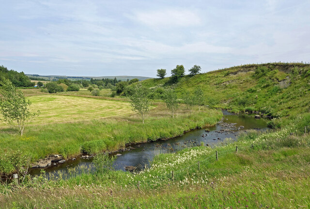
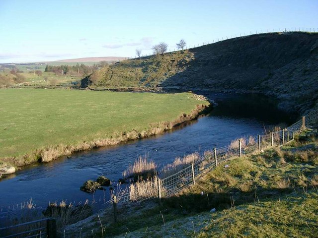
Connel Burn

Connel Burn is a river in East Ayrshire, Scotland which rises at Enoch Hill in the Southern Uplands and flows northwards through Laglaf and Connel Park...

New Cumnock Town Hall

New Cumnock Town Hall is a municipal building in Castle, New Cumnock, East Ayrshire, Scotland. The structure, which is used as a community events venue...

New Cumnock

New Cumnock is a town in East Ayrshire, Scotland. It expanded during the coal-mining era from the late 18th century, and mining remained its key industry...

River Afton

The River Afton (or Afton Water) is a small river in Ayrshire, Scotland, which flows north from Alwhat Hill in the Carsphairn and Scaur Hills, through...

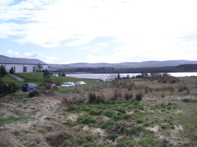
Loch o' th' Lowes (New Cumnock)

Loch o' th' Lowes (NS 60183 14581), Lochside or Meikle Creoch Loch is a freshwater loch in the Parish of New Cumnock in the East Ayrshire Council Area...

Glenafton Athletic F.C.

Glenafton Athletic Football Club is a Scottish football club, based in New Cumnock, Ayrshire. Members of the Scottish Junior Football Association, they...

New Cumnock railway station

New Cumnock railway station is a railway station serving the town of New Cumnock, East Ayrshire, Scotland. The station is managed by ScotRail and is on...

Related Videos

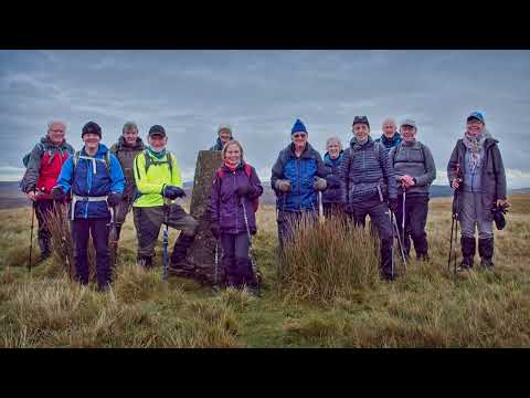
Kilmarnock Ramblers, Corsencon, New Cumnock, Nov 4th 2023

A nice day weatherwise sees us down at New Cumnock where we walk a Corsencon circular walk. A really nice day out on the ...

Killie Ramblers, New Cumnock Circular, New Cumnock, Dec 17th 2022

A nice easy walk around New Cumnock apart from the slippery conditions underfoot. A good day out with even some sunshine to ...

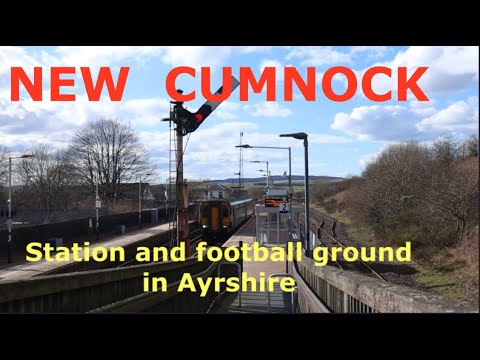
New Cumnock - a station and a football ground.

New Cumnock station in Ayrshire, on the Glasgow & South-Western main line. My visit coincided with diversions off the WCML ...

Chloe & Chris' Wedding Highlights Film - Lochside House Hotel - New Cumnock, Scotland

Venue: Lochside House Hotel Officiant: Norrie Flowers Flowers: I Am Flowers UK Dress: Eleganza Sposa Hair: Cameo Bridal ...

Nearby Amenities

Located within 500m of 55.381941,-4.211294
Post Box
Source: survey
Lat/Long: 55.3861094/-4.2120939
Power: pole
Lat/Long: 55.3778749/-4.2083577
Power: pole
Lat/Long: 55.3832098/-4.2181447
Power: pole
Lat/Long: 55.3825801/-4.217742
Power: pole
Lat/Long: 55.384526/-4.2170306
Power: pole
Lat/Long: 55.3838891/-4.2171165
Power: pole
Lat/Long: 55.3832263/-4.2172023
Power: pole
Lat/Long: 55.3779402/-4.2126613
Power: pole
Lat/Long: 55.385252/-4.2160449
Power: pole
Lat/Long: 55.3845252/-4.2160422
Power: pole
Lat/Long: 55.3837817/-4.2160127
Power: pole
Lat/Long: 55.3829924/-4.2159993
Power: pole
Lat/Long: 55.3823905/-4.2159966
Power: pole
Lat/Long: 55.3817643/-4.2159725
Power: pole
Lat/Long: 55.381077/-4.2160342
Power: pole
Lat/Long: 55.3804325/-4.2160878
Power: pole
Lat/Long: 55.3797086/-4.2161549
Power: pole
Lat/Long: 55.3788766/-4.2162139
Power: pole
Lat/Long: 55.3856291/-4.2158236
Power: pole
Lat/Long: 55.3852056/-4.2157593
Power: pole
Lat/Long: 55.3839432/-4.2156211
Power: pole
Lat/Long: 55.3828065/-4.2154763
Power: pole
Lat/Long: 55.3823341/-4.2154763
Power: pole
Lat/Long: 55.3817178/-4.2155635
Power: pole
Lat/Long: 55.3810443/-4.2156761
Power: pole
Lat/Long: 55.380322/-4.2157861
Power: pole
Lat/Long: 55.379554/-4.2159148
Power: pole
Lat/Long: 55.3787509/-4.2160704
Power: pole
Lat/Long: 55.3789238/-4.2168952
Power: pole
Lat/Long: 55.3796644/-4.2169783
Power: pole
Lat/Long: 55.3811319/-4.217158
Power: pole
Lat/Long: 55.3817323/-4.2172492
Power: pole
Lat/Long: 55.3823661/-4.2173163
Power: pole
Lat/Long: 55.3830747/-4.2177937
Power: pole
Lat/Long: 55.3837573/-4.2182416
Power: pole
Lat/Long: 55.3779571/-4.2141644
Power: pole
Lat/Long: 55.377918/-4.211201
Power: pole
Lat/Long: 55.3778955/-4.2097156
Power: pole
Lat/Long: 55.3776061/-4.2133377
Power: pole
Lat/Long: 55.3841766/-4.2153065
Power: pole
Lat/Long: 55.3846803/-4.2153699
Power: pole
Lat/Long: 55.3852071/-4.2149197
Power: pole
Lat/Long: 55.3859177/-4.214266
The data included in this document is from www.openstreetmap.org. The data is made available under ODbL.

Have you been to Connel Park?

Leave your review of Connel Park below (or comments, questions and feedback).