Underwood Grove

Wood, Forest in Gloucestershire Forest of Dean

England

Underwood Grove

Gateway to Tintern Quarry
Gateway to Tintern Quarry Credit: Gareth James

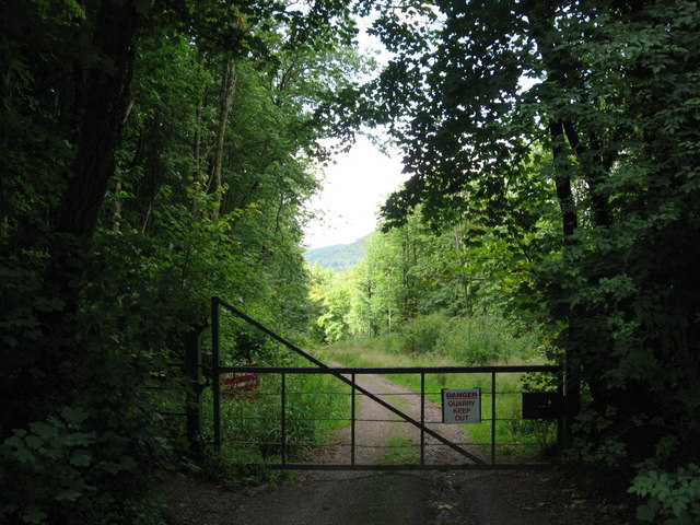
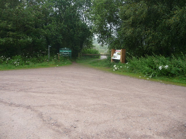
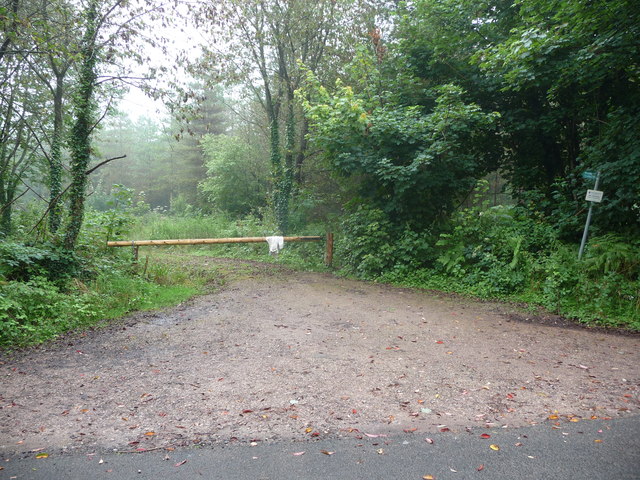
Underwood Grove, located in Gloucestershire, England, is a picturesque woodland area that offers visitors a serene and tranquil escape from the hustle and bustle of city life. Spanning over a vast expanse of land, the grove is nestled within the heart of Gloucestershire's rich forests.

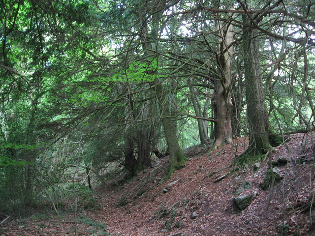
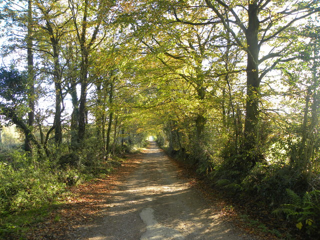
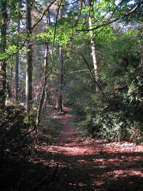
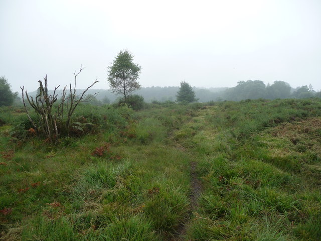
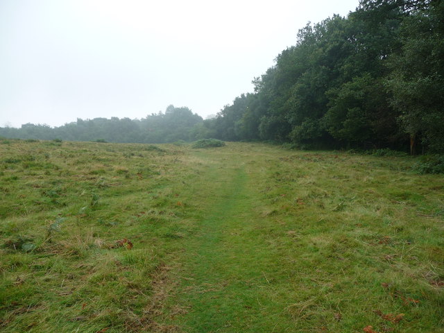
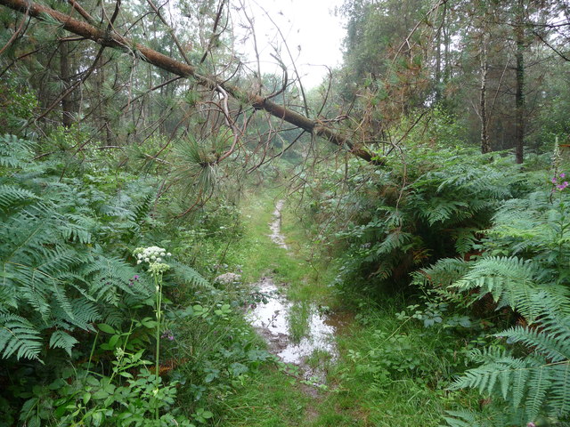
The woodland is primarily composed of a variety of deciduous trees, such as oak, beech, and birch, which create a stunning display of vibrant colors during the autumn months. The dense foliage provides a haven for a diverse range of wildlife, including deer, squirrels, and numerous bird species. As a result, Underwood Grove is a popular destination for nature enthusiasts and birdwatchers alike.

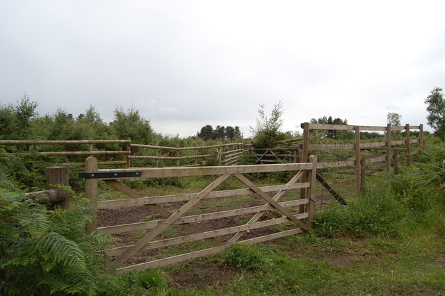
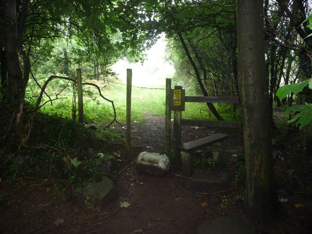
The grove features a network of well-maintained walking trails that wind their way through the forest, offering visitors the opportunity to explore its natural beauty at their own pace. These paths are suitable for all levels of fitness and provide stunning views of the surrounding landscape.

For those looking to immerse themselves further in nature, Underwood Grove also offers camping facilities. Campers can pitch their tents in designated areas amidst the trees, allowing them to experience a night under the stars while surrounded by the soothing sounds of the forest.

Overall, Underwood Grove is a hidden gem in Gloucestershire, offering a peaceful retreat for individuals seeking solace in nature. With its diverse flora and fauna, well-maintained trails, and camping opportunities, the grove provides an enriching experience for all who visit.

If you have any feedback on the listing, please let us know in the comments section below.

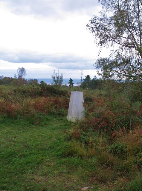
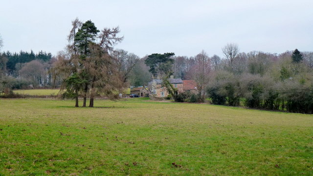
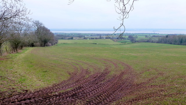
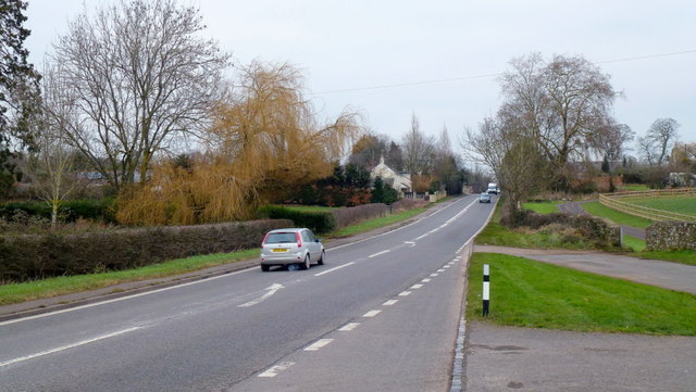
Underwood Grove Images

Images are sourced within 2km of 51.682292/-2.6283406 or Grid Reference ST5698. Thanks to Geograph Open Source API. All images are credited.

Gateway to Tintern Quarry
Beside Offa's Dyke
Beside Offa's Dyke
Flush Bracket on Trig Pillar
Trig Pillar Tidenham Park
Animal Pound Tidenham  Park
Animal Pound Tidenham Park
Miss Graces Lane This lane borders "The Park", an area of woodland and heathland.
Miss Graces Lane
This lane borders "The Park", an area of woodland and heathland.
Path through Parson's Allotment Public footpath passing through mixed woodland.
Path through Parson's Allotment
Public footpath passing through mixed woodland.
Old lime kilns at Ash Grove Former lime kilns at the edge of a shallow quarry next to Miss Grace's Lane.
Old lime kilns at Ash Grove
Former lime kilns at the edge of a shallow quarry next to Miss Grace's Lane.
Trig Point 217m Now largely surrounded by small trees and scrub, this OS trig point was probably erected when the view around was clear. The Severn estuary can be glimpsed in the distance.
Trig Point 217m
Now largely surrounded by small trees and scrub, this OS trig point was probably erected when the view around was clear. The Severn estuary can be glimpsed in the distance.
House at Park Hill View across pasture land with the backdrop of Burnt Plantation.
House at Park Hill
View across pasture land with the backdrop of Burnt Plantation.
Pastoral scene to the mighty Severn View from Park Hill Road over High Woolaston.
Pastoral scene to the mighty Severn
View from Park Hill Road over High Woolaston.
A48 at Stroat Looking north-east towards Lydney and Gloucester.
A48 at Stroat
Looking north-east towards Lydney and Gloucester.
Part of the Forestry Commission car park at The Park near Tidenham Chase Information boards and waymarked paths abound. Nice starting point for several walks locally.
Part of the Forestry Commission car park at The Park near Tidenham Chase
Information boards and waymarked paths abound. Nice starting point for several walks locally.
Heathland path near Poor's Allotment Heath and scrubland on a slightly dismal summer morning.
Heathland path near Poor's Allotment
Heath and scrubland on a slightly dismal summer morning.
Track into woodland off Rosemary Lane A barrier prevents unwelcome vehicular access.
Track into woodland off Rosemary Lane
A barrier prevents unwelcome vehicular access.
Path on Poor's Allotment A slightly autumnal August morning sets off the scene on this area of grassland and scrub.
Path on Poor's Allotment
A slightly autumnal August morning sets off the scene on this area of grassland and scrub.
Woodland path through Parson's Allotment Soggy, slippery path after a night of rain, made trickier by the odd obstacle.
Woodland path through Parson's Allotment
Soggy, slippery path after a night of rain, made trickier by the odd obstacle.
Woodland stile The stile gets me out of the woods. Great.
Woodland stile
The stile gets me out of the woods. Great.
Show me another place!

Underwood Grove is located at Grid Ref: ST5698 (Lat: 51.682292, Lng: -2.6283406)

Administrative County: Gloucestershire

District: Forest of Dean

Police Authority: Gloucestershire

What 3 Words

///downsize.hairstyle.vineyard. Near Tintern, Monmouthshire

Related Wikis

Ridley Bottom, Tidenham

Ridley Bottom (grid reference ST563985) is a 1.1-hectare (2.7-acre) nature reserve in Gloucestershire. The site is listed in the 'Forest of Dean Local...

Poor's Allotment

Poor's Allotment (grid reference ST560990) is a 28.57-hectare (70.6-acre) biological Site of Special Scientific Interest in Gloucestershire, notified in...

Miss Grace's Lane

Miss Grace's Lane (also known as Miss Grace's Lane Swallett), near Tidenham in the Forest of Dean, Gloucestershire, England, is a natural cave system,...

Boughspring

Boughspring is a hamlet in Gloucestershire, England. == History == Settlement at Boughspring dates back to Roman times when a villa was built nearby. Boughspring...

Nearby Amenities

Located within 500m of 51.682292,-2.6283406
Kellys Cottage
Landuse: residential
Source: OS OpenData StreetView
Lat/Long: 51.6851635/-2.6332434
Redding Well
Natural: spring
Source: OS OpenData StreetView
Lat/Long: 51.6808729/-2.6252611
Slade Well
Natural: spring
Source: OS OpenData StreetView
Lat/Long: 51.6841657/-2.6314409
The data included in this document is from www.openstreetmap.org. The data is made available under ODbL.

Have you been to Underwood Grove?

Leave your review of Underwood Grove below (or comments, questions and feedback).