Birch Spring Wood
Wood, Forest in Westmorland South Lakeland
England
Birch Spring Wood

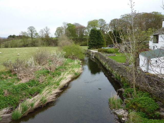
Birch Spring Wood is a picturesque woodland located in the county of Westmorland, England. Covering an area of approximately 50 acres, it is renowned for its stunning birch trees and tranquil atmosphere. The wood is situated on the outskirts of the small village of Westmorland, surrounded by rolling hills and meandering streams.
The woodland is primarily composed of silver birch trees, characterized by their slender trunks and distinct white bark. These trees create a beautiful canopy overhead, allowing dappled sunlight to filter through and illuminate the forest floor. In spring, the wood comes alive with vibrant colors as bluebells and wildflowers carpet the ground, creating a breathtaking sight.
Birch Spring Wood is a haven for wildlife, attracting a diverse range of species. Bird enthusiasts can often spot woodpeckers, nuthatches, and owls nestled among the branches, while deer and squirrels roam freely throughout the undergrowth. The wood is also home to a variety of insects, including butterflies and dragonflies, adding to its biodiversity.
The wood is a popular destination for nature lovers and hikers, offering a network of well-maintained trails that meander through its enchanting landscape. Visitors can enjoy a leisurely stroll, absorbing the peaceful ambiance, or engage in more vigorous activities such as running or cycling.
Overall, Birch Spring Wood in Westmorland is a captivating woodland that showcases the beauty of nature. Its stunning birch trees, vibrant flora, and diverse wildlife make it a must-visit destination for anyone seeking solace and tranquility in a natural setting.
If you have any feedback on the listing, please let us know in the comments section below.
Birch Spring Wood Images
Images are sourced within 2km of 54.361702/-2.6730198 or Grid Reference SD5696. Thanks to Geograph Open Source API. All images are credited.


Birch Spring Wood is located at Grid Ref: SD5696 (Lat: 54.361702, Lng: -2.6730198)
Administrative County: Cumbria
District: South Lakeland
Police Authority: Cumbria
What 3 Words
///clocks.joints.request. Near Burneside, Cumbria
Nearby Locations
Related Wikis

Docker, Cumbria
Docker is a civil parish in the South Lakeland district of the English county of Cumbria. Docker is 4.3 miles north east of the market town of Kendal....

Grayrigg derailment
The Grayrigg derailment was a fatal railway accident that occurred at approximately 20:15 GMT on 23 February 2007, just to the south of Grayrigg, Cumbria...
Patton Bridge
Patton Bridge is a small rural hamlet approximately 5 miles from the outskirts of Kendal, Cumbria, England. Its post code region is LA8.

Grayrigg
Grayrigg is a small village and civil parish in the South Lakeland district of Cumbria, England. In the 2001 census the parish had a population of 223...

Scalthwaiterigg
Scalthwaiterigg is a former civil parish, now in the parish of Skelsmergh and Scalthwaiterigg, in the Westmorland and Furness district, in the ceremonial...
Whinfell
Whinfell is a civil parish in South Lakeland, Cumbria, England. It does not have a parish council but a parish meeting. The parish lies north east of Kendal...
Beck Houses
Beck Houses is a hamlet in Cumbria, England. It lies south of Grayrigg in the Westmorland and Furness unitary authority area. The West Coast Main Line...
Lambrigg
Lambrigg is a civil parish in the South Lakeland district of the English county of Cumbria. It includes the hamlets of Cross Houses and Lambrigg Head...
Nearby Amenities
Located within 500m of 54.361702,-2.6730198Have you been to Birch Spring Wood?
Leave your review of Birch Spring Wood below (or comments, questions and feedback).