Bove Wood

Wood, Forest in Cumberland Carlisle

England

Bove Wood

St Mary's church, Cumrew
St Mary's church, Cumrew Credit: David Purchase

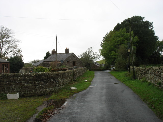
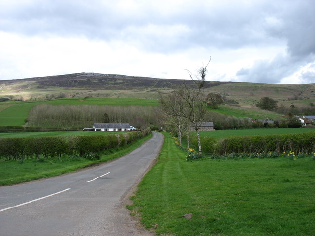
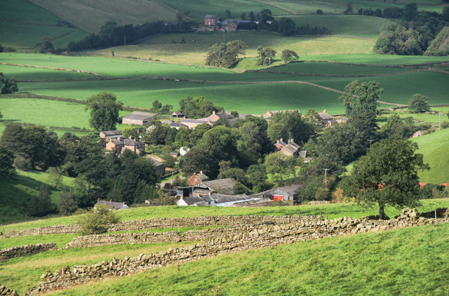
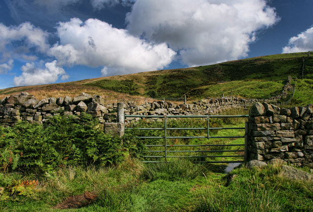
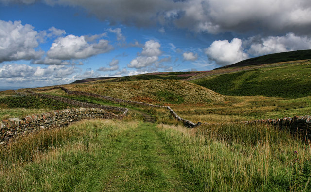
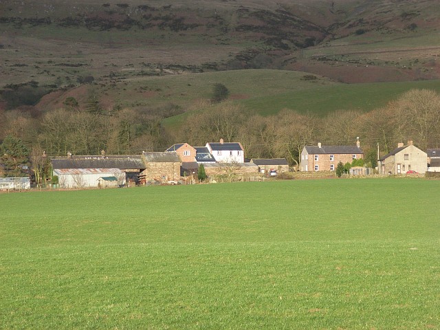
Bove Wood is a picturesque forest located in Cumberland, England. Covering an area of approximately 300 acres, it is known for its diverse flora and fauna, making it a popular destination for nature enthusiasts and hikers alike.

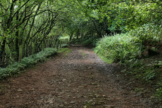
The wood is characterized by its dense canopy of ancient oak, beech, and birch trees, which provide a habitat for a wide range of wildlife. Visitors to Bove Wood may have the chance to spot various bird species, including woodpeckers, owls, and thrushes, as well as mammals such as deer, foxes, and squirrels.

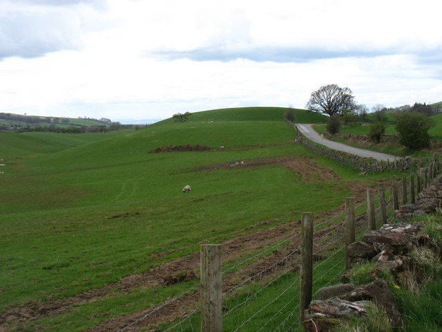
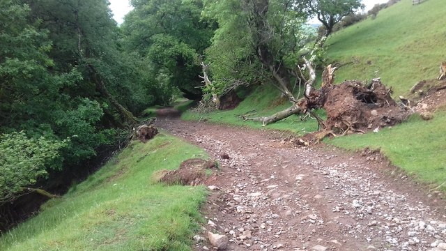
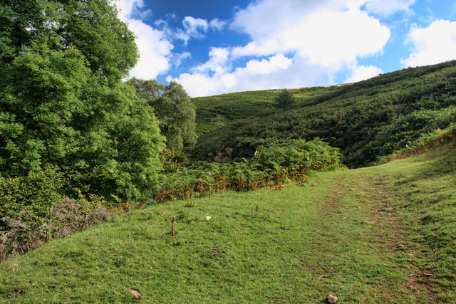
Traversing the wood, visitors can explore a network of well-marked trails that wind through its enchanting landscapes. The paths offer breathtaking views of the surrounding countryside and lead to hidden gems like babbling brooks, small waterfalls, and tranquil clearings. During spring, Bove Wood is adorned with vibrant wildflowers, creating a colorful and vibrant atmosphere.

The wood also holds historical significance, as evidence of its use for charcoal production during the medieval period has been found. The remnants of old charcoal platforms can still be seen today, providing a glimpse into the area's past.

Bove Wood is managed by the local forestry commission, ensuring its preservation and maintenance. It is open to the public year-round, and visitors can enjoy a peaceful and serene experience in this natural haven. Whether it's a leisurely walk, birdwatching, or simply enjoying the beauty of nature, Bove Wood offers a delightful escape from the bustling world.

If you have any feedback on the listing, please let us know in the comments section below.

Bove Wood Images

Images are sourced within 2km of 54.8383/-2.6856158 or Grid Reference NY5649. Thanks to Geograph Open Source API. All images are credited.

St Mary's church, Cumrew
Cumrew village Though I cannot be certain, it looks as if the B6413 never went through this small and attractive village.
Cumrew village
Though I cannot be certain, it looks as if the B6413 never went through this small and attractive village.
The lane to Cumrew Cumrew is a tiny village just east of the B6413. Cumrew Fell is behind: its summit is in <a href="https://www.geograph.org.uk/gridref/NY5652">NY5652</a>.
The lane to Cumrew
Cumrew is a tiny village just east of the B6413. Cumrew Fell is behind: its summit is in NY5652.
The B6413 to Newbiggin
Track above Newbiggin Track above Newbiggin.
Track above Newbiggin
Track above Newbiggin.
Woodgill House Woodgill House near Cairn Head.
Woodgill House
Woodgill House near Cairn Head.
Cairnhead Fields above Cairnhead Farm.
Cairnhead
Fields above Cairnhead Farm.
Gateshawhill Gateshawhill Farm.
Gateshawhill
Gateshawhill Farm.
Newbiggin Townfoot Farm in Newbiggin, beneath the Pennines.
Newbiggin
Townfoot Farm in Newbiggin, beneath the Pennines.
Newbiggin Track above Townhead Farm in Newbiggin.
Newbiggin
Track above Townhead Farm in Newbiggin.
Newbiggin beck Track alongside Newbiggin Beck.
Newbiggin beck
Track alongside Newbiggin Beck.
Newbiggin View of Newbiggin seen from the track leading to Croglin.
Newbiggin
View of Newbiggin seen from the track leading to Croglin.
Eden Valley View of the Eden Valley seen from above Newbiggin.
Eden Valley
View of the Eden Valley seen from above Newbiggin.
Newbiggin Fell Gate on Newbiggin Fell.
Newbiggin Fell
Gate on Newbiggin Fell.
Newbiggin Fell Track between Croglin and Newbiggin on Newbiggin Fell.
Newbiggin Fell
Track between Croglin and Newbiggin on Newbiggin Fell.
Lakeland View from Middle Top, Geltsdale  NY5852 looking to NY5749 This was the actual view which greeted me from near the summit of Middle Top.  I know it doesn't look real but there it was!  The mist is glowing in the valley there and the snowy summits just took my breath away!
Lakeland View from Middle Top, Geltsdale NY5852 looking to NY5749
This was the actual view which greeted me from near the summit of Middle Top. I know it doesn't look real but there it was! The mist is glowing in the valley there and the snowy summits just took my breath away!
Warning road sign on B6413 Between Newbiggin and Croglin
Warning road sign on B6413
Between Newbiggin and Croglin
The B6413 through Newbiggin With the Blue Bell Inn on the right
The B6413 through Newbiggin
With the Blue Bell Inn on the right
Show me another place!

Bove Wood is located at Grid Ref: NY5649 (Lat: 54.8383, Lng: -2.6856158)

Administrative County: Cumbria

District: Carlisle

Police Authority: Cumbria

What 3 Words

///verdict.mush.credit. Near Wetheral, Cumbria

Nearby Locations

Bove Wood

Related Wikis

Newbiggin, Ainstable

Newbiggin is a small hamlet in Cumbria, England. Cumrew beck flows north-west through Newbiggin eventually joining the Eden close to Armathwaite. The village...

Cumrew

Cumrew is a small village and civil parish in north-east Cumbria, England. About 7 miles (11 km) south of Brampton and 13 miles (21 km) east of Carlisle...

Carlatton and Cumrew

Carlatton and Cumrew are civil parishes in Cumbria, England with a common parish council.The Eastern boundary of this rural parish is Cardunneth Pike in...

Croglin

Croglin is the name of a village, former civil parish, beck (stream), and grange now in the parish of Ainstable, in the Westmorland and Furness district...

Albyfield

Albyfield is a hamlet in Cumbria, England.

Geltsdale

Geltsdale is a hamlet and former civil parish, now in the parish of Castle Carrock, in the Cumberland district, in the ceremonial county of Cumbria, England...

Low House, Wetheral

Low House is an 18th-century Georgian manor house located one and a half miles north of the village of Armathwaite in the Eden Valley of Cumbria, England...

Geltsdale Reservoir railway

The Geltsdale Reservoir railway was a 3 ft (914 mm) narrow gauge industrial railway used during the construction of Castle Carrock Reservoir near Carlisle...

Nearby Amenities

Located within 500m of 54.8383,-2.6856158
Newbiggin
Is In County: Cumbria
Place: hamlet
Wikidata: Q15058956
Wikipedia: en:Newbiggin, Ainstable
Lat/Long: 54.8352727/-2.6889562
Newbiggin Farm (N bound)
Naptan AtcoCode: 090074012406
Naptan Bearing: N
Naptan BusStopType: CUS
Naptan CommonName: Newbiggin Farm (N bound)
Naptan Indicator: o/s
Naptan Landmark: Newbiggin Farm
Naptan NaptanCode: cumawtdp
Naptan Street: No name
Naptan Verified: no
Source: naptan_import
Lat/Long: 54.8351421/-2.6907197
Newbiggin Farm (S bound)
Naptan AtcoCode: 090074013357
Naptan Bearing: S
Naptan BusStopType: CUS
Naptan CommonName: Newbiggin Farm (S bound)
Naptan Indicator: opp
Naptan Landmark: Newbiggin Farm
Naptan NaptanCode: cumawtdw
Naptan Street: No name
Naptan Verified: no
Source: naptan_import
Lat/Long: 54.835206/-2.6905496
Bench
Lat/Long: 54.8355008/-2.6908914
Grit Bin
Lat/Long: 54.8354488/-2.6908914
Booth: K6
Removed Amenity: telephone
Lat/Long: 54.8355759/-2.6906084
Post Box
Post Box Type: lamp
Ref: CA8 43
Royal Cypher: EIIR
Royal Cypher Wikidata: Q33102113
Lat/Long: 54.8347474/-2.6872569
Grit Bin
Lat/Long: 54.8347178/-2.687292
Parking
Lat/Long: 54.8349894/-2.6834879
Public Bookcase
Public Bookcase Type: shelf
Lat/Long: 54.8355647/-2.6905625
Advertising: board
Lat/Long: 54.8355595/-2.6905133
Power: pole
Lat/Long: 54.8405495/-2.6923186
Power: pole
Lat/Long: 54.8399144/-2.6924534
Power: pole
Lat/Long: 54.8390365/-2.6926053
Power: pole
Lat/Long: 54.8381728/-2.6919338
Power: pole
Lat/Long: 54.8373274/-2.6912329
Power: pole
Lat/Long: 54.8367699/-2.6907672
Power: pole
Lat/Long: 54.8365271/-2.6901987
Power: pole
Lat/Long: 54.8360769/-2.6892134
Power: pole
Lat/Long: 54.8355984/-2.6874097
Power: pole
Lat/Long: 54.835326/-2.6864024
The data included in this document is from www.openstreetmap.org. The data is made available under ODbL.

Have you been to Bove Wood?

Leave your review of Bove Wood below (or comments, questions and feedback).