The Park

Wood, Forest in Herefordshire

England

The Park

River Wye near Shepherd's Rough Looking north-east at the sweeping bend with Haugh Wood on the horizon. A tranquil scene on an August evening.
River Wye near Shepherd's Rough Credit: Trevor Rickard

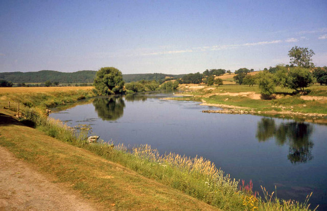
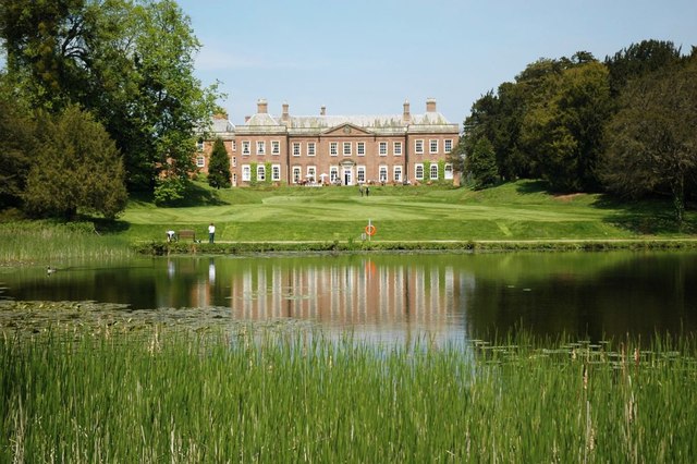
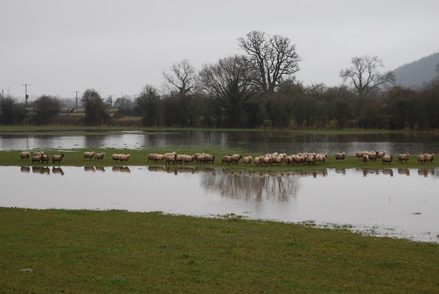
The Park, located in Herefordshire, is a pristine woodland area renowned for its natural beauty and diverse ecosystem. Spanning over a vast expanse, it is a haven for outdoor enthusiasts and nature lovers alike. The woodland is characterized by ancient trees, predominantly oak and beech, which create a dense, enchanting canopy overhead. These trees provide shelter and sustenance for a variety of wildlife species, making The Park a biodiversity hotspot.

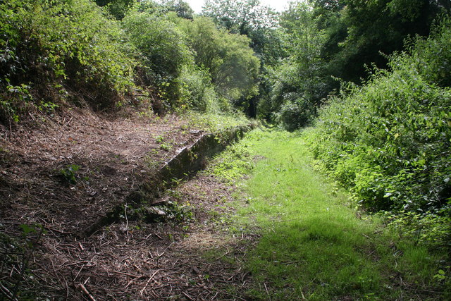
Within the woodland, numerous footpaths and trails wind through the forest, offering visitors the opportunity to explore and immerse themselves in its serene surroundings. The dense undergrowth is home to an array of flora, including bluebells, wild garlic, and ferns, which add a splash of color to the verdant landscape. Additionally, the forest floor is speckled with fallen leaves and moss, creating a soft carpet underfoot.

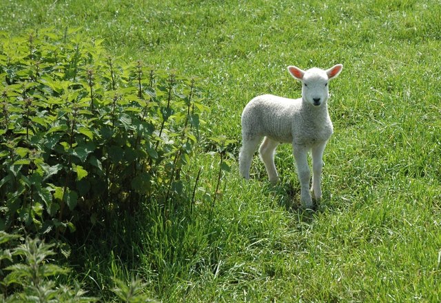
The Park is a refuge for a plethora of wildlife. It is home to a diverse range of bird species, such as the great spotted woodpecker, tawny owl, and nuthatch, providing birdwatchers with ample opportunities to spot these feathered creatures in their natural habitat. Other inhabitants of the woodland include squirrels, foxes, badgers, and deer, which can often be glimpsed during early morning or late evening walks.

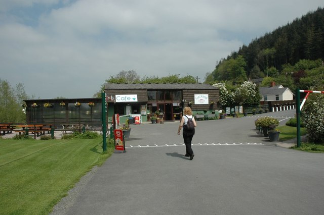
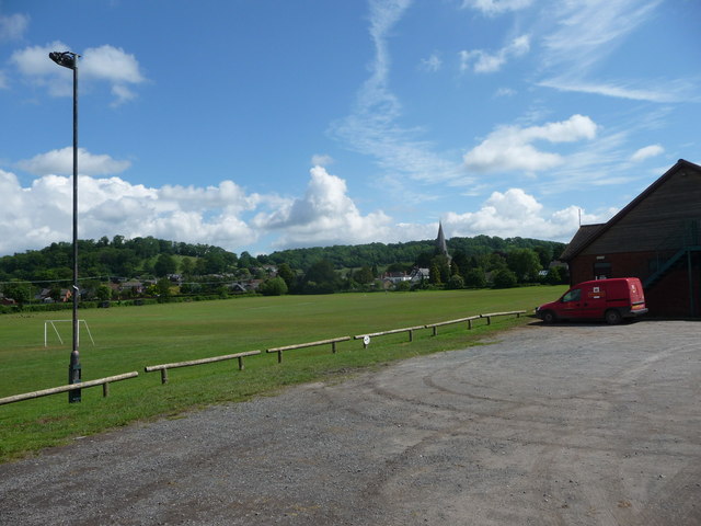
Visitors to The Park can also enjoy recreational activities such as picnicking, camping, and photography. Its tranquil ambience and picturesque scenery make it an ideal location for those seeking respite from the hustle and bustle of daily life. The Park in Herefordshire, with its ancient woodland and abundant wildlife, truly is a gem of natural beauty.

If you have any feedback on the listing, please let us know in the comments section below.

The Park Images

Images are sourced within 2km of 52.006284/-2.6417564 or Grid Reference SO5634. Thanks to Geograph Open Source API. All images are credited.

River Wye near Shepherd's Rough Looking north-east at the sweeping bend with Haugh Wood on the horizon. A tranquil scene on an August evening.
River Wye near Shepherd's Rough
Looking north-east at the sweeping bend with Haugh Wood on the horizon. A tranquil scene on an August evening.
The Village Hall, Holme Lacy
Former railway bridge, Holme Lacy
Herefordshire College of Technology, Holme Lacy Campus
Ufton Court
Ufton Court
Caravan Club site, The Paddocks, Bogmarsh
River Wye, near Fownhope
Fownhope: The Green Man
Lucksall Caravan & Camping Park
River Wye near Holme Lacy
Rapeseed Field Rapeseed also known as rape, oilseed rape, rapa, rappi, rapaseed, is a bright yellow flowering member of the family Brassicaceae (mustard or cabbage family). The name derives from the Latin for turnip, rāpa or rāpum, and is first recorded in English at the end of the 14th century.
Rapeseed Field
Rapeseed also known as rape, oilseed rape, rapa, rappi, rapaseed, is a bright yellow flowering member of the family Brassicaceae (mustard or cabbage family). The name derives from the Latin for turnip, rāpa or rāpum, and is first recorded in English at the end of the 14th century.
Rapeseed near Holme Lacy Rapeseed also known as rape, oilseed rape, rapa, rappi, rapaseed, is a bright yellow flowering member of the family Brassicaceae (mustard or cabbage family). The name derives from the Latin for turnip, rāpa or rāpum, and is first recorded in English at the end of the 14th century.
Rapeseed near Holme Lacy
Rapeseed also known as rape, oilseed rape, rapa, rappi, rapaseed, is a bright yellow flowering member of the family Brassicaceae (mustard or cabbage family). The name derives from the Latin for turnip, rāpa or rāpum, and is first recorded in English at the end of the 14th century.
Holme Lacy Mansion House The mansion of Holme Lacy built by Viscount Scudamore remained, until 1909, the family seat of the Earls of Chesterfield.
Holme Lacy Mansion House
The mansion of Holme Lacy built by Viscount Scudamore remained, until 1909, the family seat of the Earls of Chesterfield.
Spring Lamb In the fields at Holme Lacy.
Spring Lamb
In the fields at Holme Lacy.
View towards Fownhope village A postie is having a quiet skive here hidden from the road and village by the sports centre. When I say quiet skive I mean carefully planning out his itinerary, re-prioritising his morning, taking a well earned allocated break, responding to customer needs, communicating with colleagues on a matter of urgency etc.
View towards Fownhope village
A postie is having a quiet skive here hidden from the road and village by the sports centre. When I say quiet skive I mean carefully planning out his itinerary, re-prioritising his morning, taking a well earned allocated break, responding to customer needs, communicating with colleagues on a matter of urgency etc.
River Wye on a wet day The flood plain is starting to get covered with water, more from persistant rain than the flooded river.
River Wye on a wet day
The flood plain is starting to get covered with water, more from persistant rain than the flooded river.
Stranded sheep The flood water has nearly cut them off.
Stranded sheep
The flood water has nearly cut them off.
The Green Man, Fownhope Hotel and restaurant, recently refurbished.
The Green Man, Fownhope
Hotel and restaurant, recently refurbished.
Show me another place!

The Park is located at Grid Ref: SO5634 (Lat: 52.006284, Lng: -2.6417564)

Unitary Authority: County of Herefordshire

Police Authority: West Mercia

What 3 Words

///deposits.spooned.indicates. Near Brockhampton, Herefordshire

Nearby Locations

Apostle Wood The Park

Related Wikis

St Cuthbert's Church, Holme Lacy

St Cuthbert's Church is a redundant Anglican church about 1 mile (1.6 km) to the southeast of the village of Holme Lacy, Herefordshire, England. It stands...

Holme Lacy

Holme Lacy is a village in the English county of Herefordshire. The population of the civil parish was 466 at the 2011 Census. == Category == It is a primarily...

Holme Lacy railway station

Holme Lacy railway station is a disused railway station that served the village of Holme Lacy in Herefordshire. One of the original two stations between...

National School of Blacksmithing

The National School of Blacksmithing (NSB) is part of Herefordshire and Ludlow College, a college of further education (FE). It is located at the Centre...

Fiddler's Green, Herefordshire

Fiddler's Green is a hamlet in the English county of Herefordshire. It is located near the River Wye on the B4224 road that connects Hereford and Ross...

Bolstone

Bolstone is a village and civil parish in Herefordshire, England, 9 km (5.6 mi) south of Hereford. According to the 2001 census, it had a population of...

River Lugg

The River Lugg (Welsh: Afon Llugwy) rises near Llangynllo in Radnorshire, Wales. It flows through the border town of Presteigne and then through Herefordshire...

Ballingham

Ballingham is a small village of about 140 people, increasing to 181 at the 2011 Census in Herefordshire, England, situated in a loop of the River Wye...

Nearby Amenities

Located within 500m of 52.006284,-2.6417564
Old School House
Power: pole
Transformer: distribution
Voltage Primary: 11000
Lat/Long: 52.0088922/-2.6450282
Power: pole
Lat/Long: 52.0086941/-2.6435637
Power: pole
Lat/Long: 52.0085034/-2.6421972
Hollington Farm North
Power: pole
Transformer: distribution
Voltage Primary: 11000
Lat/Long: 52.0038832/-2.638894
Power: pole
Lat/Long: 52.00435/-2.6387706
Power: pole
Lat/Long: 52.0051116/-2.6397309
Power: pole
Lat/Long: 52.0058641/-2.6406656
Power: pole
Lat/Long: 52.0062484/-2.6401828
Power: pole
Lat/Long: 52.0068465/-2.6406636
Power: pole
Lat/Long: 52.0075483/-2.6412275
Power: pole
Lat/Long: 52.0083222/-2.6408909
Power: pole
Lat/Long: 52.0089368/-2.6406428
Holme Lacy Bore Hole
Power: pole
Transformer: distribution
Voltage Primary: 11000
Lat/Long: 52.0092554/-2.6405047
Power: pole
Lat/Long: 52.0099051/-2.640207
Power: pole
Lat/Long: 52.0105737/-2.6399159
Power: pole
Lat/Long: 52.0025506/-2.6393453
Power: pole
Lat/Long: 52.0033845/-2.6390436
The data included in this document is from www.openstreetmap.org. The data is made available under ODbL.

Have you been to The Park?

Leave your review of The Park below (or comments, questions and feedback).