Ewe Brae

Wood, Forest in Cumberland Carlisle

England

Ewe Brae

In the Newcastleton Forest, by the Kershope Burn National Cycle Route 10 follows this track, bound for Scotch Knowe and a crossing into England.

This photograph was taken during the Coronavirus (COVID-19) pandemic of 2020/21/22.
In the Newcastleton Forest, by the Kershope Burn Credit: James T M Towill

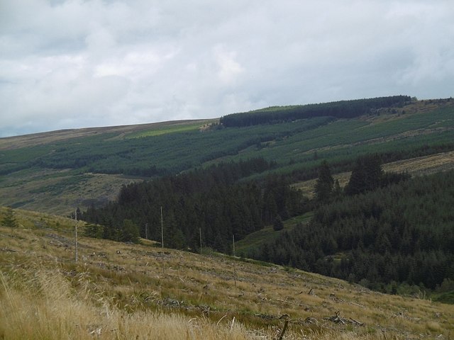
Ewe Brae, situated in Cumberland, is a picturesque and serene woodland area renowned for its natural beauty and tranquil surroundings. Nestled within the larger Forest of Cumberland, Ewe Brae showcases an abundance of lush greenery, towering trees, and meandering streams, making it a haven for nature enthusiasts and outdoor enthusiasts alike.

Covering an expansive area, Ewe Brae offers a diverse range of flora and fauna, providing a habitat for various species of plants and animals. The woodland is predominantly populated by native tree species such as oak, beech, and birch, with their majestic canopies providing a sheltered and shaded environment throughout the year.

The forest floor of Ewe Brae is adorned with a rich carpet of ferns, mosses, and wildflowers, adding to the area's natural charm. Additionally, the presence of several small streams and brooks that meander through the woodland creates a soothing ambiance and offers a refreshing respite for visitors.

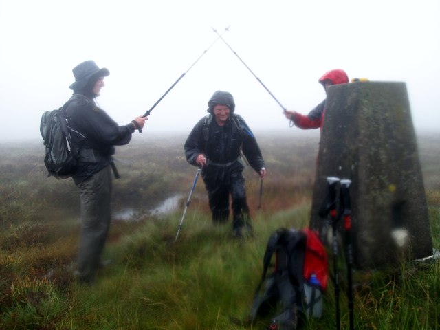
Ewe Brae provides ample opportunities for outdoor activities, including hiking, birdwatching, and photography. The well-maintained trails within the woodland lead visitors through its enchanting landscapes, providing stunning vistas and a chance to encounter the local wildlife.

The tranquility and natural beauty of Ewe Brae attract visitors from far and wide, making it a popular destination for nature lovers, families, and individuals seeking solace in nature. Whether it's a leisurely stroll, a picnic by the streams, or an exploration of the diverse ecosystem, Ewe Brae in Cumberland promises a memorable and rejuvenating experience for all.

If you have any feedback on the listing, please let us know in the comments section below.

Ewe Brae Images

Images are sourced within 2km of 55.181509/-2.6946858 or Grid Reference NY5587. Thanks to Geograph Open Source API. All images are credited.

In the Newcastleton Forest, by the Kershope Burn National Cycle Route 10 follows this track, bound for Scotch Knowe and a crossing into England.

This photograph was taken during the Coronavirus (COVID-19) pandemic of 2020/21/22.
In the Newcastleton Forest, by the Kershope Burn
National Cycle Route 10 follows this track, bound for Scotch Knowe and a crossing into England. This photograph was taken during the Coronavirus (COVID-19) pandemic of 2020/21/22.
Forestry track opposite Kershope Head A firm track for cycling and walking takes the visitor through the edge of the Newcastleton Forest alongside the Kershope Burn.

This photograph was taken during the Coronavirus (COVID-19) pandemic of 2020/21/22.
Forestry track opposite Kershope Head
A firm track for cycling and walking takes the visitor through the edge of the Newcastleton Forest alongside the Kershope Burn. This photograph was taken during the Coronavirus (COVID-19) pandemic of 2020/21/22.
The Kershope Burn near Havering Bog The Kershope Burn in its infancy just south of Scotch Knowe.

This photograph was taken during the Coronavirus (COVID-19) pandemic of 2020/21/22.
The Kershope Burn near Havering Bog
The Kershope Burn in its infancy just south of Scotch Knowe. This photograph was taken during the Coronavirus (COVID-19) pandemic of 2020/21/22.
Straddling the border On the footbridge over the Kershope Burn at Scotch Knowe: Scotland (left), England (right).

This photograph was taken during the Coronavirus (COVID-19) pandemic of 2020/21/22.
Straddling the border
On the footbridge over the Kershope Burn at Scotch Knowe: Scotland (left), England (right). This photograph was taken during the Coronavirus (COVID-19) pandemic of 2020/21/22.
At the high point of the 'Reivers Route' 357 metres above sea level at Caplestone Fell finds the National Cycle Route 10 deep within forestry.

This photograph was taken during the Coronavirus (COVID-19) pandemic of 2020/21/22.
At the high point of the 'Reivers Route'
357 metres above sea level at Caplestone Fell finds the National Cycle Route 10 deep within forestry. This photograph was taken during the Coronavirus (COVID-19) pandemic of 2020/21/22.
The Building at Kershopehead A basic building looked after by the Mountain Bothies Association with permission of the landowner. The "Bothy Watch" sign on the door is a police initiative to help prevent misuse of these volunteer maintained hiking shelters.
The Building at Kershopehead
A basic building looked after by the Mountain Bothies Association with permission of the landowner. The "Bothy Watch" sign on the door is a police initiative to help prevent misuse of these volunteer maintained hiking shelters.
Glendhu Hill Trig An ascend from east with the magnificent seven to bag Martin Richardson's last HuMP in England and Wales. Chris Watson provided the wet weather which made the tough going even tougher.
Name: Glendhu Hill
Hill number: 3556
Height: 514m / 1686ft
Area: 33: The Scottish Border to the River Tyne
Class: Hu,5
Grid ref: NY 56838 86370
Summit feature: no feature
Drop: 115m
Col: 399m  NY569848
Glendhu Hill Trig
An ascend from east with the magnificent seven to bag Martin Richardson's last HuMP in England and Wales. Chris Watson provided the wet weather which made the tough going even tougher. Name: Glendhu Hill Hill number: 3556 Height: 514m / 1686ft Area: 33: The Scottish Border to the River Tyne Class: Hu,5 Grid ref: NY 56838 86370 Summit feature: no feature Drop: 115m Col: 399m NY569848
Bridge near Scotch Knowe This bridge takes the Cross Border Trail into England (or Scotland if coming the other way), a bike and walking route linking Newcastleton and Kielder and signed by the Forestry Commission.  From here there is a short section of single-track before the route rejoins a forestry road for a nice downhill section before turning back and climbing to the Bloody Bush Toll Stone and the communication mast at Larriston Fells.  Longer routes are available.
Bridge near Scotch Knowe
This bridge takes the Cross Border Trail into England (or Scotland if coming the other way), a bike and walking route linking Newcastleton and Kielder and signed by the Forestry Commission. From here there is a short section of single-track before the route rejoins a forestry road for a nice downhill section before turning back and climbing to the Bloody Bush Toll Stone and the communication mast at Larriston Fells. Longer routes are available.
Kershope Head The head of Kershope Burn.
Kershope Head
The head of Kershope Burn.
Logging road, Kershope Forest A well surfaced road on the English side of the Kershope Burn.
Logging road, Kershope Forest
A well surfaced road on the English side of the Kershope Burn.
Kershope Burn A long clearing beside the border burn in Kershope/Newcastleton Forest.
Kershope Burn
A long clearing beside the border burn in Kershope/Newcastleton Forest.
Kershope Burn Taken whilst returning to Scotland. There is no bridge here now, but there are the ruins of one.
Kershope Burn
Taken whilst returning to Scotland. There is no bridge here now, but there are the ruins of one.
Slopes of Glendhu Hill View over the Kershope Burn from Newcastleton Forest.
Slopes of Glendhu Hill
View over the Kershope Burn from Newcastleton Forest.
A lesser-used track? The track here appears to be less well used than others in this part of the Newcastleton Forest.  This photograph is taken near Yearning Sike, a tributary of the Kershope Burn, out of shot to the right.

This photograph was taken during the Coronavirus (COVID-19) pandemic of 2020/21.
A lesser-used track?
The track here appears to be less well used than others in this part of the Newcastleton Forest. This photograph is taken near Yearning Sike, a tributary of the Kershope Burn, out of shot to the right. This photograph was taken during the Coronavirus (COVID-19) pandemic of 2020/21.
Kershope Burn and an old sheepfold A reminder of a time before afforestation of these hills and valleys.

This photograph was taken during the Coronavirus (COVID-19) pandemic of 2020/21.
Kershope Burn and an old sheepfold
A reminder of a time before afforestation of these hills and valleys. This photograph was taken during the Coronavirus (COVID-19) pandemic of 2020/21.
Sunshine and shade by the border Sunshine and shade in the Newcastleton Forest beside the Kershope Burn (far right) which forms the Scotland/England border.

This photograph was taken during the Coronavirus (COVID-19) pandemic of 2020/21.
Sunshine and shade by the border
Sunshine and shade in the Newcastleton Forest beside the Kershope Burn (far right) which forms the Scotland/England border. This photograph was taken during the Coronavirus (COVID-19) pandemic of 2020/21.
Scotch Knowe In this image, the photographer is in Cumbria (just!), Scotland is over the Kershope Burn to the left and Northumberland is to the left of the fencepost remains which can be noted to the far right of shot.  It's a pity more is not made of this intriguing spot by the forestry authorities.  Three largely rotten and barely discernible forestry signs are all that mark this spot.  This photograph was taken on a beautiful late afternoon with the lowering sun creating a beautiful light at this remote spot.

This photograph was taken during the Coronavirus (COVID-19) pandemic of 2020/21.
Scotch Knowe
In this image, the photographer is in Cumbria (just!), Scotland is over the Kershope Burn to the left and Northumberland is to the left of the fencepost remains which can be noted to the far right of shot. It's a pity more is not made of this intriguing spot by the forestry authorities. Three largely rotten and barely discernible forestry signs are all that mark this spot. This photograph was taken on a beautiful late afternoon with the lowering sun creating a beautiful light at this remote spot. This photograph was taken during the Coronavirus (COVID-19) pandemic of 2020/21.
The crossing to England This bridge carries the walker or cyclist over the Kershope Burn into England. A small picnic area is out of shot to the left.  

This photograph was taken during the Coronavirus (COVID-19) pandemic of 2020/21.
The crossing to England
This bridge carries the walker or cyclist over the Kershope Burn into England. A small picnic area is out of shot to the left. This photograph was taken during the Coronavirus (COVID-19) pandemic of 2020/21.
Show me another place!

Ewe Brae is located at Grid Ref: NY5587 (Lat: 55.181509, Lng: -2.6946858)

Administrative County: Cumbria

District: Carlisle

Police Authority: Cumbria

What 3 Words

///petal.pelt.simulates. Near Langholm, Dumfries & Galloway

Nearby Locations

Ewe Brae

Related Wikis

Scottish Marches

Scottish Marches was the term used for the Anglo-Scottish border during the late medieval and early modern eras, characterised by violence and cross-border...

Dinlabyre

Dinlabyre is a village on the B6357 in Liddesdale, on the edge of the Newcastleton Forest, close to Castleton, in the Scottish Borders area of Scotland...

Liddel Castle

Liddel Castle is a ruined castle in Liddesdale, by the Liddel Water, near Castleton in the Scottish Borders area of Scotland, in the former county of Roxburghshire...

Steele Road railway station

Steele Road railway station served the hamlet of Steele Road, Scottish Borders, Scotland, from 1862 to 1969 on the Border Union Railway. == History... ==

Castleton, Scottish Borders

Castleton (Scottish Gaelic: Baile Chaisteil) is a civil parish in the Scottish Borders area of Scotland, in the former Roxburghshire, in the extreme south...

Newcastleton railway station

Newcastleton railway station served the village of Newcastleton, Scottish Borders, Scotland from 1862 to 1969 on the Border Union Railway. == History... ==

Newcastleton

Newcastleton, also called Copshaw Holm, is a village in Liddesdale, the Scottish Borders, a few miles from the border with England, on the Liddel Water...

Sighty Crag

Sighty Crag is a hill in the southern part of the Kielder Forest region in northern England, a region which also includes its fellow Marilyns of Peel Fell...

Nearby Amenities

Located within 500m of 55.181509,-2.6946858
The data included in this document is from www.openstreetmap.org. The data is made available under ODbL.

Have you been to Ewe Brae?

Leave your review of Ewe Brae below (or comments, questions and feedback).