Conderton

Settlement in Worcestershire Wychavon

England

Conderton

Barn at the top of the lane This barn on Bredon Hill appears to have been reroofed since I last photographed it in 2007 <a href="https://www.geograph.org.uk/photo/524620">SO9538 : Barn on Bredon Hill</a>.
Barn at the top of the lane Credit: Philip Halling

Conderton is a small village located in the county of Worcestershire, England. Situated approximately six miles southeast of the town of Tewkesbury and eight miles northwest of the city of Cheltenham, Conderton is nestled in the picturesque landscape of the Cotswolds.

The village is known for its charming rural setting, surrounded by rolling hills and fields, providing a tranquil and idyllic environment for residents and visitors alike. It boasts a population of around 250 people, making it a tight-knit community with a strong sense of camaraderie.

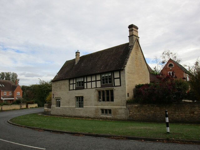
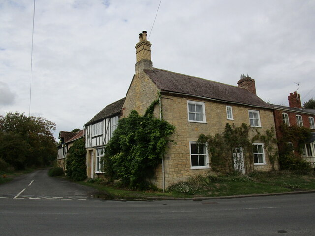
Conderton is home to a historic parish church, St. James the Great, which dates back to the 12th century. The church's architecture showcases a combination of Norman and Gothic styles, making it an interesting attraction for history enthusiasts. Additionally, the village has a small primary school, providing education for the local children.

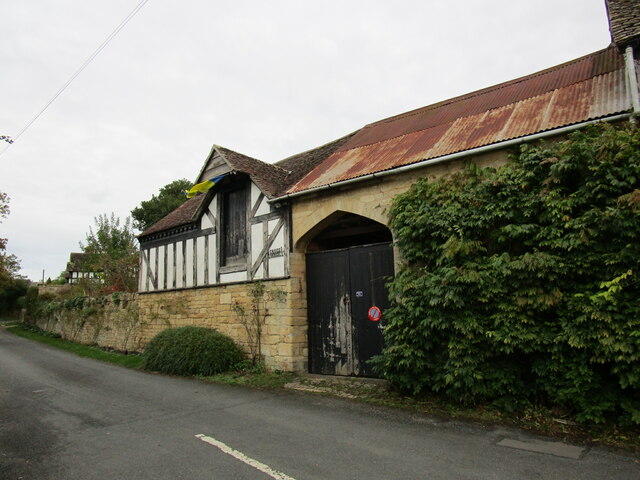
The village, although small, offers some amenities to its residents. There is a village hall that serves as a hub for community events and gatherings. The local pub, The Yew Tree Inn, is a popular spot for locals and visitors to enjoy a pint and traditional English fare.

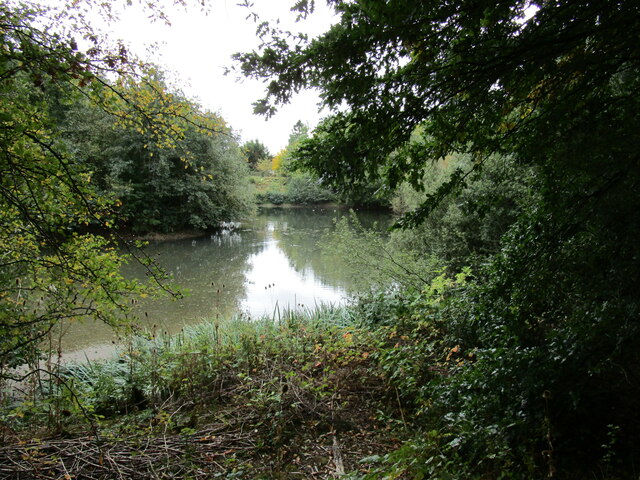
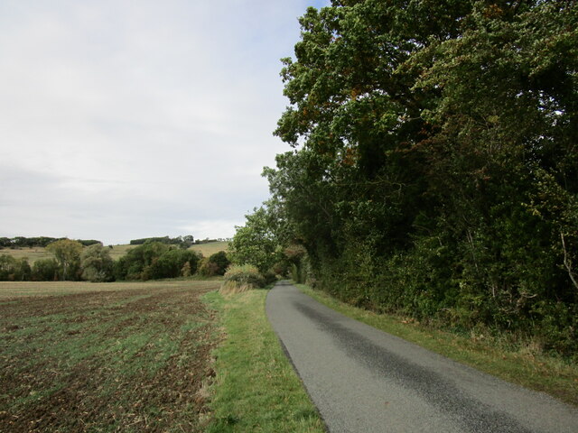
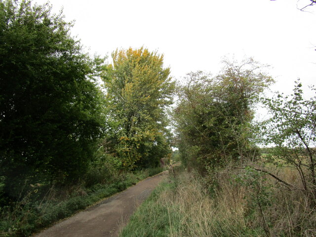
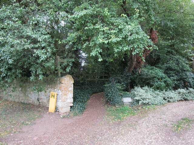
Conderton is surrounded by beautiful countryside, offering ample opportunities for outdoor activities such as walking, hiking, and cycling. The nearby Bredon Hill provides stunning panoramic views of the surrounding area.

Overall, Conderton is a charming and peaceful village, offering a close-knit community, rich history, and access to the natural beauty of the Cotswolds.

If you have any feedback on the listing, please let us know in the comments section below.
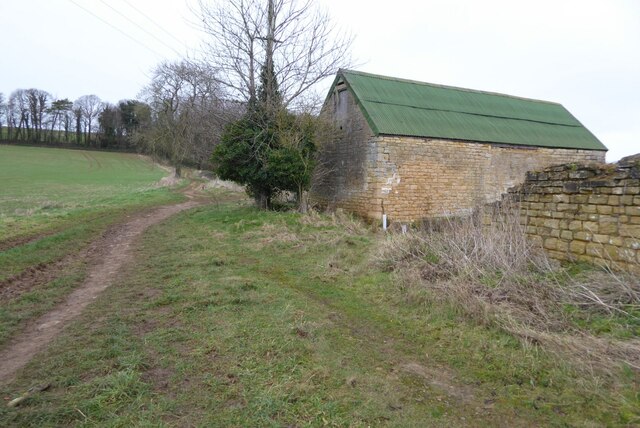
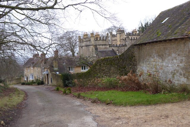
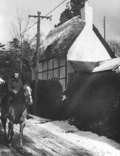
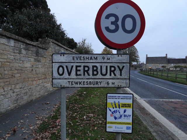
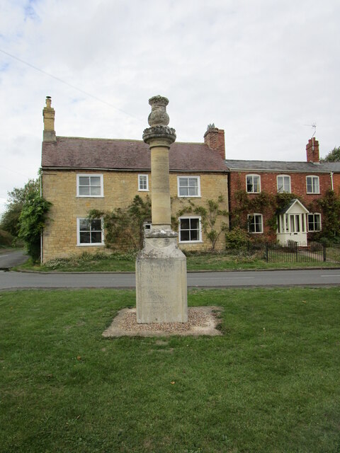
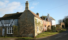
Conderton Images

Images are sourced within 2km of 52.032105/-2.053057 or Grid Reference SO9637. Thanks to Geograph Open Source API. All images are credited.

Barn at the top of the lane This barn on Bredon Hill appears to have been reroofed since I last photographed it in 2007 <a href="https://www.geograph.org.uk/photo/524620">SO9538 : Barn on Bredon Hill</a>.
Barn at the top of the lane
This barn on Bredon Hill appears to have been reroofed since I last photographed it in 2007 SO9538 : Barn on Bredon Hill.
Bell's Castle Bell's Castle on the southern slopes of Bredon Hill.  The house is said to have been built for Captain Bell a buccaneer during the Napoleonic Wars.  The house is Grade II listed, see: <span class="nowrap"><a title="https://historicengland.org.uk/listing/the-list/list-entry/1349974?section=official-list-entry" rel="nofollow ugc noopener" href="https://historicengland.org.uk/listing/the-list/list-entry/1349974?section=official-list-entry">Link</a><img style="margin-left:2px;" alt="External link" title="External link - shift click to open in new window" src="https://s1.geograph.org.uk/img/external.png" width="10" height="10"/></span>
Bell's Castle
Bell's Castle on the southern slopes of Bredon Hill. The house is said to have been built for Captain Bell a buccaneer during the Napoleonic Wars. The house is Grade II listed, see: LinkExternal link
Rider passes cottage in snowy Kemerton, 1953 Date approximate.
Rider passes cottage in snowy Kemerton, 1953
Date approximate.
Bottle stall, Bredon Hill Flower Show, Kemerton 1954 The first Bredon Hill Flower Show was held at the Victoria Hall Kemerton on 13th September 1947 and was held annually for many years. The flowers and vegetables on show were in the hall, in the adjoining field were various fairground-type stalls like hoopla, whack the mole, lucky dip, bowling for a pig, and this one where you draw a ticket and win a bottle, mainly lemonade or beer, a few bottles of spirits or sherry.
Bottle stall, Bredon Hill Flower Show, Kemerton 1954
The first Bredon Hill Flower Show was held at the Victoria Hall Kemerton on 13th September 1947 and was held annually for many years. The flowers and vegetables on show were in the hall, in the adjoining field were various fairground-type stalls like hoopla, whack the mole, lucky dip, bowling for a pig, and this one where you draw a ticket and win a bottle, mainly lemonade or beer, a few bottles of spirits or sherry.
Village Signpost for Kemerton Located on the south side of the road 55 metres east of the junction near St Benet's church in Kemerton parish. Kemerton was in Gloucestershire until 1931.

Milestone Society National ID: WO_SO9437V
Village Signpost for Kemerton
Located on the south side of the road 55 metres east of the junction near St Benet's church in Kemerton parish. Kemerton was in Gloucestershire until 1931. Milestone Society National ID: WO_SO9437V
Village Signpost for Overbury Located on the north side of the road 130 metres west of the junction with Church Row in Overbury parish.

Milestone Society National ID: WO_SO9537V
Village Signpost for Overbury
Located on the north side of the road 130 metres west of the junction with Church Row in Overbury parish. Milestone Society National ID: WO_SO9537V
Kemerton primary school, 1952 The school was built near the church and in the 19th Century run by the local clergy.
Kemerton primary school, 1952
The school was built near the church and in the 19th Century run by the local clergy.
Entering Kemerton Main Street, with old bakehouse  The white building on the left was the bakehouse into the early 1950s. It is listed, originally 18th Century.
Entering Kemerton Main Street, with old bakehouse
The white building on the left was the bakehouse into the early 1950s. It is listed, originally 18th Century.
Harrowed field near Grafton
Flooded pit near Beckford Now part of a nature reserve.
Flooded pit near Beckford
Now part of a nature reserve.
The Old House, Beckford Dates from the sixteenth century <span class="nowrap"><a title="https://historicengland.org.uk/listing/the-list/list-entry/1349950?section=official-list-entry" rel="nofollow ugc noopener" href="https://historicengland.org.uk/listing/the-list/list-entry/1349950?section=official-list-entry">Link</a><img style="margin-left:2px;" alt="External link" title="External link - shift click to open in new window" src="https://s1.geograph.org.uk/img/external.png" width="10" height="10"/></span>
The Old House, Beckford
Dates from the sixteenth century LinkExternal link
Lane to Grafton
Lane to Grafton
Nest holes in low cliiff, Beckford Nature Reserve Most likely the nest holes of sand martins.
Nest holes in low cliiff, Beckford Nature Reserve
Most likely the nest holes of sand martins.
Roadway to Court Farm, Beckford
Footpath to the church, Beckford
Outbuildings, Cross House, Beckford
Cross House, Beckford
Milepost at Beckford Dated 1887 <span class="nowrap"><a title="https://historicengland.org.uk/listing/the-list/list-entry/1296922?section=official-list-entry" rel="nofollow ugc noopener" href="https://historicengland.org.uk/listing/the-list/list-entry/1296922?section=official-list-entry">Link</a><img style="margin-left:2px;" alt="External link" title="External link - shift click to open in new window" src="https://s1.geograph.org.uk/img/external.png" width="10" height="10"/></span>
Milepost at Beckford
Dated 1887 LinkExternal link
Show me another place!

Conderton is located at Grid Ref: SO9637 (Lat: 52.032105, Lng: -2.053057)

Administrative County: Worcestershire

District: Wychavon

Police Authority: West Mercia

What 3 Words

///medium.tonality.solves. Near Bredon, Worcestershire

Nearby Locations

Conderton

Related Wikis

Conderton

Conderton is a small hamlet in the Wychavon district of Worcestershire, England. == Toponymy == The name Conderton is derived from the Old English Cantware...

Overbury

Overbury is a village and civil parish in Worcestershire, England, midway between Evesham and Tewkesbury south of Bredon Hill. The manor of Overbury was...

Overbury Court

Overbury Court is a Georgian style country house in Overbury, Worcestershire, England. It is a privately owned Grade II* listed building. It is built in...

Beckford Nature Reserve

Beckford Nature Reserve is near Beckford, in Worcestershire, England, situated immediately north of the village. The nature reserve was created from a...

Beckford Priory

Beckford Priory was a medieval house of Augustinian Canons, historically within Gloucestershire, presently in Worcestershire, England. It was founded in...

Kemerton

Kemerton is a village and civil parish in Worcestershire in England. It lies at the extreme south of the county in the local government district of Wychavon...

Kemerton Court

Kemerton Court is the principal manor house of the village of Kemerton, near Tewkesbury in Gloucestershire. The house is built of local Cotswold stone...

Beckford, Worcestershire

Beckford is a small village on the main Cheltenham to Evesham Road, five miles north-east of Tewkesbury, on the Worcestershire—Gloucestershire border....

Nearby Amenities

Located within 500m of 52.032105,-2.053057
Bus Stop
Shelter
Bus: yes
Naptan AtcoCode: 2000G082700
Naptan Bearing: E
Naptan CommonName: Shelter
Naptan Indicator: Adj
Naptan NaptanCode: wocdgjtg
Naptan Street: unknown road
Naptan Verified: no
Public Transport: platform
Shelter: yes
Source: naptan_import
Lat/Long: 52.032375/-2.0546495
Shelter
Naptan AtcoCode: 2000G323217
Naptan Bearing: W
Naptan BusStopType: CUS
Naptan CommonName: Shelter
Naptan Indicator: opp
Naptan NaptanCode: wocdmadj
Naptan Street: unknown road
Naptan Verified: no
Source: naptan_import
Lat/Long: 52.0322866/-2.0544974
Booth: K6
Removed Amenity: telephone
Lat/Long: 52.0317564/-2.0531126
Post Box
Collection Times: Mo-Fr 16:15; Sa 08:00
Post Box Type: wall
Ref: GL20 16
Royal Cypher: GVIR
Royal Cypher Wikidata: Q33102169
Lat/Long: 52.0323478/-2.0541931
Barrier: stile
Lat/Long: 52.0308081/-2.0538673
Power: pole
Lat/Long: 52.0294904/-2.0554304
Power: pole
Lat/Long: 52.0277693/-2.0523348
Power: pole
Lat/Long: 52.0298864/-2.0575628
Power: pole
Lat/Long: 52.0289163/-2.0543867
Power: pole
Lat/Long: 52.0283601/-2.0533942
Power: pole
Lat/Long: 52.0299342/-2.0584989
Power: pole
Lat/Long: 52.0296323/-2.0562217
Fixme: Is there a public footpath heading north from here?
Note: Definitive Statement suggests Overbury FP 5 may leave the road here
Lat/Long: 52.0326144/-2.0573544
Barrier: stile
Lat/Long: 52.0330673/-2.0510889
Barrier: stile
Lat/Long: 52.0326727/-2.0490199
Barrier: stile
Lat/Long: 52.033834/-2.0551594
Barrier: stile
Lat/Long: 52.0336949/-2.0544687
Barrier: stile
Lat/Long: 52.03406/-2.0569545
Waste Basket
Waste: dog_excrement
Lat/Long: 52.0330763/-2.0511578
Fixme: incomplete
Lat/Long: 52.0346817/-2.0572168
Fixme: incomplete
Lat/Long: 52.0338917/-2.0572377
Barrier: stile
Lat/Long: 52.0333579/-2.0528756
Toff Milway - Conderton Pottery
Addr City: Tewkesbury
Addr Housename: The Old Forge
Addr Postcode: GL20 7PP
Addr Street: Main Street
Addr Village: Conderton
Craft: pottery
Url: http://www.toffmilway.co.uk/
Lat/Long: 52.0326588/-2.0552107
Conderton
Power: pole
Transformer: distribution
Voltage Primary: 11000
Lat/Long: 52.0331772/-2.0535629
Location Transition: yes
Power: pole
Lat/Long: 52.0319153/-2.0553902
Power: pole
Lat/Long: 52.031766/-2.0557724
Beckford Lane
Power: pole
Transformer: distribution
Voltage Primary: 11000
Lat/Long: 52.0311463/-2.0543844
Power: pole
Lat/Long: 52.0311554/-2.0558931
Power: pole
Lat/Long: 52.0304202/-2.0560661
The data included in this document is from www.openstreetmap.org. The data is made available under ODbL.

Have you been to Conderton?

Leave your review of Conderton below (or comments, questions and feedback).