Mill Wood

Wood, Forest in Gloucestershire Forest of Dean

England

Mill Wood

Bigsweir Bridge Bigsweir Bridge crossing the River Wye in early July, I was here at the beginning of June on a bright day <a href="https://www.geograph.org.uk/photo/7194394">SO5305 : Bigsweir Bridge</a>.  The bridge was built in 1826-29; the iron-work was cast at Merthyr Tydfil.  The bridge is Grade II* listed, see: <span class="nowrap"><a title="https://historicengland.org.uk/listing/the-list/list-entry/1186622?section=official-list-entry" rel="nofollow ugc noopener" href="https://historicengland.org.uk/listing/the-list/list-entry/1186622?section=official-list-entry">Link</a><img style="margin-left:2px;" alt="External link" title="External link - shift click to open in new window" src="https://s1.geograph.org.uk/img/external.png" width="10" height="10"/></span>
Bigsweir Bridge Credit: Philip Halling

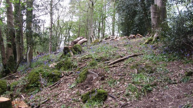
Mill Wood is a picturesque woodland located in the county of Gloucestershire, England. Situated within the larger Forest of Dean, this woodland is a true gem for nature enthusiasts and those seeking tranquility. With an area of approximately 100 hectares, Mill Wood offers a diverse range of flora and fauna, making it a haven for wildlife.

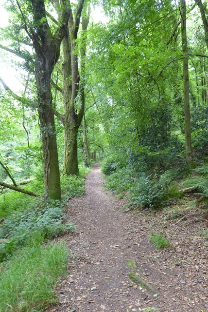
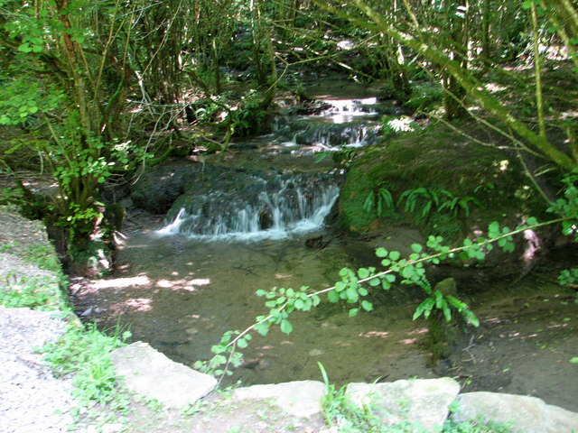
The wood is characterized by its dense canopy of trees, which includes a mixture of native species such as oak, beech, and birch. These towering trees provide a shady and cool atmosphere, perfect for a leisurely stroll on a hot summer day. The forest floor is carpeted with wildflowers, ferns, and mosses, creating a vibrant and colorful display throughout the year.

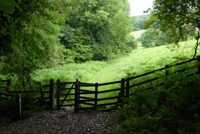
Numerous walking trails wind their way through Mill Wood, offering visitors the chance to explore its beauty at their own pace. These paths vary in difficulty, catering to both casual walkers and more experienced hikers. Along the way, one can encounter ancient ruins, remnants of the area's industrial past, including the remains of a watermill that once operated within the wood.

The wood is also home to a wide variety of wildlife, including deer, foxes, badgers, and a multitude of bird species. Birdwatchers will be delighted by the opportunity to spot woodpeckers, owls, and various songbirds in their natural habitat.

Mill Wood is not only a place of natural beauty but also a site of historical significance. It has been designated as a Site of Special Scientific Interest (SSSI) due to its geological features and rich biodiversity. This recognition ensures the preservation and conservation of the woodland for future generations to enjoy.

If you have any feedback on the listing, please let us know in the comments section below.
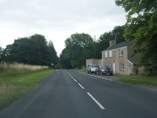
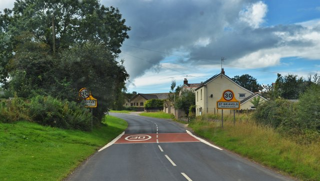
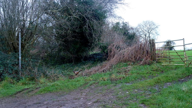
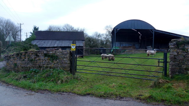
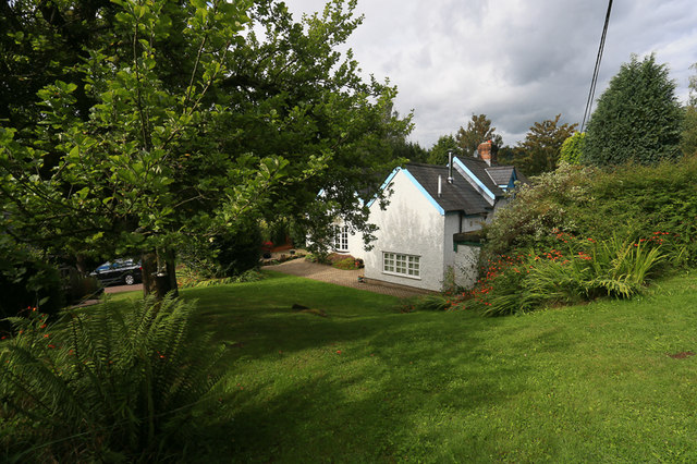
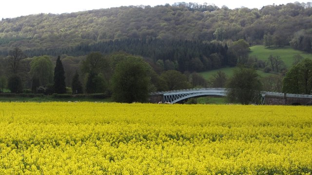
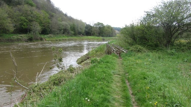
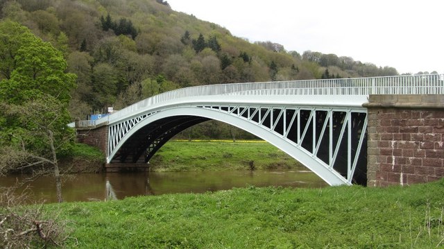
Mill Wood Images

Images are sourced within 2km of 51.74587/-2.6496747 or Grid Reference SO5505. Thanks to Geograph Open Source API. All images are credited.

Bigsweir Bridge Bigsweir Bridge crossing the River Wye in early July, I was here at the beginning of June on a bright day <a href="https://www.geograph.org.uk/photo/7194394">SO5305 : Bigsweir Bridge</a>.  The bridge was built in 1826-29; the iron-work was cast at Merthyr Tydfil.  The bridge is Grade II* listed, see: <span class="nowrap"><a title="https://historicengland.org.uk/listing/the-list/list-entry/1186622?section=official-list-entry" rel="nofollow ugc noopener" href="https://historicengland.org.uk/listing/the-list/list-entry/1186622?section=official-list-entry">Link</a><img style="margin-left:2px;" alt="External link" title="External link - shift click to open in new window" src="https://s1.geograph.org.uk/img/external.png" width="10" height="10"/></span>
Bigsweir Bridge
Bigsweir Bridge crossing the River Wye in early July, I was here at the beginning of June on a bright day SO5305 : Bigsweir Bridge. The bridge was built in 1826-29; the iron-work was cast at Merthyr Tydfil. The bridge is Grade II* listed, see: LinkExternal link
Road approaching Bigsweir Offa's Dyke long distance path follows the road here. Bigsweir Bridge can be seen in the valley crossing the River Wye.
Road approaching Bigsweir
Offa's Dyke long distance path follows the road here. Bigsweir Bridge can be seen in the valley crossing the River Wye.
View to Bigsweir Bridge View to Bigsweir Bridge in the Wye valley.
View to Bigsweir Bridge
View to Bigsweir Bridge in the Wye valley.
Offa's Dyke Path Offa's Dyke Path in Bigsweir Wood.
Offa's Dyke Path
Offa's Dyke Path in Bigsweir Wood.
Path in Wyeseal Wood Offa's Dyke Path in Wyeseal Wood.
Path in Wyeseal Wood
Offa's Dyke Path in Wyeseal Wood.
Kissing gate on Offa's Dyke Path Kissing gate on Offa's Dyke Path on Weeping Hill.
Kissing gate on Offa's Dyke Path
Kissing gate on Offa's Dyke Path on Weeping Hill.
B4228 at St Briavels village boundary
B4228 Barrowell Lane in St Briavels
B4228 north-east of St Briavels
Road To St Briavels B road entering the village from the north
Road To St Briavels
B road entering the village from the north
Footpath north from Stowe Lane Complete with cock pheasant.
Footpath north from Stowe Lane
Complete with cock pheasant.
Stowegreen Farm Some ewes in the very safe pasture next to the barns.
Stowegreen Farm
Some ewes in the very safe pasture next to the barns.
Beside the Wye at Whitebrook, Monmouthshire A dairy herd graze here beside the river.
Beside the Wye at Whitebrook, Monmouthshire
A dairy herd graze here beside the river.
St. Margaret's Cottage, St. Briavels Opposite a wood called St. Margaret's Grove is the appropriately named St. Margaret's cottage, a secluded holiday home in an area called "The Fence" just outside the village of St. Briavels. Offa's Dyke Path and the River Wye are within walking distance.
St. Margaret's Cottage, St. Briavels
Opposite a wood called St. Margaret's Grove is the appropriately named St. Margaret's cottage, a secluded holiday home in an area called "The Fence" just outside the village of St. Briavels. Offa's Dyke Path and the River Wye are within walking distance.
Bigsweir Bridge View over oilseed rape on the west side of the Wye.
Bigsweir Bridge
View over oilseed rape on the west side of the Wye.
River Wye below Bigsweir Bridge The footbridge crosses the Mork Brook.
River Wye below Bigsweir Bridge
The footbridge crosses the Mork Brook.
Bigsweir Bridge View from the Gloucestershire side. This is an early cast iron bridge (Hollis 1827). Must have been quite an enterprise bringing the parts down from Merthyr.
Bigsweir Bridge
View from the Gloucestershire side. This is an early cast iron bridge (Hollis 1827). Must have been quite an enterprise bringing the parts down from Merthyr.
Clearing, Great Park Coniger At the start of the long climb out of the Wye Valley.
Clearing, Great Park Coniger
At the start of the long climb out of the Wye Valley.
Show me another place!

Mill Wood is located at Grid Ref: SO5505 (Lat: 51.74587, Lng: -2.6496747)

Administrative County: Gloucestershire

District: Forest of Dean

Police Authority: Gloucestershire

What 3 Words

///selects.toys.besotted. Near Bream, Gloucestershire

Related Wikis

Bigsweir Woods

Bigsweir Woods (grid reference SO546060) is a 48.16-hectare (119.0-acre) biological Site of Special Scientific Interest in Gloucestershire, notified in...
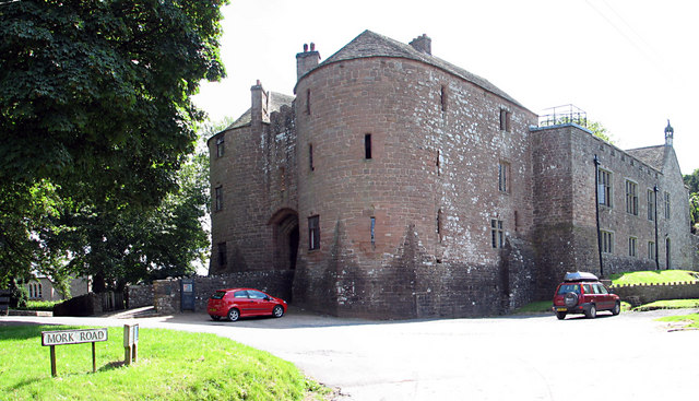
St Briavels Castle

St Briavels Castle is a moated Norman castle at St Briavels in the English county of Gloucestershire. The castle is noted for its huge Edwardian gatehouse...

Slade Brook

Slade Brook (grid reference SO564055) is a 3.63-hectare (9.0-acre) biological and geological Site of Special Scientific Interest in Gloucestershire, notified...
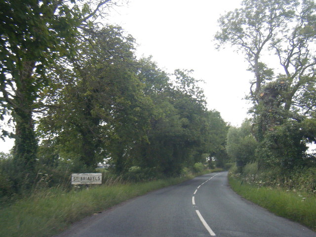
St Briavels

St Briavels (pronounced Brevels, once known as 'Ledenia Parva' (Little Lydney)), is a medium-sized village and civil parish in the Royal Forest of Dean...

Bigsweir Bridge

Bigsweir Bridge is an 1827 road bridge crossing the River Wye, straddling the boundary between the parish of St. Briavels, Gloucestershire, England, and...

Stow Green, St Briavels

Stow Green Castle, also known as Castle Tump, was a castle near the village of St Briavels in Gloucestershire, England. The castle is believed to have...

St Briavels railway station

St Briavels Station was a station along the Wye Valley Railway. It was built in 1876 during the construction of the line on the Monmouthshire side of the...

Whitebrook Halt railway station

Whitebrook Halt was a request stop on the former Wye Valley Railway. It was opened in 1927 to serve the village of Whitebrook. It was closed in 1959 when...

Nearby Amenities

Located within 500m of 51.74587,-2.6496747
Mork
Is In: Gloucestershire, England, UK
Place: hamlet
Source: NPE
Lat/Long: 51.7452194/-2.6490604
Bus Stop
Mork Corner Cottage
Naptan AtcoCode: 1600GL3359
Naptan Bearing: SE
Naptan BusStopType: CUS
Naptan CommonName: Mork Corner Cottage
Naptan NaptanCode: gloadgtj
Naptan Street: Lower Cinderhill
Naptan Verified: no
Source: naptan_import
Lat/Long: 51.7456794/-2.6508295
Bus Stop
Mork Corner Cottage
Naptan AtcoCode: 1600GL3360
Naptan Bearing: NE
Naptan CommonName: Mork Corner Cottage
Naptan Indicator: Opp
Naptan NaptanCode: gloadgtg
Naptan Street: Lower Cinderhill
Naptan Verified: no
Source: naptan_import
Lat/Long: 51.7456542/-2.6512871
Bus Stop
Brook Farm
Naptan AtcoCode: 1600GLF615
Naptan Bearing: SW
Naptan BusStopType: CUS
Naptan CommonName: Brook Farm
Naptan NaptanCode: gloadjaj
Naptan Street: Stowe Rd
Naptan Verified: no
Source: naptan_import
Lat/Long: 51.7475449/-2.6464878
Bus Stop
Brook Farm
Naptan AtcoCode: 1600GLF616
Naptan Bearing: NE
Naptan CommonName: Brook Farm
Naptan Indicator: Opp
Naptan NaptanCode: gloadjag
Naptan Street: Stowe Rd
Naptan Verified: no
Source: naptan_import
Lat/Long: 51.7474836/-2.6467291
Ford: yes
Lat/Long: 51.7472896/-2.6463825
Post Box
Collection Times: Mo-Fr 16:30; Sa 09:45; Su off
Drive Through: no
Operator: Royal Mail
Post Box Type: wall
Ref: GL15 25
Royal Cypher: VR
Royal Cypher Wikidata: Q33102356
Source: survey
Lat/Long: 51.7457064/-2.6511452
Barrier: stile
Lat/Long: 51.7469423/-2.6436348
The data included in this document is from www.openstreetmap.org. The data is made available under ODbL.

Have you been to Mill Wood?

Leave your review of Mill Wood below (or comments, questions and feedback).