Barkrigg Wood

Wood, Forest in Westmorland South Lakeland

England

Barkrigg Wood

Near Laverock Bridge The nearby bridge is over the west coast mainline. Neat football pitch in the fields above the houses. Kendal in the distance
Near Laverock Bridge Credit: Michael Graham

Barkrigg Wood is a picturesque woodland located in the county of Westmorland, England. Covering an area of approximately 100 acres, it is nestled in the heart of the stunning Lake District National Park. The wood is easily accessible, situated just a few miles south of the charming village of Kendal.

Barkrigg Wood is predominantly composed of native broadleaf trees, such as oak, ash, and beech, which create a rich and diverse habitat for a variety of wildlife. The woodland floor is blanketed with a carpet of bluebells in the spring, enhancing its natural beauty and attracting nature enthusiasts and photographers alike.

This ancient woodland is steeped in history, with evidence of human activity dating back to the Neolithic period. There are remnants of old stone walls and boundary markers, serving as a testament to the area's past. Additionally, Barkrigg Wood is believed to have been used as a hunting ground by the local aristocracy during the medieval period.

Visitors to Barkrigg Wood can enjoy a network of well-maintained paths and trails, making it an ideal location for walking, hiking, and exploring the natural surroundings. The wood offers a peaceful and tranquil atmosphere, allowing visitors to escape the hustle and bustle of everyday life and connect with nature.

Overall, Barkrigg Wood is a hidden gem within Westmorland, offering a unique opportunity to experience the beauty and serenity of the Lake District. Whether you are a nature lover, history enthusiast, or simply seeking a peaceful retreat, Barkrigg Wood is a must-visit destination.

If you have any feedback on the listing, please let us know in the comments section below.

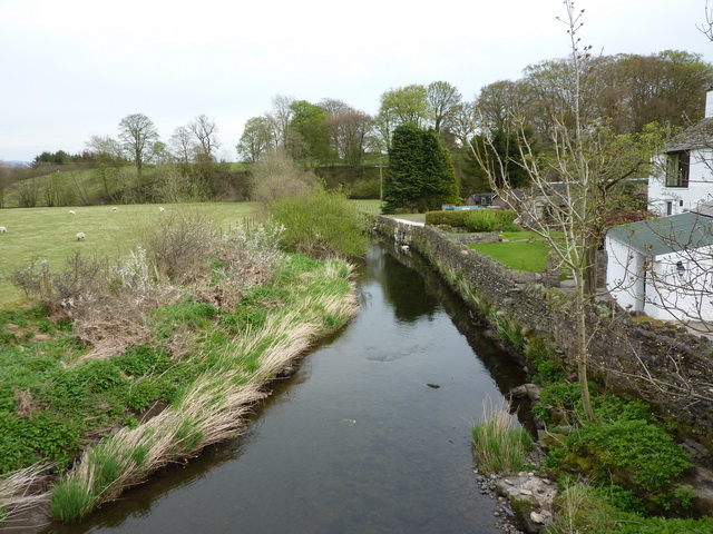
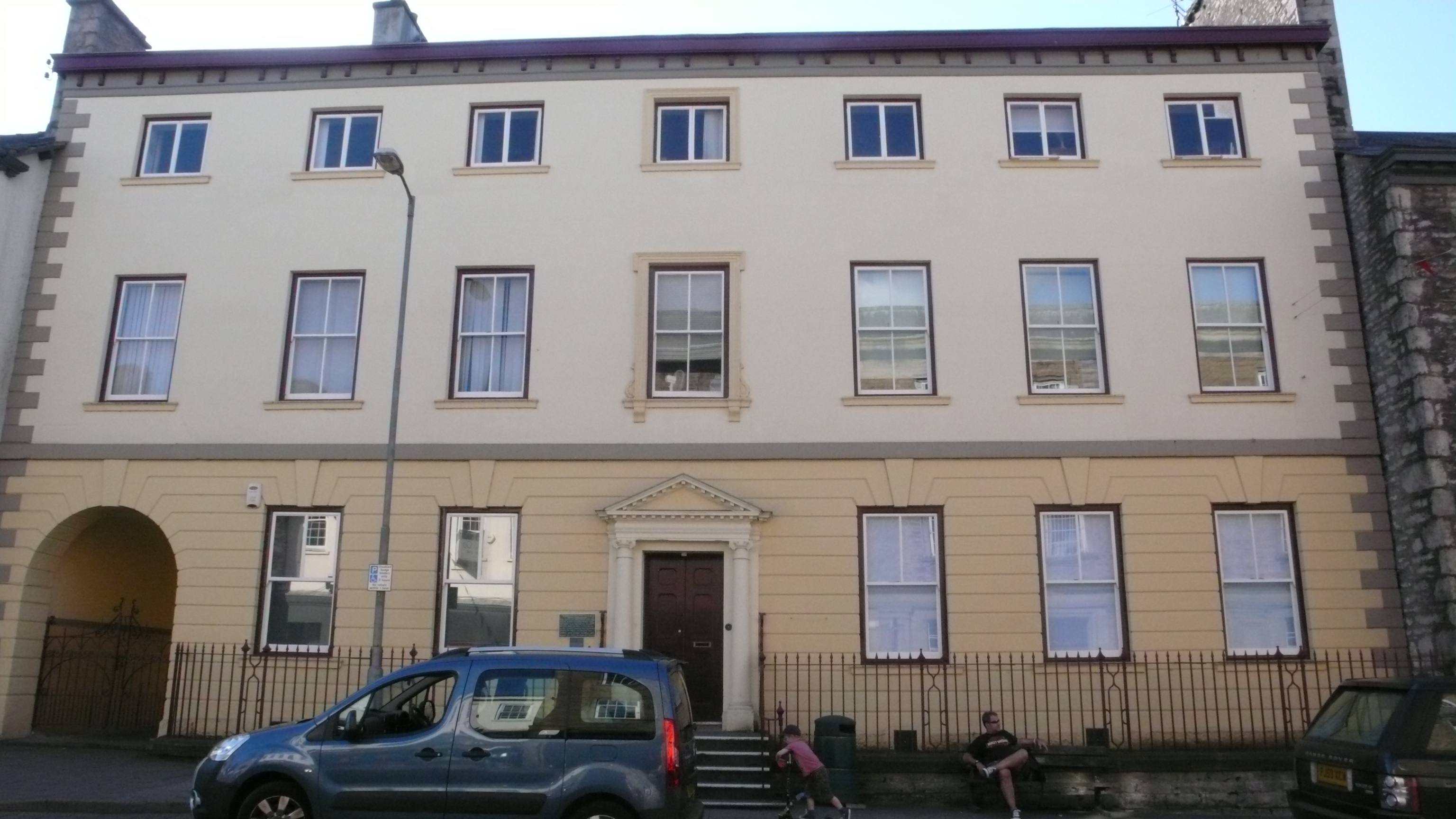
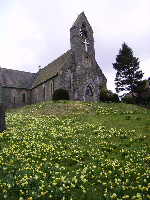
Barkrigg Wood Images

Images are sourced within 2km of 54.360121/-2.693584 or Grid Reference SD5596. Thanks to Geograph Open Source API. All images are credited.

Near Laverock Bridge The nearby bridge is over the west coast mainline. Neat football pitch in the fields above the houses. Kendal in the distance
Near Laverock Bridge
The nearby bridge is over the west coast mainline. Neat football pitch in the fields above the houses. Kendal in the distance
Looking towards Whinfell Common West Coast main line in the cutting. Mallard exiting shot left.
Looking towards Whinfell Common
West Coast main line in the cutting. Mallard exiting shot left.
Beck Docker Bridge Enters the River Mint before it leaves the square
Beck Docker Bridge
Enters the River Mint before it leaves the square
Viaduct near Docker Bridge Carries west coast main line
Viaduct near Docker Bridge
Carries west coast main line
Country Road Near Crake Hall Crake Hall in the trees
Country Road Near Crake Hall
Crake Hall in the trees
Sheep and Lamb From the crossroads near Browfoot
Sheep and Lamb
From the crossroads near Browfoot
Patton Bridge Over the River Mint
Patton Bridge
Over the River Mint
Wall Field End Above the farm. Howgills in the distance
Wall Field End
Above the farm. Howgills in the distance
Patton Hall From the road to Kendal from Patton Bridge
Patton Hall
From the road to Kendal from Patton Bridge
River Mint At Meal Bank
River Mint
At Meal Bank
Skelsmergh Tarn An unexpected gem tucked away in the trees.
Skelsmergh Tarn
An unexpected gem tucked away in the trees.
Kingscups Marsh Marigolds on the path around Skelsmergh tarn
Kingscups
Marsh Marigolds on the path around Skelsmergh tarn
Bowthwaite Bridge Small bridge which carries a minor road over Light Water
Bowthwaite Bridge
Small bridge which carries a minor road over Light Water
Light Water It eventually flows into the River Mint N of Patton Bridge
Light Water
It eventually flows into the River Mint N of Patton Bridge
Gate Just N of The Borrans on the way to Howestone.
Gate
Just N of The Borrans on the way to Howestone.
Whinfell Tarn Whinfell Beacon can be seen dominating the skyline in this photo of Whinfell Tarn.
Whinfell Tarn
Whinfell Beacon can be seen dominating the skyline in this photo of Whinfell Tarn.
Stream on Hay Fell Just south of Slough Farm
Stream on Hay Fell
Just south of Slough Farm
West Coast Main Line at Docker A freight train heads for Scotland. The Howgills in the distance
West Coast Main Line at Docker
A freight train heads for Scotland. The Howgills in the distance
Show me another place!

Barkrigg Wood is located at Grid Ref: SD5596 (Lat: 54.360121, Lng: -2.693584)

Administrative County: Cumbria

District: South Lakeland

Police Authority: Cumbria

What 3 Words

///alongside.bars.tensions. Near Burneside, Cumbria

Related Wikis

Patton Bridge

Patton Bridge is a small rural hamlet approximately 5 miles from the outskirts of Kendal, Cumbria, England. Its post code region is LA8.

Scalthwaiterigg

Scalthwaiterigg is a former civil parish, now in the parish of Skelsmergh and Scalthwaiterigg, in the Westmorland and Furness district, in the ceremonial...

Docker, Cumbria

Docker is a civil parish in the South Lakeland district of the English county of Cumbria. Docker is 4.3 miles north east of the market town of Kendal....

Skelsmergh and Scalthwaiterigg

Skelsmergh and Scalthwaiterigg is a civil parish in South Lakeland district, Cumbria, England. It was formed on 1 April 2015 by merging the parishes of...

South Westmorland Rural District

South Westmorland was a rural district in Westmorland, England from 1894 to 1974. It saw various boundary changes during its existence, particularly in...

Skelsmergh

Skelsmergh is a small village and former civil parish, now in the parish of Skelsmergh and Scalthwaiterigg, in South Lakeland in rural Cumbria, England...

Grayrigg derailment

The Grayrigg derailment was a fatal railway accident that occurred at approximately 20:15 GMT on 23 February 2007, just to the south of Grayrigg, Cumbria...

Selside

Selside is a small village in rural Cumbria, England, about 6 miles (9.7 km) north of Kendal, close to the A6 road. It is now in the civil parish of Selside...

Nearby Amenities

Located within 500m of 54.360121,-2.693584
Created By: Merkaartor 0.13
Lat/Long: 54.3621447/-2.6944786
Created By: Merkaartor 0.13
Lat/Long: 54.3615305/-2.6957473
Created By: Merkaartor 0.13
Lat/Long: 54.3610732/-2.6967188
Created By: Merkaartor 0.13
Lat/Long: 54.3607115/-2.6975874
Created By: Merkaartor 0.13
Lat/Long: 54.3604795/-2.6979988
Created By: Merkaartor 0.13
Lat/Long: 54.3601928/-2.6983417
Design: three-level
Power: tower
Lat/Long: 54.3578443/-2.6916701
Design: three-level
Power: tower
Lat/Long: 54.3618451/-2.6982808
Design: three-level
Power: tower
Lat/Long: 54.360251/-2.6956844
Power: pole
Lat/Long: 54.3577665/-2.6999913
Power: pole
Lat/Long: 54.3585323/-2.6971427
Power: pole
Lat/Long: 54.3587824/-2.6960806
Power: pole
Lat/Long: 54.3592169/-2.6943372
Power: pole
Lat/Long: 54.3596139/-2.6925991
Power: pole
Lat/Long: 54.3599827/-2.691081
Power: pole
Lat/Long: 54.3603391/-2.6895092
Power: pole
Lat/Long: 54.3606642/-2.6882807
Power: pole
Lat/Long: 54.3609205/-2.6870845
Generator Method: photovoltaic
Generator Output Electricity: yes
Generator Source: solar
Generator Type: solar_photovoltaic_panel
Location: roof
Power: generator
Lat/Long: 54.3577357/-2.6980433
The data included in this document is from www.openstreetmap.org. The data is made available under ODbL.

Have you been to Barkrigg Wood?

Leave your review of Barkrigg Wood below (or comments, questions and feedback).