High Wood

Wood, Forest in Gloucestershire Forest of Dean

England

High Wood

Tourist at Tintern Abbey As I was wandering around and about the abbey taking photos this retired couple pulled their car onto the pavement and the wife climbed out and took a few digital photos of the ruins, the husband rummaged in a camera case in the boot and took a few photos with his digital SLR then he climbed back into the car and they went. Tintern done in maybe two minutes. "What is this life, if full of care, we have no time to stand and stare?"...
Tourist at Tintern Abbey Credit: Jeremy Bolwell

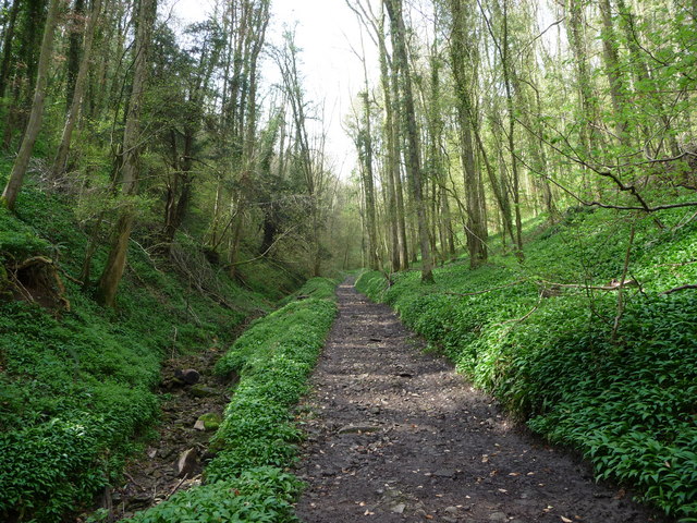
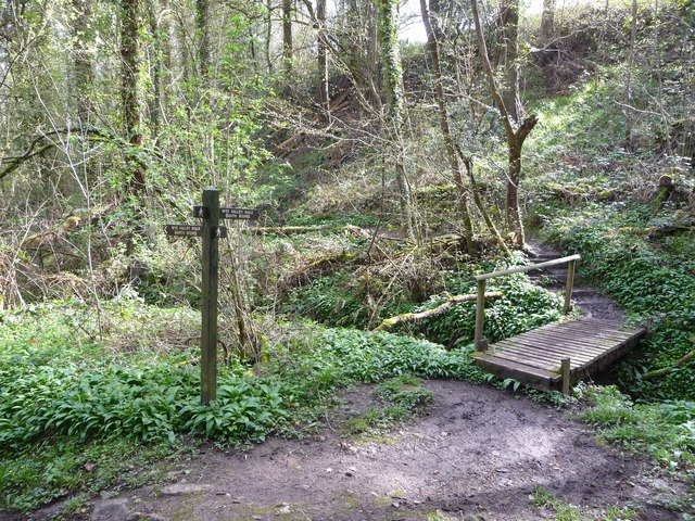
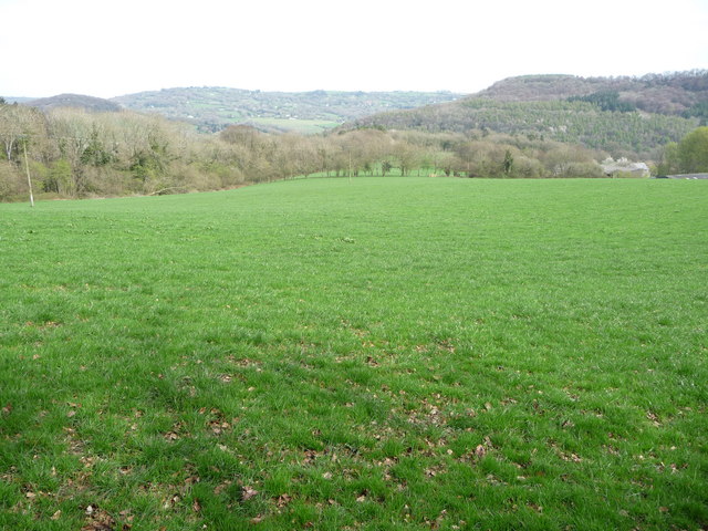
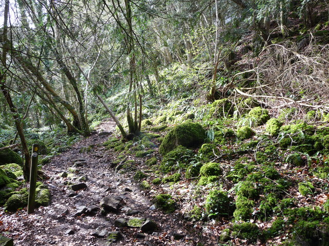
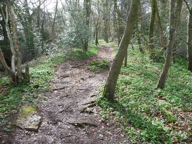
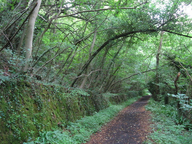
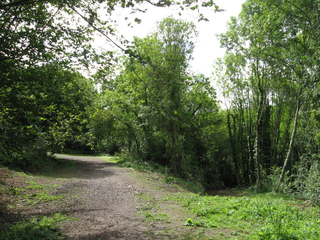
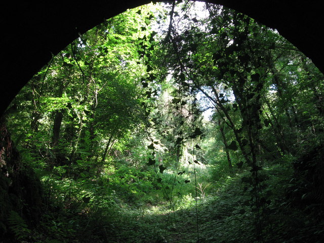
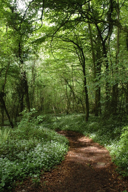
High Wood is a small forest located in Gloucestershire, England. It covers an area of approximately 50 acres and is situated within the larger Forest of Dean. The wood is characterized by its dense vegetation, consisting primarily of deciduous trees such as oak, beech, and birch. The forest floor is covered in a thick layer of leaf litter, providing a habitat for various small animals and insects.

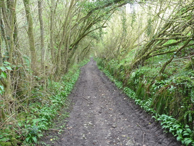
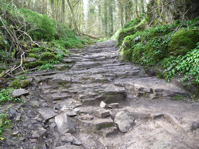
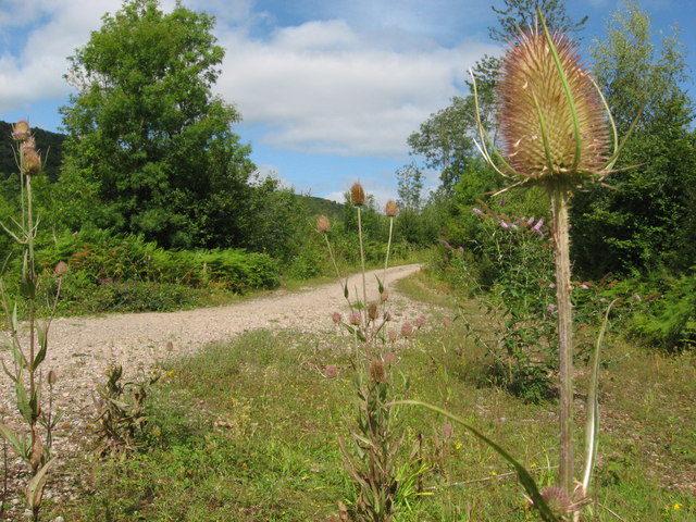
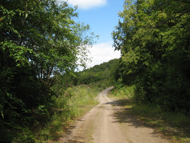
High Wood is known for its tranquil and peaceful atmosphere, attracting visitors who seek solace in nature. It offers a network of well-maintained walking trails, allowing visitors to explore the woodland and appreciate the diverse flora and fauna that inhabit the area. The forest is particularly beautiful in autumn, when the leaves change color and create a vibrant display of reds, oranges, and yellows.

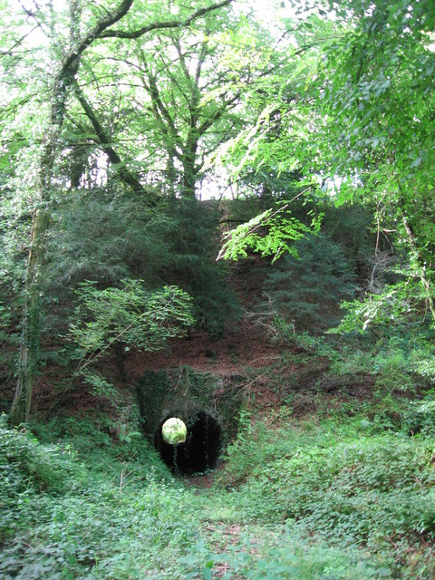
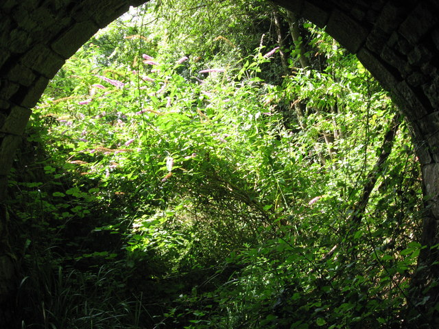
The wood has a rich history, dating back many centuries. It was once used as a hunting ground for the royal family, and remnants of old hunting lodges and deer stands can still be found within the forest. Today, High Wood is managed by the Forestry Commission, who ensure the preservation of the woodland and its ecological value.

High Wood is not only a popular destination for nature lovers and hikers but also a haven for wildlife. The forest provides a habitat for many species, including deer, foxes, badgers, and a variety of bird species. It is also home to a diverse range of plant life, including rare orchids and ferns.

Overall, High Wood in Gloucestershire is a picturesque and ecologically significant forest that offers a peaceful retreat for visitors and a vital habitat for a wide range of flora and fauna.

If you have any feedback on the listing, please let us know in the comments section below.
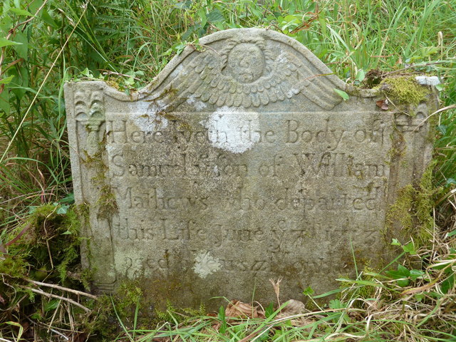
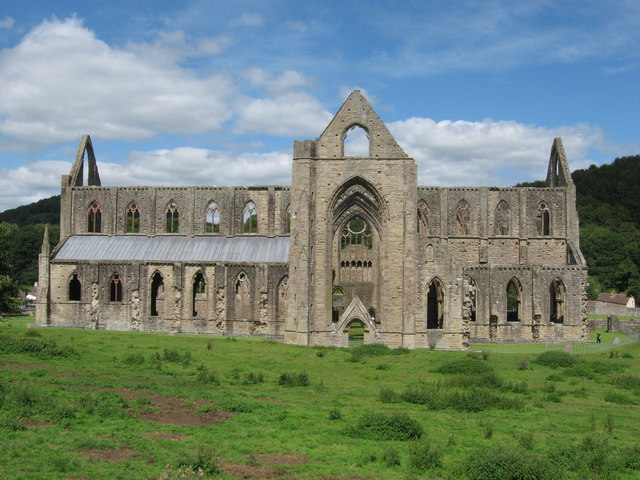
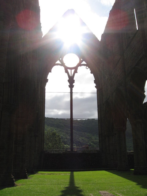
High Wood Images

Images are sourced within 2km of 51.688977/-2.6586677 or Grid Reference ST5499. Thanks to Geograph Open Source API. All images are credited.

Tourist at Tintern Abbey As I was wandering around and about the abbey taking photos this retired couple pulled their car onto the pavement and the wife climbed out and took a few digital photos of the ruins, the husband rummaged in a camera case in the boot and took a few photos with his digital SLR then he climbed back into the car and they went. Tintern done in maybe two minutes. "What is this life, if full of care, we have no time to stand and stare?"...
Tourist at Tintern Abbey
As I was wandering around and about the abbey taking photos this retired couple pulled their car onto the pavement and the wife climbed out and took a few digital photos of the ruins, the husband rummaged in a camera case in the boot and took a few photos with his digital SLR then he climbed back into the car and they went. Tintern done in maybe two minutes. "What is this life, if full of care, we have no time to stand and stare?"...
The Wye Valley Walk in Limekiln Woods This track carries the WVW into beautiful woodland.
The Wye Valley Walk in Limekiln Woods
This track carries the WVW into beautiful woodland.
The Wye Valley Walk climbs through Limekiln Wood Wild garlic grows in profusion here in April and the woods are alive with birdsong.
The Wye Valley Walk climbs through Limekiln Wood
Wild garlic grows in profusion here in April and the woods are alive with birdsong.
Part of the Wye Valley Walk in Limekiln Wood Here the underlying bedrock forms a series of steps.
Part of the Wye Valley Walk in Limekiln Wood
Here the underlying bedrock forms a series of steps.
The Wye Valley Walk in Limekiln Wood Here the path turns south through beautiful woodland.
The Wye Valley Walk in Limekiln Wood
Here the path turns south through beautiful woodland.
On the Wye Valley Walk in April It's early April above the Lower Wye Valley and these woodlands and fields are just about to transform with Spring. To catch them in the moments before that happens is special.
On the Wye Valley Walk in April
It's early April above the Lower Wye Valley and these woodlands and fields are just about to transform with Spring. To catch them in the moments before that happens is special.
The Wye Valley Walk in Black Cliff Wood The Wye Valley Walk here ascends an Iron Age hillfort on the northern edge of Black Cliff wood. Mossy boulders lie in jumbles and slanting saplings compete for sunlight. The wood is humid and clammy, the steep path muddy and slippery. It is easy to imagine the Silures shock at the coming of the Romans to this area and how things would never be the same again.
The Wye Valley Walk in Black Cliff Wood
The Wye Valley Walk here ascends an Iron Age hillfort on the northern edge of Black Cliff wood. Mossy boulders lie in jumbles and slanting saplings compete for sunlight. The wood is humid and clammy, the steep path muddy and slippery. It is easy to imagine the Silures shock at the coming of the Romans to this area and how things would never be the same again.
The Wye Valley Walk in Black Cliff Wood in April After the hillfort summit the walk levels out and you walk through woodland on a twisting path that almost seems to good to be true.
The Wye Valley Walk in Black Cliff Wood in April
After the hillfort summit the walk levels out and you walk through woodland on a twisting path that almost seems to good to be true.
Tintern - 1713 gravestone in St Mary's churchyard "Here lyeth the Body of Samuel ye son of William Mathews who departed this Life June ye 7th 1713 aged 9 Years ..."
Tintern - 1713 gravestone in St Mary's churchyard
"Here lyeth the Body of Samuel ye son of William Mathews who departed this Life June ye 7th 1713 aged 9 Years ..."
Tintern Abbey
Tintern Abbey
Tintern Abbey, east window
Path along course of Wye Valley Railway near Tintern
Path along course of Wye Valley Railway near Tintern The railway line carried on straight ahead at this point, through the trees. Walkers now have a choice and can drop down right, or go up to the left.
Path along course of Wye Valley Railway near Tintern
The railway line carried on straight ahead at this point, through the trees. Walkers now have a choice and can drop down right, or go up to the left.
Path junction in woods near River Wye
Tunnel beneath disused railway line near Tintern Quarry
(No) light at the end of the tunnel The path at the western end of the tunnel (<a href="https://www.geograph.org.uk/photo/2544718">ST5498 : Tunnel beneath disused railway line near Tintern Quarry</a>) is very overgrown and currently impassable.
(No) light at the end of the tunnel
The path at the western end of the tunnel (ST5498 : Tunnel beneath disused railway line near Tintern Quarry) is very overgrown and currently impassable.
Path from tunnel under railway near Tintern Quarry The view from the eastern portal of <a href="https://www.geograph.org.uk/photo/2544718">ST5498 : Tunnel beneath disused railway line near Tintern Quarry</a> shows an overgrown, but still passable path.
Path from tunnel under railway near Tintern Quarry
The view from the eastern portal of ST5498 : Tunnel beneath disused railway line near Tintern Quarry shows an overgrown, but still passable path.
Path near Tintern Quarry
Show me another place!

High Wood is located at Grid Ref: ST5499 (Lat: 51.688977, Lng: -2.6586677)

Administrative County: Gloucestershire

District: Forest of Dean

Police Authority: Gloucestershire

What 3 Words

///pebbles.delusions.flies. Near Tintern, Monmouthshire

Related Wikis

Devil's Pulpit, Gloucestershire

The Devil's Pulpit is a rocky limestone outcrop and scenic viewpoint in the Forest of Dean District of Gloucestershire, England, within the Wye Valley...

Miss Grace's Lane

Miss Grace's Lane (also known as Miss Grace's Lane Swallett), near Tidenham in the Forest of Dean, Gloucestershire, England, is a natural cave system,...

Lippets Grove

Lippets Grove (grid reference SO540000) is a 5-hectare (12-acre) nature reserve in Gloucestershire. The site was leased from the Forestry Commission in...

Tintern Quarry

Tintern Quarry was a quarry in the Forest of Dean, Gloucestershire, England. It was served by the Wye Valley Railway from 1876 until it closed in 1981...

Poor's Allotment

Poor's Allotment (grid reference ST560990) is a 28.57-hectare (70.6-acre) biological Site of Special Scientific Interest in Gloucestershire, notified in...

Shorn Cliff and Caswell Woods

Shorn Cliff And Caswell Woods (SO540005 & SO540990) is a 69.2-hectare (171-acre) biological Site of Special Scientific Interest in Gloucestershire, notified...
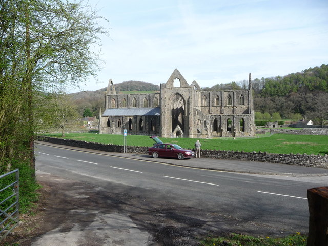
Tintern Abbey

Tintern Abbey (Welsh: Abaty Tyndyrn ) was founded on 9 May 1131 by Walter de Clare, Lord of Chepstow. It is situated adjacent to the village of Tintern...

St Anne's House, Tintern

St Anne's House, Tintern, Monmouthshire, is a house of early medieval origin which includes elements of the gatehouse and chapel of Tintern Abbey. The...

Nearby Amenities

Located within 500m of 51.688977,-2.6586677
Devil's Pulpit
Tourism: viewpoint
Lat/Long: 51.6925543/-2.6627893
Barrier: kissing_gate
Lat/Long: 51.6926172/-2.6617966
Archaeological Site: tumulus
Historic: archaeological_site
Lat/Long: 51.6855318/-2.6611833
Bench
Lat/Long: 51.6903506/-2.6625044
Shorn Cliff Cave
Access: yes
Ele: 175
Natural: cave_entrance
Lat/Long: 51.6895746/-2.6644766
The data included in this document is from www.openstreetmap.org. The data is made available under ODbL.

Have you been to High Wood?

Leave your review of High Wood below (or comments, questions and feedback).