Bleasehall Wood

Wood, Forest in Westmorland South Lakeland

England

Bleasehall Wood

High House
High House Credit: N Chadwick

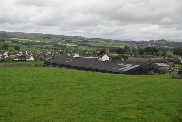
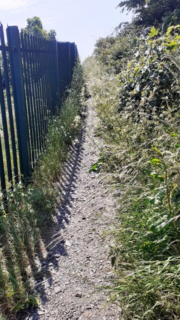
Bleasehall Wood is a picturesque woodland situated in the county of Westmorland, England. Located near the village of Bleasehall, this dense forest covers an area of approximately 50 acres and is a popular destination for nature enthusiasts and hikers alike.

The woodland is predominantly composed of deciduous trees, including oak, birch, and beech, which create a vibrant and diverse ecosystem. The forest floor is blanketed with a thick layer of leaf litter, providing a habitat for numerous species of plants, fungi, and small animals.

Bleasehall Wood is known for its stunning natural beauty, particularly during the autumn months when the leaves change color, painting the landscape with vibrant hues of red, orange, and gold. The forest also boasts an extensive network of footpaths and trails, allowing visitors to explore its hidden corners and discover its many wonders.

The wood is home to a variety of wildlife, including deer, badgers, foxes, and a rich array of bird species. Birdwatchers can spot common woodland birds such as robins, blue tits, and great tits, as well as some rarer species like woodpeckers and buzzards.

Managed by the local forestry commission, Bleasehall Wood is well-maintained, with designated picnic areas and benches scattered throughout, providing visitors with the perfect opportunity to relax and appreciate the tranquil surroundings.

Overall, Bleasehall Wood is a captivating woodland that offers visitors a chance to immerse themselves in nature, witness breathtaking seasonal changes, and enjoy the peaceful ambiance of this enchanting forest.

If you have any feedback on the listing, please let us know in the comments section below.

Bleasehall Wood Images

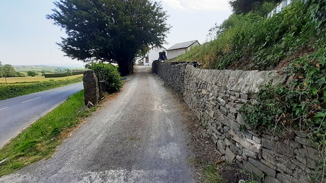
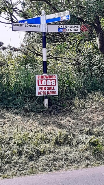
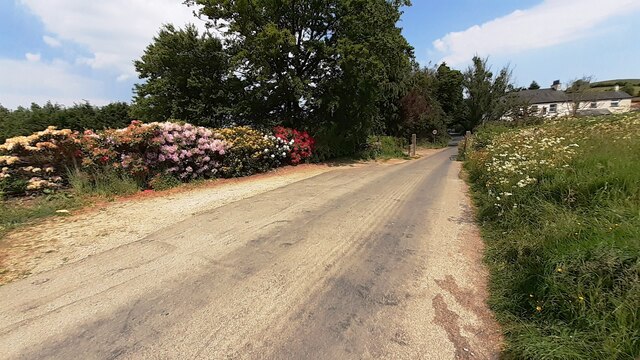
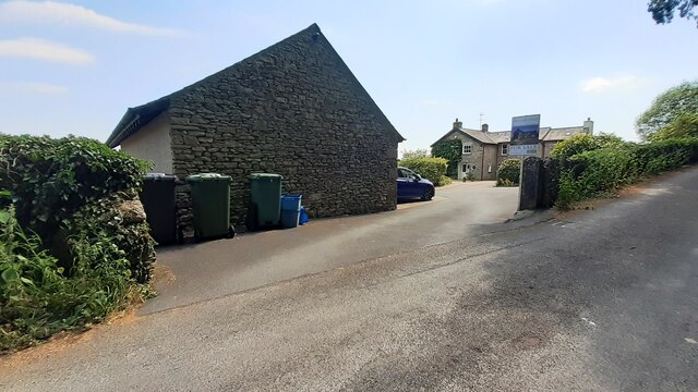
Images are sourced within 2km of 54.289454/-2.7042553 or Grid Reference SD5488. Thanks to Geograph Open Source API. All images are credited.

High House
High House
Old Milestone, B6254, Middleshaw, Parish of Old Hutton and Holmescales The milestone is located 200m South of the village edge against the wall on the North side of road. Carved stone post, Kirkby Kendal stone design, erected by the Kendal, Kirkby Lonsdale, Milnthorpe turnpike trust in the 19th century.

Repainted by John Heap, John Shorrock and Arthur Robinson from Old Hutton & Holmescales Parish Council, August 2021. See  <a title="https://www.geograph.org.uk/photo/6865247" href="https://www.geograph.org.uk/photo/6865247">Link</a> taken before the repainting.

Inscription reads:- KIRKBY / LONSDALE / 8 : : KENDAL / 4 
Carved benchmark on top

Grade II Listed by Historic England, list entry number 1137692 <span class="nowrap"><a title="https://historicengland.org.uk/listing/the-list/list-entry/1137692" rel="nofollow ugc noopener" href="https://historicengland.org.uk/listing/the-list/list-entry/1137692">Link</a><img style="margin-left:2px;" alt="External link" title="External link - shift click to open in new window" src="https://s1.geograph.org.uk/img/external.png" width="10" height="10"/></span>

Milestone Society National ID: WE_KLKDa08
Old Milestone, B6254, Middleshaw, Parish of Old Hutton and Holmescales
The milestone is located 200m South of the village edge against the wall on the North side of road. Carved stone post, Kirkby Kendal stone design, erected by the Kendal, Kirkby Lonsdale, Milnthorpe turnpike trust in the 19th century. Repainted by John Heap, John Shorrock and Arthur Robinson from Old Hutton & Holmescales Parish Council, August 2021. See Link taken before the repainting. Inscription reads:- KIRKBY / LONSDALE / 8 : : KENDAL / 4 Carved benchmark on top Grade II Listed by Historic England, list entry number 1137692 LinkExternal link Milestone Society National ID: WE_KLKDa08
Old Boundary Marker on the B6254 at Saint Sunday's Bridge Parish Boundary Marker incised in the southern parapet of Saint Sunday's Bridge on the B6254 750 metres northwest of Middleshaw. On the boundary of Old Hutton and Homescales and New Hutton parishes. Inscribed OLD HUTTON and NEW HUTTON in two adjacent coping stones. Re-painted in August 2021 by John Heap, John Shorrock and Arthur Robinson from Old Hutton and Holmescales Parish Council. See also <a title="https://www.geograph.org.uk/photo/6094846" href="https://www.geograph.org.uk/photo/6094846">Link</a> and <a title="https://www.geograph.org.uk/photo/6864933" href="https://www.geograph.org.uk/photo/6864933">Link</a>.

Milestone Society National ID: WE_KLKDa08pb
Old Boundary Marker on the B6254 at Saint Sunday's Bridge
Parish Boundary Marker incised in the southern parapet of Saint Sunday's Bridge on the B6254 750 metres northwest of Middleshaw. On the boundary of Old Hutton and Homescales and New Hutton parishes. Inscribed OLD HUTTON and NEW HUTTON in two adjacent coping stones. Re-painted in August 2021 by John Heap, John Shorrock and Arthur Robinson from Old Hutton and Holmescales Parish Council. See also Link and Link. Milestone Society National ID: WE_KLKDa08pb
Footpath dropping down to Peasey Beck The line of trees marks the position of Peasey Beck, - though it does conceal the feature
Footpath dropping down to Peasey Beck
The line of trees marks the position of Peasey Beck, - though it does conceal the feature
Countryside South of Birkrigg Park
Footbridge over Peasey Beck It actually takes a bridleway across the beck, although horses would be advised to wade across the water instead, due to the narrowness of the span
Footbridge over Peasey Beck
It actually takes a bridleway across the beck, although horses would be advised to wade across the water instead, due to the narrowness of the span
Bridleway heading West towards Birkrigg High Park
Track beside Barkhouse Beck
Farm Track heading towards Birkrigg High Park
Benchmark on gatepost beside minor road from B6254 to The Helm Ordnance Survey cut mark benchmark levelled at 125.064m above Newlyn Datum verified 1969
Benchmark on gatepost beside minor road from B6254 to The Helm
Ordnance Survey cut mark benchmark levelled at 125.064m above Newlyn Datum verified 1969
NW side of road to The Helm at B6254 junction There is an Ordnance Survey benchmark <a href="https://www.geograph.org.uk/photo/7509072">SD5389 : Benchmark on gatepost beside minor road from B6254 to The Helm</a> on the gatepost
NW side of road to The Helm at B6254 junction
There is an Ordnance Survey benchmark SD5389 : Benchmark on gatepost beside minor road from B6254 to The Helm on the gatepost
Entrance drive to Helm End from B6254 Ordnance Survey documents indicate that a benchmark levelled at 123.725m above Newlyn Datum was verified on a gatepost at the left hand side of the drive
Entrance drive to Helm End from B6254
Ordnance Survey documents indicate that a benchmark levelled at 123.725m above Newlyn Datum was verified on a gatepost at the left hand side of the drive
Finger signpost on south side of B6254 opposite Station Inn
Road from The Helm to junction with B6254 opposite the Station Inn Rhododendron in flower in hedge on left hand side of the road
Road from The Helm to junction with B6254 opposite the Station Inn
Rhododendron in flower in hedge on left hand side of the road
Fas-na-Coile and its garage
Footpath to Natland from Burton Road (A65) The path runs beside the West Coast Main Line railway
Footpath to Natland from Burton Road (A65)
The path runs beside the West Coast Main Line railway
Garage at Fas-na-Coile Ordnance Survey documents indicate that a benchmark levelled at 134.109m above Newlyn Datum was verified on the near corner of the building in 1970
Garage at Fas-na-Coile
Ordnance Survey documents indicate that a benchmark levelled at 134.109m above Newlyn Datum was verified on the near corner of the building in 1970
Benchmark on NE face of former shop Helm Garth on NW side of Helmsdale Road Ordnance Survey cut mark benchmark levelled at 94.575m above Newlyn Datum verified 1970.
Benchmark on NE face of former shop Helm Garth on NW side of Helmsdale Road
Ordnance Survey cut mark benchmark levelled at 94.575m above Newlyn Datum verified 1970.
Show me another place!

Bleasehall Wood is located at Grid Ref: SD5488 (Lat: 54.289454, Lng: -2.7042553)

Administrative County: Cumbria

District: South Lakeland

Police Authority: Cumbria

What 3 Words

///giraffes.accusing.ferrets. Near Kendal, Cumbria

Related Wikis

Halfpenny, Cumbria

Halfpenny is a hamlet in the civil parish of Stainton, in the South Lakeland district, in the county of Cumbria, England. It is located roughly two and...
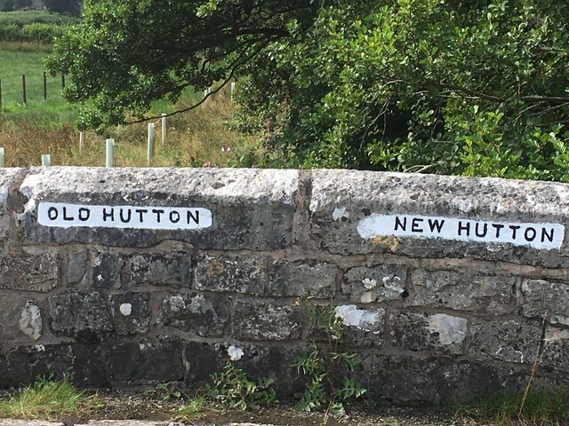
Middleshaw, Cumbria

Middleshaw is a hamlet on the B6254 road, near the village of Old Hutton, in the civil parish of Old Hutton and Holmescales, in the South Lakeland district...

Old Hutton

Old Hutton is a village in South Lakeland, Cumbria, England. It is in the civil parish of Old Hutton and Holmescales In the 2001 census the parish had...

Oxenholme

Oxenholme is a village in England just south of the town of Kendal, with which it has begun to merge. It is best known for Oxenholme Lake District railway...

Nearby Amenities

Located within 500m of 54.289454,-2.7042553
Power: tower
Lat/Long: 54.2928636/-2.7040584
Power: tower
Lat/Long: 54.2905153/-2.7067728
Power: tower
Lat/Long: 54.2879947/-2.709632
Power: pole
Lat/Long: 54.2918037/-2.6977096
Pipeline: valve
Lat/Long: 54.286383/-2.6997224
Pipeline: valve
Lat/Long: 54.2870047/-2.7002611
The data included in this document is from www.openstreetmap.org. The data is made available under ODbL.

Have you been to Bleasehall Wood?

Leave your review of Bleasehall Wood below (or comments, questions and feedback).