Bungalow Wood

Wood, Forest in Cumberland Eden

England

Bungalow Wood

Eden Bridge from east bank of River Eden The bridge carries the B6413 over the River Eden
Eden Bridge from east bank of River Eden Credit: Luke Shaw

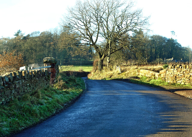
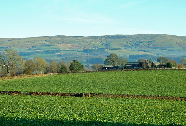
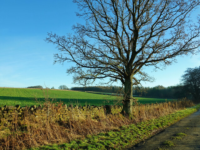
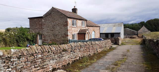
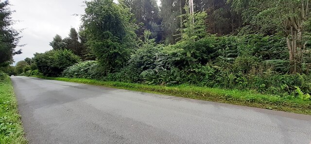
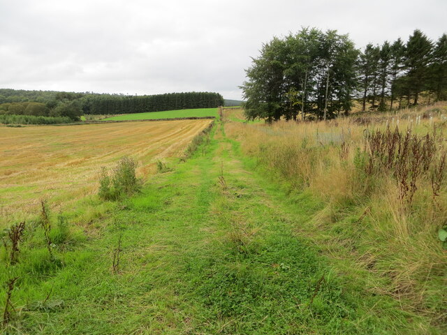
Bungalow Wood, located in Cumberland, is a pristine forest that covers an area of approximately 100 acres. It is known for its diverse range of flora and fauna, making it a popular destination for nature enthusiasts and wildlife lovers. The wood is predominantly composed of native trees such as oak, beech, and birch, creating a picturesque landscape that changes with the seasons.

The woodland is home to a variety of wildlife species, including deer, foxes, badgers, and a wide array of bird species. Birdwatchers can spot woodpeckers, owls, and various songbirds in the area. The tranquil atmosphere and abundance of wildlife make Bungalow Wood an ideal spot for birdwatching and wildlife photography.

The forest is crisscrossed with several walking trails, allowing visitors to explore the wood at their own pace. These trails vary in length and difficulty, catering to both casual strollers and more experienced hikers. There are also picnic areas and benches scattered throughout the wood, providing visitors with the opportunity to relax and soak in the natural beauty.

Bungalow Wood is managed by the local authorities, who have implemented conservation measures to protect the delicate ecosystem. These measures include controlled logging and encouraging sustainable practices among visitors. The wood is open to the public year-round, with guided tours and educational programs organized during the summer months.

Overall, Bungalow Wood offers a serene and immersive experience in nature, providing visitors with the chance to reconnect with the natural world and appreciate the beauty of Cumberland's woodlands.

If you have any feedback on the listing, please let us know in the comments section below.

Bungalow Wood Images

Images are sourced within 2km of 54.744696/-2.7165306 or Grid Reference NY5339. Thanks to Geograph Open Source API. All images are credited.

Eden Bridge from east bank of River Eden The bridge carries the B6413 over the River Eden
Eden Bridge from east bank of River Eden
The bridge carries the B6413 over the River Eden
Crossing the Settle-Carlisle line This is where Fiddler’s Lane crosses the line. A winter view taken on a mid-December afternoon.
Crossing the Settle-Carlisle line
This is where Fiddler’s Lane crosses the line. A winter view taken on a mid-December afternoon.
Lazonby farmland view Looking into the Eden Valley from Fiddler’s Lane. These fields are being used for winter livestock feeding.
Lazonby farmland view
Looking into the Eden Valley from Fiddler’s Lane. These fields are being used for winter livestock feeding.
Towards Cote Hill Farm Viewed looking across winter feeding land.
Towards Cote Hill Farm
Viewed looking across winter feeding land.
Eden Valley farmland A roadside view taken in mid-December.
Eden Valley farmland
A roadside view taken in mid-December.
Eden Bridge A closer look at this lovely old sandstone bridge near Lazonby, viewed from the adjoining square in winter afternoon sunshine.
Eden Bridge
A closer look at this lovely old sandstone bridge near Lazonby, viewed from the adjoining square in winter afternoon sunshine.
Benchmark on Cragnook Farm House Ordnance Survey cut mark benchmark levelled at 146.069m above Newlyn Datum verified 1972
Benchmark on Cragnook Farm House
Ordnance Survey cut mark benchmark levelled at 146.069m above Newlyn Datum verified 1972
Cragnook Farm farm house and access road There is an Ordnance Survey benchmark <a href="https://www.geograph.org.uk/photo/7245210">NY5340 : Benchmark on Cragnook Farm House</a> on the near corner, right hand face, of the farmhouse
Cragnook Farm farm house and access road
There is an Ordnance Survey benchmark NY5340 : Benchmark on Cragnook Farm House on the near corner, right hand face, of the farmhouse
Rural road through forestry NW of Crag Nook Ordnance Survey documents indicate that a benchmark levelled at 151.197m above Newlyn Datum was verified in 1972 on the side of the road here
Rural road through forestry NW of Crag Nook
Ordnance Survey documents indicate that a benchmark levelled at 151.197m above Newlyn Datum was verified in 1972 on the side of the road here
Grass farm track between cultivated fields and woodland Looking south-westward.
Grass farm track between cultivated fields and woodland
Looking south-westward.
Fiddler's Lane and Railway Bridge, Lazonby Looking north-westward.
Fiddler's Lane and Railway Bridge, Lazonby
Looking north-westward.
Refuse bins in the car park by the River Eden
Field path off Fiddler's Lane, Lazonby
Eden Bridge, Lazonby A fine bridge, but narrow and controlled by traffic lights.
Eden Bridge, Lazonby
A fine bridge, but narrow and controlled by traffic lights.
Country north of Lazonby
Lazonby Farmland View Viewed from a train on a fine mid-February morning.
Lazonby Farmland View
Viewed from a train on a fine mid-February morning.
Avenue of Beech trees On the Lazonby estate.
Avenue of Beech trees
On the Lazonby estate.
Gateway to Bargeat Wath Plantation Signs on the gate indicated that felling is in progress.
Gateway to Bargeat Wath Plantation
Signs on the gate indicated that felling is in progress.
Show me another place!

Bungalow Wood is located at Grid Ref: NY5339 (Lat: 54.744696, Lng: -2.7165306)

Administrative County: Cumbria

District: Eden

Police Authority: Cumbria

What 3 Words

///apprehend.groups.mashing. Near Penrith, Cumbria

Nearby Locations

Bungalow Wood

Related Wikis

Lazonby

Lazonby is a village and civil parish in the Lower Eden Valley of Cumbria; it is located about 8 miles (13 km) north-north-east of Penrith and 24 miles...

Lazonby & Kirkoswald railway station

Lazonby & Kirkoswald is a railway station on the Settle and Carlisle Line, which runs between Carlisle and Leeds via Settle. The station, which is situated...

Lacy's Caves

Lacy's Caves are a series of five chambers in the red sandstone cliff of the River Eden, just north of Little Salkeld, Cumbria, England, near Nunnery,...

Kirkoswald, Cumbria

Kirkoswald is a village, civil parish, and former market town located in Westmorland and Furness, England, about 9 miles (14 km) from Penrith. The village...

Nearby Amenities

Located within 500m of 54.744696,-2.7165306
Town Head
Naptan AtcoCode: 090074383774
Naptan Bearing: SW
Naptan BusStopType: CUS
Naptan CommonName: Town Head
Naptan Indicator: near
Naptan Landmark: Town Head Barn
Naptan NaptanCode: cumdapda
Naptan Street: No name
Naptan Verified: no
Source: naptan_import
Lat/Long: 54.7465386/-2.7096088
Post Box
Brand: Royal Mail
Brand Wikidata: Q638098
Brand Wikipedia: en:Royal Mail
Operator: Royal Mail
Operator Wikidata: Q638098
Post Box Type: lamp
Ref: CA10 300
Royal Cypher: EIIR
Royal Cypher Wikidata: Q33102113
Source: survey
Lat/Long: 54.7465551/-2.709901
Generator Method: photovoltaic
Generator Output Electricity: yes
Generator Source: solar
Generator Type: solar_photovoltaic_panel
Location: roof
Power: generator
Lat/Long: 54.7482044/-2.7129477
Advertising: board
Lat/Long: 54.7465823/-2.7098481
Power: pole
Lat/Long: 54.744086/-2.7194612
Power: pole
Lat/Long: 54.745687/-2.7185729
Power: pole
Lat/Long: 54.7462192/-2.7170215
Power: pole
Lat/Long: 54.7467476/-2.7154
Power: pole
Lat/Long: 54.7472767/-2.7137759
Power: pole
Lat/Long: 54.7475422/-2.712043
Power: pole
Lat/Long: 54.746324/-2.7147658
Power: pole
Lat/Long: 54.7456716/-2.7137759
Power: pole
Lat/Long: 54.7448306/-2.7124956
Power: pole
Lat/Long: 54.7440524/-2.7113217
Power: pole
Lat/Long: 54.7433008/-2.7101697
Power: pole
Lat/Long: 54.7432533/-2.7120744
Power: pole
Lat/Long: 54.7426721/-2.7126069
The data included in this document is from www.openstreetmap.org. The data is made available under ODbL.

Have you been to Bungalow Wood?

Leave your review of Bungalow Wood below (or comments, questions and feedback).