Furnace Grove

Wood, Forest in Gloucestershire Forest of Dean

England

Furnace Grove

View From Highbury Woods To Lower Redbrook
View From Highbury Woods Credit: Deborah Tilley

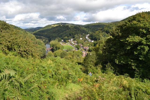
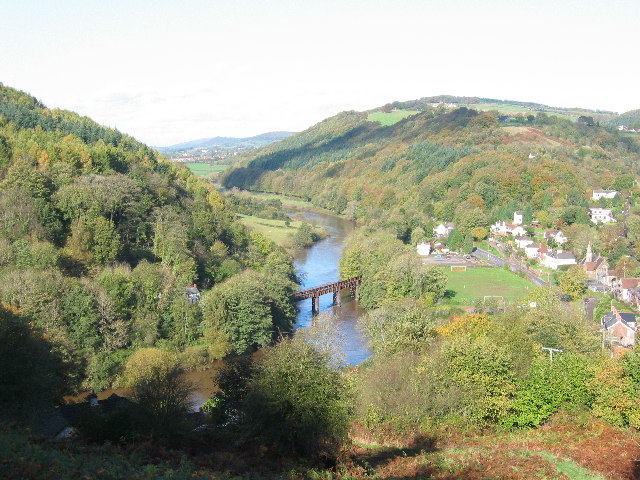
Furnace Grove is a small woodland area located in Gloucestershire, England. Situated near the village of Wood, within the heart of the Forest of Dean, it is known for its natural beauty and tranquil atmosphere. Covering an area of approximately 20 acres, Furnace Grove is a haven for nature enthusiasts and those seeking a peaceful retreat.

The woodland is predominantly composed of mixed deciduous trees, including oak, beech, and birch, which create a rich tapestry of colors throughout the seasons. The forest floor is adorned with a variety of wildflowers, such as bluebells and primroses, adding to the area's charm and biodiversity.

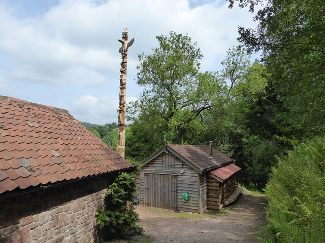
A key feature of Furnace Grove is its historic furnace, which gives the woodland its name. The furnace, dating back to the 17th century, was once used for smelting iron ore extracted from nearby mines. Although the furnace is no longer operational, its remains serve as a reminder of the area's industrial past.

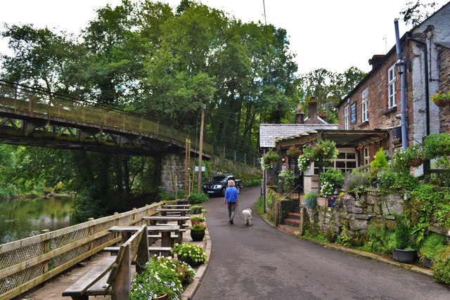
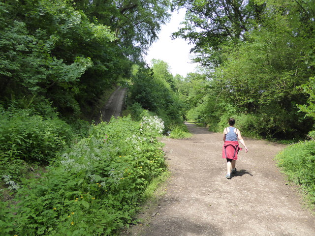
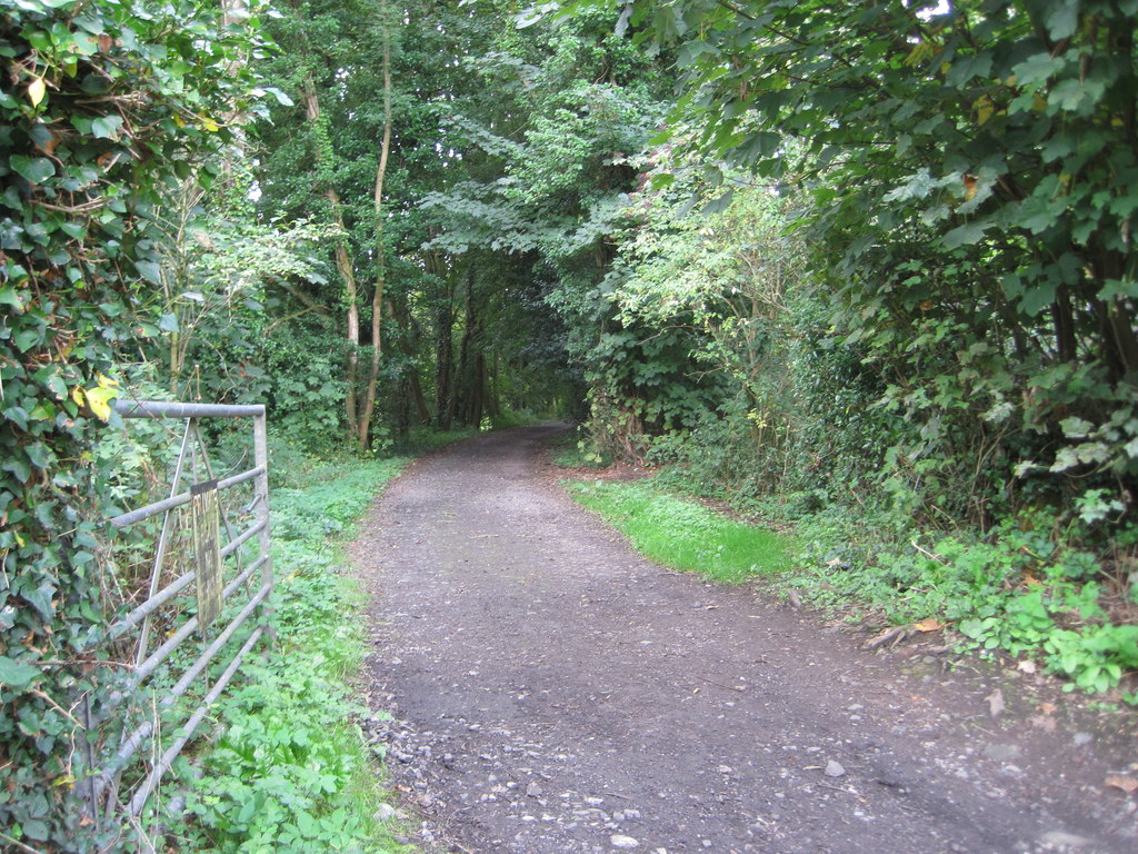
The woodland is crisscrossed by a network of footpaths and trails, making it accessible for walkers and hikers of all abilities. These paths lead visitors through the picturesque landscape, allowing them to discover hidden gems, such as a small stream and a secluded pond.

Furnace Grove is also home to a diverse range of wildlife, including deer, foxes, and a variety of bird species. Birdwatchers will delight in spotting woodpeckers, owls, and various songbirds that inhabit the woodland.

Overall, Furnace Grove offers a peaceful retreat amidst the natural beauty of Gloucestershire's woodlands. It is a place where visitors can connect with nature, explore its history, and enjoy the tranquility of the forest.

If you have any feedback on the listing, please let us know in the comments section below.

Furnace Grove Images

Images are sourced within 2km of 51.792258/-2.6699589 or Grid Reference SO5310. Thanks to Geograph Open Source API. All images are credited.

View From Highbury Woods To Lower Redbrook
View From Highbury Woods
To Lower Redbrook
Bridge Over The River Wye Connecting Lower Redbrook to the lovely Boat Inn!
Bridge Over The River Wye
Connecting Lower Redbrook to the lovely Boat Inn!
Boat Inn Near Redbrook A lovely looking place. Sadly we were there before opening time
Boat Inn Near Redbrook
A lovely looking place. Sadly we were there before opening time
A Line Of Land Rovers In Redbrook A fine display of all ages
A Line Of Land Rovers In Redbrook
A fine display of all ages
Newland Almshouses With the magnificent cross in the foreground
Newland Almshouses
With the magnificent cross in the foreground
The Ostrich, Newland An ancient inn from the 17th century. Many of the occupants of the centuries old graves opposite could well have drunk there!
The Ostrich, Newland
An ancient inn from the 17th century. Many of the occupants of the centuries old graves opposite could well have drunk there!
Newland Parish Church The 'cathedral of the forest'
Newland Parish Church
The 'cathedral of the forest'
Redbrook, Wye Valley A view of Redbrook on a misty morning, taken with a medium format Mamiya twin lens camera.
Redbrook, Wye Valley
A view of Redbrook on a misty morning, taken with a medium format Mamiya twin lens camera.
On the Wye Valley Walk below Lone Lane, Penallt Great walking.
On the Wye Valley Walk below Lone Lane, Penallt
Great walking.
Totem Pole above the Wye Valley Wow, a seven tier totem pole no less.
Totem Pole above the Wye Valley
Wow, a seven tier totem pole no less.
Property above the River Wye Here is one I took earlier, in 2012 <a title="https://www.geograph.org.uk/photo/3048988" href="https://www.geograph.org.uk/photo/3048988">Link</a>
Property above the River Wye
Here is one I took earlier, in 2012 Link
Pasture off Lone Lane below Penallt Nice tree, shady for stock on a summer day. Here it is in use <a title="https://www.geograph.org.uk/photo/3048964" href="https://www.geograph.org.uk/photo/3048964">Link</a>
Pasture off Lone Lane below Penallt
Nice tree, shady for stock on a summer day. Here it is in use Link
Boat Inn - 1983
Boat Inn - 1983
Redbrook Bridge - 1983
Way north out of Newland
Newland churchyard, south side Newland was a failed mediaeval new borough and the way houses face formally on to the churchyard is a remnant of its planning.  The south side, Almshouses Road seen here, is the most formal and also partly screens the grandest view.  The Lecturage on the left, the Jones Almshouses to the right.
Newland churchyard, south side
Newland was a failed mediaeval new borough and the way houses face formally on to the churchyard is a remnant of its planning. The south side, Almshouses Road seen here, is the most formal and also partly screens the grandest view. The Lecturage on the left, the Jones Almshouses to the right.
Newland looking south Past Birchamp Cottage and the Ostrich Inn to the Dower House, most of this range faces the churchyard from the east.
Newland looking south
Past Birchamp Cottage and the Ostrich Inn to the Dower House, most of this range faces the churchyard from the east.
Cottages on the north side of Newland churchyard
Show me another place!

Furnace Grove is located at Grid Ref: SO5310 (Lat: 51.792258, Lng: -2.6699589)

Administrative County: Gloucestershire

District: Forest of Dean

Police Authority: Gloucestershire

What 3 Words

///recruited.putts.common. Near Monmouth, Monmouthshire

Related Wikis

Swanpool Wood and Furnace Grove

Swanpool Wood and Furnace Grove (grid reference SO541107) is a 13.59-hectare (33.6-acre) biological Site of Special Scientific Interest (a conservation...

Redbrook Incline Bridge

The Redbrook Incline Bridge is a nineteenth-century tramway bridge that crosses the B4231 road at Redbrook on the England–Wales border. The bridge straddles...

Redbrook

Redbrook is a village in Gloucestershire, England, adjoining the border with Monmouthshire, Wales. It is located on the River Wye and is within the Wye...

Redbrook on Wye railway station

Redbrook on Wye railway station was a station serving the village of Redbrook on the now disused Wye Valley Railway. It was opened on 1 November 1876 with...

Penallt Viaduct

Penallt Viaduct is a viaduct that formerly carried the Wye Valley Railway over the River Wye, which at this location forms the border between England...

Penallt Halt railway station

Penallt Halt was a request stop on the former Wye Valley Railway. It was opened on 1 August 1931 and closed in 1959. Penallt Halt and Redbrook Station...

Harper's Grove – Lord's Grove

Harper's Grove – Lord's Grove is a Site of Special Scientific Interest (SSSI), noted for its biological characteristics, in Monmouthshire, south east Wales...

Newland Oak

The Newland Oak was a veteran oak tree in Newland, Gloucestershire in England. Originally part of the ancient woodland of the Forest of Dean, it survived...

Nearby Amenities

Located within 500m of 51.792258,-2.6699589
Turning Circle
Lat/Long: 51.7929579/-2.6766771
Access: no
Barrier: stile
Bicycle: no
Foot: yes
Horse: no
Locked: no
Material: wood
Motor Vehicle: no
Stile: stepover
Wheelchair: no
Lat/Long: 51.7954265/-2.6688566
Direction: 275
Generator Method: photovoltaic
Generator Output Electricity: yes
Generator Solar Modules: 8
Generator Source: solar
Generator Type: solar_photovoltaic_panel
Location: roof
Power: generator
Lat/Long: 51.7904012/-2.6728065
Direction: 275
Generator Method: photovoltaic
Generator Output Electricity: yes
Generator Solar Modules: 8
Generator Source: solar
Generator Type: solar_photovoltaic_panel
Location: roof
Power: generator
Lat/Long: 51.7903139/-2.6731716
Direction: 260
Generator Method: photovoltaic
Generator Output Electricity: yes
Generator Solar Modules: 4
Generator Source: solar
Generator Type: solar_photovoltaic_panel
Location: roof
Power: generator
Lat/Long: 51.7904601/-2.6731338
Direction: 260
Generator Method: photovoltaic
Generator Output Electricity: yes
Generator Solar Modules: 6
Generator Source: solar
Generator Type: solar_photovoltaic_panel
Location: roof
Power: generator
Lat/Long: 51.7904012/-2.6731204
Barrier: stile
Bicycle: no
Foot: yes
Horse: no
Locked: no
Material: wood
Motor Vehicle: no
Stile: stepover
Wheelchair: no
Lat/Long: 51.794611/-2.6689853
Barrier: stile
Bicycle: no
Foot: yes
Horse: no
Locked: no
Material: wood
Motor Vehicle: no
Note: Broken
Stile: stepover
Wheelchair: no
Lat/Long: 51.7950504/-2.6689943
The data included in this document is from www.openstreetmap.org. The data is made available under ODbL.

Have you been to Furnace Grove?

Leave your review of Furnace Grove below (or comments, questions and feedback).