Birklands Wood

Wood, Forest in Westmorland South Lakeland

England

Birklands Wood

View towards Kendal
View towards Kendal Credit: N Chadwick

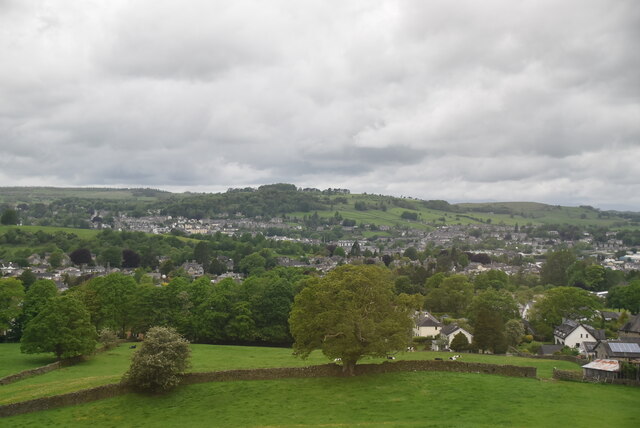
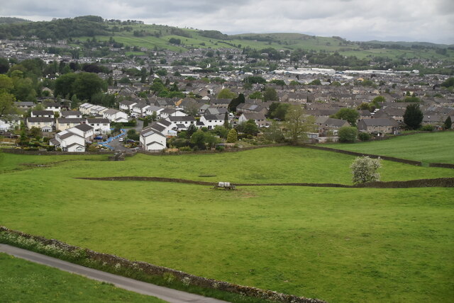
Birklands Wood, located in Westmorland, is a charming forested area known for its natural beauty and diverse range of flora and fauna. Spanning approximately 100 acres, the wood is situated near the town of Kirkby Stephen, within the county of Cumbria in northern England.

The wood is characterized by its mixture of deciduous and coniferous trees, providing a picturesque landscape throughout the year. Oak, birch, ash, and beech trees dominate the wood, while spruce and pine add to the varied ecosystem. The forest floor is covered in a rich carpet of mosses, ferns, and wildflowers, creating a vibrant and enchanting atmosphere.

Home to a diverse range of wildlife, Birklands Wood offers a haven for nature enthusiasts and birdwatchers. The wood is known for its resident population of birds such as woodpeckers, tits, and thrushes, as well as various species of owls. Mammals, including red squirrels, badgers, and roe deer, can also be spotted within the wood's boundaries.

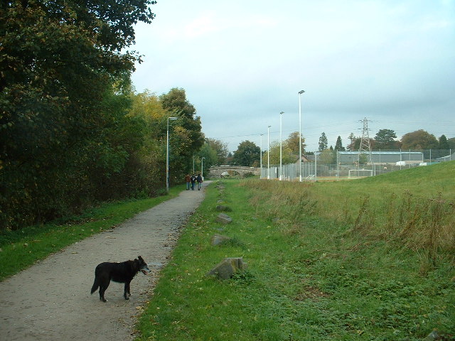
The wood provides a tranquil setting for leisurely walks and exploration. Numerous footpaths and trails crisscross the area, allowing visitors to fully immerse themselves in the woodland environment. Birklands Wood also offers opportunities for outdoor activities such as picnicking, photography, and nature studies.

With its stunning natural scenery and abundant wildlife, Birklands Wood is a cherished destination for locals and tourists alike. Whether one seeks solace in nature, wants to observe wildlife, or simply desires a peaceful retreat, this wood offers a captivating experience in the heart of Westmorland.

If you have any feedback on the listing, please let us know in the comments section below.

Birklands Wood Images

Images are sourced within 2km of 54.322551/-2.7140917 or Grid Reference SD5392. Thanks to Geograph Open Source API. All images are credited.
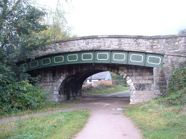
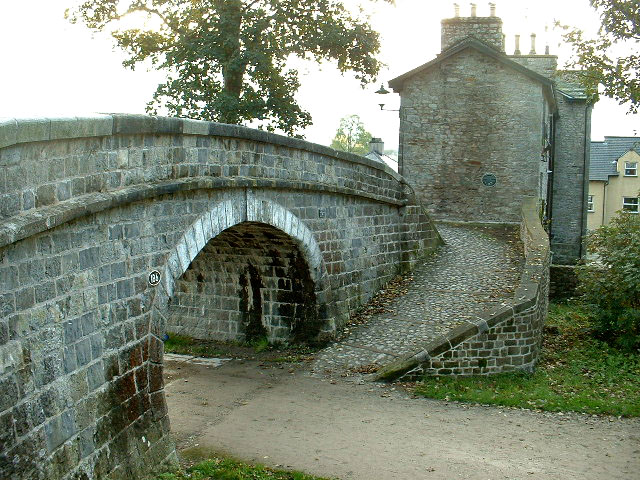
View towards Kendal
View towards Kendal
View to Sandylands
View to Sandylands
Rolling pasture
Rolling pasture
Line of Lancaster Canal in Kendal Looking north. The tall lamps illuminate an all-weather sports pitch, with shared use by local school and public.
Line of Lancaster Canal in Kendal
Looking north. The tall lamps illuminate an all-weather sports pitch, with shared use by local school and public.
The Change Bridge, Kendal Situated on the long disused section of the Lancaster Canal, this bridge allowed the Tow Horses to change from one side of the canal to the other [as the tow path changed sides] without unhitching from the barge they were towing. The horse track curving up to the bridge with no steps is clearly visible. This is the only bridge of its type in Cumbria, though there are others on the canal further south in Lancashire.
The Change Bridge, Kendal
Situated on the long disused section of the Lancaster Canal, this bridge allowed the Tow Horses to change from one side of the canal to the other [as the tow path changed sides] without unhitching from the barge they were towing. The horse track curving up to the bridge with no steps is clearly visible. This is the only bridge of its type in Cumbria, though there are others on the canal further south in Lancashire.
Canal Bridge, Kendal On the disused Lancaster Canal. The fancy metal section supports the widened road built upon the original bridge, which is now about twice as wide as originally built.
Canal Bridge, Kendal
On the disused Lancaster Canal. The fancy metal section supports the widened road built upon the original bridge, which is now about twice as wide as originally built.
Kendal Castle Viewed from the west, near the line of the disused Lancaster Canal
Kendal Castle
Viewed from the west, near the line of the disused Lancaster Canal
The end of the Lancaster Canal This beautiful, and characterful, canal ends ignominiously in a Council Works Depot, called Canal Head, in the middle of Kendal, where the canal basin used to be. It is overlooked by the impressive hill of Kendal Castle.
The end of the Lancaster Canal
This beautiful, and characterful, canal ends ignominiously in a Council Works Depot, called Canal Head, in the middle of Kendal, where the canal basin used to be. It is overlooked by the impressive hill of Kendal Castle.
River Kent, Kendal The River Kent, from which Kendal presumably takes its name, flows through the middle of the town and is a pretty, if inconvenient, landmark. The inconvenience is due to the complexities which the river adds to Kendal's traffic flow. The photo is taken looking upstream.
River Kent, Kendal
The River Kent, from which Kendal presumably takes its name, flows through the middle of the town and is a pretty, if inconvenient, landmark. The inconvenience is due to the complexities which the river adds to Kendal's traffic flow. The photo is taken looking upstream.
Mast On Hayclose Lane above Kendal
Mast
On Hayclose Lane above Kendal
Gate Looking down towards Kendal
Gate
Looking down towards Kendal
Farmland above Kendal Near Greyhound farm looking  west
Farmland above Kendal
Near Greyhound farm looking west
Sheep Down the hill from Greyhound Farm on the road to Kendal.
Sheep
Down the hill from Greyhound Farm on the road to Kendal.
Beck Near Garths farm The beck is a feeder of St. Sunday's Beck
Beck Near Garths farm
The beck is a feeder of St. Sunday's Beck
Weir Fisher Tarn No swimming
Weir Fisher Tarn
No swimming
Wall above Kendal The wall runs alongside a public footpath at this point bits of Kendal and Burneside in view.
Wall above Kendal
The wall runs alongside a public footpath at this point bits of Kendal and Burneside in view.
Country Road In between Oxenholme and Patton Bridge
Country Road
In between Oxenholme and Patton Bridge
St George's Church, Castle Street, Kendal The main part of the church was built in 1839-41, designed by G. Webster. The chancel was added in a different style with stone of a different colour in 1910-11, designed by Austin & Paley. The two thin polygonal towers of the west front are unusual. The nave is wide, without aisles. The porch and the small buildings that flank it are modern.
St George's Church, Castle Street, Kendal
The main part of the church was built in 1839-41, designed by G. Webster. The chancel was added in a different style with stone of a different colour in 1910-11, designed by Austin & Paley. The two thin polygonal towers of the west front are unusual. The nave is wide, without aisles. The porch and the small buildings that flank it are modern.
Show me another place!

Birklands Wood is located at Grid Ref: SD5392 (Lat: 54.322551, Lng: -2.7140917)

Administrative County: Cumbria

District: South Lakeland

Police Authority: Cumbria

What 3 Words

///healthier.bunks.finest. Near Kendal, Cumbria

Related Wikis

Netherfield Cricket Club

Netherfield Cricket Club Ground is a cricket ground in Kendal, Cumbria (formerly part of Westmorland). The first recorded match on the ground was in 1893...
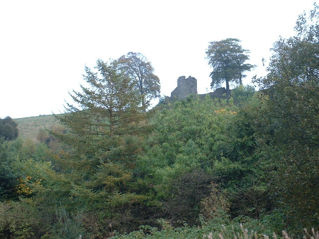
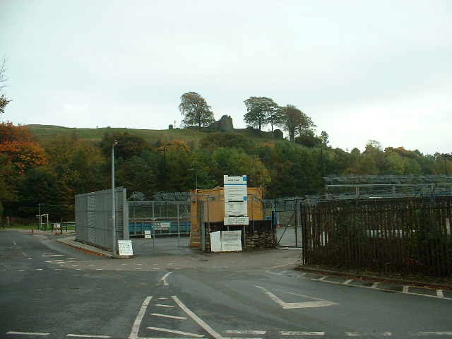
Kendal Castle

Kendal Castle is a medieval fortification to the east of the town of Kendal, Cumbria, in northern England. The castle, which is atop a glacial drumlin...

Kendal Town F.C.

Kendal Town Football Club is a football club based in Kendal, Cumbria, England. The club are currently members of the North West Counties League Premier...

Change Bridge, Kendal

Change Bridge is a Grade II listed single-arch changeline bridge spanning what was formerly a section of the Lancaster Canal in the English market town...
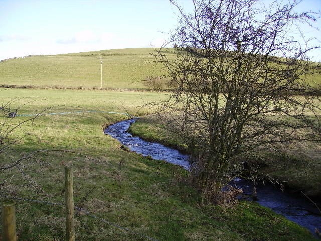
River Mint

The River Mint is a river in Cumbria, England. The Mint starts life at Whelpside at the confluence of Bannisdale Beck, running south-east from Bannisdale...

Kirkbie Kendal School

Kirkbie Kendal School is an academy school and known as a Business and Enterprise College in Kendal, Cumbria, Northern England, and serves the area around...

St George's Church, Kendal

St George's Church is in Castle Street, Kendal, Cumbria, England. It is an active Anglican parish church in the deanery of Kendal, the archdeaconry of...

Queen Katherine Street drill hall, Kendal

The Queen Katherine Street drill hall, sometimes known as the Aynam Road drill hall is a military installation located in Queen Katherine Street, off Aynam...

Nearby Amenities

Located within 500m of 54.322551,-2.7140917
Castle Green Hotel
Addr City: Kendal
Addr Postcode: LA9 6RG
Addr Street: Castle Green Lane
Fhrs Id: 299838
Operator: Best Western Hotels
Phone: +44 1539 734000
Tourism: hotel
Website: https://www.castlegreen.co.uk/
Wheelchair: yes
Lat/Long: 54.3238519/-2.7209951
Power: pole
Lat/Long: 54.3224736/-2.7134197
Power: pole
Lat/Long: 54.3265012/-2.7170501
Power: pole
Lat/Long: 54.3258849/-2.7170608
Power: pole
Lat/Long: 54.3250653/-2.7170877
Power: pole
Lat/Long: 54.3242612/-2.7171091
Power: pole
Lat/Long: 54.3233602/-2.7171306
Power: pole
Lat/Long: 54.322381/-2.7171681
Power: pole
Lat/Long: 54.3214799/-2.7171896
Power: pole
Lat/Long: 54.3206226/-2.7172325
Power: pole
Lat/Long: 54.3201877/-2.7185951
Power: pole
Lat/Long: 54.3201126/-2.7185897
Power: pole
Lat/Long: 54.3205319/-2.7167014
Power: pole
Lat/Long: 54.3210481/-2.7158377
Power: pole
Lat/Long: 54.3218178/-2.7144752
Power: pole
Lat/Long: 54.3229593/-2.7125433
Power: pole
Lat/Long: 54.3230849/-2.7111117
Power: pole
Lat/Long: 54.3231788/-2.7096472
Power: pole
Lat/Long: 54.3231756/-2.7070294
Power: pole
Lat/Long: 54.3236887/-2.7177958
Power: pole
Lat/Long: 54.3235073/-2.7183429
Power: pole
Lat/Long: 54.3246586/-2.7173773
Power: pole
Lat/Long: 54.3250809/-2.7173237
Power: pole
Lat/Long: 54.3259099/-2.7172915
Power: pole
Lat/Long: 54.3265231/-2.7172379
Power: pole
Lat/Long: 54.3250903/-2.7083705
Power: pole
Lat/Long: 54.3241877/-2.7077777
Power: pole
Lat/Long: 54.3233008/-2.7083517
Power: pole
Lat/Long: 54.323038/-2.708518
Power: pole
Lat/Long: 54.3224279/-2.7089042
Power: pole
Lat/Long: 54.321677/-2.7093978
Power: pole
Lat/Long: 54.3208197/-2.7098967
Power: pole
Lat/Long: 54.3200782/-2.7105136
Power: pole
Lat/Long: 54.3192365/-2.7111412
Power: pole
Lat/Long: 54.3187359/-2.7115703
Power: pole
Lat/Long: 54.3189956/-2.7127505
Power: pole
Lat/Long: 54.3193273/-2.71473
Power: pole
Lat/Long: 54.3194649/-2.7162589
Power: pole
Lat/Long: 54.318714/-2.710594
Power: pole
Lat/Long: 54.3231709/-2.7084965
Power: pole
Lat/Long: 54.3210468/-2.7084731
The data included in this document is from www.openstreetmap.org. The data is made available under ODbL.

Have you been to Birklands Wood?

Leave your review of Birklands Wood below (or comments, questions and feedback).