Crab Wood

Wood, Forest in Shropshire

England

Crab Wood

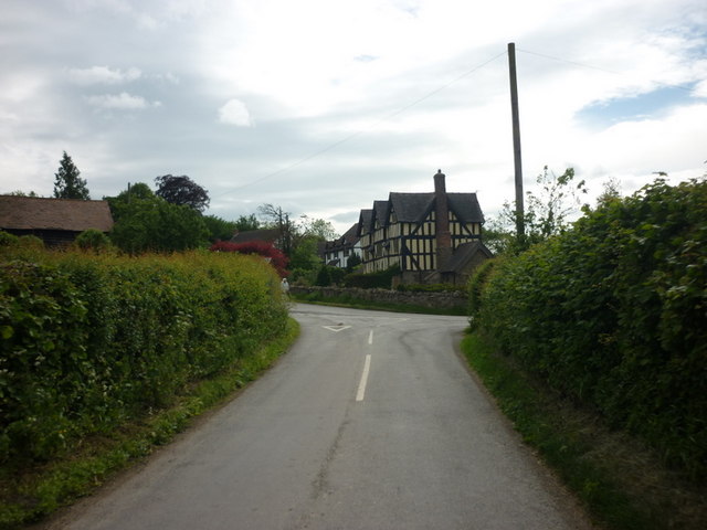
Farm road, Hope Dale The long limestone ridge which runs through Shropshire and Herefordshire is actually two ridges with a higher valley between the two. This road runs between the ridges amongst a mix of brambly woodland and fields.
Farm road, Hope Dale Credit: Richard Webb

The requested URL returned error: 429 Too Many Requests

If you have any feedback on the listing, please let us know in the comments section below.

Crab Wood Images

Images are sourced within 2km of 52.518608/-2.7042128 or Grid Reference SO5291. Thanks to Geograph Open Source API. All images are credited.

Farm road, Hope Dale The long limestone ridge which runs through Shropshire and Herefordshire is actually two ridges with a higher valley between the two. This road runs between the ridges amongst a mix of brambly woodland and fields.
Farm road, Hope Dale
The long limestone ridge which runs through Shropshire and Herefordshire is actually two ridges with a higher valley between the two. This road runs between the ridges amongst a mix of brambly woodland and fields.
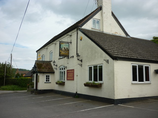
The Plough Inn at Wall under Heywood
Manor Farm, Rushbury
Entering Rushbury
Entering Rushbury
View across Ape Dale With the Long Mynd on the skyline.
View across Ape Dale
With the Long Mynd on the skyline.
Benchmark - north side of Heath Bridge This benchmark is cut into the stonework on the northern parapet of the bridge over the Heath Brook.
Benchmark - north side of Heath Bridge
This benchmark is cut into the stonework on the northern parapet of the bridge over the Heath Brook.
The track down to The Coats Farm access track, and bridleway, which leads eventually up onto Wenlock Edge.
The track down to The Coats
Farm access track, and bridleway, which leads eventually up onto Wenlock Edge.
The Coats farmhouse
The Coats farmhouse
The old railway line, looking WSW Along the old Buildwas to Craven Arms line, adjacent to Crossing House.
The old railway line, looking WSW
Along the old Buildwas to Craven Arms line, adjacent to Crossing House.
Bridleway in Coats Wood
Along the top edge of Coats Wood Just off the bridleway in the wood, with recently germinated winter wheat in the fields.
Along the top edge of Coats Wood
Just off the bridleway in the wood, with recently germinated winter wheat in the fields.
Bridleway near the footpath in Coats Wood
Stanway Manor from the NW Pictured across a field of winter wheat from the bridleway along Wenlock Edge.
Stanway Manor from the NW
Pictured across a field of winter wheat from the bridleway along Wenlock Edge.
Cottage at Roman Bank One of the cottages adjacent to the Jack Mytton Way, the bridleway leading into Coats Wood.
Cottage at Roman Bank
One of the cottages adjacent to the Jack Mytton Way, the bridleway leading into Coats Wood.
Looking up the Jack Mytton Way from the road junction
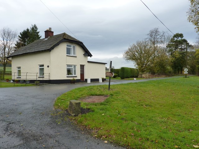
Stanway Lodge At the entrance to Stanway Manor and Upper Stanway Farm.
Stanway Lodge
At the entrance to Stanway Manor and Upper Stanway Farm.
The barns of the former Whitbach Farm The adjacent cottage is now abandoned, but these barns and the cottage itself still stand <a href="https://www.geograph.org.uk/photo/2669926">SO5390 : Whitbach farmhouse</a>
The barns of the former Whitbach Farm
The adjacent cottage is now abandoned, but these barns and the cottage itself still stand SO5390 : Whitbach farmhouse
Whitbach farmhouse The disused cottage at Whitbach; it (and the adjacent barn) was probably built around 1820, for the nearby Hungerford Farm.
Whitbach farmhouse
The disused cottage at Whitbach; it (and the adjacent barn) was probably built around 1820, for the nearby Hungerford Farm.
Show me another place!

Crab Wood is located at Grid Ref: SO5291 (Lat: 52.518608, Lng: -2.7042128)

Unitary Authority: Shropshire

Police Authority: West Mercia

What 3 Words

///over.relies.rattled. Near Cardington, Shropshire

Nearby Locations

Roman Hill Crab Wood

Related Wikis

Rushbury railway station

Rushbury railway station was a station in Rushbury, Shropshire, England. The station was opened in 1867 and closed in 1951. In 1892 a 15-lever signal box...

Shropshire Hills

The Shropshire Hills are a dissected upland area and one of the natural regions of England. They lie wholly within the county of Shropshire and encompass...

Rushbury

Rushbury is a village and civil parish in Shropshire, roughly five miles from Church Stretton and eight miles from Much Wenlock. Nearby villages include...

Wilderhope Manor

Wilderhope Manor is a 16th-century manor house in the care of the National Trust. It is located on Wenlock Edge 7 miles (11 km) south west of Much Wenlock...

Nearby Amenities

Located within 500m of 52.518608,-2.7042128
Power: pole
Transformer: distribution
Lat/Long: 52.5167921/-2.7003622
Power: pole
Lat/Long: 52.5173618/-2.6994261
Power: pole
Lat/Long: 52.5179428/-2.6985544
Power: pole
Lat/Long: 52.5184912/-2.6976424
Barrier: kissing_gate
Lat/Long: 52.5211269/-2.7085412
Barrier: kissing_gate
Lat/Long: 52.5209768/-2.708332
The data included in this document is from www.openstreetmap.org. The data is made available under ODbL.

Have you been to Crab Wood?

Leave your review of Crab Wood below (or comments, questions and feedback).